[{"name":"Everest Base Camp Trek","duration":"16","image_url":"https:\/\/www.treklanders.com\/storage\/trip-galleries\/1\/thumb_419a755c003cc609f3030ee332965ebe.jpg","offer_price":1405,"url":"https:\/\/www.treklanders.com\/trips\/everest-base-camp-trek"},{"name":"Gokyo Valley Trekking","duration":"16","image_url":"https:\/\/www.treklanders.com\/storage\/trip-galleries\/2\/thumb_676d1021b574aeba4d19d3f2a0b04ed2.webp","offer_price":1205,"url":"https:\/\/www.treklanders.com\/trips\/gokyo-valley-trekking"},{"name":"Annapurna Circuit Trek","duration":"23","image_url":"https:\/\/www.treklanders.com\/storage\/trip-galleries\/3\/thumb_2a9a92ea23c62f41de27b37f5e3e8c17.webp","offer_price":1495,"url":"https:\/\/www.treklanders.com\/trips\/annapurna-circuit-trek"},{"name":"Everest Panorama Trek","duration":"12","image_url":"https:\/\/www.treklanders.com\/storage\/trip-galleries\/4\/thumb_35c9f677ea2e88b1ff11a9f43daa3ddb.jpg","offer_price":1100,"url":"https:\/\/www.treklanders.com\/trips\/everest-panorama-trek"},{"name":"Everest Base Camp Trekking from Jiri","duration":"22","image_url":"https:\/\/www.treklanders.com\/storage\/trip-galleries\/6\/thumb_14763592492417b294aa66bf0ebf4e64.webp","offer_price":1400,"url":"https:\/\/www.treklanders.com\/trips\/everest-base-camp-trekking-from-jiri"},{"name":"Everest Base Camp via Cho la Pass from Gokyo Valley Trekking","duration":"18","image_url":"https:\/\/www.treklanders.com\/storage\/trip-galleries\/7\/thumb_d4e470e98d4e9e2ab8e93e39b8b7d252.jpg","offer_price":1405,"url":"https:\/\/www.treklanders.com\/trips\/everest-base-camp-via-cho-la-pass-from-gokyo-valley-trekking"},{"name":"Everest Three Passes Trekking","duration":"22","image_url":"https:\/\/www.treklanders.com\/storage\/trip-galleries\/8\/thumb_b413b221e913171500bb3dfd5c08ceea.jpg","offer_price":1635,"url":"https:\/\/www.treklanders.com\/trips\/everest-three-passes-trekking"},{"name":"Annapurna Base Camp Trekking","duration":"14","image_url":"https:\/\/www.treklanders.com\/storage\/trip-galleries\/9\/thumb_2e71f2ffe116c659fa66b01c2d571b4e.webp","offer_price":845,"url":"https:\/\/www.treklanders.com\/trips\/annapurna-base-camp-trekking"},{"name":"Mardi Base Camp Trekking","duration":"14","image_url":"https:\/\/www.treklanders.com\/storage\/trip-galleries\/10\/thumb_d7b2d2dc638f6bbf2c31c167ac68029d.webp","offer_price":845,"url":"https:\/\/www.treklanders.com\/trips\/mardi-base-camp-trekking"},{"name":"Mohare Danda Trekking","duration":"12","image_url":"https:\/\/www.treklanders.com\/storage\/trip-galleries\/11\/thumb_a384c8d35d789d29b19991c1d675c910.webp","offer_price":755,"url":"https:\/\/www.treklanders.com\/trips\/mohare-danda-trekking"},{"name":"Khopra Ridge & Khair Lake Trekking","duration":"15","image_url":"https:\/\/www.treklanders.com\/storage\/trip-galleries\/12\/thumb_c0f50461ddc74acfb553ba85be00fab0.webp","offer_price":855,"url":"https:\/\/www.treklanders.com\/trips\/khopra-ridge-khair-lake-trekking"},{"name":"Upper Mustang Trekking","duration":"17","image_url":"https:\/\/www.treklanders.com\/storage\/trip-galleries\/13\/thumb_7aa4dfdb69186b0f224a303d80a25c95.jpg","offer_price":1715,"url":"https:\/\/www.treklanders.com\/trips\/upper-mustang-trekking"},{"name":"Langtang Valley Trek","duration":"12","image_url":"https:\/\/www.treklanders.com\/storage\/trip-galleries\/14\/thumb_8650b4b1a3c160cff75da65369398353.webp","offer_price":735,"url":"https:\/\/www.treklanders.com\/trips\/langtang-valley-trek"},{"name":"Gosainkunda Lake Trek","duration":"11","image_url":"https:\/\/www.treklanders.com\/storage\/trip-galleries\/15\/thumb_bfe94c14e760c48234e117021105be84.webp","offer_price":735,"url":"https:\/\/www.treklanders.com\/trips\/gosainkunda-lake-trek"},{"name":"Chisapani-Nagarkot to Dhulikhel Hiking","duration":"7","image_url":"https:\/\/www.treklanders.com\/storage\/trip-galleries\/16\/thumb_468defe9a4000ee3129cd7e6421ee105.webp","offer_price":565,"url":"https:\/\/www.treklanders.com\/trips\/chisapani-nagarkot-to-dhulikhel-hiking"},{"name":"Kanchenjunga Trek","duration":"23","image_url":"https:\/\/www.treklanders.com\/storage\/trip-galleries\/17\/thumb_51f43fa4203106cc49aaedc89d76e01d.jpg","offer_price":1725,"url":"https:\/\/www.treklanders.com\/trips\/kanchenjunga-trek"},{"name":"Helambu Trek","duration":"12","image_url":"https:\/\/www.treklanders.com\/storage\/trip-galleries\/18\/thumb_0fe8e3fa1299d2e43bf1fb5977875ce2.jpg","offer_price":685,"url":"https:\/\/www.treklanders.com\/trips\/helambu-trek"},{"name":"Upper Dolpo Trek","duration":"26","image_url":"https:\/\/www.treklanders.com\/storage\/trip-galleries\/19\/thumb_d6080d490e1db83b0a711e7304000864.jpg","offer_price":3005,"url":"https:\/\/www.treklanders.com\/trips\/upper-dolpo-trek"},{"name":"Manaslu Circuit Trek","duration":"18","image_url":"https:\/\/www.treklanders.com\/storage\/trip-galleries\/20\/thumb_1fdd224e849f4f328e73d2d12b3d282d.jpg","offer_price":1225,"url":"https:\/\/www.treklanders.com\/trips\/manaslu-circuit-trek"},{"name":"Tilicho Lake Base Camp Trek","duration":"19","image_url":"https:\/\/www.treklanders.com\/storage\/trip-galleries\/21\/thumb_eba8ac5e029e6543e0c17630ebd9e2fb.jpg","offer_price":1220,"url":"https:\/\/www.treklanders.com\/trips\/tilicho-lake-base-camp-trek"},{"name":"Nar-Phu Valley With Thorang-La Pass Trek","duration":"21","image_url":"https:\/\/www.treklanders.com\/storage\/trip-galleries\/22\/thumb_43597423a5a366fe9c8937fb30d2fe2a.jpg","offer_price":1315,"url":"https:\/\/www.treklanders.com\/trips\/nar-phu-valley-with-thorang-la-pass-trek"},{"name":"Nepal Round Trip of Kathmandu-Pokhara-Lumbini and Chitwan Tour","duration":"10","image_url":"https:\/\/www.treklanders.com\/storage\/trip-galleries\/23\/thumb_32497d170b2ab340b0a1b3310e91e784.webp","offer_price":845,"url":"https:\/\/www.treklanders.com\/trips\/nepal-round-trip-of-kathmandu-pokhara-lumbini-and-chitwan-tour"},{"name":"Nagarkot Day Hike","duration":"2","image_url":"https:\/\/www.treklanders.com\/storage\/trip-galleries\/24\/thumb_a5a654930fd8ba7852e41738105bacfc.webp","offer_price":105,"url":"https:\/\/www.treklanders.com\/trips\/nagarkot-day-hike"},{"name":"Nagarkot Sunrise Tour","duration":"1","image_url":"https:\/\/www.treklanders.com\/storage\/trip-galleries\/25\/thumb_17dc28a29cfa44381ad503f0a75ee84f.webp","offer_price":22,"url":"https:\/\/www.treklanders.com\/trips\/nagarkot-sunrise-tour"},{"name":"Namobuddha Day Tour with Shiva Statue","duration":"1","image_url":"https:\/\/www.treklanders.com\/storage\/trip-galleries\/26\/thumb_beeb34202f9077764aa08c67ef2867f9.webp","offer_price":45,"url":"https:\/\/www.treklanders.com\/trips\/namobuddha-day-tour-with-shiva-statue"},{"name":"Kathmandu Full Day Sightseeing Tour","duration":"1","image_url":"https:\/\/www.treklanders.com\/storage\/trip-galleries\/27\/thumb_d045fc0f1acee2cfa6b3c95f3c656d18.jpg","offer_price":30,"url":"https:\/\/www.treklanders.com\/trips\/kathmandu-full-day-sightseeing-tour"},{"name":"Patan and Bhaktapur Sightseeing Tour","duration":"1","image_url":"https:\/\/www.treklanders.com\/storage\/trip-galleries\/28\/thumb_750eacac3424b5dba686dd93656ab87c.jpg","offer_price":30,"url":"https:\/\/www.treklanders.com\/trips\/patan-and-bhaktapur-sightseeing-tour"},{"name":"Upper Mustang Heli Tour","duration":"1","image_url":"https:\/\/www.treklanders.com\/storage\/trip-galleries\/29\/thumb_0b785f69a15557f8660c805c76fda14e.webp","offer_price":1250,"url":"https:\/\/www.treklanders.com\/trips\/upper-mustang-heli-tour"},{"name":"Everest Heli Tour","duration":"1","image_url":"https:\/\/www.treklanders.com\/storage\/trip-galleries\/30\/thumb_dc45f2beb36a3699e0decf0de41a6f17.jpg","offer_price":1495,"url":"https:\/\/www.treklanders.com\/trips\/everest-heli-tour"},{"name":"Island Peak Trek & Climb","duration":"21","image_url":"https:\/\/www.treklanders.com\/storage\/trip-galleries\/31\/thumb_a0f3e3468c92a8e436045cf8b2fbf361.jpg","offer_price":2295,"url":"https:\/\/www.treklanders.com\/trips\/island-peak-trek-climb"},{"name":"Mera Peak Trek & Climb","duration":"18","image_url":"https:\/\/www.treklanders.com\/storage\/trip-galleries\/32\/thumb_3e8128a23c36f02fa38135475e811b9e.jpg","offer_price":2815,"url":"https:\/\/www.treklanders.com\/trips\/mera-peak-trek-climb"},{"name":"Chandragiri Cable Car Tour","duration":"1","image_url":"https:\/\/www.treklanders.com\/storage\/trip-galleries\/33\/thumb_faa70b716449eada6d7f1450335edbb3.jpg","offer_price":30,"url":"https:\/\/www.treklanders.com\/trips\/chandragiri-cable-car-tour"},{"name":"Everest Base Camp Trek and Returning via Heli","duration":"13","image_url":"https:\/\/www.treklanders.com\/storage\/trip-galleries\/34\/thumb_11190941866206e1d578db11986ebc73.webp","offer_price":2100,"url":"https:\/\/www.treklanders.com\/trips\/everest-base-camp-trek-and-returning-via-heli"},{"name":"Annapurna Semi Circuit Trek","duration":"15","image_url":"https:\/\/www.treklanders.com\/storage\/trip-galleries\/35\/thumb_30ddd8ba818cdcb52efd5eb0a017bcdb.jpg","offer_price":965,"url":"https:\/\/www.treklanders.com\/trips\/annapurna-semi-circuit-trek"},{"name":"Everest Base Camp Luxury Trek","duration":"14","image_url":"https:\/\/www.treklanders.com\/storage\/trip-galleries\/39\/thumb_6079aea3c5dd83e745a16fd6162270dc.jpg","offer_price":2685,"url":"https:\/\/www.treklanders.com\/trips\/everest-base-camp-luxury-trek"},{"name":"Mt. Kailash & Lake Manasarover Tour","duration":"15","image_url":"https:\/\/www.treklanders.com\/storage\/trip-galleries\/41\/thumb_cf3fededfd7dd2b40399af399e04f95a.jpg","offer_price":2205,"url":"https:\/\/www.treklanders.com\/trips\/mt-kailash-lake-manasarover-tour"},{"name":"Ghorepani Poonhill Trek","duration":"11","image_url":"https:\/\/www.treklanders.com\/storage\/trip-galleries\/43\/thumb_602d9a56976e1b836ba8adc69b8d09c5.webp","offer_price":720,"url":"https:\/\/www.treklanders.com\/trips\/ghorepani-poonhill-trek"},{"name":"11 Days Gokyo Valley Trekkking","duration":"11","image_url":"https:\/\/www.treklanders.com\/storage\/trip-galleries\/45\/thumb_ab552c3c91de392f94230a937b1c4801.jpg","offer_price":900,"url":"https:\/\/www.treklanders.com\/trips\/11-days-gokyo-valley-trekkking"},{"name":"9-Day Everest Base Camp Trekking with Helicopter Return","duration":"9","image_url":"https:\/\/www.treklanders.com\/storage\/trip-galleries\/46\/thumb_9a8ba2b582500cd86786be056902c31a.webp","offer_price":1990,"url":"https:\/\/www.treklanders.com\/trips\/9-day-everest-base-camp-trekking-with-helicopter-return"},{"name":"12-Day Everest Base Camp Trek","duration":"12","image_url":"https:\/\/www.treklanders.com\/storage\/trip-galleries\/47\/thumb_d12c9ef776c0b395ceea817fe05c5892.jpg","offer_price":1000,"url":"https:\/\/www.treklanders.com\/trips\/12-day-everest-base-camp-trek"},{"name":"8-Day Everest Panorama Trek","duration":"8","image_url":"https:\/\/www.treklanders.com\/storage\/trip-galleries\/49\/thumb_c81ae3a8ac757a317a9362e6872e2dcb.jpg","offer_price":850,"url":"https:\/\/www.treklanders.com\/trips\/8-day-everest-panorama-trek"},{"name":"7-Day Langtang Valley Trek","duration":"7","image_url":"https:\/\/www.treklanders.com\/storage\/trip-galleries\/50\/thumb_99c2904df5475ab028c9e3633ea95ef3.jpg","offer_price":420,"url":"https:\/\/www.treklanders.com\/trips\/7-day-langtang-valley-trek"},{"name":"4-Day Trekking Adventure near Kathmandu","duration":"4","image_url":"https:\/\/www.treklanders.com\/storage\/trip-galleries\/51\/thumb_594681060514dc57be1959236a6996d0.jpg","offer_price":275,"url":"https:\/\/www.treklanders.com\/trips\/4-day-trekking-adventure-near-kathmandu"},{"name":"4-Day Ghorepani Ponnhill Trek from Pokhara","duration":"4","image_url":"https:\/\/www.treklanders.com\/storage\/trip-galleries\/53\/thumb_eede04edac01f983d9af2c16f55d03e8.webp","offer_price":500,"url":"https:\/\/www.treklanders.com\/trips\/4-day-ghorepani-ponnhill-trek-from-pokhara"},{"name":"7-Day Annapurna Base Camp Trek from Pokhara","duration":"7","image_url":"https:\/\/www.treklanders.com\/storage\/trip-galleries\/55\/thumb_547e91c74088c491111ebe31a759cfbb.jpg","offer_price":420,"url":"https:\/\/www.treklanders.com\/trips\/7-day-annapurna-base-camp-trek-from-pokhara"},{"name":"13-Day Manaslu Circuit Trekking","duration":"13","image_url":"https:\/\/www.treklanders.com\/storage\/trip-galleries\/56\/thumb_aef1af4f0c4a2a9622d518ad5959542b.jpg","offer_price":1050,"url":"https:\/\/www.treklanders.com\/trips\/13-day-manaslu-circuit-trekking"},{"name":"5-Day Mardi Himal Trek from Pokhara","duration":"5","image_url":"https:\/\/www.treklanders.com\/storage\/trip-galleries\/57\/thumb_dcd598d556c14835f0a18169afafcbc6.webp","offer_price":420,"url":"https:\/\/www.treklanders.com\/trips\/5-day-mardi-himal-trek-from-pokhara"},{"name":"Nagarkot Sunrise Tour with Day Hike","duration":"1","image_url":"https:\/\/www.treklanders.com\/storage\/trip-galleries\/58\/thumb_7cdfa1f16719486da2a0718da45b1f2f.webp","offer_price":30,"url":"https:\/\/www.treklanders.com\/trips\/nagarkot-sunrise-tour-with-day-hike"},{"name":"Seven Unesco Heritage Sites Day Tour in Kathmandu","duration":"1","image_url":"https:\/\/www.treklanders.com\/storage\/trip-galleries\/59\/thumb_92aed7b9c67e76740000aab9313dced7.jpg","offer_price":40,"url":"https:\/\/www.treklanders.com\/trips\/seven-unesco-heritage-sites-day-tour-in-kathmandu"},{"name":"10-Day Ghorepani Poonhill with Annapurna Base Camp Trek","duration":"10","image_url":"https:\/\/www.treklanders.com\/storage\/trip-galleries\/60\/thumb_d4c2c089497950ccb5f8541d76e1269b.webp","offer_price":835,"url":"https:\/\/www.treklanders.com\/trips\/10-day-ghorepani-poonhill-with-annapurna-base-camp-trek"},{"name":"3-Day Chitwan Wildlife Tour","duration":"3","image_url":"https:\/\/www.treklanders.com\/storage\/trip-galleries\/61\/thumb_fc4de9cbf5bc83d67491b41df5725552.jpg","offer_price":150,"url":"https:\/\/www.treklanders.com\/trips\/3-day-chitwan-wildlife-tour"},{"name":"3-Day Pokhara Sightseeing Tour","duration":"3","image_url":"https:\/\/www.treklanders.com\/storage\/trip-galleries\/62\/thumb_a79a253f1a8bcbbf288eefc1d2f4038f.jpg","offer_price":230,"url":"https:\/\/www.treklanders.com\/trips\/3-day-pokhara-sightseeing-tour"},{"name":"7-Day Kathmandu Pokhara and Chitwan wildlifeTour","duration":"7","image_url":"https:\/\/www.treklanders.com\/storage\/trip-galleries\/63\/thumb_4f963fc141d7ef39e8a6a3c60317ae9b.jpg","offer_price":545,"url":"https:\/\/www.treklanders.com\/trips\/7-day-kathmandu-pokhara-and-chitwan-wildlifetour"},{"name":"Nagarjun Jamacho Day Hiking","duration":"1","image_url":"https:\/\/www.treklanders.com\/storage\/trip-galleries\/64\/thumb_85867eb85c60c8228e44f927341f67d1.jpg","offer_price":30,"url":"https:\/\/www.treklanders.com\/trips\/nagarjun-jamacho-day-hiking"},{"name":"Everest Mountain Flight from Kathmandu","duration":"1","image_url":"https:\/\/www.treklanders.com\/storage\/trip-galleries\/65\/thumb_1a66526d340ec175023842c38efd8a95.webp","offer_price":120,"url":"https:\/\/www.treklanders.com\/trips\/everest-mountain-flight-from-kathmandu"},{"name":"One Day Trishuli River Rafting Adventures","duration":"1","image_url":"https:\/\/www.treklanders.com\/storage\/trip-galleries\/66\/thumb_55ba0ea676c9c625f99f3d41bda224fb.jpg","offer_price":35,"url":"https:\/\/www.treklanders.com\/trips\/one-day-trishuli-river-rafting-adventures"},{"name":"13-Day Annapurna Circuit Trek","duration":"13","image_url":"https:\/\/www.treklanders.com\/storage\/trip-galleries\/67\/thumb_859e7a1fbb468a9252d365cab8379f10.jpg","offer_price":815,"url":"https:\/\/www.treklanders.com\/trips\/13-day-annapurna-circuit-trek"},{"name":"15-Day Tilicho Base Camp with Thorong-La Pass Trekking","duration":"15","image_url":"https:\/\/www.treklanders.com\/storage\/trip-galleries\/68\/thumb_56a5fd1506c9b9f1f83844353dc55edf.jpg","offer_price":920,"url":"https:\/\/www.treklanders.com\/trips\/15-day-tilicho-base-camp-with-thorong-la-pass-trekking"},{"name":"Cooking Class in Thamel-Full Course Meal","duration":"1","image_url":"https:\/\/www.treklanders.com\/storage\/trip-galleries\/69\/thumb_ed5cfbc0d94b624642d347c0776d36bb.webp","offer_price":30,"url":"https:\/\/www.treklanders.com\/trips\/cooking-class-in-thamel-full-course-meal"},{"name":"Cooking Class in Thamel-Full Course","duration":"3 Hours 30 Minutes","image_url":"https:\/\/www.treklanders.com\/img\/default.gif","offer_price":30,"url":"https:\/\/www.treklanders.com\/trips\/cooking-class-in-thamel-full-course"},{"name":"Cooking Class in Thamel-Full Course Meal","duration":"3 Hours 30 Minutes","image_url":"https:\/\/www.treklanders.com\/img\/default.gif","offer_price":30,"url":"https:\/\/www.treklanders.com\/trips\/cooking-class-in-thamel-full-course-meal"},{"name":"Momo Making Class in Thamel","duration":"1","image_url":"https:\/\/www.treklanders.com\/storage\/trip-galleries\/72\/thumb_a36e5ceca4d5c4cb0ecda367505b31d3.webp","offer_price":20,"url":"https:\/\/www.treklanders.com\/trips\/momo-making-class-in-thamel"},{"name":"8 Days Bhutan Tour from Kathmandu","duration":"8","image_url":"https:\/\/www.treklanders.com\/storage\/trip-galleries\/73\/thumb_df319d7d3ac21bcd9cf728cb1a70ea09.webp","offer_price":2275,"url":"https:\/\/www.treklanders.com\/trips\/8-days-bhutan-tour-from-kathmandu"},{"name":"10 Days Bhutan Tour with Druk path Trek","duration":"10","image_url":"https:\/\/www.treklanders.com\/storage\/trip-galleries\/74\/thumb_c7d4a4b89aceaf5d3aac313265729bb3.webp","offer_price":5715,"url":"https:\/\/www.treklanders.com\/trips\/10-days-bhutan-tour-with-druk-path-trek"},{"name":"9 -Day Langtang Valley Trek","duration":"9","image_url":"https:\/\/www.treklanders.com\/storage\/trip-galleries\/75\/thumb_65e69cec8917e39091c9e40ae06df3da.webp","offer_price":620,"url":"https:\/\/www.treklanders.com\/trips\/9--day-langtang-valley-trek"},{"name":"14 Day Everest Base Camp Trek","duration":"14","image_url":"https:\/\/www.treklanders.com\/storage\/trip-galleries\/76\/thumb_446e7f33a5f43896c9cdf470cd7be947.webp","offer_price":1175,"url":"https:\/\/www.treklanders.com\/trips\/14-day-everest-base-camp-trek"},{"name":"Lhasa Tour from Kathmandu: 10-Day Tibet Overland Journey via Gyirong","duration":"10","image_url":"https:\/\/www.treklanders.com\/img\/default.gif","offer_price":null,"url":"https:\/\/www.treklanders.com\/trips\/lhasa-tour-from-kathmandu-10-day-tibet-overland-journey-via-gyirong"},{"name":"13 Day Lhasa Tour from Kathmandu via Everest Base Camp","duration":"13","image_url":"https:\/\/www.treklanders.com\/storage\/trip-galleries\/78\/thumb_8a2bfb2abd99ba9ddc902b768e7b0759.webp","offer_price":2565,"url":"https:\/\/www.treklanders.com\/trips\/13-day-lhasa-tour-from-kathmandu-via-everest-base-camp"},{"name":"11 Day Annapurna Base Camp Trek","duration":"11","image_url":"https:\/\/www.treklanders.com\/storage\/trip-galleries\/79\/thumb_4e48a19c538c00cc8c36160ca97c5f21.webp","offer_price":720,"url":"https:\/\/www.treklanders.com\/trips\/11-day-annapurna-base-camp-trek"},{"name":"9 Day Mardi Himal Trek","duration":"9","image_url":"https:\/\/www.treklanders.com\/storage\/trip-galleries\/80\/thumb_8214945c5614ac9a84e5ca0b58b1f5a3.webp","offer_price":735,"url":"https:\/\/www.treklanders.com\/trips\/9-day-mardi-himal-trek"},{"name":"14 Day Manaslu Circuit Trek","duration":"14","image_url":"https:\/\/www.treklanders.com\/storage\/trip-galleries\/81\/thumb_b3ec98cd4036da5cb6e92250afa0d59e.webp","offer_price":1085,"url":"https:\/\/www.treklanders.com\/trips\/14-day-manaslu-circuit-trek"},{"name":"20 Day Manaslu Circuit with Tsum Valley Trek","duration":"20","image_url":"https:\/\/www.treklanders.com\/storage\/trip-galleries\/82\/thumb_b8c202cf8e16197517811d535f2a6795.webp","offer_price":1765,"url":"https:\/\/www.treklanders.com\/trips\/20-day-manaslu-circuit-with-tsum-valley-trek"},{"name":"15 Day Langtang Gosaikunda Lake Helambu Trek","duration":"15","image_url":"https:\/\/www.treklanders.com\/storage\/trip-galleries\/83\/thumb_a9c7bbb74f733cdc9a3469a448df7109.webp","offer_price":985,"url":"https:\/\/www.treklanders.com\/trips\/15-day-langtang-gosaikunda-lake-helambu-trek"},{"name":"14 Day Tamang Heritage with Langtang Valley Trek","duration":"14","image_url":"https:\/\/www.treklanders.com\/storage\/trip-galleries\/84\/thumb_57fe1b0ad2b7d0489273633b906d2f43.webp","offer_price":895,"url":"https:\/\/www.treklanders.com\/trips\/14-day-tamang-heritage-with-langtang-valley-trek"},{"name":"6 Day Pikey Peak Trek","duration":"6","image_url":"https:\/\/www.treklanders.com\/storage\/trip-galleries\/85\/thumb_f69c5c05ac7a2100c9010f66292efc86.webp","offer_price":550,"url":"https:\/\/www.treklanders.com\/trips\/6-day-pikey-peak-trek"},{"name":"Everest Base Camp Trek with Lobuche East Peak Climbing Expedition","duration":"17","image_url":"https:\/\/www.treklanders.com\/storage\/trip-galleries\/86\/thumb_9e7f330ecdbd7f74fe6f16202d3fed28.webp","offer_price":2295,"url":"https:\/\/www.treklanders.com\/trips\/everest-base-camp-trek-with-lobuche-east-peak-climbing-expedition"}]
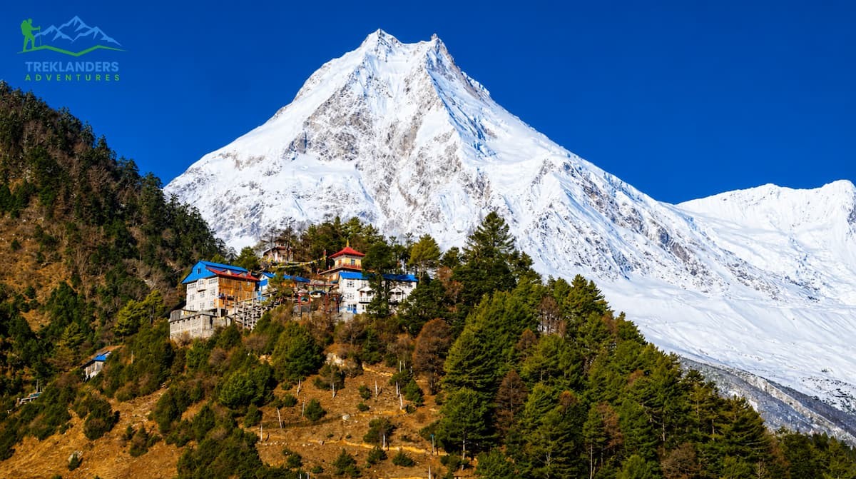
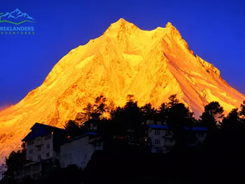
Stunning sunrise view of Mt. Manaslu from Shyala Village.
The Manaslu Circuit Trek commences with Mt. Manaslu, standing as the world's 8th highest peak at 8,163 meters, and proceeds around it for about 180 kilometers in the Gorkha District of Nepal. It creates a unique blend of features, including high-altitude mountain passes, Tibetan-style villages, subtropical river valleys, and alpine glaciers, all in one route. While Everest Base Camp attracted approximately 50,000 trekkers and Annapurna Base Camp nearly 250,000 in the 2024 season, Manaslu drew only 12,000. This huge difference is not a random event. It is a restricted zone. Besides permits, you also require a licensed guide and a minimum of two trekkers in your group. While most people see these requirements as a great deterrent, seasoned trekkers see them as an added feature.
This guide will help you with everything from finding your way around, getting your permits, choosing the right time, gauging the difficulty, estimating costs, booking accommodation, packing, and uncovering what most trekking blogs don't tell you about the Manaslu Circuit Trek in 2026 and 2027.
You definitely won't be passing narrow trails on the edge of cliffs with a crowd of day traders. The restricted area permits the system to limit the number of people going to that place. It not only protects nature but also the emotional connection that people have with the place.
Huge change of altitude
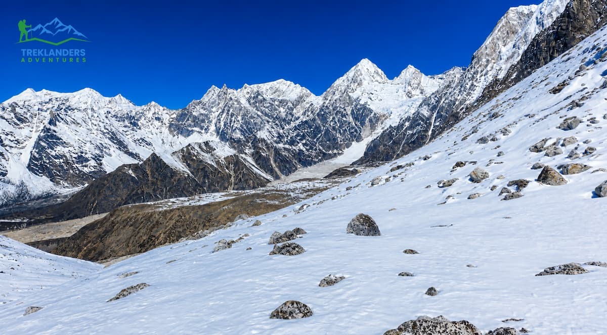
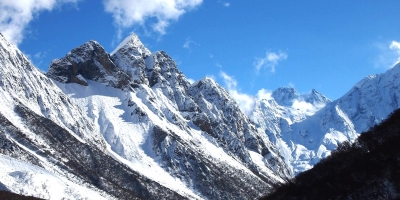
The pathway goes up from about 700m of Soti Khola to 5,106 m at Larkya La Pass. The distance between these two altitudes covers almost all the types of ecosystems found in Nepal -subtropical forests, terraced farmland, rhododendron groves, alpine meadows, moraines, and glaciated peaks. Very few treks in the Himalayas can offer this level of diversity along one route.
In the Manaslu area, four ethnic groups -Gurung, Magar, Tibetan, and Nubri- live in harmony. Even after the fast economic development of Nepal, villages like Namrung Lho Samagaun and Samdo have retained their old traditional ways of living. These are the kinds of villages where you can meet monks in their monasteries, see the natural beauty of houses with prayer flags, and even enjoy native festivals that are not tourist oriented.
Great value addition
The Manaslu Circuit is the perfect blend with the Annapurna Circuit as it joins at Dharapani. By giving an extra five to six days, you will be able to experience in one trip not only two of Nepal's best circuits but also a diverse range of scenery and culture. Besides, you have the option of going further to the Tsum Valley, which is a restricted area famous for its ancient Buddhist monastery as well as its extreme isolation.
Note:- Manaslu offers what Everest and Annapurna used to offer before the lodges and the crowds arrived: genuine wilderness within a day's drive of Kathmandu.
Manaslu Circuit Trek Route and Itinerary
Stunning view of Birendra Lake during the Manaslu Circuit Trek.
The traditional path goes anticlockwise from Soti Khola to Besisahar, initially tracing the Budhi Gandaki River, then gradually heading to the alpine zone and crossing Larkya La Pass. Most of the agencies suggest 14 to 18 days. There are also shorter 10 to 11-day itineraries, but they are quite risky: since you will not have enough time to get used to the altitude, you will be exposed to the risk of altitude sickness, and the Nepalese authorities cannot always rescue all climbers who fall ill in the remote areas.
Day 1: Drive to Machha Khola (900 m / 2,952 ft) Approx: 7 hrs. (160 km)
The trip starts in Kathmandu with a fantastic trip transport by car, where the direction will be northwest along the Prithvi Highway, then turning to mountainous, tough roads. The road will follow along the Budhi Gandhi River with terraces for agriculture and green subtropical hills. Machha Khola, a small riverside village, is the traditional trail beginning point for the Manaslu Circuit.
Day 2: Trek to Jagat (1,340 m) via Dovan (1,070 m): 7 hrs.
Today, the track will start unveiling its personality; you will be crossing hanging bridges over wild rivers and going through thick forests. Dovan village is a perfect place to take a break before heading up Jagat, a village with a checkpoint and where trekking permits are verified.
Day 3: Trek to Deng (1,860 m) via Philim Village: 6 hrs.
You will go to Philim, one of the biggest villages in the lower Budhi Gandaki valley, which is very much decorated with the Gurung way of life. As the valley gets deeper, the path becomes narrower, and the scenery of steep gorges and falling water will be with you as you get to the tiny town of Deng.
Day 4: Trek to Namrung (2,660 m): 6 hours
As you ascend, the scenery changes quite a bit. You can see pine and rhododendron covering the hills as the subtropical plants disappear. Namrung is the entrance of the high Manaslu Valley, and from here, only a couple of hours of walking per day are planned to allow the hikers to properly acclimatize.
Day 5: Trek to Lho-Gaon (3,180 m): 5 hours
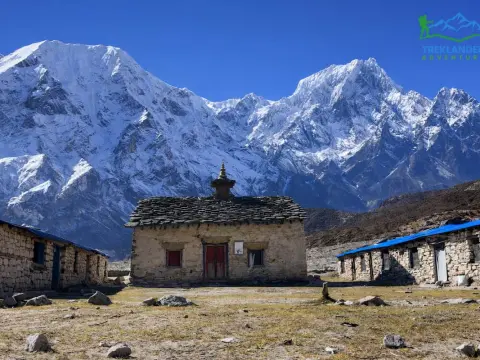
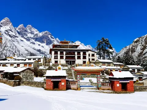
This day will likely provide the most beautiful views of the entire trek. Going through lovely villages like Lho and Shyala, the tourists will enjoy the ever-changing majestic views of the Himalayas. The old monastery of Lho village is a remarkable finishing touch to the imposing Mount Manaslu.
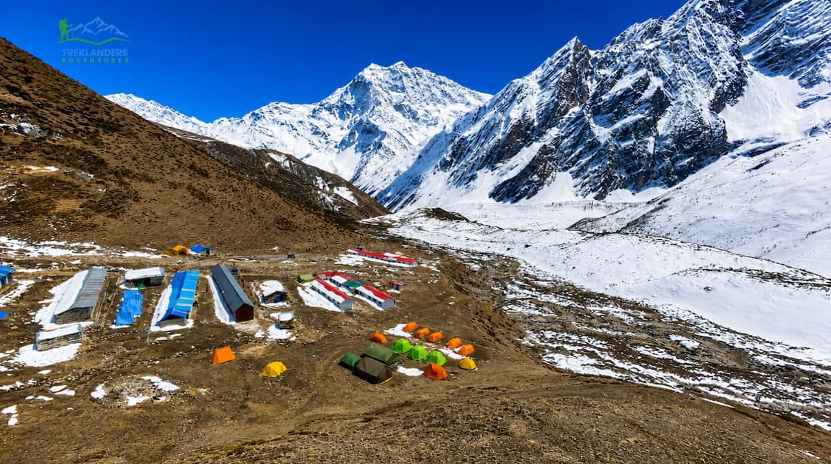
Day 6: Trek to Sama-Gaon (3,500 m / 11,480 ft): 6 hours
First, we quite slowly creep along the path of yaks, then we hear the scream of eagles and finally the touch of snow on our nose as we get higher. At the end of the day, there is this large, splendid, and empty valley. Sama-Gaon is the main Tibetan village in this area and a major cultural feature of the trek. There are ancient gompas, mani walls, and a very friendly community that has kept its culture alive for generations.
Day 7: Rest Day at Sama-Gaon Acclimatization Excursion
Pungen Gompa- Rest Day at Sama-Gaon Acclimatization Excursion
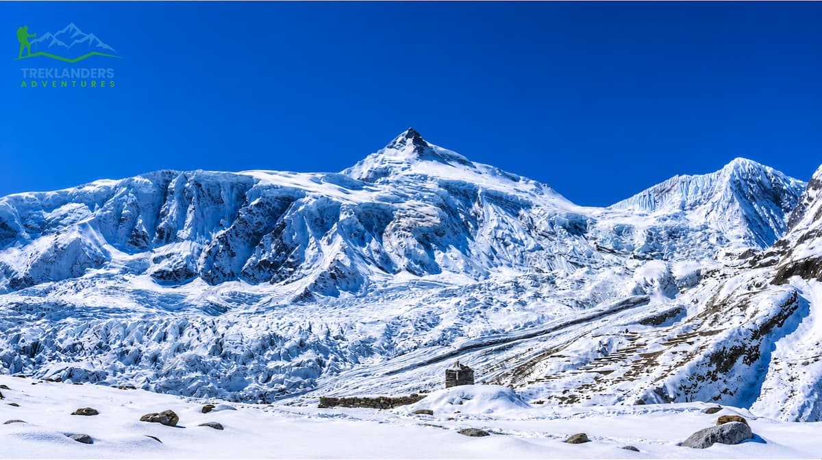
It is a very important day for your body to get used to the higher altitude before the major climbs ahead. You can either go for a long walk to Manaslu Base Camp or have your way to the nearby Birendra Lake.
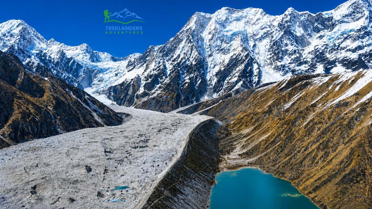
From the base camp area, you will get a spectacular view of Mount Manaslu and the surrounding glaciers. The crystal-clear water of Birendra Tal, on calm mornings, reflects Mount Manaslu (8,163 m) and Peak 29 (Ngadi Chuli) so perfectly that it is the most preferred spot for photographers.
Day 8: Trek to Samdo (3,875 m): 5 hours
Samdo Village- Manaslu Circuit Trek
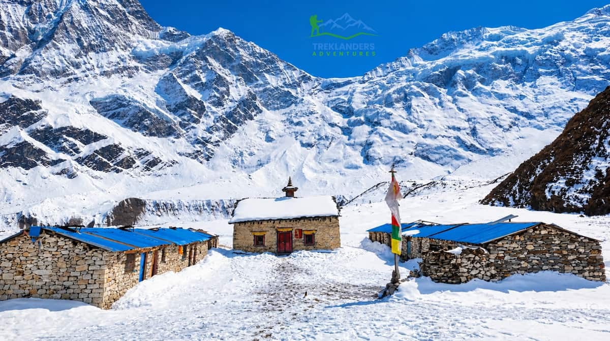
A gentle trek through the pastures where yaks graze and alpine landscapes bring you to the Tibetan-influenced village of Samdo. This village is almost on the border of Tibet, and the Tibetan-style becomes more evident as you walk on the ridgeline's way above the tree line.
Day 9: Trek to Dharmasala: 4 hours
Dharmashala- Manaslu Circuit Trek
Called also Larkya La Base Camp, Dharmasala is a very isolated high-camp location where only basic teahouses are available for accommodation. The path goes up, more or less, through the mountainous area with occasional rugged features. Besides, you really need to make sure that you are well rested and sleep early, as this will be essential for you to be in good condition for the very challenging pass that you will be crossing in the morning.
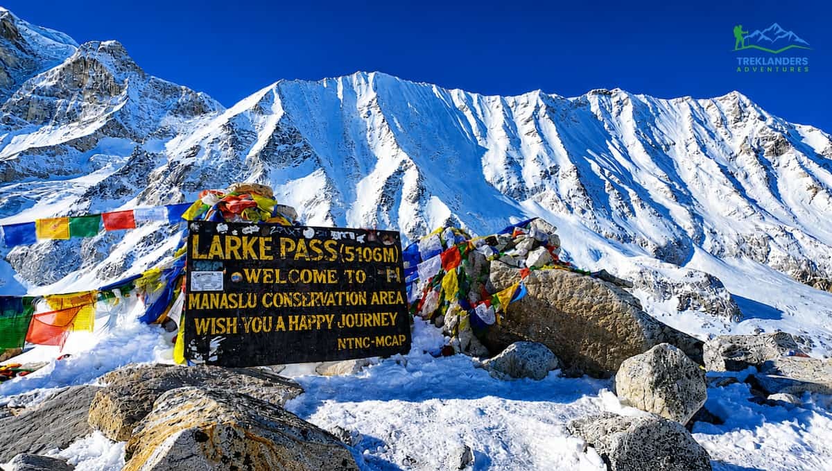
Day 10: Hike to Bhimthang (3,590 m) crossing Larkya La Pass (5,106 m) - 8 hours
Hike to Bhimthang (3,590 m) after crossing Larkya La Pass
The highlight of the entire circuit is undoubtedly the pass. To get to the highest point ahead of the winds, which usually are around late morning, one has to start at 4 am. The most amazing sights are found on a western path after the top, as a huge glacial amphitheatre comes into view. The long descent to Bhimthang shows open valleys, glaciers, and the first growth of the lower-altitude vegetation.
Day 11: Walk to Gho (2,535 m) - 4 hours
It is an easy day after the passing day, a steep one. The way goes down through the trees and green fields that highly contrast with the barren mountains of the last days.
Day 12: Walk to Dharapani (1,820 m), Drive to Bhesishar (760 m) - 7 hours
The endpoint for the trek is Dharapani. At that point, the Manaslu Circuit trail intersects with the Annapurna Circuit trail. Then, a car ride along the Marsyangdi valley takes you down to Bhesishar (Besisahar), the main town of the Lamjung district.
Day 13: Drive to Kathmandu - 5 hours
The last part of the trip is via Prithvi Highway to Kathmandu. The 13-day program organized by Treklanders Adventures is the most popular and considered a comfortable journey covering all the main highlights of the Manaslu Circuit.
Day 10 is famously the toughest day on this trek. On this day, you will ascend for about 700 meters to reach Larkya La, the highest point of this trekking at 5,106 meters, and then you will descend for more than 1,500 meters to reach Bimthang. You must start your trek early in the morning, most probably from 3:00 to 4:00 AM, so that you can cross the pass before the afternoon weather changes. Most of the trekkers have stated that it was such a difficult and lasting experience for them.
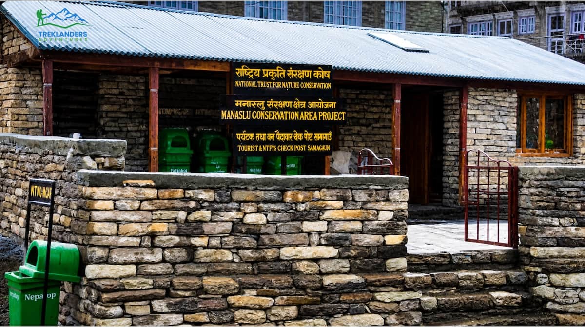
3. Manaslu Trek Permits: What You Need and What It Costs?
Permits required for entry to the Manaslu Circuit remain strict. Three distinct ones must be secured, and though agencies manage forms, knowing exact fees and guidelines helps shape realistic travel plans.
Required Permits for Manaslu Circuit Trek
Manaslu Restricted Area Permit (MRAP) USD $100 per week for September-November (peak season); USD $75 per week for all other seasons. This permit costs the most among all, and it is the only one with seasonal pricing.
Manaslu Conservation Area Permit (MCAP) NPR 3,000 (approximately USD $22). It is applicable for the entire trek period.
Annapurna Conservation Area Permit (ACAP) NPR 3,000 (approximately USD $22). This permit is necessary as the route goes out of the Annapurna area in Dharapani.
Travel to this area can only be done together with a guide who has a license and is registered through a recognized Nepalese trekking agency. Hiking solo independently is prohibited in this zone. The minimum size of a trekking group is two people. Agencies can pair you with another solo trekker for a shared departure if you are travelling alone.
The permits are given out in Kathmandu by the Nepal Tourism Board. Your agency will handle the whole permit processing for you. You should consider that it may take 1 to 2 business days to get your permits, so include this in your pre-trek schedule.
4. Best Time to Trek the Manaslu Circuit
Mt. Manaslu-Manaslu Circuit Trek
Because Larkya La Pass is shut in case of heavy snow, it is generally more time-sensitive to Manaslu than to lower-altitude treks. If you pick a bad window, you are faced with the options of going back or taking a very serious risk.
Best Season
Autumn: Sep–Nov
Clear skies, stable weather, excellent visibility. The busiest window for Manaslu, though still far quieter than Everest or Annapurna. MRAP costs $100/week during this period. October is a sweet spot.
Spring: Mar–May
Rhododendron forests bloom across the lower trail. Temperatures are moderate. Visibility can be hazy from dust before the monsoon clears the air. Permit costs drop to $75/week. April is the most optimal month.
Avoid
Monsoon: Jun–Aug
Landslides and trail erosion make the lower sections of the Budhi Gandaki corridor genuinely dangerous. Leeches are abundant. Not recommended for any fitness level.
Experienced Only
Winter: Dec–Feb
Larkya La Pass accumulates heavy snowfall. Crossing becomes difficult to impossible without mountaineering experience. Teahouses above 3,500m close or operate with limited service. Not recommended for standard trekkers.
5. Manaslu Circuit Trek Difficulty: What to Expect?
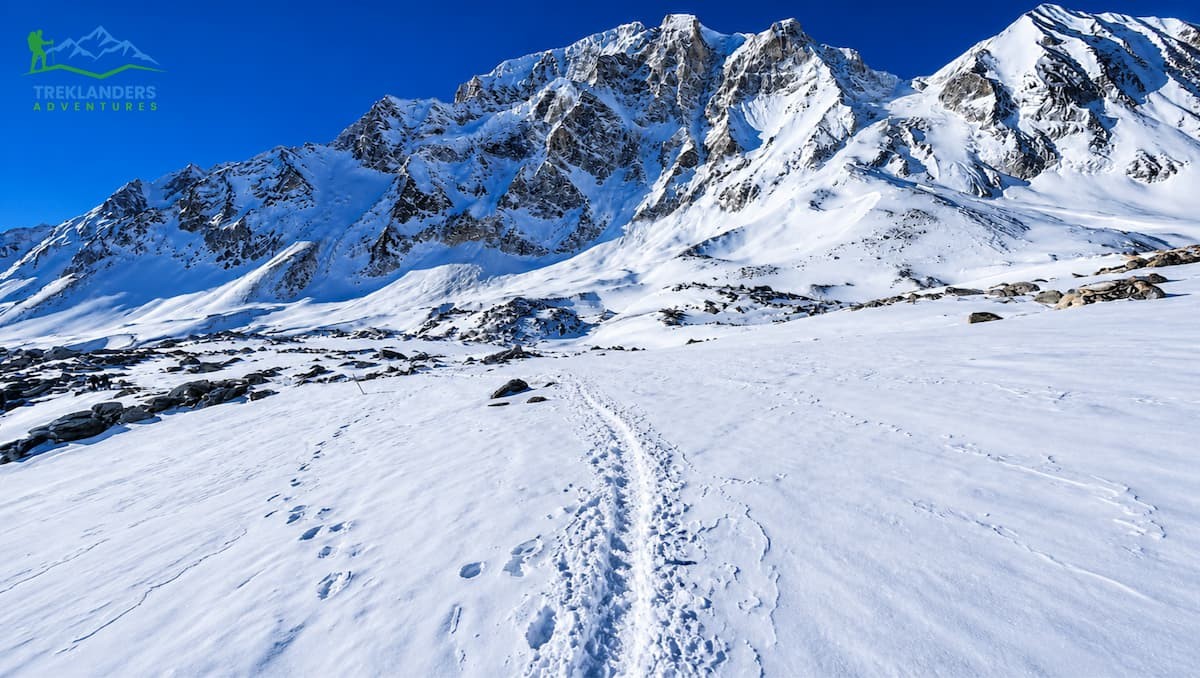
Trail along Larke Pass on the Manaslu Circuit Trek.
Official classification: moderate to strenuous. That designation, however, needs a bit of explanation since the difficulty levels on Manaslu change from one section to another.
The lower trail
Lower trail section of the Manaslu Circuit Trek.
(Days 1-4) is physically very demanding even before the altitude challenge comes into play. Walking in the Budhi Gandaki valley means constant up and down work rather than a steady gain in elevation. You keep going down to the river crossings and climbing back the way you come, over and over again. Steps made of stone, trails getting slippery after rain and suspension bridges over deep gorges are the things you will regularly encounter. Your legs will give you signs of the exertion from the very beginning.
The mid-section
(Days 5-9) is high-altitude hiking, gradually reaching the point where altitude sickness is a major hazard. Above 2,500 meters, the air contains less oxygen, and you will be able to feel it. Many people get headaches and are tired. An acclimatization day at Samagaun (3,530m) is mandatory; in fact, the risk of acute mountain sickness at Larkya La is decreased by the rest day built into the itinerary.
Larkya La Pass Day
Larkya La Pass- Manaslu Circuit Trek
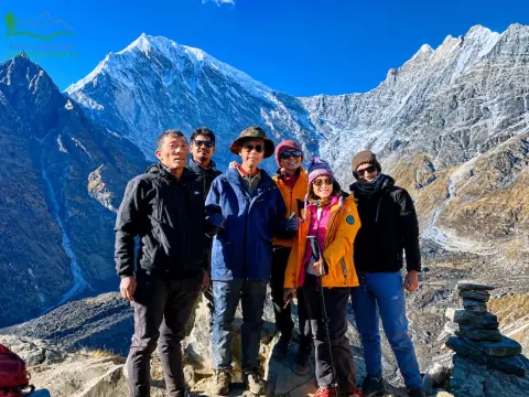
This (Day 10) is the toughest day. You will be trekking for eight to ten hours, in the dark, climbing 700 meters to 5,106 meters, and then descending 1,500 meters on the other side. At the summit, the temperature can drop to -10 °C or even lower early in the morning. You will be simultaneously tired, cold, and operating at a high altitude. Having prior trekking experience will be an advantage here. No technical mountaineering skills are necessary. During the standard trekking season, you do not need crampons, ropes, or ice axes. What matters are good cardiovascular fitness, well-broken-in boots, and some prior multi-day hiking experience. Every season, people of various ages and fitness levels do this trek, but no one does it without a lot of effort.
The Manaslu Circuit is not Nepal's hardest trek. It is Nepal's most honest one: it rewards preparation and punishes shortcuts.
6. Accommodation and Food on the Manaslu Circuit
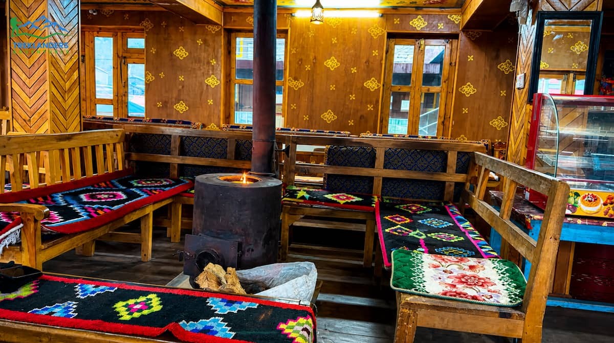
Heated dining areas in teahouses along the Manaslu Circuit Trek.
You stay in teahouses throughout the trek. These are family-run guesthouses that provide you with a bed, blankets, and meals. The standard varies quite a lot from place to place.
In the lower villages such as Soti Khola, Machha Khola, and Jagat, teahouses are rather simple but still quite functional. You will be given a private room with a wooden bed and foam mattress; toilet facilities are shared, and there is a dining hall. Hot showers will cost you an additional fee, usually NPR 200-300. A few places offer Wi-Fi, but it is slow and quite unreliable.
Going up towards high altitude areas, especially Samagaun, Samdo, and Dharmasala, the level of amenities decreases. Rooms are a lot colder there. The heating in the communal dining hall is usually done with a wood stove or yak dung. The electricity that you get is from solar panels, and the power goes off during the night. One may not even get hot water at Dharmasala before the Larkya La crossing.
At higher elevations, food choices shrink sharply. Below Samagaun, diners find dal bhat, noodles, pasta, soups, eggs, and porridge, more variety than above. Beyond that zone, meals stay limited to dal bhat, noodles, and Tibetan bread. Even though dal bhat keeps its status as the richest in calories and the cheapest option, hunger fades with altitude, making meal planning a conscious task.
One must drink only filtered or boiled water. A purification tablet or portable filter works well on the trail. Bottled water exists but costs more past 3,000 meters and adds trash to the delicate mountain environment.
7. Altitude Sickness on the Manaslu Trek: Prevention and Response
The main risk associated with hiking the Manaslu Circuit is Acute Mountain Sickness (AMS). It is a disease that can incapacitate even the strongest and most physically fit trekkers. You must know about AMS before heading out.
Symptoms of AMS usually start manifesting at altitudes higher than 2,500 meters, and the affected person will most likely feel the condition within 6 to 12 hours of arrival at the higher altitude. Headache, nausea, loss of energy, dizziness, and sleep problems are the most common symptoms. If you are able to identify the symptoms, you can control them through proper actions.
Remember that the most important thing is not to go up the mountain at all with the symptoms of AMS. Give yourself time to stay at your current altitude until the symptoms are gone. If the condition gets worse, you have to go down immediately. Sometimes, even going down 300 to 500 meters can lead to relief from symptoms.
Practical AMS Prevention on Manaslu
Follow the acclimatization schedule for your guide sets. Do not push ahead.
Take the acclimatization rest day at Samagaun seriously. Use it for a short, low hike rather than staying sedentary.
Hydrate consistently. Aim for 3–4 liters of water daily above 3,000 meters.
Avoid alcohol above 3,000 meters. It accelerates dehydration and masks AMS symptoms.
Consult your doctor about Diamox (Acetazolamide) before departure. Many trekkers take it preventively from 3,000 meters upward.
Maintain a resting pulse oximeter reading. Many teahouses carry them. A reading below 70% SpO2 at rest is a warning sign requiring immediate attention.
Ensure your travel insurance covers helicopter evacuation from altitude. Confirm the policy details cover the Manaslu region specifically.
During your trek, your guide is your health supervisor. A certified local guide will be aware of the symptoms of AMS and will be able to give permission to stop the climb or arrange a descent. Heed that advice. A summit view or your personal pride is not worth a medical emergency in a five-day walk from the nearest road.
8. Wildlife, Flora, and the Manaslu Conservation Area
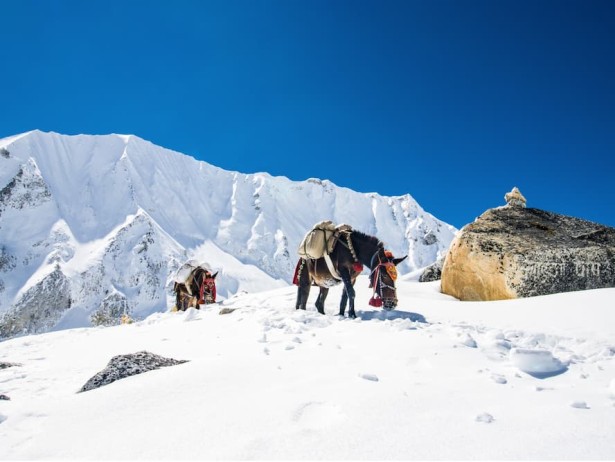
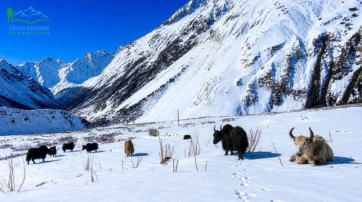
Yaks grazing along the Manaslu Circuit Trek trail.
The Manaslu Conservation Area is an extensive reserve of 1,663 square kilometers that shelters one of the richest zones of biodiversity in Nepal. The trail runs through it almost entirely.
To start, the conservation area stretches from subtropical lowland at 600 meters to a glaciated alpine terrain above 5,000 meters. This vertical range allows for a large diversity of ecosystems: tropical and subtropical forests in the Budhi Gandaki valley, temperate mixed forests in the middle section, and high-alpine scrub and tundra above Samagaun.
Wildlife in the conservation area comprises the snow leopard, red panda, Himalayan tahr, blue sheep, musk deer, grey wolf, and the Himalayan black bear. Sighting is rare; the snow leopard is especially difficult to see. In May 2025, a trekking team working in the region got a picture of a snow leopard on the trail, which an experienced local guide declared to be a once-in-a-lifetime experience.
Alpine grasses and mosses grow only above 4,000 meters, where the air is thin and cold. Below that, birch, blue pine, and juniper take over the slopes above 3,000 meters in the higher elevations. Rhododendrons dominate the underbrush through spring, painting hillsides crimson and rose from March to April.
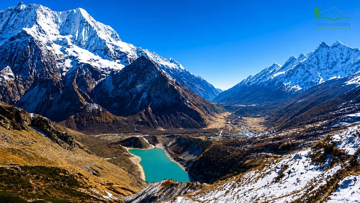
At 3,980 meters near Samagaun, Birendra Lake cuts a sharp profile against the Manaslu southern wall. It's fed straight from the glacier above - no runoff or streams along its edge. Most trekkers hit it on their acclimatization day after a two-hour hike from village life.
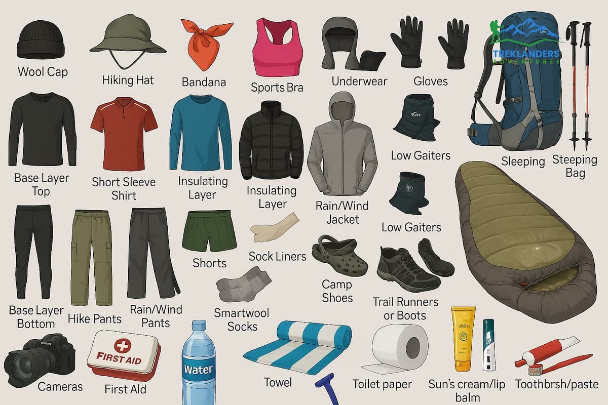
9. Manaslu Circuit Trek Packing List and Gear Essentials
Manaslu Circuit Trek Packing List
A porter will carry your main baggage, generally limited to 15 kilograms, while you carry a day pack. Pack responsibly, as you will only be accountable for what you carry at altitude.
Begin with your footwear. Use waterproof hiking boots that are well-broken-in to help you avoid blisters and instability. To keep snow, mud and scree out of your boots, gaiters will work great. To allow your feet to rest, also pack a pair of lightweight camp sandals.
Develop a dependable layering system. Always pack two moisture-wicking base layers so that you can rotate and stay dry. A fleece mid-layer should be your insulation when you are moving actively. A great down jacket is the one you can count on cold mornings and evenings. Lastly, a waterproof shell jacket and pants will protect your outfit from wind, rain, and snow.
Start your preparation for the High Pass. Warm gloves that allow for basic dexterity should be carried out. A balaclava is good for protecting the face against windburn. When you are resting, your thermal hat is going to keep your head warm. A neck gaiter will be a good addition to the layers. Micro spikes are a must if there is ice on Larkya La, as walking on ice without spikes is not just a question of comfort but a matter of safety.
Protect yourself against the sun. The higher you go, the stronger the ultraviolet rays. Apply sunscreen, SPF 50 or higher, on any skin that you expose. Prevent snow blindness by wearing sunglasses that block UV rays. A wide-brimmed or stiff sun hat will also limit your direct exposure.
Don't depend on the teahouse blankets for sleeping when you are over 4,000 meters. Bring with you a sleeping bag that can keep you warm to at least minus 10 degrees Celsius. This way, you can get good sleep, which is very important for acclimatization and recovery.
Always be prepared for the worst. Have a headlamp with extra batteries, as there can be blackouts. Before going out of Kathmandu, download offline maps with apps like Maps.me or Gaia GPS, as the network will be very limited.
Look after your health and cleanliness. A small first aid kit should have supplies for blister care, as foot problems are the primary reason for people to give up trekking. Rehydration salts will help you keep your electrolyte balance. Instead of buying bottled water at the top, use water purification tablets or a filter. A pulse oximeter will provide you with real measurements of oxygen saturation. Only bring Diamox if you have a prescription and are capable of correctly using it.
Be prepared for power restrictions. A good power bank would be your best companion as charging at teahouses is both limited, and you must pay for it. Generally, you will be charged around NPR 100 to 300 per device for one night of charging.
Protect your pieces of ID. Make your original passport handy. Take hard copies of all your permits, as you will be asked to show them at various checkpoints. Do not forget to carry your insurance papers and a card from your trekking agency with you for emergency or any coordination purposes.
20 Day Manaslu Circuit with Tsum Valley Trek | 20 days
Stunning views of glaciers, lakes, and mountains on the Manaslu Circuit Trek.
The Manaslu Circuit Trek is challenging to trek in Nepal. With permit fees, the guide requirement and high altitude, it’s not meant for first-time trekkers with little to no prior high-altitude experience. Whether you have previously completed another multi-day high altitude trekking route or are willing to take conditioning seriously and listen to your guide’s advice on the trail.
There are rewards for tackling Manaslu. You’ll hike through a region of Nepal that is still truly remote, culturally intact and as rugged as you like. Less than 12,000 people finished this trek in 2024, while several hundred thousand trekked the heavily advertised routes. More will take on Manaslu in the future, but until then, it still offers what many come to Nepal to experience.
At Treklanders, we lead small group and private Manaslu Circuit Trek adventures with professional local guides. We handle all the permitting and include flexible itineraries with rest days for acclimatization. If you’d like to talk about your fitness level, the best season to go, or how to combine trekking Manaslu with either the Annapurna Circuit or Tsum Valley Trek, reach out to us. We’ll be honest with you about whether this trek is appropriate for your skill level and time frame.