
Ultimate Manaslu Circuit Trek Guide: Route, Itinerary, Cost, Permits & Larkya La Pass
5 May 2026
Manaslu Circuit Trek guide covering route, cost, permits, and difficulty—Nepal’s remote Himalayan adventure.
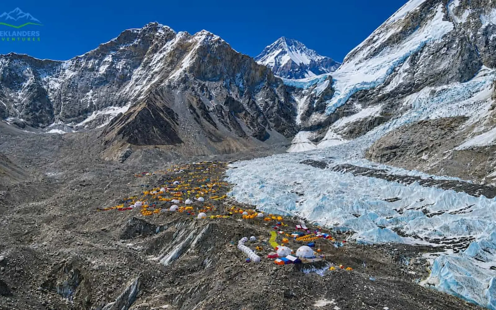
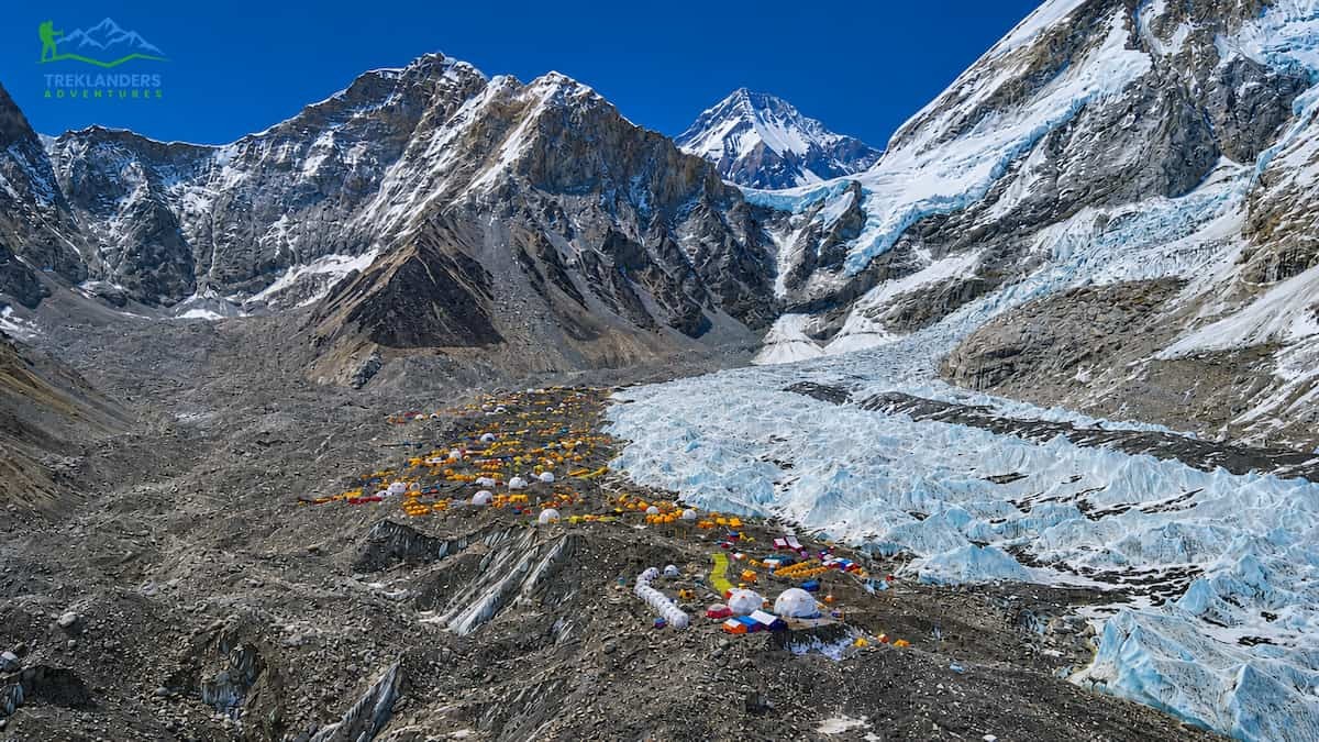
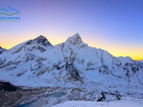
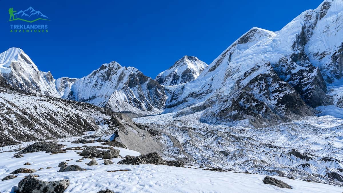
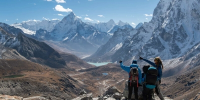
Everest Base Camp elevation stands at 5,364 meters (17,598 feet) above sea level, and because of its rarefied atmosphere, it is one of the world’s most inhospitable travel destinations – with up to half the oxygen of sea level, night-time temperatures as low as -20 °C, and glaciers creaking and groaning beneath your feet. Yet more than 10,000 trekkers make the journey to the Everest Base Camp each year, and while a tiny percentage fails to return, most return home to be changed forever.
Unlike so many treks, this one starts in Kathmandu and makes its way up through Namche Bazaar, a medieval trading town at 3,440m, through the humble villages of Tengboche, Dingboche, Lobuche, and Gorak Shep en route to Everest Base Camp. Every step takes you up, and every night at a new camp, your body scrambles to adapt. But the payoff is worth it, standing at the base of Mount Everest between the massive moraine walls at the foot of the West Shoulder, exactly where Edmund Hillary and Sherpa mountaineer Tenzing Norgay left from in 1953 to complete the first-ever summit of the highest mountain in the world.
Most people’s biggest fear of trekking is becoming ill with Acute Mountain Sickness or Altitude Sickness. There is some truth behind this fear. Studies state that between 30-50% of all EBC trekkers get Acute Mountain Sickness or Altitude Sickness according to the data published by World Health Organization. However, it is fairly easy to mitigate your chances of falling severely ill, especially if you are doing the right trekking itinerary, have the correct amount of acclimatization days, and if you have the proper guidance and advice. This EBC Trekking Guide offers every single fact, figure, and tips and trick about trekking to Everest Base Camp in 2026.
Treklanders' guides and staff have led many expeditions into the Khumbu region over the years. In this post, we lay out our insider knowledge on the terrain, culture, and altitude (including the telltale signs and symptoms of Acute Mountain Sickness). Come back to this page before you book, before you pack, or before you even tie up your hiking boots.
Let the knowledgeable and experienced Treklanders guides handle the trekking permits, itineraries and health issues associated with altitude. Our unique small group approach, customized to suit your travel style, enables you to choose the pace that suits you best.
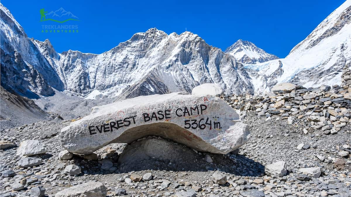
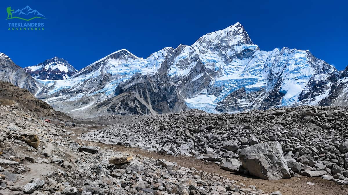
Officially, Everest Base Camp (EBC) is reported to be 5,364 m/17,598 ft above sea level. This figure is consistently provided by Nepal Tourism Board and the Survey of India, two entities known to have precise information on geographic measurements in Nepal. GPS readings from many trekkers and Everest expeditions spanning from 2020 to 2025 vary by a matter of a few meters, reporting measurements for the central campsite around 5,360 m to 5,380 m, depending on exactly where you are on the moraine. At the very bottom of the moraine and what is widely accepted as the reference point for EBC, the site where the communications tent is located reads 5,364 m.
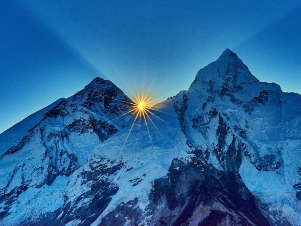
For reference, that’s 5,364m | 17,600ft, a decent hike from Lukla down in the Solu. Just for interest, when I looked at the figure for Kala Patthar, the vantage point used by trekkers to see Everest’s summit, it was 5,644m | 18,514ft. That’s just 280m | 920ft higher than base camp. Of course, many trekkers aim to visit both EBC and Kala Patthar around the same time, with a pre-dawn hike up Kala Patthar for a clear view of the Everest summit at sunrise.
| Location | Elevation (m) | Elevation (ft) | Notes |
| Everest Base Camp (Nepal) | 5,364m | 17,598 ft | Trek destination |
| Kala Patthar | 5,644m | 18,514 ft | Best Everest viewpoint |
| Gorak Shep | 5,164m | 16,942 ft | Last teahouses stop |
| Lobuche | 4,940m | 16,207 ft | Night before EBC push |
| Dingboche | 4,410m | 14,469 ft | Acclimatization stop |
| Namche Bazaar | 3,440m | 11,286 ft | Acclimatization hub |
| Lukla Airport | 2,860m | 9,383 ft | Trek starting point |
| Mont Blanc (Alps) | 4,808m | 15,774 ft | Europe's highest peak |
| Kilimanjaro Summit | 5,895m | 19,341 ft | Africa's highest peak |

EBC is the highest point of my trek, isn’t it? No, it isn’t! Kala Patthar (5,644m/18,491ft) is the higher, and you see EBC on the same day or on the following day of the Kala Patthar hike.
You can see the summit of Everest from base camp. THE WRONG MASSIVE LANDMASS IS IN THE WAY: EVEREST WEST SHOULDER Blocks View of Summit from EBC, NO IT DOES NOT! This is why Kala Patthar is the place to go to experience one of the most iconic views of Mount Everest.
Only super-fit athletes can make it to EBC. There are loads of people who make this trek every year with all levels of fitness and ages ranging from teenagers to people in their 70s. Yes, some may have done long-distance running or triathlon before or have prior mountaineering experience, but what really matters is how your body acclimatizes and if you can deal with the elevation rather than just running a marathon every day.
The Annapurna Base Camp and Everest Base Camp treks are both known to adventure travellers around the world. The Everest Base Camp trek, in particular, stands out as one of the most historic and epic walks on Earth, not only because of its elevation, but because of the sheer breadth of unique aspects to the trail. Here are 20 facts that explore the trek history, culture, wildlife, geology, and more that many EBC travellers probably have never heard of.
On May 29, 1953, Edmund Hillary (New Zealand) and Tenzing Norgay Sherpa (Nepal/India) became the first people to successfully summit Mount Everest, which stands at 8,849m. On this attempt, they left the base camp site.
This 1953 expedition was led by Colonel John Hunt and organized by the Royal Geographical Society.
Trekking in the Everest region was first opened to foreign trekkers in 1950, the year following the Tribhuvan Royal Visit to Nepal. Commercial treks began in the late 1960s.
There is also a Nepali name for Everest - it is called Sagarmatha, which translates as "Goddess of the Sky". In the Tibetan language, it is called Chomolungma.
In 2020, a joint Nepal and China survey of the Everest massif confirmed a revised height for the summit of 8,849 meters. The previously cited elevation was 8,848 meters.
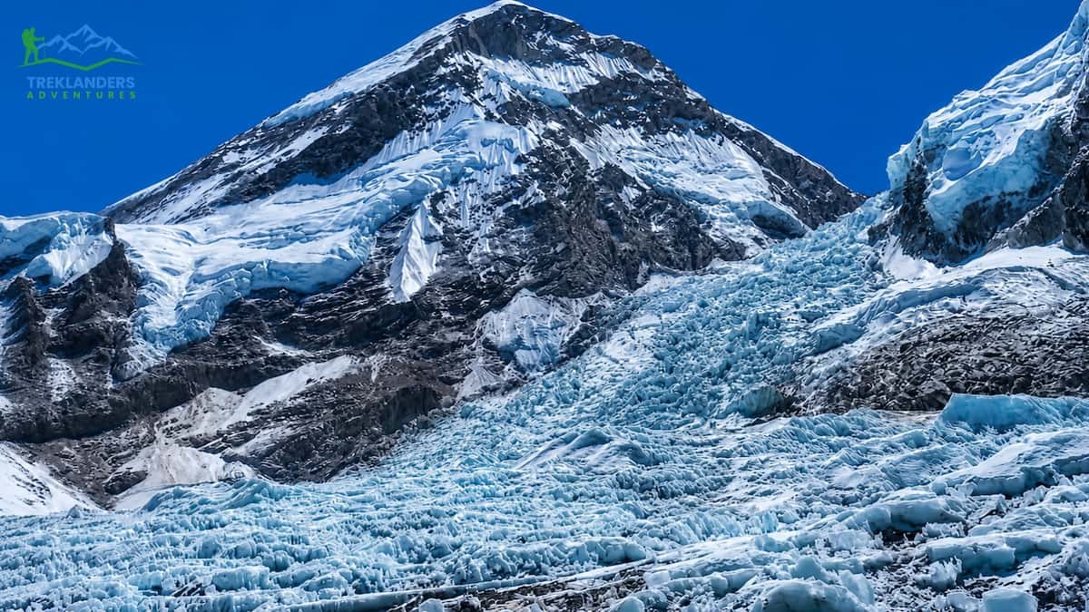
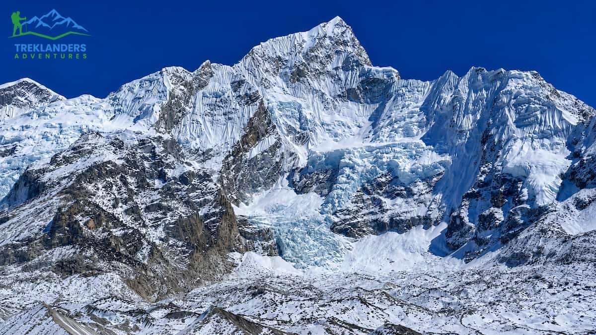
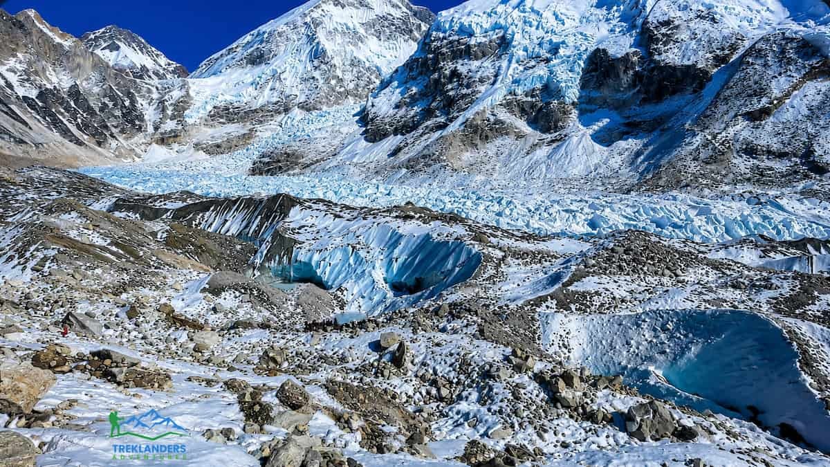
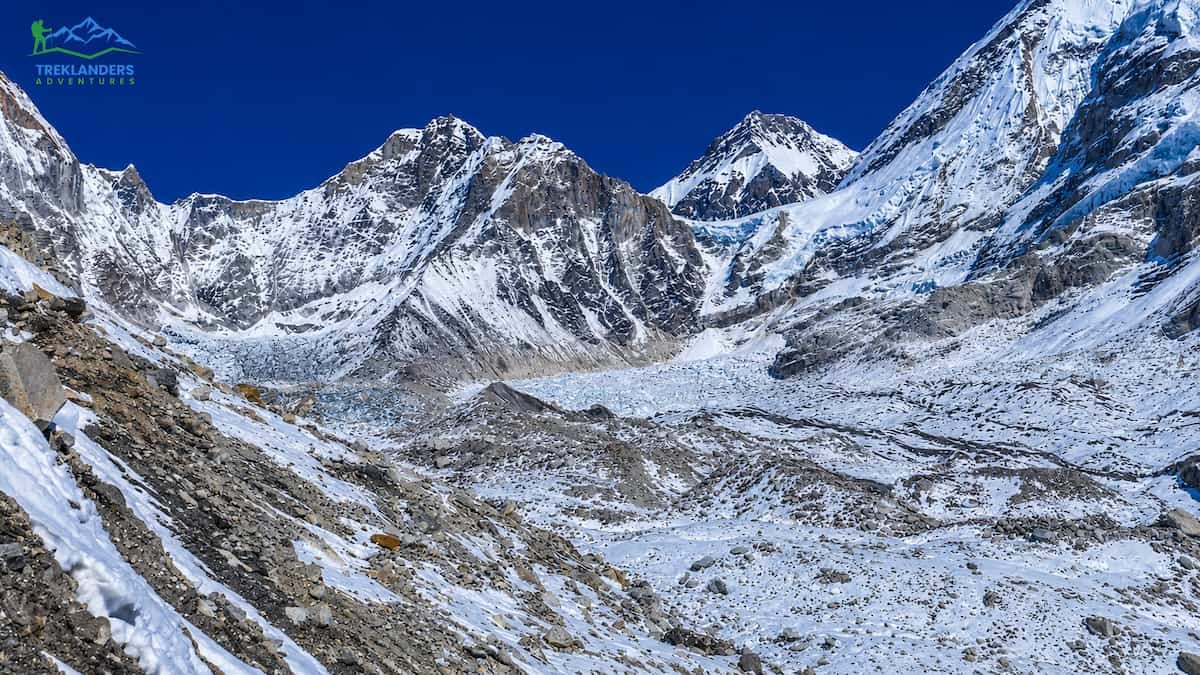
The Khumbu Icefall is above EBC on the standard route to the summit, and it is by far the most hazardous part of the trek to the South Col. In most climb scenarios, you retrace your footsteps through the icefall multiple times.
This part of the Breithorn icefall moves downhill at a rate of about one meter per day, continually changing the morphology of the seracs and large crevasses through which climbers must pass.
The Icefall Doctors are a team of a few experienced Sherpas who, every season, fix the ropes and ladders through the icefall, allowing climbers to attempt the summit.
Sherpas are an ethnic group found mainly in the Solu-Khumbu district of Nepal. The name Sherpa (also spelt "Sherpa" or "Herepa") literally means people from the east.
The Sherpa community is predominantly Tibetan Buddhist; therefore, you will see prayer flags, mani stones and chortens (stupas) everywhere on the trek. When encountering these religious items, please walk around them in a clockwise direction.
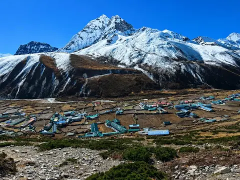
Namche Bazaar (3 440 m): Namche Bazaar, the largest village on the trekking route, has roughly 1,600 permanent residents, who double up during the trekking season.
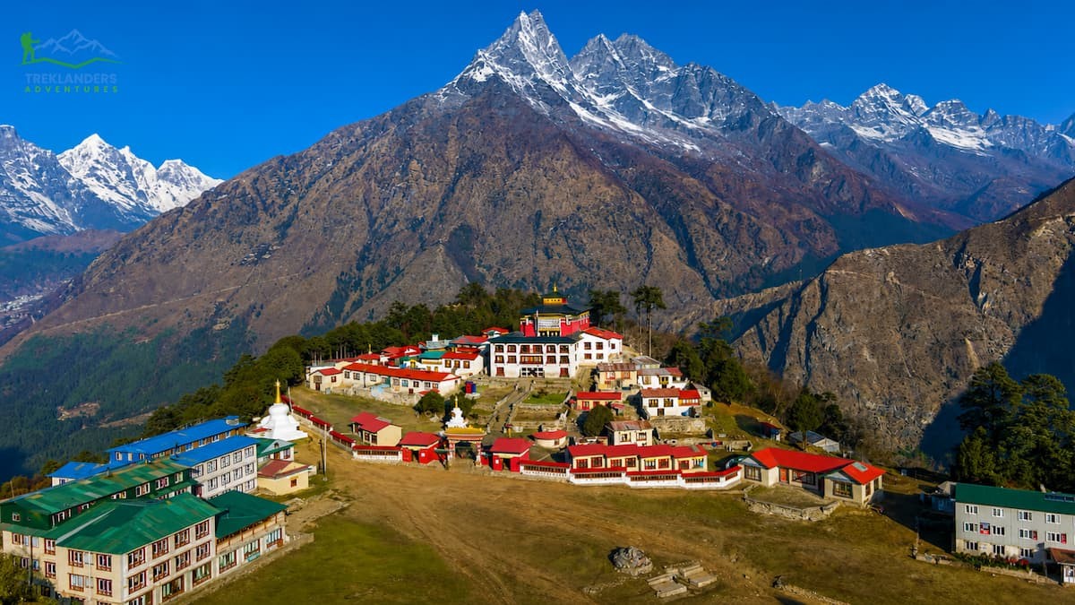
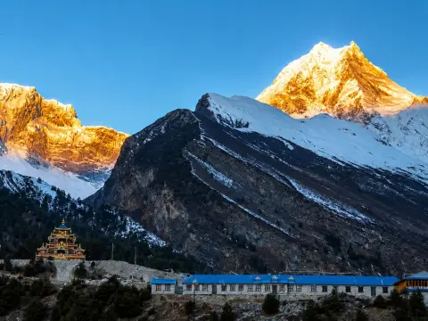
Tengboche Monastery is one of the trek’s most famous stops at 3,867m. The original monastery was built in 1916, destroyed by an earthquake in 1934, rebuilt in the 50’s, burnt down in 1989 by a fire started by a crow trapped in a prayer wheel and then reconstructed with foreign aid in 1990.
The region of Sagarmatha National Park where the EBC trek takes place has been a UNESCO World Heritage Site since 1979. It covers an area of 1,148 square kilometers.
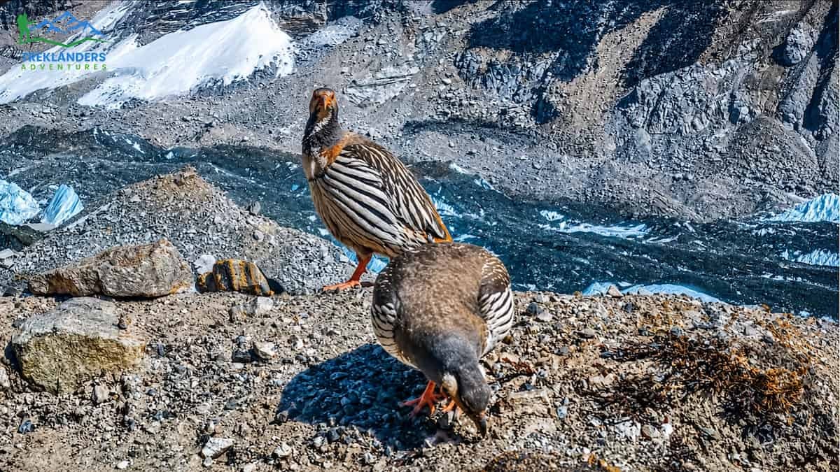
The park also hosts snow leopards, Himalayan tahr, red pandas and musk deer.
Through thick rhododendron and pine forests on the lower part of the trek below Namche Bazaar. The rhododendrons are in flower in March/April, turning to a mass of white and red.
Plastic and human waste management at high altitude is a big problem, and various NGOs are doing big work in cleaning, also the Nepali government is running cleaning campaigns.
As you go higher, the air pressure around you lowers. When you are at Everest Base Camp (5,364m), the amount of oxygen molecules you get in one breath at that height is only about 53% of what you would get in one breath at sea level. Your body reacts by making you breathe more, your heart beats faster, and your body also makes more red blood cells. This change process is known as acclimatization, and it requires some time. If you do it too quickly, your body will not be able to adapt.
AMS or Acute Mountain Sickness affects 30-50% of trekkers to Everest Base Camp and manifests itself 6-12 hours after arrival at a new altitude. Typical symptoms include:
Mild symptoms of Acute Mountain Sickness (AMS) include headaches and nausea but are not life-threatening. Stop climbing and rest until symptoms abate. If symptoms worsen or don't subside within 24 hours, descend 300 to 500 meters.
High Altitude Pulmonary Edema (HAPE) is a fluid build-up in the lungs when climbing to high altitude. It is the most common cause of altitude-related deaths worldwide. HAPE may produce headaches, tiredness, cough, shortness of breath, swelling of the face and body, wheezing, feeling sick, and loss of appetite.
HAPE Trigger: Immediate descent of at least 1,000m is required to treat HAPE. Don’t wait for symptoms to subside – evacuate promptly. Supplemental oxygen and the oral medication of nifedipine may be used during medical evacuation, but descent to a lower elevation is the definitive cure.
HACE, short for High Altitude Cerebral Edema, is a condition that results from fluid build-up in the brain. It is the most serious form of Acute Mountain Sickness, severe and developing quickly. Typical symptoms include:
HACE is a serious and potentially life-threatening medical condition that requires immediate evacuation. For this reason, we stress that all our treks operate at high altitudes. Trekkers can descend to lower altitudes by helicopter the following day if medical advice is that this is safe. During good weather, a helicopter can fly to Everest Base Camp during daylight hours. Should symptoms of HACE develop descent by helicopter to lower altitudes should begin immediately. While below 3500m, dexamethasone may not be of benefit, for those suffering from HACE; it may slow down the progression of symptoms while trekking down to lower altitudes for further medical treatment. Treklanders has its own contacts with helicopter companies, and medical advice/treatment is included in the trek price, as is our travel insurance, for all guided trekkers.
Remember, acclimatization takes place through several physiological changes, which include the kidneys excreting bicarbonate to counter the increased acidity of the blood brought on by the faster breathing. In addition, increased levels of erythropoietin (EPO) stimulate the production of red blood cells; the increase in plasma volume is initially offset by a decrease in plasma, thus concentrating the existing red cells in the blood. This whole process takes 2 to 5 days to acclimatize the increase in altitude, and a good Everest Base Camp trek itinerary includes acclimatization days at Namche Bazaar (3,440m) and Dingboche (4,410m).
There is a universal rule that hikers and trekkers follow when trekking to high altitudes, known as “Climb High, Sleep Low.” This rule essentially means that during the day, hikers complete short climbs at higher elevations but come back to bed at lower altitudes to rest. On the Namche acclimatization day, we hiked to the Everest View Hotel, which is 3,880m high and then made our way back to our hotel at 3,440m to rest for the night.
Acetazolamide (Diamox) is the most studied drug for AMS prevention. Increasing the excretion of bicarbonate, it promotes faster breathing, which results in deeper breathing and therefore better oxygenation. Typical dosing is 125 mg twice daily, beginning 24 hours before arrival at high altitude (above 3,000 m or 10,000 ft).
Side effects include increased urine production, a strange sensation in fingers and toes, and some people report an altered taste of carbonated beverages. Always advise your doctor about any drug allergies before using Diamox, as it is a sulfa drug and can cause severe reactions in people with sulfa allergies.
According to several controlled trials, taking ibuprofen (600 mg three times per day) can be as effective as using Diamox for the prevention of AMS. Ibuprofen is easily accessible and generally causes fewer side effects for most people.
As Treklanders guides many years of personal exposure in the Khumbu area, we know that some of our clients have successfully managed their altitude tolerance both with and without medication. The bottom line is that the itinerary pace is always a non-negotiable factor. No medicine can replace a good acclimatization schedule.
The standard Everest Base Camp trek itinerary runs 12 to 14 days from Lukla to base camp and back. Below are the Treklanders recommended 14-day schedule, which includes two acclimatization days. This pacing gives your body the time it needs to adapt and significantly reduces altitude sickness risk.
| Day | Route | Elevation | Distance | Walk Time |
| 1 | Fly Kathmandu to Lukla; trek to Phakding | 2,860m to 2,610m | 8 km | 3-4 hrs. |
| 2 | Phakding to Namche Bazaar | 2,610m to 3,440m | 11 km | 5-6 hrs. |
| 3 | Namche Bazaar acclimatization: hike to Everest View Hotel (3,880m), return to Namche | 3,440m | 8 km day hike | 4-5 hrs. |
| 4 | Namche Bazaar to Tengboche | 3,440m to 3,867m | 10 km | 5-6 hrs. |
| 5 | Tengboche to Dingboche | 3,867m to 4,410m | 10 km | 5-6 hrs. |
| 6 | Dingboche acclimatization: hike to Nagarjun Hill (5,100m), return to Dingboche | 4,410m | 10 km day hike | 5-6 hrs. |
| 7 | Dingboche to Lobuche | 4,410m to 4,940m | 12 km | 5-6 hrs. |
| 8 | Lobuche to Gorak Shep, then to Everest Base Camp, return to Gorak Shep | 4,940m to 5,164m to 5,364m, sleep 5,164m | 16 km | 8-9 hrs. |
| 9 | Gorak Shep to Kala Patthar (sunrise), then descend to Pheriche | 5,164m to 5,644m, sleep 4,371m | 15 km | 7-8 hrs. |
| 10 | Pheriche to Namche Bazaar | 4,371m to 3,440m | 19 km | 6-7 hrs. |
| 11 | Namche Bazaar to Lukla | 3,440m to 2,860m | 18 km | 6-7 hrs. |
| 12 | Fly Lukla to Kathmandu | 2,860m to 1,350m | — | 35 min flight |
The day 3 and day 6 are acclimatized on days. On these, we don’t do a lot of touring, but we will go up to a higher altitude and then come back again. This ‘climb high, sleep low’ method is a proven way to avoid AMS (Acute Mountain Sickness).

3,440m (Namche Bazaar): This is the first major altitude. Many people get mild headaches here. So, rest, rehydrate, and don’t climb any more hills on Day 3.
4,410m/14,533ft (Dingboche): You can really feel the effects of the thin air here, and the quality of sleep suffers. For most, taking a dose of Diamox or Ibuprofen before sleep will allow them to get a good night's rest.
5,164m / Gorak Shep: The last town before Everest Base Camp. The teahouses are very basic, food choices diminish, and sleep is difficult.
5,364m (Everest Base Camp): The summit of our journey. Most trekkers spent no more than thirty to sixty minutes at the summit, taking photos before beginning their descent. If you have 'summitted' in spirit, but your body is not up to the challenge, do not linger foolishly and risk worsening any health problems you already have.
5,644m (6,000ft/1,844m): Kala Patthar, the trek's high point. Try to start up here before 6 am so you can enjoy the sunrise and be finished by the time any afternoon clouds show up.
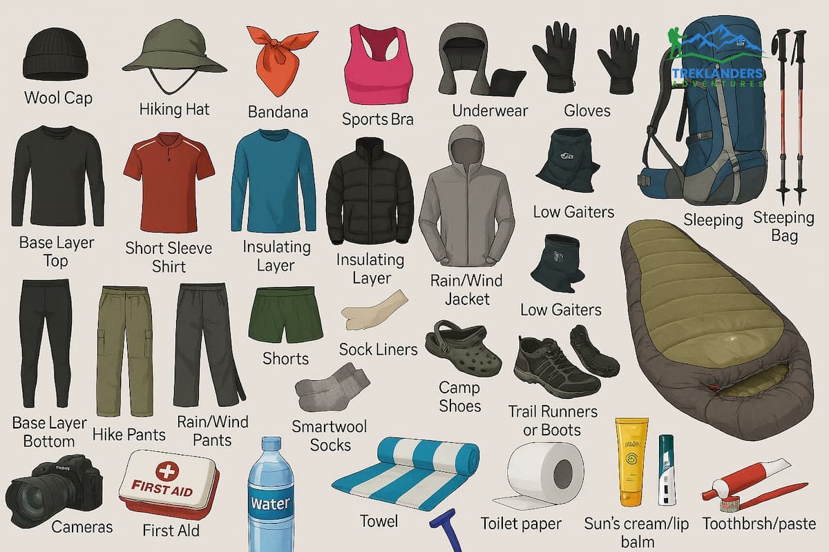
We provide porters to carry your trekking bags during the day. As a guideline, guests carry a daypack of approximately 5-10 kg. The main bag carried by the porters can weigh up to 15 kg.
Shoes: Waterproof, ankle-high trekking boots, sturdy enough for the demands of high-altitude trekking. We recommend wearing your boots before you depart for at least 50 km. For treks going above Lobuche, we recommend bringing gaiters as well.
Insulation: Down jacket rated for -20°C + fleece mid layer + base layer of moisture wicking material.
Rain gear (jacket and pants), a waterproof shell. The weather in Khumbu can change quickly.
Trekking poles: Trekking poles can even help take some pressure off your knees on descent, reducing the strain by up to 25 per cent, based on studies like one conducted by the biomechanics researchers at the University of Michigan.
It is worthwhile bringing a good sleeping bag with a temperature rating of -15°C / -20°C. Some of the teahouses along the way have sleeping bags to rent, but this is not always a guarantee, and you may find that what they have is not up to standard.
Headlamp: All kinds of power outages can happen, so always have extra batteries (or a USB rechargeable model).
Water purification: Water purification tablets or a UV pen filter. Bottled water is available but expensive and plastic waste-generating.
Medical kit containing: Diamox, ibuprofen, loperamide, rehydration salts, blister kit and antiseptic wipes for general first aid and antiseptic cleaning as required. A pulse oximeter to monitor oxygen levels in the blood.
Bring sunscreen and lip balm with SPF 50+ minimum, as UV at high altitude can cause severe sunburn in a matter of minutes.
Electronics: Portable power bank (10,000 mAh minimum), camera, universal power adapter. Some teahouses charge for charging electronic items (USD $1-$3 per item, per charge).
Two primary trekking windows exist. Both have trade-offs.
| Season | Months | Pros | Cons |
| Spring (pre-monsoon) | March to May | Rhododendrons bloom, summit expeditions active, warmer temperatures | Crowded trails and teahouses, hazy skies by May |
| Autumn (post-monsoon) | September to November | Crystal-clear skies, stable weather, best mountain views | Coldest nights, trails can be icy by November |
| Winter | December to February | Empty trails, lower teahouse prices | Extreme cold, some passes snowed in, flight delays common |
| Monsoon | June to August | Lush vegetation, fewer trekkers | Heavy rain, leeches below Namche, trail washouts, poor visibility |
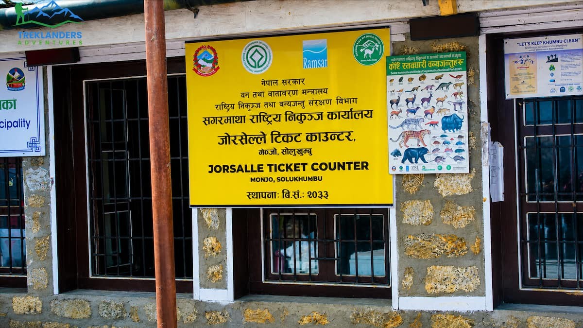
Treklanders will take care of all your permit application procedures if you decide to book a Everest Base Camp guided trek through them.
Altitude sickness can be unpleasant or worse if not properly treated. But it’s far easier to prevent it in the first place! With the elevation of Everest Base Camp at 5,364m, it’s something that should not be ignored, but with these simple tips, you can greatly minimize the chances of suffering from altitude sickness.
Stick to a sensible acclimatization schedule (see notes for example schedule) and avoid racing upwards. Include rest days at Namche Bazaar (3,450m) and Dingboche (4,400m). Avoid climbing more than 500m (560yd) above the 3,000m (9,800ft) altitude per day, and specifically, above 3,000m, always add a day to acclimatize for each 500m of climbing.
Drink lots of water. Bring water into your hang glider before launch and drink 3-4 litres of water per day. It is said that dehydration can decrease the body's ability to acclimatize and make AMS (Acute Mountain Sickness) like headaches and fatigue worse. Also, avoid alcohol for the first two days at any given altitude.
Use a pulse oximeter each day. Normal EBC blood oxygen at rest is 70-80%. Anything below 60% at rest is very concerning. Treklanders Guides will have pulse oximeters and can take all trekkers' vital signs each morning.
Consume sufficient calories. Your body burns a lot more at high altitudes. Forgo appetite and eat away, and the best food to consume are high carbohydrate meals (such as dal bhat, rice, noodles).
Know the Symptoms – High Altitude Headache, Nausea, Dizziness, and Confusion. Report any symptoms to your guide/trekker staff immediately. If you experience these symptoms, inform your guide/trekker staff. Early reporting can save lives.
Never climb with Acute Mountain Sickness (AMS) symptoms. There is no good reason to risk your health. If you have any symptoms, wait until they have cleared before climbing more.
If you are showing symptoms of altitude sickness, go down. This is the definitive treatment for all types of altitude sickness. Loss of about 300 to 500m can start to make you feel better within a few hours.
Administer supplemental oxygen, if available. Many teahouses between Namche Bazaar and Everest Base Camp stock canisters of oxygen for trekkers to relieve headache symptoms but never forget that serious cases of Acute Mountain Sickness require descent.
it.
9. Bring a Gamow bag. These expandable hyperbaric chamber tents or bags are designed to allow acclimatization by reversing the mountain climbing process in a serious medical emergency. Many of the more comfortable lodges now have one, but the Treklanders group kits come with one as well.
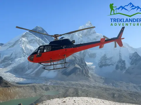
10. Buy helicopter evacuation insurance. A helicopter rescue from EBC costs $4000-$6000 USD. Trekking insurance will cover this cost. Not trekking insured is idiotic.

The Everest Base Camp altitude of 5,364 meters is not merely a figure. It is a milestone. Passing it means becoming part of those few who have physically carried themselves all the way to the world's highest mountain. You've experienced that rarefied Khumbu atmosphere. You've been at the very spot where history was made.
The way up to this milestone will not be without its demands: It calls for a lift in altitude capacity, a good understanding of the body's acclimatization to changes in oxygen level, and recognizing the mountain environment that has for centuries supported Sherpa communities. A hurried, unprepared expedition can lead to health risks and also take away from the enjoyment of others around you. Meanwhile, a thoughtfully scheduled journey accompanied by knowledgeable guides ensures that you will be able to take full advantage of what the Khumbu region has to offer.
Treklanders have been leading trekkers to Everest Base Camp for many years. Our crew is familiar with the altitude profile, the teahouses along the route, the acclimatization schedules, and the evacuation protocols. We take care of your permits, help you maintain your pace, and check your health at every step. Your only concern is the mountains.
Reserve Your 2026 EBC Trek with Treklanders
Manaslu Circuit Trek guide covering route, cost, permits, and difficulty—Nepal’s remote Himalayan adventure.
Why Dingboche is the most important acclimatization stop on the Everest Base Camp Trek for safe altitude adjustment and stunning Himalayan views.
Guided vs independent Langtang Valley Trek: compare cost, safety, flexibility, and experience to choose the best trek in Nepal.