
Manaslu Circuit Trek in Autumn vs Winter: Larkya La Pass Conditions, Weather, Safety & Best Season Guide
5 Apr 2026
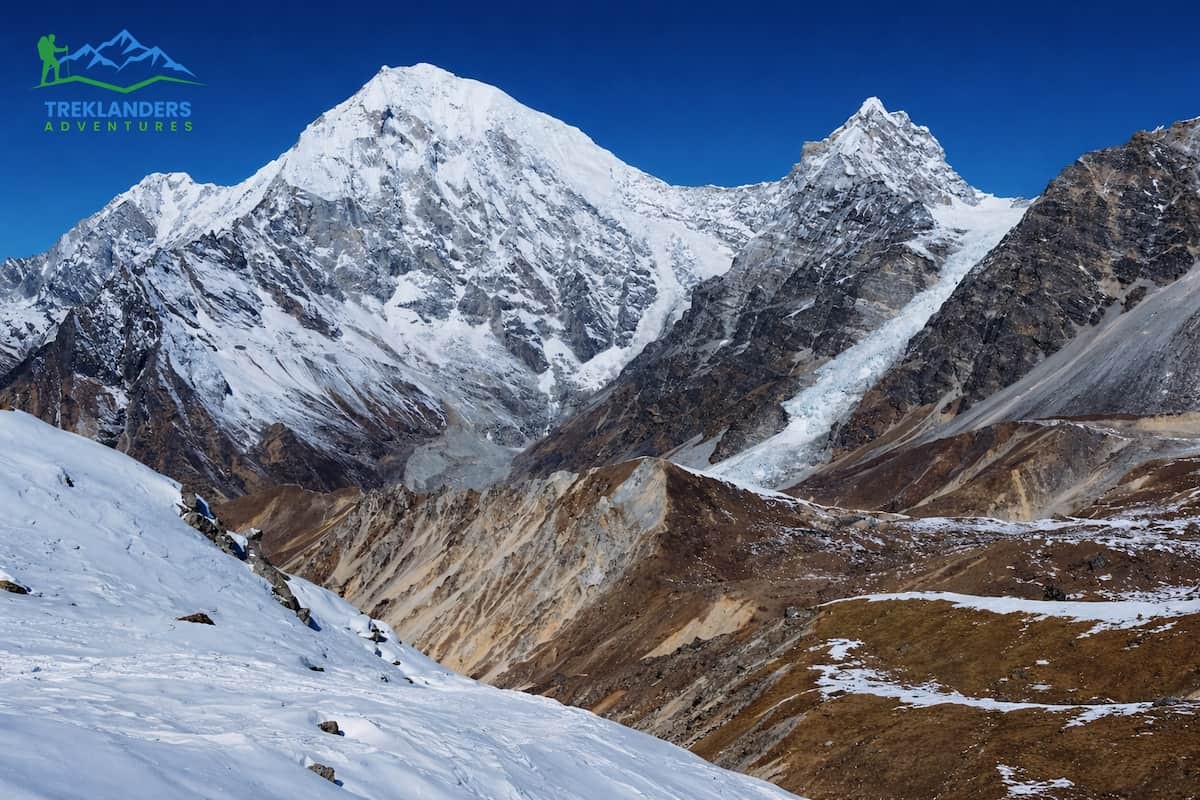
Autumn and winter on the Manaslu Circuit differ greatly—compare conditions to choose the best season.
The earthquake on April 25 2015, transformed the Langtang Valley to an extent that every level was affected. It was far from a small interruption. Besides reshaping the landscape, it wiped out the infrastructure and changed the very nature of trekking today.
The disaster set off an enormous avalanche and air blast that immediately buried Langtang Village. Most of the buildings were damaged or destroyed, and the death toll ran into hundreds, including both residents and trekkers. The original settlement's old format ceased to exist. Now, you only visit the location as a memorial area, not a real village.
Rescuers and survivors reconstructing the village of Langtang after a disaster had to choose a safer place, which was a bit higher in the valley. This new community complies with a better plan. Houses and teahouses are made with more durable materials such as stones, cement, and steel. A lot of buildings now at least partially comply with earthquake-resistant designs.
Large parts of trekking trails were erased as a result of slides, avalanches, and shifting ground. Footbridges fell. Whole paths became dangerous. The trail of today is not the same as the one before 2015. Many parts have been adjusted to the ground to make it less dangerous. The path is also well-marked and steadier.
The earthquake made a physical alteration to the valley. Slopes crashed down. River courses were turned. Some forests and pastures were hidden under the earth or changed. The marks of the avalanche can still be seen today. Nevertheless, the gradual return of plants and animals indicates natural recovery.
Teahouses, temples, schools, and bridges were damaged or destroyed throughout the entire valley. Even popular temples like Kyanjin Gompa were heavily damaged. It took a very long time to reconstruct. Nowadays, there are new lodges, schools, and facilities which often meet higher safety standards and are equipped with solar energy support.
After the earthquake, trekking came to a complete halt. The valley remained deserted for a few months as it was considered unsafe, and the damage was extensive. However, tourism started creeping back as early as about 2 to 3 years after. At present, trekking is done actively, but still, the number of tourists is less than the number visiting the Everest routes or Annapurna routes.

The calamity made the people start over. Many of them were not only displaced but also lost their source of income. They had to depend on each other, the community as a whole, and international donors to rebuild. Nowadays, tourism has become a mainstay of the economic fabric of the area. Visitors indirectly keep the doors of the newly reconstructed teahouses and local people open.
Reconstruction after the earthquake was done with a focus on safety. Where possible, trails have been rerouted to avoid areas considered high-risk. The structures have also been made more resilient. People are more enlightened about the dangers of landslides and avalanches now. Having a guide, getting insurance, and being prepared are things that have gained importance compared to the time before.
The Langtang Valley hike is a different one at present. You are strolling through a place that depicts not only destruction but also recovery. Apart from the scenic mountains, you will find this trek to be a living example of resilience and transformation.
The Langtang Valley Trek these days is considered safe, easily reachable, and gratifying. The trail has bounced back quite well since 2015. Besides, you are guaranteed to get the full trekking dose with much less crowding compared to the main routes.
The trail is not only visible but also properly signposted. Besides, the local administrations and communities have reconstructed the damaged parts and even enhanced safety measures. You are going to move along a combination of forest trails, stone steps, and exposed alpine landscapes. The suspension bridges are safe as they are constantly checked and maintained. While landslide areas are still there, guides are quite familiar with the safest timings and paths.
Teahouses are found at all main stops, including Lama Hotel, Langtang Village, and Kyanjin Gompa. The rooms are basic but clean. Most of the lodges offer beds, blankets, and some basic charging facilities. The food is almost the same throughout the trek. You get dal bhat noodles, fried rice, soups, and tea. The menus are similar to other well-known treks, though a bit limited at higher elevations.
The trail is much quieter compared to Everest Base Camp and the Annapurna Circuit. That means you will meet fewer trekkers every day. This results in a much more laid-back pace. The teahouses are less crowded, and you also have better chances to interact with the locals. If you want to be alone without being isolated, this trek is just perfect.
The scenery is diverse and changes quickly with altitude. You start in dense forests of rhododendron and bamboo. As you climb, the valley opens into wide alpine meadows with yaks grazing nearby. From Kyanjin Gompa, you see peaks like Langtang Lirung dominating the skyline. Day hikes to Kyanjin Ri or Tserko Ri offer panoramic views of glaciers and snow-covered ranges.
The Langtang valley is home to Tamang communities. You pass through villages with prayer flags, mani walls, and monasteries. Kyanjin Gompa remains a cultural highlight. Despite damage in 2015, it has been restored and continues to serve as a spiritual center.
The trek is moderate in difficulty. Daily walking ranges from 5 to 7 hours. Altitude gain is steady, which helps with acclimatization. You do not need technical skills, but you need basic fitness and stamina. The highest point, Tserko Ri, reaches over 5,000 meters, so altitude awareness is essential.
Mobile signal is available in the lower sections and in some villages, though it is unreliable. Wi-Fi exists in a few teahouses for a fee. The trek starts with a road drive from Kathmandu to Syabrubesi. Roads are rough but manageable.
Today, the Langtang Valley Trek offers a balanced mix of nature, culture, and recovery. You see rebuilt villages, improved trails, and a community that depends on trekking.
It is a quieter alternative to busier routes, without sacrificing scenery or depth.
Since 2025, the Langtang Valley Trek rule has become a lot stricter. Every trekker entering the Langtang National Park must be accompanied by a licensed guide. Solo trekking is banned at all times in all the routes inside the park, such as Langtang Valley, Gosainkunda Lake, and the Tamang Heritage Trail.
Therefore, you may only begin your trek with a certified guide. Your guide should have credentials that are valid and recognized by the Trekking Agencies' Association of Nepal or the Nepal Tourism Board. Entry point officials and checkpoints check your permits as well as your guide's license. If you're not with a guide, then you won't be allowed to continue.
Such a rule may lead to some change in your travel style among the Langtang Valley Trek, the Gosainkunda Lake and Tamang Heritage Trail. You are not in charge of navigation and route decision-making anymore. The guide is the one in charge of choosing safe paths, determining walking times, and modifying the daily itinerary according to changing conditions. In a place where landslides, river crossings, and high altitude are frequent, the risk of getting exposed to highly dangerous situations is considerably decreased.
Moreover, guides are not only there for the sake of navigation. They assess your fitness and recognize the initial symptoms of altitude sickness. In case of any trouble, they take measures immediately by reducing the pace, suggesting rest, or arranging a descent. In the case of an emergency, they serve as the link to communications and evacuation, thus shortening the response time.
The rule also enhances the overall management of the trail by making the movement more methodical. It ensures that trekkers strictly follow the main routes and have less possibility to wander into dangerous or off-limits areas. Besides, this will decrease the element of surprise and make it easier to keep track of the order, especially in far-flung parts where the changes in visibility and trail clarity are quite rapid.
This rule serves to reduce environmental damage in a way, too. Trekking discipline is part of what guides insist on. They keep travellers on the main path, control waste, and discourage actions detrimental to the delicate mountain environment. So, even as valley trekking expands in popularity, its natural beauty is safeguarded.
Still, the trekking occasion is an unfolding story. You cover your way through the woods, the town, and still very high in the mountains. Executing is what makes the difference. You base your decision on local knowledge instead of your own.
This rule characterizes the current Langtang trekking system. It not only clarifies what is to be expected but also lays emphasis on safety, structure, and responsible travel throughout the region.
Trekking in the Langtang region directly supports local livelihoods. The valley relies heavily on tourism, especially after the damage caused by the 2015 earthquake. When you trek here, your presence creates steady income across multiple parts of the local economy.
Teahouses are the main beneficiaries. Most lodges in villages like Langtang and Kyanjin Gompa are family-run. When you stay overnight, eat meals, and use basic services, you contribute to household income. This money supports daily needs such as food, education, and rebuilding efforts. Unlike large commercial destinations, income here stays within the community.
Guides and porters also depend on trekking activity. Hiring a guide employs trained locals who understand the terrain, culture, and risks of the region. Porters earn income by carrying loads between villages, which remains a key source of work in remote mountain areas where other job options are limited.
Local supply chains benefit as well. Food served in teahouses often comes from nearby farms or regional markets. Items like potatoes, vegetables, dairy products, and yak-based goods are sourced locally whenever possible. This creates demand for agriculture and livestock, which strengthens the rural economy.
Trekking also supports reconstruction and long-term development. After the earthquake, many homes, schools, and monasteries were destroyed. Tourism revenue has played a key role in rebuilding infrastructure. Villages have invested in stronger buildings, better sanitation, and solar energy systems. This improves living standards for residents, not just visitors.
Cultural preservation is another impact. The Langtang Valley is home to Tamang communities with distinct traditions, language, and religious practices. When trekkers visit monasteries, observe local customs, and interact respectfully, it reinforces the value of maintaining these traditions. Tourism creates an incentive to preserve heritage rather than abandon it.
There is also a shift toward more responsible tourism. With the mandatory guide system in place, trekking activity is better managed. Guides educate trekkers about local norms and environmental practices. This reduces damage to natural resources and ensures that tourism remains sustainable over time.
Economic benefits in Langtang are direct and visible. Your spending reaches local families rather than external operators. Each night you stay, each meal you eat, and each service you use contribute to recovery and stability in the valley.
Trekking in Langtang is not only a travel experience. It is active participation in a community’s rebuilding process and long-term survival.
When hiking in the Langtang Valley area, it is essential to have two primary documents with you. You should not only get them but also have them handy all the time because entry-point staff and trekkers-checkers will frequently ask for them.
This is the document that authorizes you to walk in the National Park of Langtang. The Park, in addition to conserving the forest and the natural environment, also oversees the local human settlements; therefore, access to the park is regulated. You may obtain this permit either from the Nepal Tourism Board office in Kathmandu or at the park entry point in Dhunche. Most trekkers arrange their permit beforehand in Kathmandu in order to avoid any delays.
Usually, a permission check is made when you enter Langtang National Park and sometimes during your actual trekking as well. You are supposed to show your permit at every checkpoint, so keeping it both safe and handy is a wise idea. In case you misplace it, you might have issues with your further trekking. Part of the income generated from the permit fees is channeled towards the conservation efforts. This includes maintaining the trails, protecting the wildlife, and managing the waste. By purchasing the permit, you are essentially providing the necessary funds for the long-term preservation of the Langtang region.
The TIMS card serves as a tracking system for trekkers in Nepal. It is overseen by the Trekking Agencies' Association of Nepal and the Nepal Tourism Board.
The card keeps your basic personal information, including your name, nationality, trekking route, and emergency contact numbers. The authorities use this information to track who is currently on the trail.
Safety is the key motive behind the system. In case you go missing or get into an accident, officials will be able to find and identify you quickly by means of TIMS information. This leads to better rescue operations and less confusion during searches.
You can obtain a TIMS card in Kathmandu through trekking agencies or authorized offices. If you are travelling with a guide, the agency will most probably take care of the TIMS card procedure on your behalf.
Trekking permits might be simple, but it is a necessity. In the absence of permits, it will not be legal for you to trek in the Langtang region. Apart from this, permits help in maintaining a safe, orderly, and protected environment in the area.

Indeed, the longest-lasting period for hiking in Langtang Valley didn't change much after the 2015 earthquake. However, aspects like safety on the trails, staying alert to weather changes, and paying attention to the seasonal conditions at a particular time of year really matter now. The valley has healed quite well, but a well-timed trek definitely helps to ensure safety and maximize the overall experience.
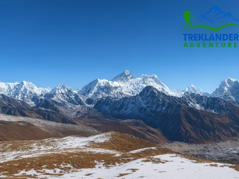
Autumn, from September to November, is a better time for trekking throughout the Nepal region. Another great benefit of hiking in the valley at this time of year is the clarity of the skies. Snow-capped mountains can be seen clearly, with Langtang Lirung being one of the most noticeable peaks. The trails are generally free of mud and very stable since the heavy rains have stopped. In fact, this greatly decreases the chance of accidents in landslide-prone places. Near the villages, the weather will be quite moderate, whereas it will be cold but bearable when you go higher. The villages function at their natural pace, and all the amenities are available without any hassle. By the way, this is the safest and most reliable season for trekking.
Spring is a lovely season and quite close to being the best one. The forests come alive with blooms of rhododendrons, especially in the lower areas. The weather is mostly stable, though the haze may cause slight visibility reductions. Since it is warmer than in the fall, trekking will be more enjoyable. Snow can still be there at the high places at the beginning of the season, but usually, the paths are accessible. This way, you get a nice mix of beautiful nature and not too challenging conditions.
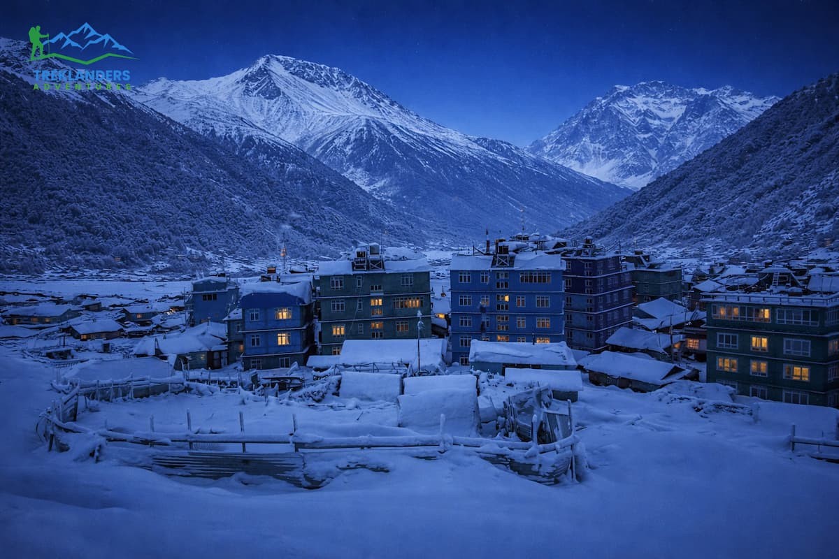
It is possible to go on hikes in winter; however, it is much harder. Snow blankets the upper parts in particular around Kyanjin Gompa and lookouts such as Tserko Ri. Paths might be slippery, and some teahouses could be closed. Besides that, nights are very cold since the temperature can drop to below zero. If you are well prepared, you will have stunning views due to the clear skies. A winter Langtang valley trek with a guide is still a good option for those who are very experienced and know what they are doing.
The monsoon is the worst season for trekking. Because of the heavy rain, lower trails will be covered in mud and will be slippery. Also, narrow valley sections are more prone to landslides. Mountain views are often obscured by clouds. Forest areas are infested with leeches. Besides that, due to very bad road conditions between Kathmandu and Syabrubesi, travel delays are common.
As the valley is post-earthquake, it is still sensitive to weather, though it is safe. Autumn gives the most stable weather. Spring is full of great scenery and is less crowded. Winter is best for well-prepared trekkers. Monsoon is the time when one must be very cautious and also flexible.
Season selection has an immediate impact on safety, visibility, and the overall trekking experience in Langtang.
On arrival in Kathmandu, you will be transferred to your hotel in about 20 to 30 minutes. The remainder of the day is yours for relaxation and getting ready. You will also take this opportunity to check your equipment, get your permits, and have a meeting with your guide. If there is extra time, you may want to explore the local areas such as Thamel. This is a good way to help you get accustomed to the time before going to the mountains. Overnight in Kathmandu.
You will leave very early to get to Syabrubesi by car. It will take about 6 hours to cover the distance, but the time may vary depending on the condition of the roads. The path of the vehicle will be alongside hills, rivers, and terraced farms that are quite winding. On the way, you will cross Dhunche, which is the administrative center of the district.
Near Syabrubesi, the road is not paved in some spots and quite rough. You will get very impressive glimpses of the traditional rural mountain lifestyle. Small villages, local markets, and forested hills are some of the main features of the landscape. Syabrubesi will be reached around the rest of the day, and you will get the chance to prepare for the trek. Overnight in a teahouse.
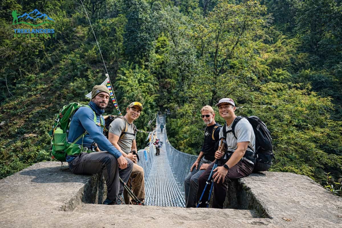
The trekking trail goes beside the Langtang River. You will cross several suspension bridges and go through dense forests of oak and rhododendron. The path ascends gradually with some steep sections.
While walking along the path, you will come across small villages such as Bamboo and Rimche. Besides the river, one of the main attractions is the forest, which is dripping with wildlife. Scattered along the route, groups of monkeys can be spotted. The river slowly leaves for a change to the sound of water combined with birdsong.
After a 6-hour trek, you arrive at Lama Hotel, a small settlement of lodges surrounded by forest. The temperature here is a bit lower because of the altitude and shade. Stay the night in a teahouse.
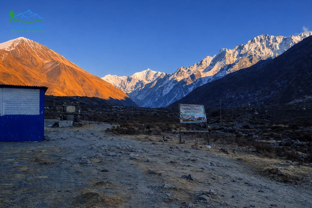
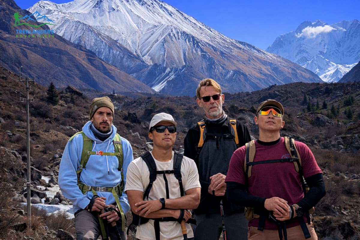
The path leads you through the forest to where the terrain is gradually revealed. The valley is getting broader, and the mountain views are starting to appear. The spectacular Langtang Lirung and other peaks are in view.
You continue past Ghodatabela, which is a checkpoint area surrounded by open meadows. From this point, the path continues to go uphill regularly. Yak grazing areas and small villages dot the landscape.
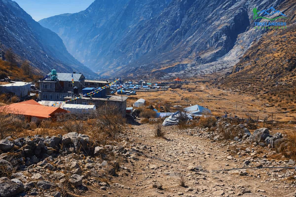
After approximately 6 hours of walking, you will arrive at Langtang Village. Here, the village has been rebuilt after the 2015 earthquake. It is an open area with wide views and few trees. Seeing the community here, you can tell the amount of recovery the people have made. Overnight stay in a teahouse.
Today is a short and light day, making the trek a bit easier. The path winds up slowly through alpine scenery. Along the way, you will see many walls, prayer flags and small streams. The terrain gradually gets rockier, and the vegetation decreases.
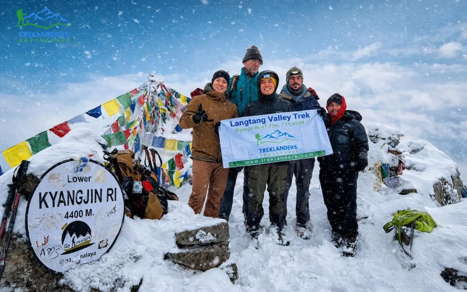
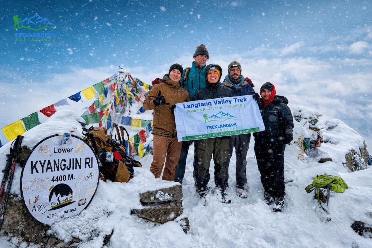
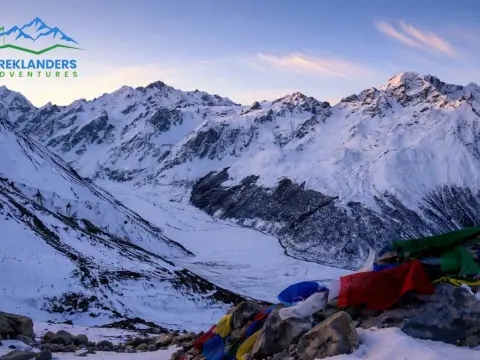
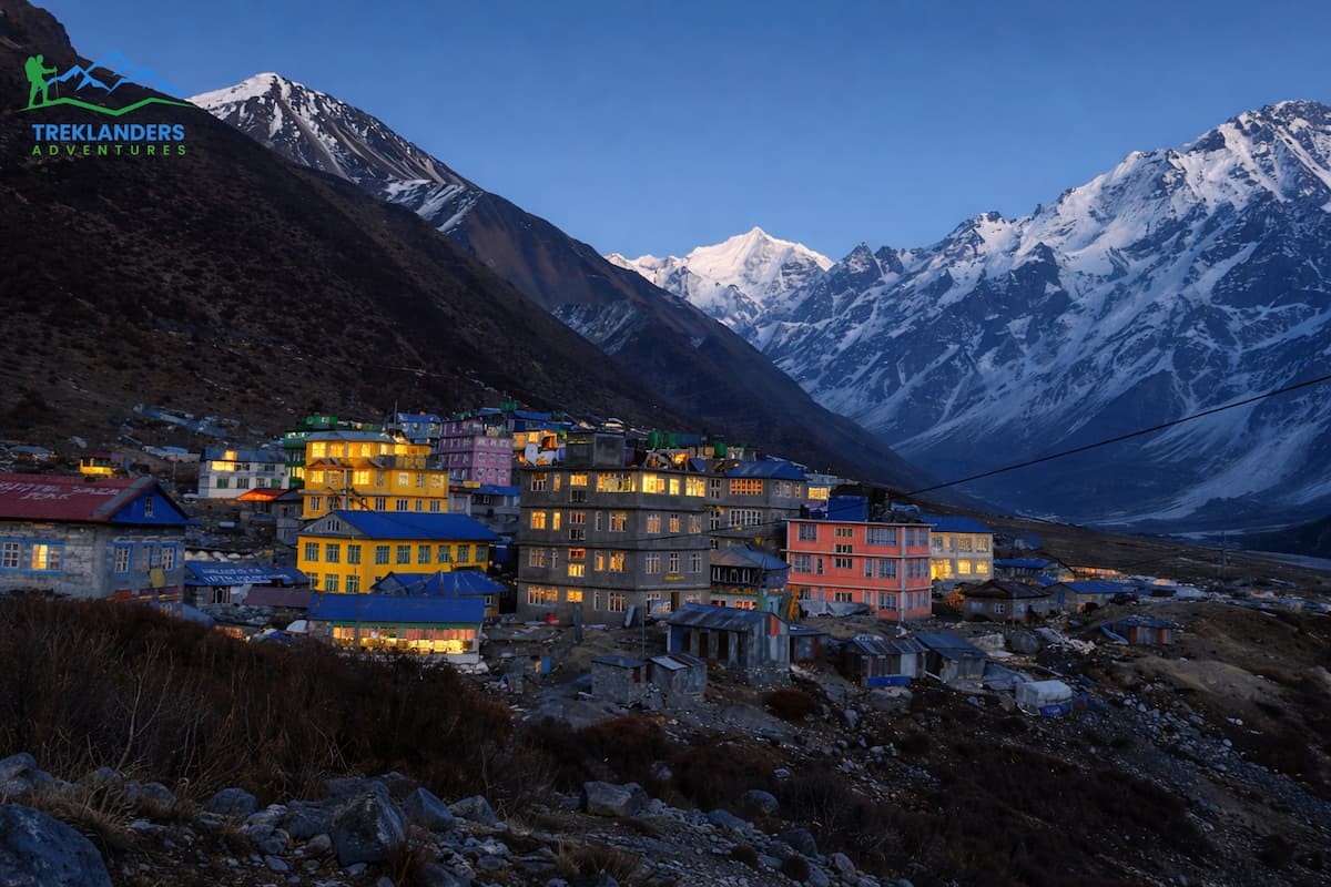
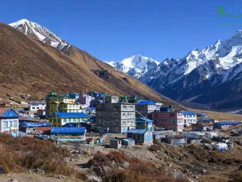
After walking for approximately 4 hours, you will arrive at Kyanjin Gompa. This is the highest village along the route. There are beautiful views of glaciers and mountain peaks.
The monastery and a cheese factory are other places you may be interested in seeing. The rest of the day is free to relax and get used to the altitude. Overnight in a teahouse.
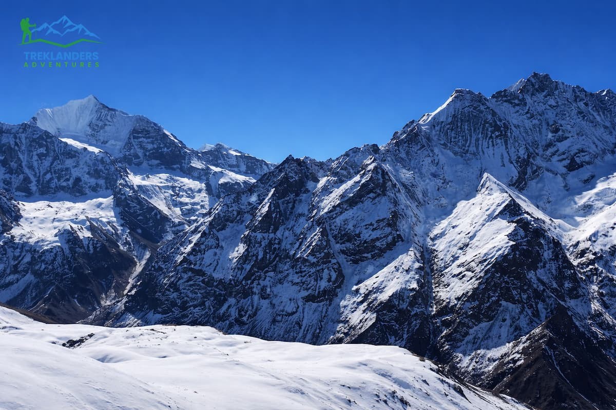
Getting up early, you set off for the Kyanjin Ri hike. The ascent lasts 3 hours. Though very steep, you also get spectacular views for all your efforts. The summit provides a wide outlook over the Langtang range with glaciers and snow-capped peaks.
Once you have come down again to Kyanjin Gompa, the long journey back starts. Continuing along the same path through Langtang Village and then onward to Lama Hotel, you will be making the return walk.
Descending normally takes about 6 hours. Even though downhill walking will be faster, the knees will feel quite a lot of pressure. Familiar parts of the valley will be seen again. Overnight in Lama Hotel.
Down you go, winding through trees on narrow paths. Beside the water now, the trail sticks close to the flowing river. Bamboo appears, then a few quiet spots pop up as you move forward. Five hours of walking stretch out beneath your feet. Heat rises slowly, plants grow denser, and air thickens with each step. By afternoon, you arrive in Syabrubesi. The walking part finishes here. A teahouse holds your stay through the night.
Back on the road toward Kathmandu. Six hours roughly, give or take, depending on rain or road jams. Hills fade in the mirror while rooftops grow ahead. Evening unwinds how you choose - rest, buying things, eating. Sleep again in the city that never quite sleeps.
Head to the airport for your international flight. At least 3 hours before your flight, you should reach the airport. It will be the end of your Langtang Valley trip.
This 9-day itinerary is straightforward. It allows for a good balance between walking and acclimatizing. You ascend slowly and do a main viewpoint hike, Kyanjin Ri. The path is a clear up-and-down pattern, so the logistics are very simple.
Within a very short time, you go through different phases, i.e., forest alpine, local villages, and high mountain views. The schedule is perfect for hikers with moderate fitness who desire a well-planned and dependable itinerary.
The 2015 earthquake inflicted massive damage in the Langtang Valley. Since then, the authorities and local people have been working hand-in-hand to create safer conditions for trekkers.
Revealing and heavily damaged parts of the trail were restored using more durable materials. The steps made from stone, retaining walls, and strengthened paths are some of the ways implemented to cut down the risks of slides and breaking. River suspension bridges were fixed and enhanced to allow the safe carrying of heavier loads. Trails have also been made safer through markings like signposts and directional markers that have been strategically placed.
Landslide and flood monitoring systems were put into operation in vulnerable zones. At certain places, signs have been installed to alert about the danger of avalanches or high-water river crossings. The guides are even taught to leave the risky sections during times of instability.
Teahouses and lodges were rebuilt following the most stringent construction standards. Most are now characterized by stone or concrete bases combined with wooden frames that can resist earthquakes. The roofs and groundworks also incorporate earthquake-resistant features. Therefore, it guarantees that trekkers can enjoy safe nights.
There are first-aid facilities and personnel with formal training in villages like Kyanjin Gompa and Lama Hotel. Guides are capable of handling emergencies since they carry medical kits and are well conversant with the evacuation processes. Rescue helicopters are managed through local authorities, thus enhancing the speed of responses in the case of accidents or medical emergencies related to altitude sickness.
From 2025, trekking with a licensed guide is mandatory. Guides manage route safety, monitor trekkers’ health, and respond to emergencies. TIMS cards and park permits provide authorities with accurate information about who is on the trail. This allows faster rescue coordination if problems occur.
Residents participate in trail maintenance and emergency management. They help repair paths, clear debris, and educate trekkers on safety rules. Their presence improves both immediate response and long-term trail sustainability.
Mobile networks and Wi-Fi points have been expanded in key villages. Satellite phone access is available for emergency use. This allows guides and lodges to call for help in remote areas.
Overall, safety improvements have transformed Langtang Valley into a more secure trekking destination. Trails, lodges, guides, and communication systems now work together to reduce risk and protect both trekkers and the local community.
Langtang's recovery after the 2015 earthquake relied heavily on tourism. Since demolition destroyed many homes, teahouses, and community buildings, trekking revenue funded most lodge rebuilding. The new lodges used stone and reinforced wood, which are safer and stronger.
Behind the scenes, guides and porters earned dependable wages and were still able to support their families. Local farmers and traders sold fresh produce, milk, and other products. They sold to teahouses and trekkers. They also benefited economically.
Restoration teams restored the cultural sites, such as monasteries and prayer walls. Tradition is still alive today and continues to draw people. Furthermore, crews enhanced trails, bridges, and checkpoints to increase safety measures.
Tourism was more than just a means of recovery; it was a way of achieving sustainable growth. Daily visitor spending helps maintain infrastructure and local services. It also directly supports local people’s livelihoods. Thus, tourism in the valley has boosted economic growth.
It has helped preserve local culture.
It has also improved safety and access for trekkers.
Starting deep in the mountains, this walk reveals quiet forests beside village trails where people still live much like their ancestors did. Hidden among high peaks, some homes rebuilt after storms now stand strong again through seasons of hard work.
Paths wind upward past streams humming ancient tunes beneath rhododendron branches. Far from busy roads, small teahouses open doors to travellers seeking calm air and honest talk. Each turn leads toward views few ever see - snowfields hugging cliffs under wide skies.
Under your feet, the land shifts constantly. Rhododendron thickets fade into open oaks, then melt upward into high meadows soaked by glacial streams. Above it all, Langtang Lirung rises sharply, its jagged edges cutting across the horizon wherever you turn.
Life here feels deep. Nestled in the hills live the Tamang people, their homes near quiet monasteries, colored flags fluttering above trails. At Kyanjin Gompa, old wooden temples stand beside chants that drift through the morning air. After the tremors of 2015, walls came down - now stone by stone, they rise again.
The path feels reachable but still gives back. Each day covers a fair amount of ground, slowly climbing higher, so bodies adjust well. Side trips such as the one to Kyanjin Ri bring extra effort along with standout sights - no special gear or training needed there.
Quiet hums where crowds once tread on paths like Everest Base Camp or Annapurna Base Camp. Solitude wraps around you, yet village voices rise through shared moments along firm stone routes.
Shaking changed things for the better. They laid the paths again, made the crossings sturdier, improved the shelters—and these days, every trek includes a guide. Paying attention to what matters comes easier when safety isn't hanging by a thread.
Walking here means money reaches village lodges, trail keepers, food growers - helping rebuild lives, protect traditions. Each footfall feeds a slower kind of travel, one that listens before it moves. Income flows not just once but grows where people live and work, remember.
High in the hills, Langtang packs a full mountain experience into fewer miles. Through green valleys and old villages, the path unfolds with beauty at every turn.
Culture lives here - not performed but practiced daily by Tamang communities along the trail. The climb stays within reach of most hikers who train steadily beforehand. Local groups care for the trails through their efforts, helping nature stay balanced across seasons. Adventure walks hand-in-hand with caution on these slopes.
The Langtang Valley Trek is a great mix of stunning views, cultural discovery, and the human spirit to endure. The hiking routes go through woodlands, grasslands of the high mountains, and places with stunning views of the Himalayas. At the same time, the villages and temples reflect local life.
Since the earthquake in 2015, the valley has gone through major changes for the better. Roads and bridges are sturdier than before, and lodges offer a comfortable getaway. Besides safety rules, required guides help ensure the best trekking experience.
They also provide quick help in case of a crisis. Tourism supports local well-being by earning income for families, farmers, guides, and porters. It also keeps cultural heritage alive.
This trek is one step more challenging than a walk. It suits people with moderate fitness, offers time to adjust to high altitude, and includes side trips like Kyanjin Ri for great views.
Going to Langtang is more than just walking through the mountains. A chance to see amazing Himalayan scenery.
Also, a way to support people as they recover. You can get to know a strong community. The valley combines adventure, culture, and a life-changing experience in one trip.
Autumn and winter on the Manaslu Circuit differ greatly—compare conditions to choose the best season.
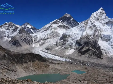
Planning the Everest Base Camp trek? This complete guide answers the most important questions about altitude, distance, difficulty, permits and safety
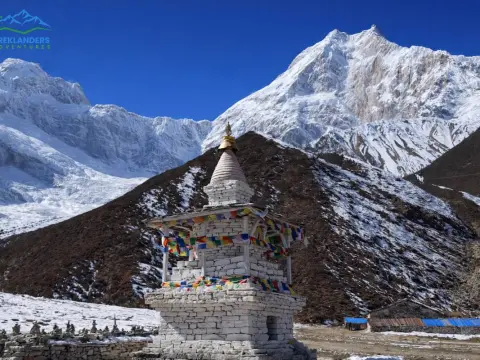
Planning the Manaslu Circuit Trek? This FAQ guide covers permits, itinerary, cost, difficulty, Larkya La Pass, best time, and essential tips.