[{"name":"Everest Base Camp Trek","duration":"16","image_url":"https:\/\/www.treklanders.com\/storage\/trip-galleries\/1\/thumb_419a755c003cc609f3030ee332965ebe.jpg","offer_price":1405,"url":"https:\/\/www.treklanders.com\/trips\/everest-base-camp-trek"},{"name":"Gokyo Valley Trekking","duration":"16","image_url":"https:\/\/www.treklanders.com\/storage\/trip-galleries\/2\/thumb_676d1021b574aeba4d19d3f2a0b04ed2.webp","offer_price":1205,"url":"https:\/\/www.treklanders.com\/trips\/gokyo-valley-trekking"},{"name":"Annapurna Circuit Trek","duration":"23","image_url":"https:\/\/www.treklanders.com\/storage\/trip-galleries\/3\/thumb_2a9a92ea23c62f41de27b37f5e3e8c17.webp","offer_price":1495,"url":"https:\/\/www.treklanders.com\/trips\/annapurna-circuit-trek"},{"name":"Everest Panorama Trek","duration":"12","image_url":"https:\/\/www.treklanders.com\/storage\/trip-galleries\/4\/thumb_35c9f677ea2e88b1ff11a9f43daa3ddb.jpg","offer_price":1100,"url":"https:\/\/www.treklanders.com\/trips\/everest-panorama-trek"},{"name":"Everest Base Camp Trekking from Jiri","duration":"22","image_url":"https:\/\/www.treklanders.com\/storage\/trip-galleries\/6\/thumb_14763592492417b294aa66bf0ebf4e64.webp","offer_price":1400,"url":"https:\/\/www.treklanders.com\/trips\/everest-base-camp-trekking-from-jiri"},{"name":"Everest Base Camp via Cho la Pass from Gokyo Valley Trekking","duration":"18","image_url":"https:\/\/www.treklanders.com\/storage\/trip-galleries\/7\/thumb_d4e470e98d4e9e2ab8e93e39b8b7d252.jpg","offer_price":1405,"url":"https:\/\/www.treklanders.com\/trips\/everest-base-camp-via-cho-la-pass-from-gokyo-valley-trekking"},{"name":"Everest Three Passes Trekking","duration":"22","image_url":"https:\/\/www.treklanders.com\/storage\/trip-galleries\/8\/thumb_b413b221e913171500bb3dfd5c08ceea.jpg","offer_price":1635,"url":"https:\/\/www.treklanders.com\/trips\/everest-three-passes-trekking"},{"name":"Annapurna Base Camp Trekking","duration":"14","image_url":"https:\/\/www.treklanders.com\/storage\/trip-galleries\/9\/thumb_2e71f2ffe116c659fa66b01c2d571b4e.webp","offer_price":845,"url":"https:\/\/www.treklanders.com\/trips\/annapurna-base-camp-trekking"},{"name":"Mardi Base Camp Trekking","duration":"14","image_url":"https:\/\/www.treklanders.com\/storage\/trip-galleries\/10\/thumb_d7b2d2dc638f6bbf2c31c167ac68029d.webp","offer_price":845,"url":"https:\/\/www.treklanders.com\/trips\/mardi-base-camp-trekking"},{"name":"Mohare Danda Trekking","duration":"12","image_url":"https:\/\/www.treklanders.com\/storage\/trip-galleries\/11\/thumb_a384c8d35d789d29b19991c1d675c910.webp","offer_price":755,"url":"https:\/\/www.treklanders.com\/trips\/mohare-danda-trekking"},{"name":"Khopra Ridge & Khair Lake Trekking","duration":"15","image_url":"https:\/\/www.treklanders.com\/storage\/trip-galleries\/12\/thumb_c0f50461ddc74acfb553ba85be00fab0.webp","offer_price":855,"url":"https:\/\/www.treklanders.com\/trips\/khopra-ridge-khair-lake-trekking"},{"name":"Upper Mustang Trekking","duration":"17","image_url":"https:\/\/www.treklanders.com\/storage\/trip-galleries\/13\/thumb_7aa4dfdb69186b0f224a303d80a25c95.jpg","offer_price":1715,"url":"https:\/\/www.treklanders.com\/trips\/upper-mustang-trekking"},{"name":"Langtang Valley Trek","duration":"12","image_url":"https:\/\/www.treklanders.com\/storage\/trip-galleries\/14\/thumb_8650b4b1a3c160cff75da65369398353.webp","offer_price":735,"url":"https:\/\/www.treklanders.com\/trips\/langtang-valley-trek"},{"name":"Gosainkunda Lake Trek","duration":"11","image_url":"https:\/\/www.treklanders.com\/storage\/trip-galleries\/15\/thumb_bfe94c14e760c48234e117021105be84.webp","offer_price":735,"url":"https:\/\/www.treklanders.com\/trips\/gosainkunda-lake-trek"},{"name":"Chisapani-Nagarkot to Dhulikhel Hiking","duration":"7","image_url":"https:\/\/www.treklanders.com\/storage\/trip-galleries\/16\/thumb_468defe9a4000ee3129cd7e6421ee105.webp","offer_price":565,"url":"https:\/\/www.treklanders.com\/trips\/chisapani-nagarkot-to-dhulikhel-hiking"},{"name":"Kanchenjunga Trek","duration":"23","image_url":"https:\/\/www.treklanders.com\/storage\/trip-galleries\/17\/thumb_51f43fa4203106cc49aaedc89d76e01d.jpg","offer_price":1725,"url":"https:\/\/www.treklanders.com\/trips\/kanchenjunga-trek"},{"name":"Helambu Trek","duration":"12","image_url":"https:\/\/www.treklanders.com\/storage\/trip-galleries\/18\/thumb_0fe8e3fa1299d2e43bf1fb5977875ce2.jpg","offer_price":685,"url":"https:\/\/www.treklanders.com\/trips\/helambu-trek"},{"name":"Upper Dolpo Trek","duration":"26","image_url":"https:\/\/www.treklanders.com\/storage\/trip-galleries\/19\/thumb_d6080d490e1db83b0a711e7304000864.jpg","offer_price":3005,"url":"https:\/\/www.treklanders.com\/trips\/upper-dolpo-trek"},{"name":"Manaslu Circuit Trek","duration":"18","image_url":"https:\/\/www.treklanders.com\/storage\/trip-galleries\/20\/thumb_1fdd224e849f4f328e73d2d12b3d282d.jpg","offer_price":1225,"url":"https:\/\/www.treklanders.com\/trips\/manaslu-circuit-trek"},{"name":"Tilicho Lake Base Camp Trek","duration":"19","image_url":"https:\/\/www.treklanders.com\/storage\/trip-galleries\/21\/thumb_eba8ac5e029e6543e0c17630ebd9e2fb.jpg","offer_price":1220,"url":"https:\/\/www.treklanders.com\/trips\/tilicho-lake-base-camp-trek"},{"name":"Nar-Phu Valley With Thorang-La Pass Trek","duration":"21","image_url":"https:\/\/www.treklanders.com\/storage\/trip-galleries\/22\/thumb_43597423a5a366fe9c8937fb30d2fe2a.jpg","offer_price":1315,"url":"https:\/\/www.treklanders.com\/trips\/nar-phu-valley-with-thorang-la-pass-trek"},{"name":"Nepal Round Trip of Kathmandu-Pokhara-Lumbini and Chitwan Tour","duration":"10","image_url":"https:\/\/www.treklanders.com\/storage\/trip-galleries\/23\/thumb_32497d170b2ab340b0a1b3310e91e784.webp","offer_price":845,"url":"https:\/\/www.treklanders.com\/trips\/nepal-round-trip-of-kathmandu-pokhara-lumbini-and-chitwan-tour"},{"name":"Nagarkot Day Hike","duration":"2","image_url":"https:\/\/www.treklanders.com\/storage\/trip-galleries\/24\/thumb_a5a654930fd8ba7852e41738105bacfc.webp","offer_price":105,"url":"https:\/\/www.treklanders.com\/trips\/nagarkot-day-hike"},{"name":"Nagarkot Sunrise Tour","duration":"1","image_url":"https:\/\/www.treklanders.com\/storage\/trip-galleries\/25\/thumb_17dc28a29cfa44381ad503f0a75ee84f.webp","offer_price":22,"url":"https:\/\/www.treklanders.com\/trips\/nagarkot-sunrise-tour"},{"name":"Namobuddha Day Tour with Shiva Statue","duration":"1","image_url":"https:\/\/www.treklanders.com\/storage\/trip-galleries\/26\/thumb_beeb34202f9077764aa08c67ef2867f9.webp","offer_price":45,"url":"https:\/\/www.treklanders.com\/trips\/namobuddha-day-tour-with-shiva-statue"},{"name":"Kathmandu Full Day Sightseeing Tour","duration":"1","image_url":"https:\/\/www.treklanders.com\/storage\/trip-galleries\/27\/thumb_d045fc0f1acee2cfa6b3c95f3c656d18.jpg","offer_price":30,"url":"https:\/\/www.treklanders.com\/trips\/kathmandu-full-day-sightseeing-tour"},{"name":"Patan and Bhaktapur Sightseeing Tour","duration":"1","image_url":"https:\/\/www.treklanders.com\/storage\/trip-galleries\/28\/thumb_750eacac3424b5dba686dd93656ab87c.jpg","offer_price":30,"url":"https:\/\/www.treklanders.com\/trips\/patan-and-bhaktapur-sightseeing-tour"},{"name":"Upper Mustang Heli Tour","duration":"1","image_url":"https:\/\/www.treklanders.com\/storage\/trip-galleries\/29\/thumb_0b785f69a15557f8660c805c76fda14e.webp","offer_price":1250,"url":"https:\/\/www.treklanders.com\/trips\/upper-mustang-heli-tour"},{"name":"Everest Heli Tour","duration":"1","image_url":"https:\/\/www.treklanders.com\/storage\/trip-galleries\/30\/thumb_dc45f2beb36a3699e0decf0de41a6f17.jpg","offer_price":1495,"url":"https:\/\/www.treklanders.com\/trips\/everest-heli-tour"},{"name":"Island Peak Trek & Climb","duration":"21","image_url":"https:\/\/www.treklanders.com\/storage\/trip-galleries\/31\/thumb_a0f3e3468c92a8e436045cf8b2fbf361.jpg","offer_price":2295,"url":"https:\/\/www.treklanders.com\/trips\/island-peak-trek-climb"},{"name":"Mera Peak Trek & Climb","duration":"18","image_url":"https:\/\/www.treklanders.com\/storage\/trip-galleries\/32\/thumb_3e8128a23c36f02fa38135475e811b9e.jpg","offer_price":2815,"url":"https:\/\/www.treklanders.com\/trips\/mera-peak-trek-climb"},{"name":"Chandragiri Cable Car Tour","duration":"1","image_url":"https:\/\/www.treklanders.com\/storage\/trip-galleries\/33\/thumb_faa70b716449eada6d7f1450335edbb3.jpg","offer_price":30,"url":"https:\/\/www.treklanders.com\/trips\/chandragiri-cable-car-tour"},{"name":"Everest Base Camp Trek and Returning via Heli","duration":"13","image_url":"https:\/\/www.treklanders.com\/storage\/trip-galleries\/34\/thumb_11190941866206e1d578db11986ebc73.webp","offer_price":2100,"url":"https:\/\/www.treklanders.com\/trips\/everest-base-camp-trek-and-returning-via-heli"},{"name":"Annapurna Semi Circuit Trek","duration":"15","image_url":"https:\/\/www.treklanders.com\/storage\/trip-galleries\/35\/thumb_30ddd8ba818cdcb52efd5eb0a017bcdb.jpg","offer_price":965,"url":"https:\/\/www.treklanders.com\/trips\/annapurna-semi-circuit-trek"},{"name":"Everest Base Camp Luxury Trek","duration":"14","image_url":"https:\/\/www.treklanders.com\/storage\/trip-galleries\/39\/thumb_6079aea3c5dd83e745a16fd6162270dc.jpg","offer_price":2685,"url":"https:\/\/www.treklanders.com\/trips\/everest-base-camp-luxury-trek"},{"name":"Mt. Kailash & Lake Manasarover Tour","duration":"15","image_url":"https:\/\/www.treklanders.com\/storage\/trip-galleries\/41\/thumb_cf3fededfd7dd2b40399af399e04f95a.jpg","offer_price":2205,"url":"https:\/\/www.treklanders.com\/trips\/mt-kailash-lake-manasarover-tour"},{"name":"Ghorepani Poonhill Trek","duration":"11","image_url":"https:\/\/www.treklanders.com\/storage\/trip-galleries\/43\/thumb_602d9a56976e1b836ba8adc69b8d09c5.webp","offer_price":720,"url":"https:\/\/www.treklanders.com\/trips\/ghorepani-poonhill-trek"},{"name":"11 Days Gokyo Valley Trekkking","duration":"11","image_url":"https:\/\/www.treklanders.com\/storage\/trip-galleries\/45\/thumb_ab552c3c91de392f94230a937b1c4801.jpg","offer_price":900,"url":"https:\/\/www.treklanders.com\/trips\/11-days-gokyo-valley-trekkking"},{"name":"9-Day Everest Base Camp Trekking with Helicopter Return","duration":"9","image_url":"https:\/\/www.treklanders.com\/storage\/trip-galleries\/46\/thumb_9a8ba2b582500cd86786be056902c31a.webp","offer_price":1990,"url":"https:\/\/www.treklanders.com\/trips\/9-day-everest-base-camp-trekking-with-helicopter-return"},{"name":"12-Day Everest Base Camp Trek","duration":"12","image_url":"https:\/\/www.treklanders.com\/storage\/trip-galleries\/47\/thumb_d12c9ef776c0b395ceea817fe05c5892.jpg","offer_price":1000,"url":"https:\/\/www.treklanders.com\/trips\/12-day-everest-base-camp-trek"},{"name":"8-Day Everest Panorama Trek","duration":"8","image_url":"https:\/\/www.treklanders.com\/storage\/trip-galleries\/49\/thumb_c81ae3a8ac757a317a9362e6872e2dcb.jpg","offer_price":850,"url":"https:\/\/www.treklanders.com\/trips\/8-day-everest-panorama-trek"},{"name":"7-Day Langtang Valley Trek","duration":"7","image_url":"https:\/\/www.treklanders.com\/storage\/trip-galleries\/50\/thumb_99c2904df5475ab028c9e3633ea95ef3.jpg","offer_price":420,"url":"https:\/\/www.treklanders.com\/trips\/7-day-langtang-valley-trek"},{"name":"4-Day Trekking Adventure near Kathmandu","duration":"4","image_url":"https:\/\/www.treklanders.com\/storage\/trip-galleries\/51\/thumb_594681060514dc57be1959236a6996d0.jpg","offer_price":275,"url":"https:\/\/www.treklanders.com\/trips\/4-day-trekking-adventure-near-kathmandu"},{"name":"4-Day Ghorepani Ponnhill Trek from Pokhara","duration":"4","image_url":"https:\/\/www.treklanders.com\/storage\/trip-galleries\/53\/thumb_eede04edac01f983d9af2c16f55d03e8.webp","offer_price":500,"url":"https:\/\/www.treklanders.com\/trips\/4-day-ghorepani-ponnhill-trek-from-pokhara"},{"name":"7-Day Annapurna Base Camp Trek from Pokhara","duration":"7","image_url":"https:\/\/www.treklanders.com\/storage\/trip-galleries\/55\/thumb_547e91c74088c491111ebe31a759cfbb.jpg","offer_price":420,"url":"https:\/\/www.treklanders.com\/trips\/7-day-annapurna-base-camp-trek-from-pokhara"},{"name":"13-Day Manaslu Circuit Trekking","duration":"13","image_url":"https:\/\/www.treklanders.com\/storage\/trip-galleries\/56\/thumb_aef1af4f0c4a2a9622d518ad5959542b.jpg","offer_price":1050,"url":"https:\/\/www.treklanders.com\/trips\/13-day-manaslu-circuit-trekking"},{"name":"5-Day Mardi Himal Trek from Pokhara","duration":"5","image_url":"https:\/\/www.treklanders.com\/storage\/trip-galleries\/57\/thumb_dcd598d556c14835f0a18169afafcbc6.webp","offer_price":420,"url":"https:\/\/www.treklanders.com\/trips\/5-day-mardi-himal-trek-from-pokhara"},{"name":"Nagarkot Sunrise Tour with Day Hike","duration":"1","image_url":"https:\/\/www.treklanders.com\/storage\/trip-galleries\/58\/thumb_7cdfa1f16719486da2a0718da45b1f2f.webp","offer_price":30,"url":"https:\/\/www.treklanders.com\/trips\/nagarkot-sunrise-tour-with-day-hike"},{"name":"Seven Unesco Heritage Sites Day Tour in Kathmandu","duration":"1","image_url":"https:\/\/www.treklanders.com\/storage\/trip-galleries\/59\/thumb_92aed7b9c67e76740000aab9313dced7.jpg","offer_price":40,"url":"https:\/\/www.treklanders.com\/trips\/seven-unesco-heritage-sites-day-tour-in-kathmandu"},{"name":"10-Day Ghorepani Poonhill with Annapurna Base Camp Trek","duration":"10","image_url":"https:\/\/www.treklanders.com\/storage\/trip-galleries\/60\/thumb_d4c2c089497950ccb5f8541d76e1269b.webp","offer_price":835,"url":"https:\/\/www.treklanders.com\/trips\/10-day-ghorepani-poonhill-with-annapurna-base-camp-trek"},{"name":"3-Day Chitwan Wildlife Tour","duration":"3","image_url":"https:\/\/www.treklanders.com\/storage\/trip-galleries\/61\/thumb_fc4de9cbf5bc83d67491b41df5725552.jpg","offer_price":150,"url":"https:\/\/www.treklanders.com\/trips\/3-day-chitwan-wildlife-tour"},{"name":"3-Day Pokhara Sightseeing Tour","duration":"3","image_url":"https:\/\/www.treklanders.com\/storage\/trip-galleries\/62\/thumb_a79a253f1a8bcbbf288eefc1d2f4038f.jpg","offer_price":230,"url":"https:\/\/www.treklanders.com\/trips\/3-day-pokhara-sightseeing-tour"},{"name":"7-Day Kathmandu Pokhara and Chitwan wildlifeTour","duration":"7","image_url":"https:\/\/www.treklanders.com\/storage\/trip-galleries\/63\/thumb_4f963fc141d7ef39e8a6a3c60317ae9b.jpg","offer_price":545,"url":"https:\/\/www.treklanders.com\/trips\/7-day-kathmandu-pokhara-and-chitwan-wildlifetour"},{"name":"Nagarjun Jamacho Day Hiking","duration":"1","image_url":"https:\/\/www.treklanders.com\/storage\/trip-galleries\/64\/thumb_85867eb85c60c8228e44f927341f67d1.jpg","offer_price":30,"url":"https:\/\/www.treklanders.com\/trips\/nagarjun-jamacho-day-hiking"},{"name":"Everest Mountain Flight from Kathmandu","duration":"1","image_url":"https:\/\/www.treklanders.com\/storage\/trip-galleries\/65\/thumb_1a66526d340ec175023842c38efd8a95.webp","offer_price":120,"url":"https:\/\/www.treklanders.com\/trips\/everest-mountain-flight-from-kathmandu"},{"name":"One Day Trishuli River Rafting Adventures","duration":"1","image_url":"https:\/\/www.treklanders.com\/storage\/trip-galleries\/66\/thumb_55ba0ea676c9c625f99f3d41bda224fb.jpg","offer_price":35,"url":"https:\/\/www.treklanders.com\/trips\/one-day-trishuli-river-rafting-adventures"},{"name":"13-Day Annapurna Circuit Trek","duration":"13","image_url":"https:\/\/www.treklanders.com\/storage\/trip-galleries\/67\/thumb_859e7a1fbb468a9252d365cab8379f10.jpg","offer_price":815,"url":"https:\/\/www.treklanders.com\/trips\/13-day-annapurna-circuit-trek"},{"name":"15-Day Tilicho Base Camp with Thorong-La Pass Trekking","duration":"15","image_url":"https:\/\/www.treklanders.com\/storage\/trip-galleries\/68\/thumb_56a5fd1506c9b9f1f83844353dc55edf.jpg","offer_price":920,"url":"https:\/\/www.treklanders.com\/trips\/15-day-tilicho-base-camp-with-thorong-la-pass-trekking"},{"name":"Cooking Class in Thamel-Full Course Meal","duration":"1","image_url":"https:\/\/www.treklanders.com\/storage\/trip-galleries\/69\/thumb_ed5cfbc0d94b624642d347c0776d36bb.webp","offer_price":30,"url":"https:\/\/www.treklanders.com\/trips\/cooking-class-in-thamel-full-course-meal"},{"name":"Cooking Class in Thamel-Full Course","duration":"3 Hours 30 Minutes","image_url":"https:\/\/www.treklanders.com\/img\/default.gif","offer_price":30,"url":"https:\/\/www.treklanders.com\/trips\/cooking-class-in-thamel-full-course"},{"name":"Cooking Class in Thamel-Full Course Meal","duration":"3 Hours 30 Minutes","image_url":"https:\/\/www.treklanders.com\/img\/default.gif","offer_price":30,"url":"https:\/\/www.treklanders.com\/trips\/cooking-class-in-thamel-full-course-meal"},{"name":"Momo Making Class in Thamel","duration":"1","image_url":"https:\/\/www.treklanders.com\/storage\/trip-galleries\/72\/thumb_a36e5ceca4d5c4cb0ecda367505b31d3.webp","offer_price":20,"url":"https:\/\/www.treklanders.com\/trips\/momo-making-class-in-thamel"},{"name":"8 Days Bhutan Tour from Kathmandu","duration":"8","image_url":"https:\/\/www.treklanders.com\/storage\/trip-galleries\/73\/thumb_df319d7d3ac21bcd9cf728cb1a70ea09.webp","offer_price":2275,"url":"https:\/\/www.treklanders.com\/trips\/8-days-bhutan-tour-from-kathmandu"},{"name":"10 Days Bhutan Tour with Druk path Trek","duration":"10","image_url":"https:\/\/www.treklanders.com\/storage\/trip-galleries\/74\/thumb_c7d4a4b89aceaf5d3aac313265729bb3.webp","offer_price":5715,"url":"https:\/\/www.treklanders.com\/trips\/10-days-bhutan-tour-with-druk-path-trek"},{"name":"9 -Day Langtang Valley Trek","duration":"9","image_url":"https:\/\/www.treklanders.com\/storage\/trip-galleries\/75\/thumb_65e69cec8917e39091c9e40ae06df3da.webp","offer_price":620,"url":"https:\/\/www.treklanders.com\/trips\/9--day-langtang-valley-trek"},{"name":"14 Day Everest Base Camp Trek","duration":"14","image_url":"https:\/\/www.treklanders.com\/storage\/trip-galleries\/76\/thumb_446e7f33a5f43896c9cdf470cd7be947.webp","offer_price":1175,"url":"https:\/\/www.treklanders.com\/trips\/14-day-everest-base-camp-trek"},{"name":"Lhasa Tour from Kathmandu: 10-Day Tibet Overland Journey via Gyirong","duration":"10","image_url":"https:\/\/www.treklanders.com\/img\/default.gif","offer_price":null,"url":"https:\/\/www.treklanders.com\/trips\/lhasa-tour-from-kathmandu-10-day-tibet-overland-journey-via-gyirong"},{"name":"13 Day Lhasa Tour from Kathmandu via Everest Base Camp","duration":"13","image_url":"https:\/\/www.treklanders.com\/storage\/trip-galleries\/78\/thumb_8a2bfb2abd99ba9ddc902b768e7b0759.webp","offer_price":2565,"url":"https:\/\/www.treklanders.com\/trips\/13-day-lhasa-tour-from-kathmandu-via-everest-base-camp"},{"name":"11 Day Annapurna Base Camp Trek","duration":"11","image_url":"https:\/\/www.treklanders.com\/storage\/trip-galleries\/79\/thumb_4e48a19c538c00cc8c36160ca97c5f21.webp","offer_price":720,"url":"https:\/\/www.treklanders.com\/trips\/11-day-annapurna-base-camp-trek"},{"name":"9 Day Mardi Himal Trek","duration":"9","image_url":"https:\/\/www.treklanders.com\/storage\/trip-galleries\/80\/thumb_8214945c5614ac9a84e5ca0b58b1f5a3.webp","offer_price":735,"url":"https:\/\/www.treklanders.com\/trips\/9-day-mardi-himal-trek"},{"name":"14 Day Manaslu Circuit Trek","duration":"14","image_url":"https:\/\/www.treklanders.com\/storage\/trip-galleries\/81\/thumb_b3ec98cd4036da5cb6e92250afa0d59e.webp","offer_price":1085,"url":"https:\/\/www.treklanders.com\/trips\/14-day-manaslu-circuit-trek"},{"name":"20 Day Manaslu Circuit with Tsum Valley Trek","duration":"20","image_url":"https:\/\/www.treklanders.com\/storage\/trip-galleries\/82\/thumb_b8c202cf8e16197517811d535f2a6795.webp","offer_price":1765,"url":"https:\/\/www.treklanders.com\/trips\/20-day-manaslu-circuit-with-tsum-valley-trek"},{"name":"15 Day Langtang Gosaikunda Lake Helambu Trek","duration":"15","image_url":"https:\/\/www.treklanders.com\/storage\/trip-galleries\/83\/thumb_a9c7bbb74f733cdc9a3469a448df7109.webp","offer_price":985,"url":"https:\/\/www.treklanders.com\/trips\/15-day-langtang-gosaikunda-lake-helambu-trek"},{"name":"14 Day Tamang Heritage with Langtang Valley Trek","duration":"14","image_url":"https:\/\/www.treklanders.com\/storage\/trip-galleries\/84\/thumb_57fe1b0ad2b7d0489273633b906d2f43.webp","offer_price":895,"url":"https:\/\/www.treklanders.com\/trips\/14-day-tamang-heritage-with-langtang-valley-trek"},{"name":"6 Day Pikey Peak Trek","duration":"6","image_url":"https:\/\/www.treklanders.com\/storage\/trip-galleries\/85\/thumb_f69c5c05ac7a2100c9010f66292efc86.webp","offer_price":550,"url":"https:\/\/www.treklanders.com\/trips\/6-day-pikey-peak-trek"},{"name":"Everest Base Camp Trek with Lobuche East Peak Climbing Expedition","duration":"17","image_url":"https:\/\/www.treklanders.com\/storage\/trip-galleries\/86\/thumb_9e7f330ecdbd7f74fe6f16202d3fed28.webp","offer_price":2295,"url":"https:\/\/www.treklanders.com\/trips\/everest-base-camp-trek-with-lobuche-east-peak-climbing-expedition"}]
Is the Manaslu Trek Closed? Critical Flash Flood and Route Updates
Is the Manaslu Trek Closed? Critical Flash Flood and Route Updates
Is the Manaslu Trek Closed? Critical Flash Flood and Route Updates
Is the Manaslu Trek Closed?
If you are researching the Manaslu Circuit Trek right now, you have probably seen conflicting headlines. Some call it closed. Some call it suspended. Some say nothing changed at all. Here is the direct answer: yes, the Manaslu Circuit Trek is currently closed. A flash flood tore through the Budhigandaki and Therang rivers near Namrung, in Gorkha district, in the early hours of September 6, 2026. The flood destroyed the main suspension bridge on the trail and a second bridge nearby, and the local government suspended all travel on the Manaslu Circuit and the Larkya La Pass route until further notice.
This is not a caution notice. It is a formal closure issued by the District Administration Office in Gorkha, backed by a matching advisory from the Manaslu Conservation Area Project. The trail is physically broken where those bridges used to stand, and there is no simple way around the gap.
This guide walks you through what actually happened, why it matters for anyone with a trip booked or planned, how this event connects to the Rasuwa flood that hit Nepal in late August, what the trail itself looks like once it reopens, and what your options are if you were counting on a Manaslu trek this season. Treat this as a working reference rather than a one-time news update, since the situation on the ground will keep shifting in the weeks ahead as repair work progresses and authorities reassess the trail.
What Happened on September 6
What Happened on September 6
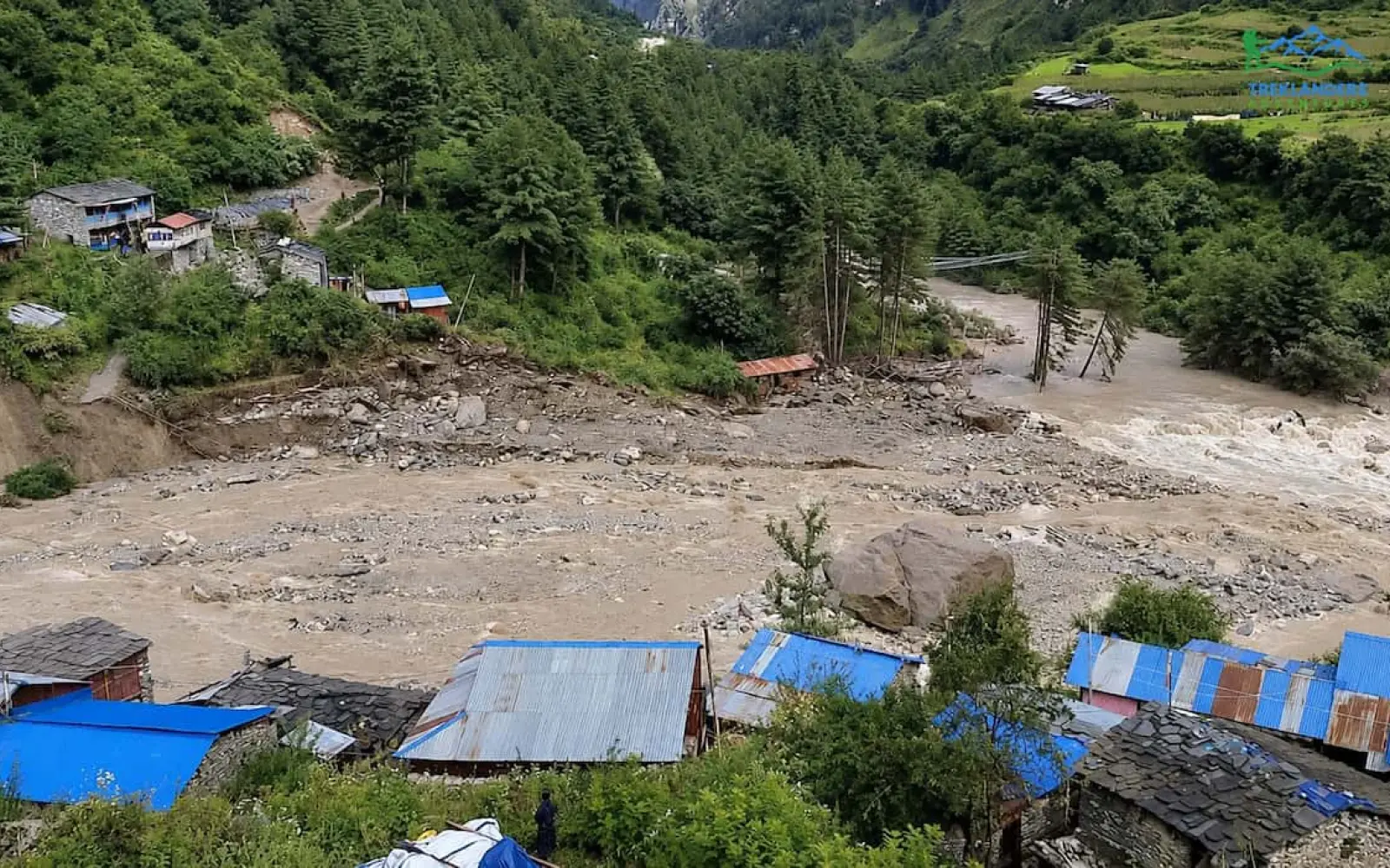
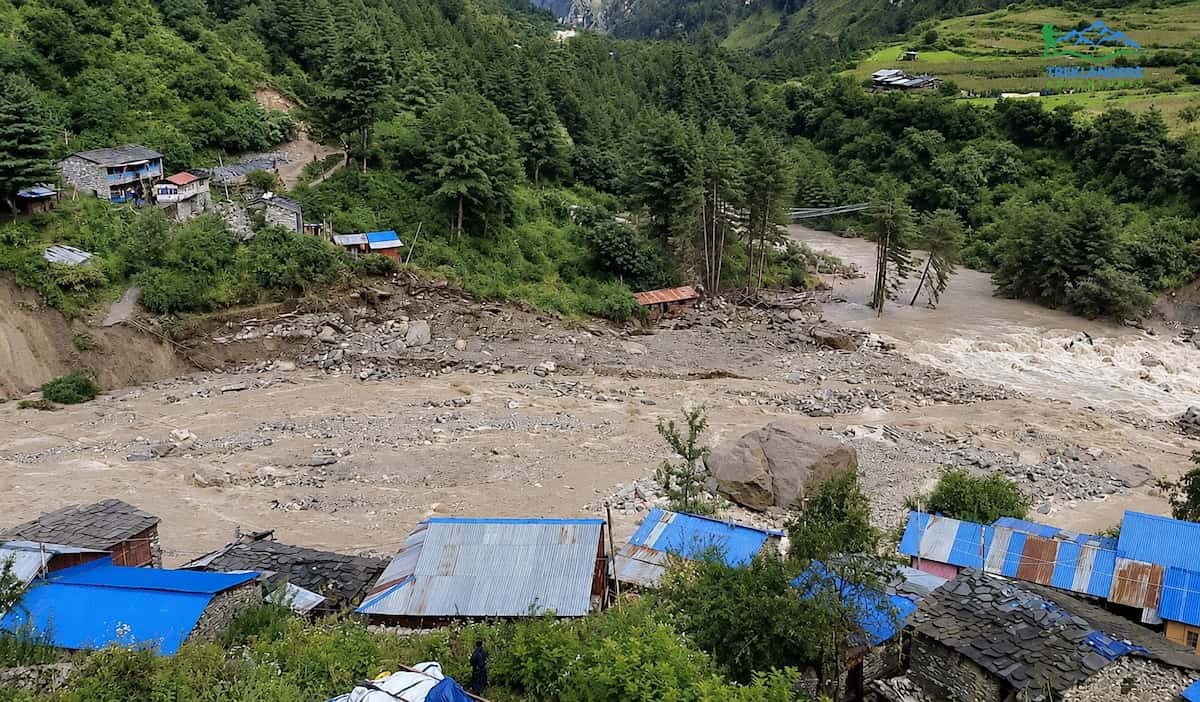
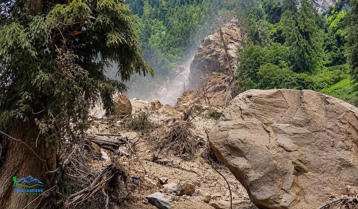
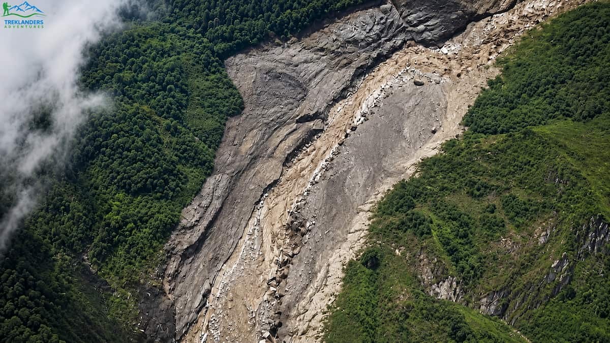
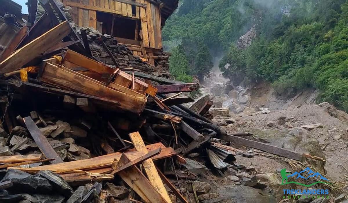
Early Sunday morning, a flash flood hit the Therang stream and the Budhigandaki river inside the Manaslu Conservation Area. According to Gorkha's Assistant Chief District Officer, Netra Prasad Sharma, a pile of debris had blocked the Therang stream close to where it starts. When that blockage gave way, the trapped water rushed downstream all at once and slammed into Namrung, in Ward 4 of Chumnubri Rural Municipality.
The surge swept away two bridges. One was the main suspension bridge over the Budhigandaki, which forms the backbone of the trekking trail through that section. The flood also destroyed a second bridge connecting wards 4 and 2, four homes belonging to local families, and two micro-hydropower plants that supplied electricity to the area. Local police confirmed there were no human casualties. Residents in the flood path noticed the rising water in time and moved to higher ground before it reached their homes.
Losing the hydropower plants means the immediate area lost power and, with it, much of its communication capacity overnight. That detail matters for anyone trying to get real-time updates from guides or lodge owners still in the region. Phone and internet access around Namrung has been unreliable since the flood, which is part of why early reports out of the area were inconsistent.
Why a Broken Bridge Shuts Down the Whole Trek
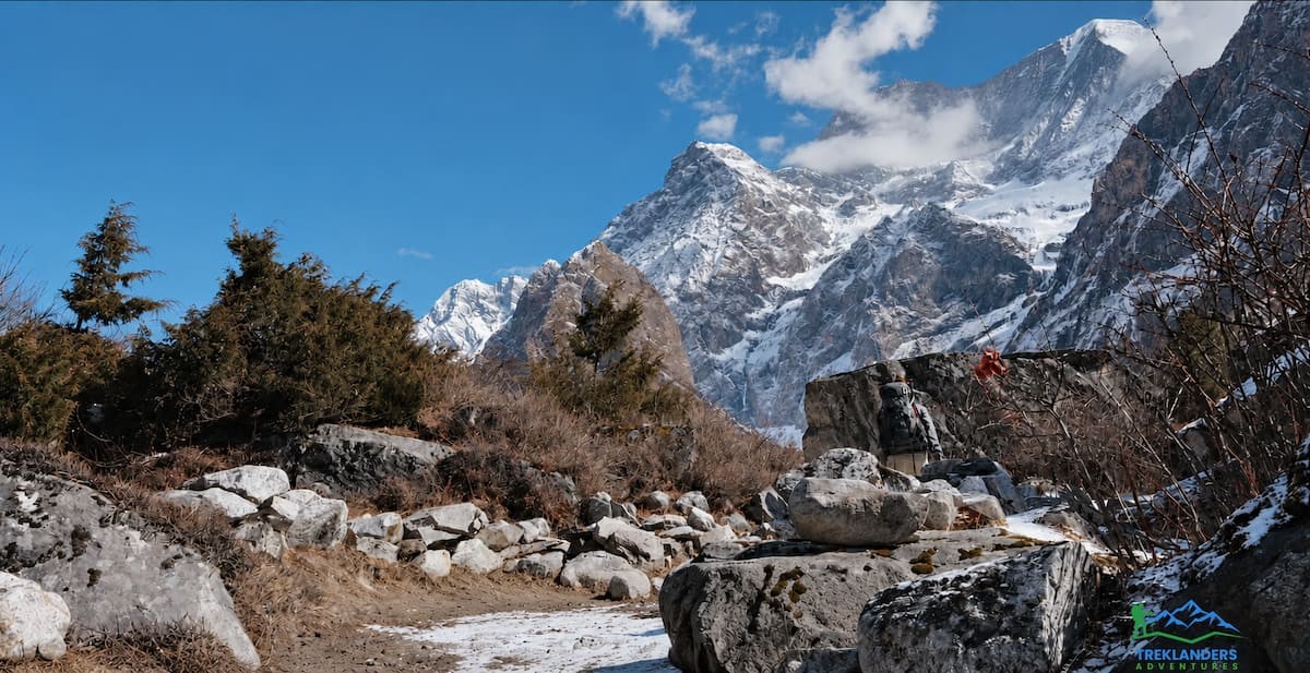
The Manaslu Circuit follows the Budhigandaki River gorge north from the lowland trailhead near Machha Khola, climbing steadily through Jagat, Deng, and Namrung before opening into the high Nubri valley around Sama Gaon. The trail depends on a series of suspension bridges to cross the river as it winds through steep, narrow terrain. There is no parallel road and no alternate trail on the far bank in most sections. When the main bridge near Namrung goes, the trekking route is severed at that exact point.
This is different from a landslide blocking one section of trail, which trekking groups can sometimes work around with a longer detour or a short scramble. A missing suspension bridge over a fast-moving glacial river is not something guides or porters can improvise past. Rebuilding or replacing it takes engineering work, materials brought in on foot or by mule, and sign-off from the relevant authorities before anyone is allowed to cross again.
Because the damage sits at Namrung, roughly the midpoint of the lower trek, it affects the entire upper circuit. Anyone trying to reach Lho, Sama Gaon, Samdo, Dharmasala, or the Larkya La Pass has to pass through this exact stretch. There is no way to reach the high Manaslu valley or the pass without crossing the break in the trail.
The Official Closure, in Plain Terms
The Official Closure
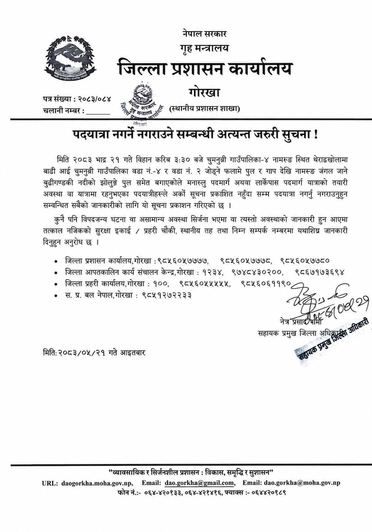
Two separate authorities issued matching notices within hours of the flood. The District Administration Office in Gorkha suspended travel on the Manaslu Circuit Trek and the Larkya La Pass route until further notice. Its statement asked anyone preparing for the trek, or already on the trail, not to travel or organize travel until a new notice is published. The Manaslu Conservation Area Project, which issues the permits required for the region, put out its own advisory telling trekkers to postpone their trips.
Two government bodies independently reaching the same conclusion on the same day is a strong signal. This is not one cautious official overreacting to a scary video on social media. It reflects an on-the-ground assessment that the trail is not currently passable and that sending trekkers into the area would be unsafe.
If your trekking agency tells you the Manaslu Circuit is open right now, ask them directly how they plan to get you across the missing bridge at Namrung. A responsible agency will tell you the truth: the route is closed, and they are watching for updates just like everyone else.
It helps to understand why Nepal treats a notice like this as binding rather than advisory. The Manaslu region is a restricted area under the Immigration Act, which means every trekker needs a Restricted Area Permit issued through a registered agency, along with the Manaslu Conservation Area Permit. Both permits route through government offices that answer to the same district administration issuing the closure. In practice, this means agencies cannot quietly work around the notice even if they wanted to, since the permit paperwork for the upper valley will not be processed while the suspension is active. Anyone claiming to run trekkers through the closed section right now is either misinformed about the current status or operating outside the permit system entirely, and neither is a good sign for a trekking company you are trusting with a high-altitude, restricted-area trip.
This Is Not the Rasuwa Flood
Rasuwa Flood
If you followed Nepal trekking news through late August and early September, you may be conflating two separate events. On August 26, 2026, a catastrophic flash flood struck Rasuwa district, on the other side of the country, originating from the Lhende River and hitting the Bhote Koshi corridor near the Nepal-China border at Timure and Syabrubesi. That flood caused widespread destruction and a significant loss of life, and it directly affected the Langtang Valley Trek, since Syabrubesi is the trailhead for that route.
The Manaslu flood on September 6 is a separate incident in a separate river system, roughly a week and a half later and in a different part of the country. The Manaslu Circuit follows the Budhigandaki River, not the Trishuli or Bhote Koshi, and the damage near Namrung has no direct connection to what happened in Rasuwa. Nepal has had a difficult monsoon tail this year, with two serious flood events in different regions within the space of two weeks, and it is easy to see how the two stories blur together in search results and social media. For planning purposes, treat them as two distinct closures with two distinct causes, two distinct locations, and two distinct timelines for reopening.
What's Actually Closed Right Now
Larkya La Pass
As things stand, the Manaslu Circuit Trek and the Larkya La Pass crossing are suspended in full. That includes every itinerary variation built around this route, whether it runs 13 days, 14 days, or 18 days with extra time in Kathmandu and a slower acclimatization schedule. If your itinerary includes Larkya La at any point, it is affected.
The lower Manaslu trail, up to and including Jagat, is also the approach route used for the Tsum Valley Trek. Since the damage sits further up the valley near Namrung, the immediate Tsum Valley side trail beyond Jagat has not been reported as directly damaged, but any combined Manaslu Circuit with Tsum Valley itinerary that continues past Namrung toward Sama Gaon and Larkya La runs into the same break in the trail as the standard circuit. Anyone with a booking on the 20-day Manaslu Circuit with Tsum Valley Trek should treat the upper circuit portion as closed along with the standalone Manaslu Circuit trek.
Nothing about this closure affects the Kathmandu portion of any itinerary. Heritage site tours, hotel stays, and trek briefings in the city continue as normal. The closure is specific to the trail beyond the point where the bridges came down.
It is also worth being clear about what has not been reported as damaged. The road and trail infrastructure between Kathmandu and Machha Khola, including the drive through Arughat, remains open and unaffected. The lower trekking days between Machha Khola and Jagat, through Dovan and the hot spring stop at Tatopani, have not been reported as damaged either. The break sits specifically at Namrung, further up the valley, which means trekking groups already partway through the lower trail when the flood hit were not stranded in dangerous terrain, though they were still required to turn back or wait once the suspension notice reached them.
How Long Will It Stay Closed
Nobody can give you a confirmed reopening date right now, and any trekking company that promises one with confidence is guessing. Reopening depends on three things happening in sequence: the bridges need to be rebuilt or replaced, the trail needs a physical inspection by the relevant authorities, and the suspension notice needs to be formally lifted.
Bridge repair in this part of Nepal typically means either restoring a temporary crossing, sometimes with cable and plank construction, while a permanent replacement is planned, or bringing in prefabricated suspension bridge components on mule trains, since there is no road access to Namrung. Both approaches take real time. Estimates circulating among operators on the ground point to late September at the earliest, but that is not a promise, and monsoon conditions through the rest of September could complicate repair work if there is further heavy rain in the catchment area.
The safest approach is to treat "late September" as the earliest realistic case and to build in flexibility if your trip dates fall anywhere close to that window. Trekking into a restricted area on the assumption that a notice will lift on schedule is a bad plan when the alternative, a short delay, costs you far less than arriving in Gorkha to find the trail still closed.
There is also a practical inspection step that often gets overlooked in reopening timelines. Even after a temporary crossing goes up, the district administration and the Manaslu Conservation Area Project typically send a team to walk the affected section before lifting the notice, checking not just the new bridge but the surrounding riverbank and trail for further instability. Namrung sits in a narrow section of the gorge, and heavy rain elsewhere in the catchment could still send debris or a smaller secondary surge down the same channel while repair crews are working. Authorities have every incentive to be conservative about reopening a route that funnels large numbers of trekkers past a site that has already failed once this season, and that caution is exactly what you want from the people responsible for your safety on a restricted, high-altitude trail.
For context, this kind of infrastructure damage is not unheard of in the Manaslu region, even outside major flood events. Landslides between Nyak and Prok disrupted sections of the trail as recently as late 2025, and local crews restored access within weeks once conditions stabilized. The current closure is more severe, since it involves a complete bridge failure rather than a landslide trekkers can work around with caution, but the region does have a track record of getting trails back into working order once the immediate danger passes.
If You Have a Manaslu Trip Booked
Manaslu
Do not cancel outright, and do not panic. Flash flood damage to a single bridge is a serious but localized problem, and Nepal's trekking infrastructure has recovered from similar events before. Your first move should be direct contact with your trekking agency, not social media groups or unofficial trekking forums, since misinformation spreads fast after any Nepal flood event and older photos or unrelated incidents often get recirculated as if they are current.
A trustworthy agency will give you an honest status update, tell you what they actually know about repair timelines from their own contacts on the ground, and offer you real options rather than vague reassurance. Those options typically include postponing your trek to later in the season once the route reopens, switching to a different trek entirely for these dates, or waiting a defined number of days closer to departure before making a final call, since conditions can change quickly once repair work starts.
If your departure date is more than three weeks out, it is worth waiting for another week or two of updates before making any final decision. If your departure date is inside the next one to two weeks, start discussing alternatives with your agency now, since a smooth switch to a different region needs some lead time for permits and logistics.
Travel insurance that covers trip disruption or itinerary changes due to natural events is worth checking closely at this point, since flash flood closures of restricted-area treks are exactly the kind of event those policies are meant to cover.
If you booked flights to Kathmandu independently of your trek package, hold off on any changes there until you have a clearer picture of your trekking dates. Most airlines serving Kathmandu allow date changes for a fee, and it is generally easier to shift a flight by a week or two than to rebook an entire international itinerary from scratch. Keep your travel insurance provider informed early rather than waiting until the last moment, since some policies require notification within a set window of learning about a disruption like this one.
Group bookings deserve a bit of extra attention here. If you are traveling with friends or family on a shared itinerary, agree as a group on your decision point in advance, whether that is a specific date or a specific piece of news you are waiting for, so that indecision does not force a rushed choice in the final days before departure. Splitting a group between waiting and switching regions creates its own logistical headache, and getting everyone aligned early avoids that.
What You're Actually Walking Into: The Manaslu Circuit Trail
The Manaslu Circuit Trail
Once the route reopens, the Manaslu Circuit remains one of the most complete trekking experiences in Nepal, and it is worth understanding the shape of the trail so you know what to expect when you do go.
The trek begins in Kathmandu with permit processing, a trek briefing, and typically a day exploring the city's heritage sites before the long overland drive to the trailhead. That drive runs along the main highway out of the Kathmandu valley, through farmland and small towns with distant mountain views, before turning onto rougher hill roads toward Gorkha district and following the Budhigandaki River to Machha Khola, a farming village at the point where the Machha Khola stream meets the larger river.
From Machha Khola, the trail follows the river upstream through subtropical forest of sal and pine, with the first short walking day usually ending at Dovan, a small settlement at the meeting point of two smaller streams. This early stretch includes a stop at Tatopani, where a natural hot spring gives tired legs a welcome soak after the long drive from Kathmandu.
The trail continues to Jagat, a moderate-sized village that also functions as the official entry checkpoint for the restricted upper Manaslu region. This is where permits get checked for the first time, since travel beyond Jagat requires the Restricted Area Permit alongside the Manaslu Conservation Area Permit. Past Jagat, the trail passes through Philim, with its terraced fields of millet, and continues north through bamboo forest and steep river gorges toward Deng, the first village where Tibetan Buddhist cultural influence becomes clearly visible in the architecture and prayer flags along the path.
From Deng, the trail climbs through Bihi and Ghap, moving through pine and rhododendron forest and crossing several more suspension bridges, including the crossing near Namrung that was destroyed in the September flood. Namrung itself sits at a meaningful altitude gain from the valley floor, with wide fields of barley and buckwheat and clear views of the snow peaks ahead. This is the section where the current closure applies.
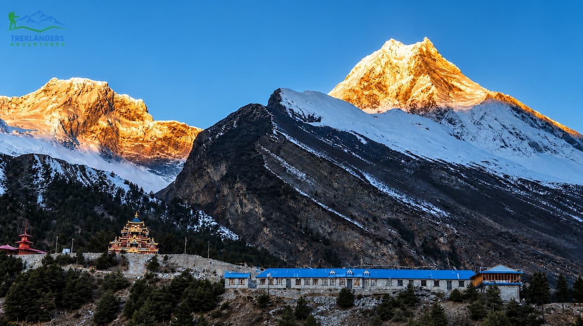
Beyond Namrung, in normal conditions, the trail climbs to Lho Gaon, a village decorated with mani walls, chortens, and stupas, with the first full, unobstructed views of the Manaslu massif opening up along the way. From Lho, the trail continues through forest to Shyala and then to Sama Gaon, the principal village of the upper valley and the base for the trek's main acclimatization stop.
Sama Gaon typically holds a full rest day, and most itineraries use it for a hike either to Pungyen Gompa, one of the oldest Tibetan Buddhist monasteries in the region with a direct view of Manaslu's north face, or to Birendra Tal, a glacial lake where the mountain's reflection sits on the water's surface on a clear morning. Either option gives the body time to adjust to the thinning air before pushing higher toward the pass.
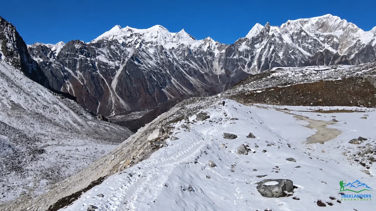
From Sama Gaon, the trail continues to Samdo, a Tibetan-style village near the old trading route to the Tibet-China border, and then to Dharmasala, sometimes called Larkya Phedi, the staging point directly below the pass. Dharmasala has minimal permanent infrastructure, with large dormitory rooms or tented camps used to handle the volume of trekkers passing through during peak season, and ordering meals early in the evening avoids the crowding that builds up as multiple groups arrive at once.
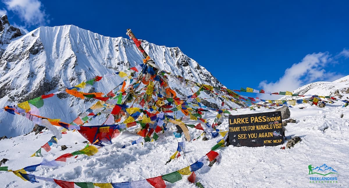
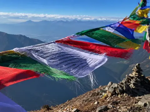
The crossing of Larkya La Pass itself is the trek's defining day. Trekkers leave Dharmasala before dawn, walking by headlamp across moraine and past frozen glacial ponds before the final climb to the pass at 5,106 meters. The summit is marked by thousands of prayer flags and a formal signboard, with panoramic views across the Manaslu Himalaya, including Himalchuli and the Annapurna range in the distance. The descent on the far side is long, dropping roughly 1,600 meters to the settlement of Bhimthang, where comfortable lodges and a hot meal wait after what is consistently the longest and hardest day of the entire circuit.
From Bhimthang, the trail eases considerably, passing through rhododendron forest to the small settlement of Gho and then down to Dharapani, where the Manaslu Circuit joins the well-known Annapurna Circuit trail. From here, most itineraries switch from walking to a vehicle for the drive down through Besisahar and back to Kathmandu, following the Marsyangdi and Trisuli rivers on the return journey.
Altogether, this covers roughly 4,200 meters of elevation gain from the low point at Machha Khola to the high point at Larkya La, spread across ten to twelve days of active trekking depending on the itinerary length chosen. It is a trek defined by contrast: warm subtropical river gorges at the start, high alpine desert at the pass, and a wide range of cultural zones in between, from Gurung and Magar hill communities in the south to strongly Tibetan Buddhist villages in the north.
Accommodation follows the tea house model throughout, with simple twin rooms and shared bathrooms in the lower villages, improving steadily as the trail climbs into Namrung, Lho Gaon, and Sama Gaon, where lodges have invested in better bedding, dining halls with wood stoves, and occasional attached bathrooms with limited hot water. Dharmasala remains the one deliberate exception, with basic dormitory or tented sleeping arrangements reflecting its role as a staging point rather than a permanent settlement. Meals follow a similar progression, with simple dal bhat and noodle dishes in the lower villages giving way to a wider menu, including Tibetan bread, thukpa, momos, and fresh bakery items, once the trail reaches the bigger settlements in the upper valley.
The Villages Behind the Headlines
The Villages Behind the Headlines
It is easy to read about a flood closure purely in terms of missed itineraries and rescheduled flights, but the families in Chumnubri Rural Municipality are dealing with something far more immediate. Four homes in Namrung, ward 4, were destroyed in the flood, along with two micro-hydropower plants that supplied electricity to the surrounding area. For a community that also depends heavily on trekking tourism during the autumn season, a closure of unknown length on top of physical damage to homes and power infrastructure is a serious economic blow layered on top of a personal one.
Trekking agencies operating in the region, including Treklanders Adventures, maintain ongoing relationships with the lodge owners, guides, and porters who live in these villages, and many operators are actively checking in on local staff and partners as part of normal business in the area, separate from the commercial question of when the trail reopens. If you plan to trek this region once it reopens, choosing an agency that pays guides and porters fairly and works directly with local, family-run lodges puts your trekking spend where it does the most good for the communities recovering from this event.
Alternatives While Manaslu Is Closed
If your travel dates fall inside the current closure window and you are not able to shift your schedule, several other Nepal trekking regions remain fully open and completely unaffected by both the Manaslu flood and the earlier Rasuwa flood.
The Everest region sits on a different river system entirely and has had no reported disruption from either flood event. The classic Everest Base Camp Trek, along with variations like the Gokyo Valley route or the Everest Three Passes trek, remains a strong option if you are looking for a comparable high-altitude Himalayan experience on short notice.
The Annapurna Circuit and Annapurna Base Camp routes are also unaffected. Annapurna Base Camp in particular offers a shorter, less logistically complex alternative for trekkers who had originally planned a shorter Manaslu itinerary, while the Annapurna Circuit gives a longer, high-pass experience with a similar overall shape to Manaslu, minus the restricted-area permit requirements.
Upper Mustang, on the far side of the Annapurna range, sits in a rain shadow and has seen no impact from the monsoon flooding affecting other regions this year. It requires its own restricted area permit but offers a genuinely different landscape, arid and Tibetan in character, for trekkers who want something distinct from the Manaslu experience.
Kanchenjunga, in Nepal's far east, is also running without disruption, though it involves a longer overall commitment and more remote logistics than the other options listed here.
If you specifically wanted the cultural and geographic character of the Manaslu region and are not fixed on the exact route, ask your agency about a shorter trek into the lower Manaslu valley that stops before Namrung, staying within the sections of trail that remain physically intact. This will not include Larkya La Pass, but it can still deliver the lower gorge scenery and the restricted-area feel that draws people to this region in the first place, once local authorities confirm that section is safe for travel.
None of these alternatives require you to abandon the idea of a restricted-area or high-pass trek for this trip. Nar Phu Valley, reached through a side trail off the Annapurna Circuit, offers a similarly remote, permit-controlled experience with strong Tibetan Buddhist cultural influence, and it remains fully open. Upper Dolpo, in Nepal's far west, is another genuine restricted-area option for trekkers with a longer window and a taste for real remoteness, though it demands more advance planning than a last-minute switch usually allows.
Whichever alternative you choose, apply the same due diligence you would to Manaslu itself. Confirm current trail conditions with your agency before committing to new dates, and do not assume that because a region was unaffected by the two flood events discussed here, it is automatically immune to unrelated seasonal issues like landslides on access roads or early snow at high passes later in autumn.
Getting Reliable Updates
Given how quickly conditions can change after a flood event like this, lean on sources that are directly connected to the region rather than general news aggregation or social media. Your trekking agency should be your primary point of contact, since established operators maintain direct lines to guides and staff on the ground and typically hear about bridge repair progress before it becomes public news.
Beyond your agency, the Nepal Tourism Board and the Manaslu Conservation Area Project are the two official bodies most likely to publish updated notices as the situation develops. Local Nepali news outlets covering Gorkha district tend to report on-the-ground developments faster than international travel media, so following a Nepali news source alongside your agency's updates gives you the fullest picture.
Avoid making decisions based on trekking forum posts or secondhand social media reports without a clear date and source attached. In the days immediately following any major flood event in Nepal, misinformation and outdated photos circulate widely, and separating confirmed fact from rumor takes a bit of discipline.
A practical habit worth adopting: whenever you read an update about the closure, check the date it was published before acting on it. A headline that says the Manaslu Circuit is closed carries very different weight if it is from September 6 versus a fresh update from later in the month. Trekking blogs and news sites sometimes leave old headlines unchanged even after the underlying content gets updated, so read past the headline into the body of the article for the actual publication or update date before treating it as current.
If you reach out to your agency and get a vague or evasive answer about the current status, take that as a signal to ask more direct questions or look elsewhere for confirmation. A trekking company with real connections in the region should be able to tell you, specifically, whether they have spoken to their guides or lodge contacts in Gorkha within the last few days, not just what a news article said last week.
Planning Ahead for a Future Manaslu Trek
Planning Ahead for a Future Manaslu Trek
None of this changes what makes the Manaslu Circuit worth doing. The route will reopen once the bridge work is complete and authorities are satisfied the trail is safe, and the trek itself, the villages, the cultural depth, the wildlife-rich conservation area, and the crossing of Larkya La, remains exactly what it was before September 6.
If you are planning a Manaslu trip for later this autumn season or for spring next year, the practical takeaway from this event is simple: build a buffer into your schedule. Restricted, remote treks that rely on a small number of river crossings are always vulnerable to exactly this kind of disruption, and a flexible booking policy with your trekking agency, along with travel insurance that covers itinerary changes, puts you in a far better position than a rigid, non-adjustable plan.
Work with a licensed agency that keeps direct contact with guides and local authorities in the region you are trekking, since that connection is what turns a flood closure from a trip-ending disaster into a manageable delay. Ask specific questions about how your agency tracks trail conditions, what their policy is on rescheduling if a route closes close to your departure date, and how they will communicate updates to you in the weeks before you fly to Kathmandu.
It is also worth thinking about seasonal timing beyond this single event. Late-monsoon flooding in September is a known risk pattern in Nepal's mid-hill river valleys, and treks that depend on crossing major glacial-fed rivers, including Manaslu, Langtang, and parts of the Annapurna region, carry a small but real chance of exactly this kind of disruption in the final weeks of the monsoon. Booking your trek for early October onward, once the rains have properly tapered off, reduces that risk without sacrificing much in terms of mountain views, since the clearest skies of the autumn season typically arrive once the monsoon fully clears out. If you have flexibility in your travel dates for a future trip, shifting a Manaslu departure a few weeks later into autumn is a reasonable, low-cost way to avoid the tail end of the wet season entirely.
Trekkers planning a spring departure instead should note that this event has no bearing on conditions eight or nine months from now. Bridges get rebuilt, trails get reassessed, and the spring rhododendron season on the Manaslu Circuit will proceed as it always has, assuming no further seasonal damage between now and then. The value of watching this story closely right now is short-term planning, not a reason to write off Manaslu as a destination for next year.
The Manaslu region has weathered landslides, seasonal trail damage, and infrastructure setbacks before, and it has come back from all of them. This flood is a serious event with real, ongoing consequences for the villages directly affected, but it does not change the long-term appeal or safety record of the route once the current damage is repaired and the closure notice is formally lifted. Stay in close contact with your agency, keep an eye on official channels, and be ready to adjust your dates if needed. That patience is what gets you safely onto the trail toward Larkya La when the route opens again.