
Nepal Trekking Update: Langtang, Manaslu, and Tsum Valley Trail Status
24 Oct 2026
Nepal trekking update 2026: Langtang open, Manaslu accessible with caution, and Tsum Valley temporarily closed. Check the latest trail conditions.

Manaslu Circuit Trek difficulty is the first question many trekkers ask once they have walked or researched the Annapurna Circuit. Both routes cross a pass above 5,000 meters. Both put you in teahouses at night, and both finish at the road head in Dharapani. On the ground they feel very different, and the gap shows up in places that a headline altitude figure never reveals.
Treklanders operates both routes, so this guide compares them with numbers taken from our own itineraries. The 18-day Manaslu Circuit Trek crosses Larkya La at 5,106 meters. Our 13-Day Annapurna Circuit Trek crosses Thorong La at 5,416 meters. Thorong La is 310 meters higher, yet Manaslu is the harder trek overall. This article shows why, and it also shows where Annapurna is the tougher choice.
You will find the altitude profile, daily walking hours, terrain, permits, teahouse quality, weather and training advice below, plus a trail narrative of each route. If you are choosing between the two for a 2027 departure, read this alongside our pages for the Manaslu region and the Annapurna region.
Manaslu is harder than the Annapurna Circuit as a complete trek. Annapurna is harder on one stretch, the climb from Yak Kharka to Thorong La, where you sleep higher and gain altitude faster.
Four things make Manaslu the tougher trek overall. The route is more remote, so a bad day carries more risk because help is farther away. The walking is longer, about 56 hours across 11 walking days, against close to 40 hours across eight walking days on our Annapurna itinerary. Lodges in the upper valley are simpler, and the night before the pass is spent in a dormitory or a tent at Dharmasala. Access is also regulated. You need a restricted area permit and a licensed guide, and that adds planning.
Annapurna has two factors that push the other way. Thorong La is higher, and the sleeping altitude jumps 790 meters from Yak Kharka at 4,110 meters to High Camp at 4,900 meters. Above 3,000 meters, the largest overnight gain on the Manaslu route is 575 meters, from Samdo to Dharmasala.
We grade both treks Moderate to Adventurous. A fit first-time Himalayan trekker can finish either one with a licensed guide and proper acclimatization. The difference lies in what each route asks of you, and the sections below break that down.
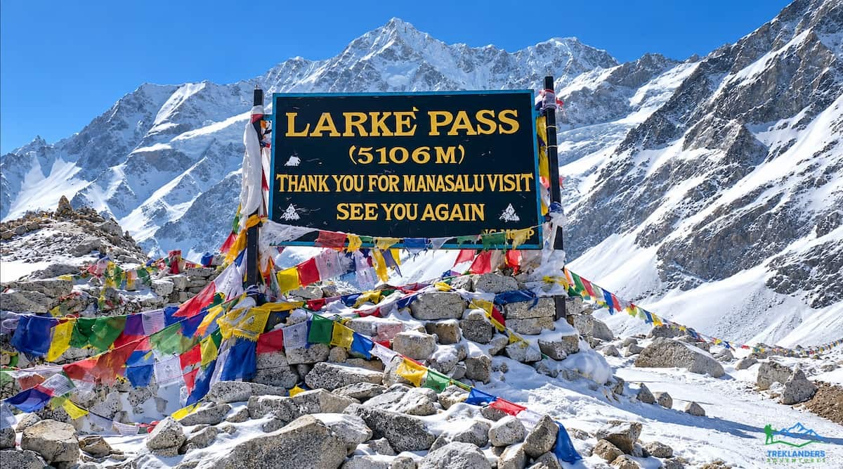
The Manaslu Circuit is a sustained effort more than a technical one. You never use ropes or crampons on the standard route, but you walk for 12 consecutive days from Machha Khola to Dharapani, and the terrain changes every few days. The trail starts at 900 meters in a warm river gorge, climbs through pine and rhododendron forest, opens into the Tibetan-style villages of the upper Budhi Gandaki valley, and then climbs over Larkya La at 5,106 meters. In total you gain about 4,200 meters between Machha Khola and the pass.
The lower valley is the part first-time visitors underestimate. Days from Jagat to Deng and from Deng to Namrung each take around six hours, with steep climbs, suspension bridges and stone staircases. The heat and the humidity tire you before the altitude does. The upper valley brings the opposite problem. Mornings are cold, the air thins above 3,500 meters, and the trail crosses moraine fields where loose, angular stones slow every step.
The hardest day is the crossing of Larkya La. You leave Dharmasala before dawn, climb about 656 meters over ice-crusted moraine and frozen glacial ponds, and then descend roughly 1,516 meters to Bhimthang. The day takes about eight hours. Our 14-day Manaslu Circuit Trek and the 13-day version shorten the schedule, and the pass day is the same hard effort in every one of them.
Two features reduce the difficulty. A full rest day at Sama Gaon, at 3,500 meters, gives your body time to adjust before the final push. The daily altitude gains above 3,000 meters also stay modest, which keeps altitude sickness risk lower than the headline altitude suggests.
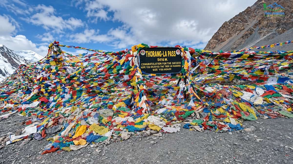
The Annapurna Circuit is a long, well-served trek with one hard climb. Our 13-day version starts with two driving days to Besisahar and Dharapani, then walks through Chame, Pisang and Manang before the pass. Road construction has shortened the classic route, and we use jeeps for sections where a road now runs, including the drive from Muktinath to Tatopani.
Most walking days are shorter than on Manaslu. You walk about five hours to Chame, five to Pisang and four to Manang. The two days after the rest day in Manang are four-hour walks to Yak Kharka and High Camp. The trail is wide, the villages are larger, and the views of Annapurna II, Gangapurna and the Chulu peaks arrive early and stay with you.
The difficulty arrives all at once. From High Camp at 4,900 meters, you climb to Thorong La at 5,416 meters in the dark, then descend about 1,616 meters to Muktinath over a seven-hour day. Wind is common on the pass, and the final climb is steep. Many trekkers also carry a heavier sense of fatigue into this day because they slept at 4,900 meters, where sleep is lighter and appetite drops.
After the pass the trek eases. You drive to Tatopani, climb to Ghorepani at 2,880 meters, and watch the sunrise from Poon Hill. That last section is one reason many people choose the shorter circuit. It ends in warm foothills with long views instead of cold moraine.
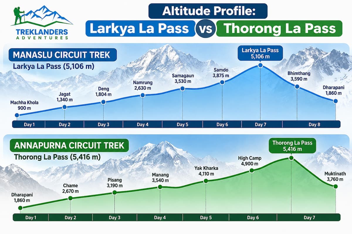
The pass altitude is the number everyone quotes, so it deserves a close look. Larkya La sits at 5,106 meters. Thorong La sits at 5,416 meters. On paper, Annapurna is the higher crossing. In practice, the way you approach each pass matters more than the final height.
On the Annapurna Circuit, you sleep at Manang at 3,540 meters, move to Yak Kharka at 4,110 meters, and then to Thorong High Camp at 4,900 meters. The final move is a gain of 790 meters in one day. Altitude guidance used by many mountain medicine groups suggests keeping sleeping altitude gains above 3,000 meters to about 500 meters a day. The High Camp jump goes well past that figure.
On the Manaslu Circuit, you sleep at Lho Gaon at 3,180 meters, Sama Gaon at 3,500 meters, Samdo at 3,875 meters and Dharmasala at 4,450 meters. The gains between nights are 320, 375 and 575 meters, with a full rest day at Sama Gaon in the middle. You cross the pass from a lower base, and you finish the day at 3,590 meters in Bhimthang, so your body gets relief within hours.
That difference explains how each pass feels. Thorong La carries the higher altitude sickness risk because of the High Camp jump, while Larkya La brings more exhaustion. The pass day on Manaslu is longer, colder at the start, and rougher underfoot. The pass day on Annapurna is shorter but steeper, and it begins after a night at a higher camp.
For trekkers who worry most about altitude, Manaslu has the gentler profile. For trekkers who worry most about stamina, Annapurna asks for less total effort. If you want to extend either route, the Tilicho Lake Base Camp trek and the Nar-Phu Valley with Thorang-La Pass trek both add high-altitude days that need the same careful pacing.
The route begins in Kathmandu, where you spend two nights before the trek. The first evening brings a trek briefing and a welcome dinner. The second day is a guided tour of the valley's heritage sites, which gives your legs an easy day and your guide time to check permits. If you want a longer city program, our Kathmandu full day sightseeing tour covers the same ground in more detail.
The trek proper starts with a seven-hour drive to Machha Khola at 900 meters. The highway out of Kathmandu gives way to a rough dirt road near Arughat in Gorkha district, and from there you follow the Budhi Gandaki river upstream. Machha Khola means fish stream, and it sits where the river meets a smaller tributary. The lodge is simple, but the night gives you a first look at the valley you will follow for the next week.
The first walking day is the shortest, about four hours to Dovan at 1,070 meters. The trail follows the river through sal and pine forest, crosses the Tharo Khola and the Machha Khola, and passes Tatopani, where a natural hot spring tempts most groups into a stop. Dovan sits where two streams meet, and the afternoon is free for walking through the village.
On day five you climb to Jagat at 1,340 meters in four to five hours. The path goes up steeply to Louri, continues to Thado Bhanjyang, crosses a river and then climbs again. Jagat is the checkpoint for the restricted area, so your Manaslu permit, your conservation permits and your guide's paperwork all get inspected here. From this point on, the region was closed to outsiders until 1992, and the villages show it.
Day six takes you to Deng at 1,860 meters through Philim, a village of millet terraces, and Ekle Bhatti, a former lonely hut that now has several teahouses. The afternoon climbs through gorges, crosses the Budhi Gandaki and enters dense bamboo forest. Deng is the first village with a strong Tibetan Buddhist influence, and you will see prayer flags on rooftops for the first time.
Day seven is a six-hour climb to Namrung at 2,660 meters. You pass Bihi, descend briefly, then climb to a bridge and enter pine and rhododendron forest dotted with Buddhist monuments. Ghap village comes next, followed by firs, oaks and bamboo groves. The last stretch follows stone-paved stairs to Namrung, where barley and buckwheat fields open toward snow peaks. The lodges here are among the best below the pass.
Day eight brings you to Lho Gaon at 3,180 meters in five hours. The path climbs through pine woods to Lihi, crosses a stream fed by glaciers on Lindanda peak, and reaches Sho, where Simnang Himal fills the horizon. Lho Gaon has Mani walls, chortens and a large dining room that serves a full menu. On a clear evening the Manaslu massif glows pink above the village.
On day nine you walk six hours through cool forest to Shyala, a village with large crop fields and benches along the trail. After crossing a stream from the Pungyen glacier, you reach Sama Gaon at 3,500 meters. This is the main settlement of the upper Gorkha district, and you spend two nights here.
Day ten is the acclimatization day. We recommend the three to four hour round trip to Pungyen Gompa, an old monastery with a view of the north face of Manaslu. The other option is a walk to Birendra Tal, a glacial lake. Both hikes take you higher than your bed, which is the standard method for adjusting to altitude. The longer trail to Manaslu base camp is available for stronger groups.
Day eleven is a short four-hour walk to Samdo at 3,875 meters. You follow pastures, enter a small woodland of birch and juniper, cross the Budhi Gandaki on a wooden bridge and climb steeply into a Tibetan-style village. Samdo is the last permanent settlement before the pass, and it lies on the traditional trading route to the Tibetan border. Use the afternoon to rest and drink water.
Day twelve is another four-hour walk, to Dharmasala at 4,450 meters, also called Larkya Phedi. You pass old Mani walls, cross the Budhi Gandaki for the last time and follow the Larke stream. The lodges here cannot hold every trekker in peak season, so groups sleep in a large dormitory or in tents beside the lodge. Order dinner early, go to bed early, and keep your sleeping bag within reach. The night before the pass is cold, and we advise a bag rated to minus 10 degrees Celsius.
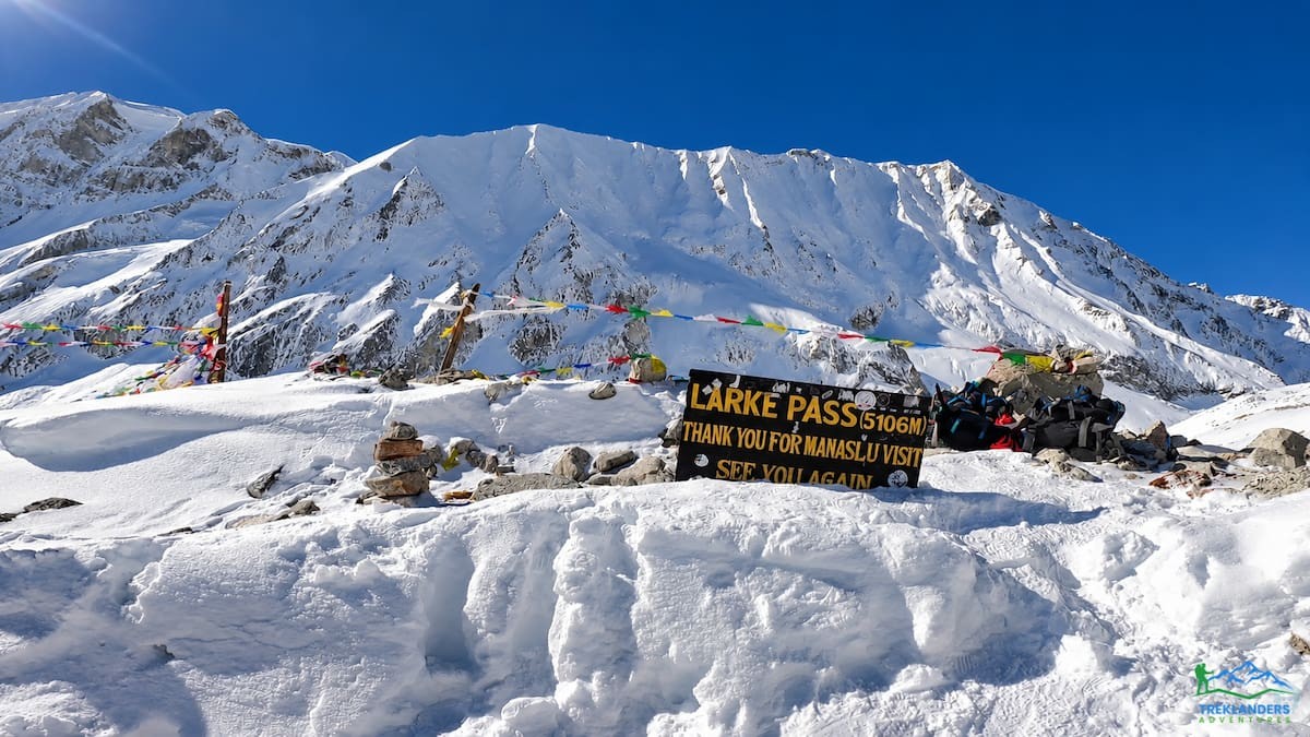
Day thirteen is the big day. You wake early, eat breakfast and carry a packed lunch for roughly eight hours of walking. The climb crosses steep moraine, drops briefly to a glacial pond and continues over rocky ground past frozen ponds. The last push brings you to Larkya La at 5,106 meters, where thousands of prayer flags and a signboard mark the boundary between Gorkha and Manang. The view takes in Larke Peak, Himalchuli, Sringi and the Annapurna range. The descent is long, and it ends at Bhimthang at 3,590 meters, where lodges and warm meals wait.
Day fourteen is deliberately gentle. You walk four hours to Gho at 2,535 meters through pastures and forests of rhododendron, magnolia, pine and fir. Most groups arrive in time for lunch, and the afternoon is free for a short walk or a rest. After the pass, the legs need this day more than they need distance.
Day fifteen takes you through Tilje to Dharapani at 1,820 meters in five hours. The trail descends through shaded forest, crosses the Marsyangdi river on a bridge and climbs briefly into Dharapani, where the Annapurna Circuit trail joins. If you have extra days, this junction is where you can continue into the Annapurna region, and the Annapurna Semi Circuit Trek shows one way to do it.
On day sixteen, a four-wheel-drive vehicle takes you from Dharapani to Besisahar in about four hours. The road follows the Marsyangdi through Tal, Chamje, Jagat and Syange, then continues past Bulbule and Khudi to Besisahar, the headquarters of Lamjung district. Day seventeen is a five-hour drive back to Kathmandu, and day eighteen is your departure.
The Annapurna route begins with two driving days. You leave Kathmandu for Besisahar at 760 meters, spend the night, then drive up the Marsyangdi valley to Dharapani at 1,860 meters. The road passes Syange, Jagat, Chamje and Tal, and it brings you to the start of the walk faster than the old trail ever did.
Day three runs five hours to Chame at 2,710 meters. You walk through rhododendron and pine forest to Bagarchap, then Danaque with its apple orchards, then climb to Timang, a large Gurung village that faces the Manaslu range. After lunch the path descends to the river, crosses to Kodo and climbs gently to Chame, the district headquarters.
Day four takes you to Pisang at 3,120 meters in about five hours. The path passes Brathang and climbs to a ridge at Dukure Pokhari, where Pisang Peak fills the view. Pisang sits on a windswept dry slope among blue pines. Day five is a four-hour walk to Manang at 3,540 meters through Humde and Braga, where an old monastery stands on a high ridge. You spend two nights in Manang, and the rest day brings a walk to a viewpoint above the Gangapurna icefall and the small turquoise lake nearby.
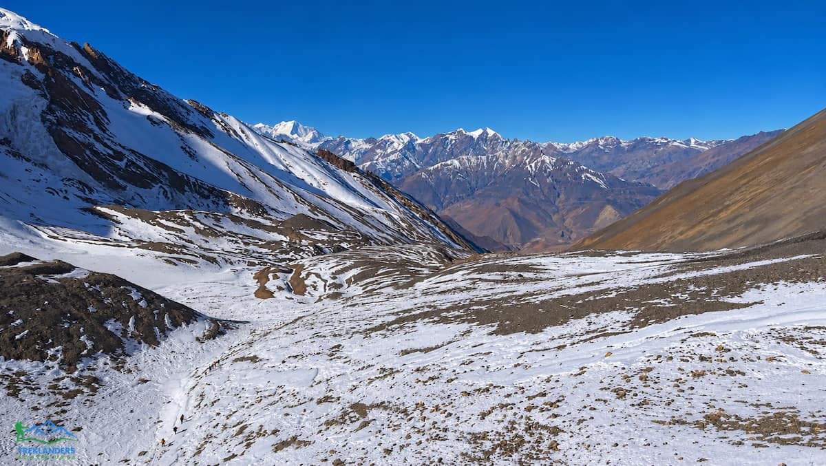
Day seven leads to Yak Kharka at 4,110 meters in four hours, with views of Chulu West, Gangapurna and Tilicho Peak. Day eight climbs to Thorong Phedi and then to High Camp at 4,900 meters, a short but steep walk where the pace slows because of altitude. Day nine is the pass. You start early, climb past a small glacial pond, and then face the steep final climb to Thorong La at 5,416 meters. The panorama includes Damodar, Dhaulagiri, the Chulu peaks and Manaslu to the east. The long descent leads to the Hindu pilgrimage site at Muktinath and then to the lodges at Rani Pauwa.
The second half is easier. On day ten you visit the Muktinath temple complex and its 108 water spouts, then drive through Jomsom, Marpha and Tukuche to Tatopani and its hot springs. Day eleven is a six-hour climb to Ghorepani at 2,880 meters. Day twelve starts with a one-hour hike to Poon Hill at 3,210 meters for sunrise over Dhaulagiri, Annapurna and Machhapuchare. You descend to Ulleri, drive to Pokhara and sleep in a hotel near Phewa Lake. Day thirteen returns you to Kathmandu by road.
For a longer version with fewer jeep sections, our 23-day Annapurna Circuit Trek adds time on the trail and more acclimatization nights.
Numbers from our itineraries show where the two treks diverge. On Manaslu, the walking days between Machha Khola and Dharapani run 4, 4.5, 6, 6, 5 and 6 hours before the Sama Gaon rest day, then 4, 4, 8, 4 and 5 hours after it. That adds up to about 56 hours. On Annapurna, the walking days run 5, 5, 4, 4, 4, 7, 6 and about 4 hours, with one rest day at Manang. That adds up to close to 40 hours.
Terrain matters as much as time. The Manaslu trail follows a steep river gorge for its first week, with suspension bridges, landslide scars and stone steps. Higher up it crosses moraine and glacial ground near Samdo and Dharmasala. Larkya La itself involves compacted ice and snowpack in the pre-dawn hours. Annapurna has its own hazards, mainly wind and cold on the pass and exposed cliff sections near Jomsom, but the main trail is wider and better maintained for most of its length.
Footwear tells the story. On Manaslu we ask for waterproof, ankle-supporting boots with a stiff sole, because trail runners fail on the moraine. Trekking poles help on the long descent from Larkya La and on the wet rock of the lower gorge. On Annapurna, boots are still necessary for Thorong La, but a larger share of the route is easy walking on packed earth.
Trail conditions also change from season to season, particularly in the Budhi Gandaki valley after heavy rain. Our blog tracks route status, and the Nepal trekking update on Langtang, Manaslu and Tsum Valley is a good place to check before you commit to dates. Our Manaslu planning page lets you ask about current conditions directly.
Remoteness is the largest hidden difficulty on Manaslu. The route above Jagat was closed to foreign visitors until 1992, and the government still limits access. You need three permits: the Manaslu Restricted Area Permit, the Manaslu Conservation Area Permit and the Annapurna Conservation Area Permit for the descent. The restricted area permit can only be issued through a registered trekking agency, and solo trekking is not allowed. We handle all permit work for you, and checkpoints between Jagat and the Larkya La army post will check the documents.
The Annapurna Circuit needs two permits, the Annapurna Conservation Area Permit and the TIMS card. Licensed guides are required there as well under Nepal's revised rules. The paperwork is lighter, and the checkpoints at Besisahar, Chame and Manang are routine.
Remoteness changes what a problem looks like. A twisted ankle at Namrung or a case of altitude sickness at Samdo means a long evacuation, because the nearest road head is days away on foot. Our guides carry first aid kits, extra oxygen and medical supplies, and they keep contact with our support team, but the geography still limits how fast help can arrive. On Annapurna, jeeps and flights from Jomsom shorten the response time after the pass.
The same remoteness is why many trekkers pick Manaslu. Fewer people use the trail, the villages feel less hurried, and the Manaslu Conservation Area shelters Himalayan tahr, blue sheep and snow leopards. Our article on why the Manaslu Circuit is quieter than Everest Base Camp explains the crowd difference in detail.
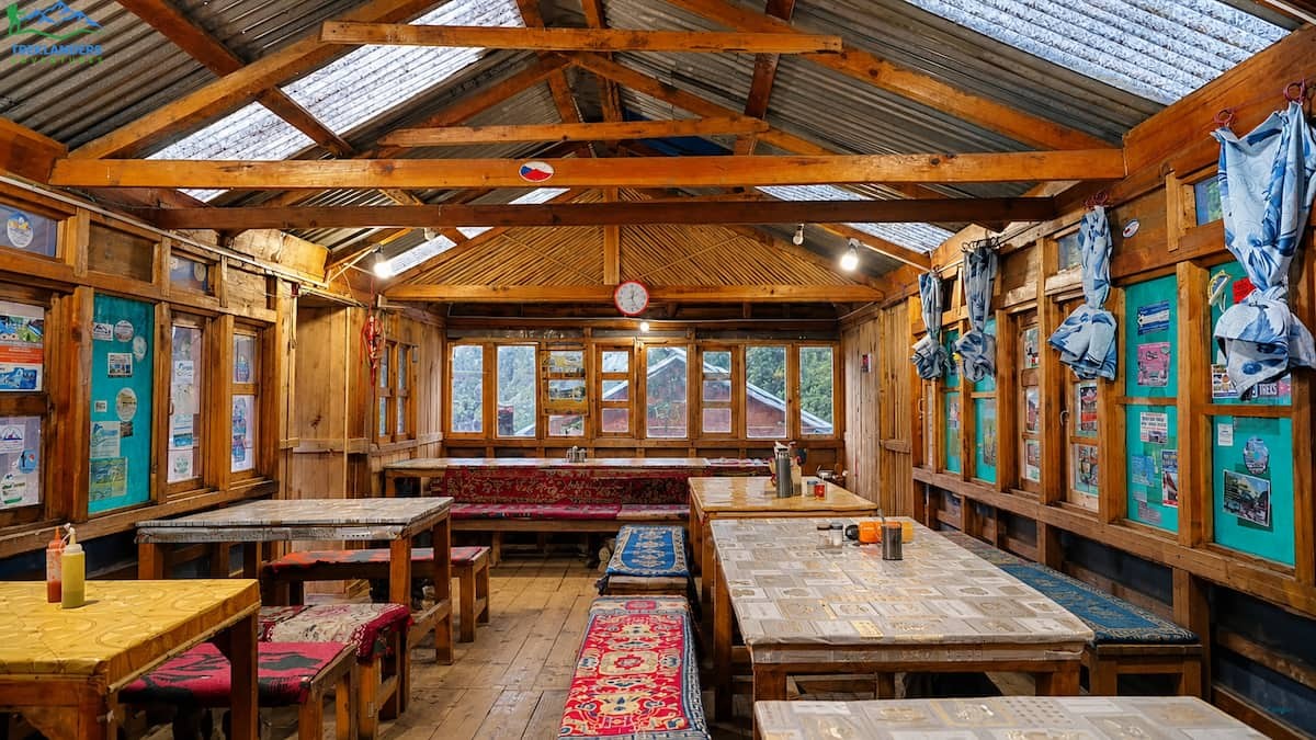
Comfort is the third place where the gap shows. Annapurna lodges are larger and better equipped. Most have attached bathrooms in the lower sections, comprehensive menus that range from porridge and pancakes to pasta and Tibetan dishes, and Wi-Fi in most lodges, though the signal weakens with altitude. Above 3,500 meters, hot showers become rare and the pipes freeze at night. Even so, the Annapurna lodges feel like small hotels next to what you find above Samdo.
Manaslu lodges improve from Namrung to Sama Gaon. Lho Gaon, Sama Gaon and Samdo have bigger dining halls with wood stoves, better bedding, paid charging points and sometimes attached bathrooms with limited hot water. Dal bhat, momos, thukpa, Tibetan bread and fresh apple pie all appear on the menus. Meals are included in our package, and a plate of dal bhat is the best fuel for the long days.
The exception is Dharmasala. The lodge there was built for a handful of trekkers, but the pass draws hundreds in peak season. Groups sleep in dormitories or tents, the rooms have no heating and the toilets are basic. You eat early, sleep early and wake at the start of the night. A warm sleeping bag, a sleeping bag liner and a thermal layer matter more here than anywhere else on the route.
Mobile signal follows the same pattern. Annapurna has coverage at Besisahar, Chame, Pisang and Manang. Manaslu has patchy coverage at Lho Gaon, Sama Gaon and Samdo, with full blackouts in between. Download offline maps and tell your family not to expect daily messages.
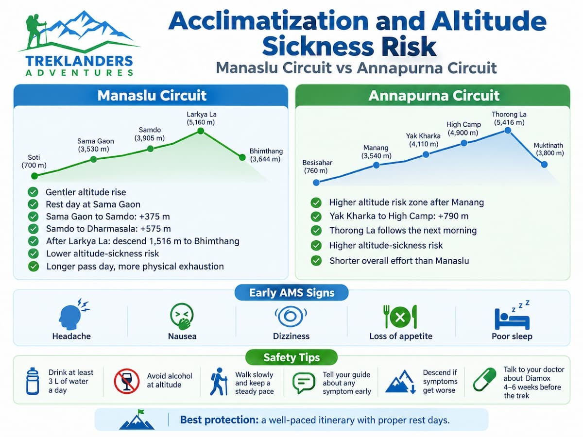
Both treks pass above 5,000 meters, so both carry real altitude risk. The pattern of that risk differs. On Annapurna, the danger zone is the two days after Manang. The gain from Yak Kharka to High Camp is 790 meters, and the pass follows the next morning. Trekkers who feel a headache at Yak Kharka should not continue upward without talking to a guide. A slow pace, plenty of water and an early start on pass day lower the risk.
On Manaslu, the rise is gentler. The Sama Gaon rest day, the 375-meter gain to Samdo and the 575-meter gain to Dharmasala give you time to adjust. Once you cross Larkya La, you lose 1,516 meters in one day, which clears most symptoms by the time you reach Bhimthang.
Headache, nausea, dizziness, loss of appetite and poor sleep are the early signs of altitude sickness on either route. If symptoms continue or get worse, you descend. That rule never changes. Dehydration makes everything worse, so drink at least three liters of water a day, avoid alcohol at altitude, and tell your guide about any symptom, even a mild one. If you plan to take Diamox, speak with your doctor four to six weeks before you leave.
Fitness does not protect you from altitude sickness. Strong runners get sick, and slower walkers sometimes feel fine. Your best protection is a schedule that gives your body time, which is why we build rest days into our itineraries and why we do not shorten the Sama Gaon stop for any group.
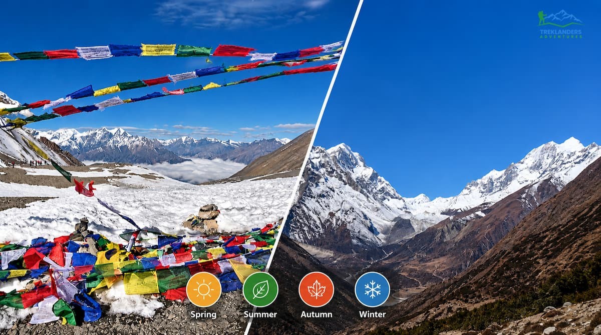
Spring from March to May and autumn from September to November suit both treks. In spring, rhododendrons bloom at lower elevations, the days are long and the mountains are usually clear in the morning. In autumn the post-monsoon air gives the sharpest views of the year, and fresh snow often dusts the high slopes. October is the busiest month, so lodges fill quickly on both routes.
Winter works only for experienced trekkers. Snow can close Larkya La or Thorong La, and the cold at Dharmasala and High Camp is severe. Monsoon from June to August is a poor choice for either route. The upper Manaslu valley sits in a rain shadow and stays relatively dry, but the lower gorge turns slippery, and leeches appear. On Annapurna, the section beyond the pass is also drier than the south side, yet the approach is wet and cloudy.
Larkya La has one extra seasonal difficulty. Because the trek starts in darkness and crosses glacial ground, a night of fresh snow can slow progress by hours. Guides sometimes delay the start or change the schedule, and this is why we recommend adding a spare day to your trip in late autumn.
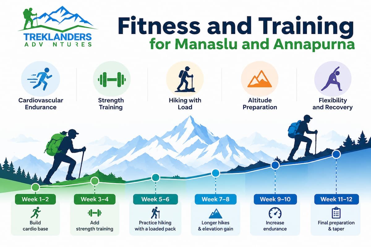
Start training six to eight weeks before departure. The strongest base is endurance cardio combined with leg strength. Running, cycling, swimming and brisk uphill hiking build the base, while squats, lunges, step-ups and calf raises prepare the muscles that carry you up steep climbs and down long descents. If you live in a flat city, stair climbing with a loaded daypack is the best substitute.
Manaslu rewards trekkers who can walk six hours on consecutive days. Practice back-to-back long hikes on weekends, with a pack that weighs about the same as your daypack on the trail. Annapurna rewards trekkers who can climb steadily at altitude, so hill repeats and long stair sessions help most there.
Mental preparation counts as well. Some mornings on both routes begin cold and gray, and the pass can feel far away. Trekkers who accept a slow pace, eat well and keep moving do better than those who rush. Our guides set the pace from the first day and adjust the schedule to the mood of the group.
If you want a lower-risk warm-up, try a shorter Himalayan trek first. The Langtang Valley Trek, the Ghorepani Poonhill Trek and the 9-Day Mardi Himal Trek all let you test your boots, your pace and your response to altitude before a longer commitment.
Both treks use the same layering system, so most of your kit carries across. A moisture-wicking base layer, a fleece or light down mid layer, a waterproof shell and a heavy down jacket for the pass cover both routes. Waterproof boots, warm gloves, a sun hat, a warm hat and UV-rated sunglasses are the same on each.
Three items matter more on Manaslu. The first is a sleeping bag rated to minus 10 degrees Celsius, because the dormitory at Dharmasala has little insulation. The second is a power bank of about 20,000 mAh, since charging carries a fee and solar power drops off above Sama Gaon. The third is a set of offline maps, because mobile signal disappears between the main villages.
Weight limits apply to both routes. Our porters carry a main bag of up to 12 kilograms, and you carry a daypack of 20 to 25 liters with water, layers, snacks, a headlamp and your documents. Keep copies of your permits in a waterproof bag, since the checkpoints on the restricted section of Manaslu ask for them more than once. Trekking poles are worth the weight on both circuits, especially on the long descents after each pass.
Trek length changes difficulty more than most people expect. Our 18-day Manaslu itinerary includes a rest day at Sama Gaon, a gentle day at Gho after the pass and an extra overnight in Besisahar before the drive to Kathmandu. Shorter schedules, such as the 13-day and 14-day Manaslu options, compress the walking and leave less margin for weather or fatigue. Our 13-day Annapurna Circuit uses jeeps to skip road sections, while the 23-day version walks more of the classic trail and adds nights for acclimatization.
A longer plan is not always better. Extra days mean more time away from work, and cold, wet weather can wear on you. Pick the length that matches your fitness, your flexibility and the season. If your dates are fixed, build one spare day into the plan, because snow on a pass or a washed-out road can force a delay.
Your guide matters as much as your itinerary. A good guide watches your breathing, your appetite and your pace, and decides when to push and when to wait. You can meet the people behind our treks on the Treklanders about page and the team page. If you want to read more route comparisons before you decide, our blog covers the Everest, Annapurna, Langtang, Manaslu and Mustang regions, and you can browse the Everest region and Mustang region pages for other high-altitude options.
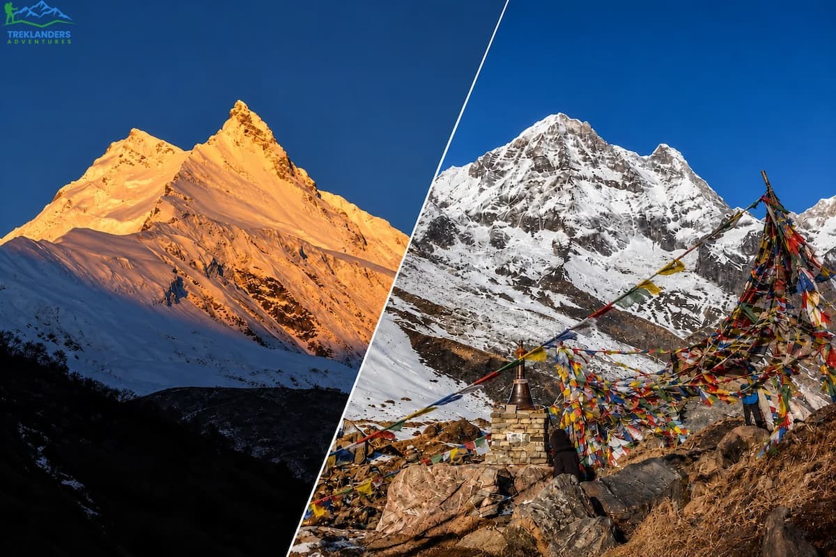
Choose the Manaslu Circuit if you want a quieter trail, if you can handle 11 walking days with basic lodges in the upper valley, and if you value cultural depth in Tibetan-style villages. It also suits trekkers who worry about altitude sickness more than long days, because the altitude gains are smaller. The 20-day Manaslu Circuit with Tsum Valley Trek adds a side valley for those with more time.
Choose the Annapurna Circuit if you prefer shorter walking days, better lodges and a varied finish through Muktinath, Tatopani and Poon Hill. It suits trekkers on a tighter schedule, and our 13-day itinerary fits it into two weeks. Our 7-Day Annapurna Base Camp Trek from Pokhara is a good alternative if you want Annapurna scenery without the pass.
Trekkers who want a bigger challenge than either can look at the Everest Three Passes Trekking route or the Upper Mustang Trekking route. Those who want a classic Himalayan goal with more crowds and more services can compare the 12-Day Everest Base Camp Trek and the Everest Base Camp Trek pages.
Manaslu is harder than the Annapurna Circuit as a whole. It takes more walking hours, it runs through remote terrain, it has simpler lodges above Samdo and it requires restricted area permits and a licensed guide. Annapurna is harder on pass day because Thorong La is higher and the night at High Camp is the highest sleeping point of either route.
Neither trek is out of reach for a fit, well prepared trekker. Both need a steady pace, enough clean water, warm clothing layers and respect for altitude. If you are unsure which route fits your fitness and schedule, our team can compare dates, group size and conditions with you through the Plan My Trip page or the contact page. You can also read recent traveler comments on our reviews page and browse more trekking in Nepal options before you decide.
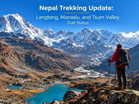
Nepal trekking update 2026: Langtang open, Manaslu accessible with caution, and Tsum Valley temporarily closed. Check the latest trail conditions.
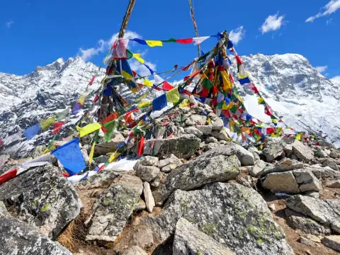
Discover Langtang’s alternate route via Dhunche, with 2026 trail updates, an 8-day itinerary, and essential safety tips.
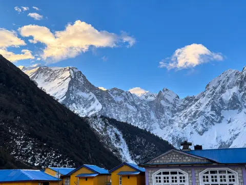
Discover why the Manaslu Circuit Trek offers a quieter, less crowded Himalayan adventure than Everest Base Camp.



