[{"name":"Everest Base Camp Trek","duration":"16","image_url":"https:\/\/www.treklanders.com\/storage\/trip-galleries\/1\/thumb_419a755c003cc609f3030ee332965ebe.jpg","offer_price":1405,"url":"https:\/\/www.treklanders.com\/trips\/everest-base-camp-trek"},{"name":"Gokyo Valley Trekking","duration":"16","image_url":"https:\/\/www.treklanders.com\/storage\/trip-galleries\/2\/thumb_676d1021b574aeba4d19d3f2a0b04ed2.webp","offer_price":1205,"url":"https:\/\/www.treklanders.com\/trips\/gokyo-valley-trekking"},{"name":"Annapurna Circuit Trek","duration":"23","image_url":"https:\/\/www.treklanders.com\/storage\/trip-galleries\/3\/thumb_2a9a92ea23c62f41de27b37f5e3e8c17.webp","offer_price":1495,"url":"https:\/\/www.treklanders.com\/trips\/annapurna-circuit-trek"},{"name":"Everest Panorama Trek","duration":"12","image_url":"https:\/\/www.treklanders.com\/storage\/trip-galleries\/4\/thumb_35c9f677ea2e88b1ff11a9f43daa3ddb.jpg","offer_price":1100,"url":"https:\/\/www.treklanders.com\/trips\/everest-panorama-trek"},{"name":"Everest Base Camp Trekking from Jiri","duration":"22","image_url":"https:\/\/www.treklanders.com\/storage\/trip-galleries\/6\/thumb_14763592492417b294aa66bf0ebf4e64.webp","offer_price":1400,"url":"https:\/\/www.treklanders.com\/trips\/everest-base-camp-trekking-from-jiri"},{"name":"Everest Base Camp via Cho la Pass from Gokyo Valley Trekking","duration":"18","image_url":"https:\/\/www.treklanders.com\/storage\/trip-galleries\/7\/thumb_d4e470e98d4e9e2ab8e93e39b8b7d252.jpg","offer_price":1405,"url":"https:\/\/www.treklanders.com\/trips\/everest-base-camp-via-cho-la-pass-from-gokyo-valley-trekking"},{"name":"Everest Three Passes Trekking","duration":"22","image_url":"https:\/\/www.treklanders.com\/storage\/trip-galleries\/8\/thumb_b413b221e913171500bb3dfd5c08ceea.jpg","offer_price":1635,"url":"https:\/\/www.treklanders.com\/trips\/everest-three-passes-trekking"},{"name":"Annapurna Base Camp Trekking","duration":"14","image_url":"https:\/\/www.treklanders.com\/storage\/trip-galleries\/9\/thumb_2e71f2ffe116c659fa66b01c2d571b4e.webp","offer_price":845,"url":"https:\/\/www.treklanders.com\/trips\/annapurna-base-camp-trekking"},{"name":"Mardi Base Camp Trekking","duration":"14","image_url":"https:\/\/www.treklanders.com\/storage\/trip-galleries\/10\/thumb_d7b2d2dc638f6bbf2c31c167ac68029d.webp","offer_price":845,"url":"https:\/\/www.treklanders.com\/trips\/mardi-base-camp-trekking"},{"name":"Mohare Danda Trekking","duration":"12","image_url":"https:\/\/www.treklanders.com\/storage\/trip-galleries\/11\/thumb_a384c8d35d789d29b19991c1d675c910.webp","offer_price":755,"url":"https:\/\/www.treklanders.com\/trips\/mohare-danda-trekking"},{"name":"Khopra Ridge & Khair Lake Trekking","duration":"15","image_url":"https:\/\/www.treklanders.com\/storage\/trip-galleries\/12\/thumb_c0f50461ddc74acfb553ba85be00fab0.webp","offer_price":855,"url":"https:\/\/www.treklanders.com\/trips\/khopra-ridge-khair-lake-trekking"},{"name":"Upper Mustang Trekking","duration":"17","image_url":"https:\/\/www.treklanders.com\/storage\/trip-galleries\/13\/thumb_7aa4dfdb69186b0f224a303d80a25c95.jpg","offer_price":1715,"url":"https:\/\/www.treklanders.com\/trips\/upper-mustang-trekking"},{"name":"Langtang Valley Trek","duration":"12","image_url":"https:\/\/www.treklanders.com\/storage\/trip-galleries\/14\/thumb_8650b4b1a3c160cff75da65369398353.webp","offer_price":735,"url":"https:\/\/www.treklanders.com\/trips\/langtang-valley-trek"},{"name":"Gosainkunda Lake Trek","duration":"11","image_url":"https:\/\/www.treklanders.com\/storage\/trip-galleries\/15\/thumb_bfe94c14e760c48234e117021105be84.webp","offer_price":735,"url":"https:\/\/www.treklanders.com\/trips\/gosainkunda-lake-trek"},{"name":"Chisapani-Nagarkot to Dhulikhel Hiking","duration":"7","image_url":"https:\/\/www.treklanders.com\/storage\/trip-galleries\/16\/thumb_468defe9a4000ee3129cd7e6421ee105.webp","offer_price":565,"url":"https:\/\/www.treklanders.com\/trips\/chisapani-nagarkot-to-dhulikhel-hiking"},{"name":"Kanchenjunga Trek","duration":"23","image_url":"https:\/\/www.treklanders.com\/storage\/trip-galleries\/17\/thumb_51f43fa4203106cc49aaedc89d76e01d.jpg","offer_price":1725,"url":"https:\/\/www.treklanders.com\/trips\/kanchenjunga-trek"},{"name":"Helambu Trek","duration":"12","image_url":"https:\/\/www.treklanders.com\/storage\/trip-galleries\/18\/thumb_0fe8e3fa1299d2e43bf1fb5977875ce2.jpg","offer_price":685,"url":"https:\/\/www.treklanders.com\/trips\/helambu-trek"},{"name":"Upper Dolpo Trek","duration":"26","image_url":"https:\/\/www.treklanders.com\/storage\/trip-galleries\/19\/thumb_d6080d490e1db83b0a711e7304000864.jpg","offer_price":3005,"url":"https:\/\/www.treklanders.com\/trips\/upper-dolpo-trek"},{"name":"Manaslu Circuit Trek","duration":"18","image_url":"https:\/\/www.treklanders.com\/storage\/trip-galleries\/20\/thumb_1fdd224e849f4f328e73d2d12b3d282d.jpg","offer_price":1225,"url":"https:\/\/www.treklanders.com\/trips\/manaslu-circuit-trek"},{"name":"Tilicho Lake Base Camp Trek","duration":"19","image_url":"https:\/\/www.treklanders.com\/storage\/trip-galleries\/21\/thumb_eba8ac5e029e6543e0c17630ebd9e2fb.jpg","offer_price":1220,"url":"https:\/\/www.treklanders.com\/trips\/tilicho-lake-base-camp-trek"},{"name":"Nar-Phu Valley With Thorang-La Pass Trek","duration":"21","image_url":"https:\/\/www.treklanders.com\/storage\/trip-galleries\/22\/thumb_43597423a5a366fe9c8937fb30d2fe2a.jpg","offer_price":1315,"url":"https:\/\/www.treklanders.com\/trips\/nar-phu-valley-with-thorang-la-pass-trek"},{"name":"Nepal Round Trip of Kathmandu-Pokhara-Lumbini and Chitwan Tour","duration":"10","image_url":"https:\/\/www.treklanders.com\/storage\/trip-galleries\/23\/thumb_32497d170b2ab340b0a1b3310e91e784.webp","offer_price":845,"url":"https:\/\/www.treklanders.com\/trips\/nepal-round-trip-of-kathmandu-pokhara-lumbini-and-chitwan-tour"},{"name":"Nagarkot Day Hike","duration":"2","image_url":"https:\/\/www.treklanders.com\/storage\/trip-galleries\/24\/thumb_a5a654930fd8ba7852e41738105bacfc.webp","offer_price":105,"url":"https:\/\/www.treklanders.com\/trips\/nagarkot-day-hike"},{"name":"Nagarkot Sunrise Tour","duration":"1","image_url":"https:\/\/www.treklanders.com\/storage\/trip-galleries\/25\/thumb_17dc28a29cfa44381ad503f0a75ee84f.webp","offer_price":22,"url":"https:\/\/www.treklanders.com\/trips\/nagarkot-sunrise-tour"},{"name":"Namobuddha Day Tour with Shiva Statue","duration":"1","image_url":"https:\/\/www.treklanders.com\/storage\/trip-galleries\/26\/thumb_beeb34202f9077764aa08c67ef2867f9.webp","offer_price":45,"url":"https:\/\/www.treklanders.com\/trips\/namobuddha-day-tour-with-shiva-statue"},{"name":"Kathmandu Full Day Sightseeing Tour","duration":"1","image_url":"https:\/\/www.treklanders.com\/storage\/trip-galleries\/27\/thumb_d045fc0f1acee2cfa6b3c95f3c656d18.jpg","offer_price":30,"url":"https:\/\/www.treklanders.com\/trips\/kathmandu-full-day-sightseeing-tour"},{"name":"Patan and Bhaktapur Sightseeing Tour","duration":"1","image_url":"https:\/\/www.treklanders.com\/storage\/trip-galleries\/28\/thumb_750eacac3424b5dba686dd93656ab87c.jpg","offer_price":30,"url":"https:\/\/www.treklanders.com\/trips\/patan-and-bhaktapur-sightseeing-tour"},{"name":"Upper Mustang Heli Tour","duration":"1","image_url":"https:\/\/www.treklanders.com\/storage\/trip-galleries\/29\/thumb_0b785f69a15557f8660c805c76fda14e.webp","offer_price":1250,"url":"https:\/\/www.treklanders.com\/trips\/upper-mustang-heli-tour"},{"name":"Everest Heli Tour","duration":"1","image_url":"https:\/\/www.treklanders.com\/storage\/trip-galleries\/30\/thumb_dc45f2beb36a3699e0decf0de41a6f17.jpg","offer_price":1495,"url":"https:\/\/www.treklanders.com\/trips\/everest-heli-tour"},{"name":"Island Peak Trek & Climb","duration":"21","image_url":"https:\/\/www.treklanders.com\/storage\/trip-galleries\/31\/thumb_a0f3e3468c92a8e436045cf8b2fbf361.jpg","offer_price":2295,"url":"https:\/\/www.treklanders.com\/trips\/island-peak-trek-climb"},{"name":"Mera Peak Trek & Climb","duration":"18","image_url":"https:\/\/www.treklanders.com\/storage\/trip-galleries\/32\/thumb_3e8128a23c36f02fa38135475e811b9e.jpg","offer_price":2815,"url":"https:\/\/www.treklanders.com\/trips\/mera-peak-trek-climb"},{"name":"Chandragiri Cable Car Tour","duration":"1","image_url":"https:\/\/www.treklanders.com\/storage\/trip-galleries\/33\/thumb_faa70b716449eada6d7f1450335edbb3.jpg","offer_price":30,"url":"https:\/\/www.treklanders.com\/trips\/chandragiri-cable-car-tour"},{"name":"Everest Base Camp Trek and Returning via Heli","duration":"13","image_url":"https:\/\/www.treklanders.com\/storage\/trip-galleries\/34\/thumb_11190941866206e1d578db11986ebc73.webp","offer_price":2100,"url":"https:\/\/www.treklanders.com\/trips\/everest-base-camp-trek-and-returning-via-heli"},{"name":"Annapurna Semi Circuit Trek","duration":"15","image_url":"https:\/\/www.treklanders.com\/storage\/trip-galleries\/35\/thumb_30ddd8ba818cdcb52efd5eb0a017bcdb.jpg","offer_price":965,"url":"https:\/\/www.treklanders.com\/trips\/annapurna-semi-circuit-trek"},{"name":"Everest Base Camp Luxury Trek","duration":"14","image_url":"https:\/\/www.treklanders.com\/storage\/trip-galleries\/39\/thumb_6079aea3c5dd83e745a16fd6162270dc.jpg","offer_price":2685,"url":"https:\/\/www.treklanders.com\/trips\/everest-base-camp-luxury-trek"},{"name":"Mt. Kailash & Lake Manasarover Tour","duration":"15","image_url":"https:\/\/www.treklanders.com\/storage\/trip-galleries\/41\/thumb_cf3fededfd7dd2b40399af399e04f95a.jpg","offer_price":2205,"url":"https:\/\/www.treklanders.com\/trips\/mt-kailash-lake-manasarover-tour"},{"name":"Ghorepani Poonhill Trek","duration":"11","image_url":"https:\/\/www.treklanders.com\/storage\/trip-galleries\/43\/thumb_602d9a56976e1b836ba8adc69b8d09c5.webp","offer_price":720,"url":"https:\/\/www.treklanders.com\/trips\/ghorepani-poonhill-trek"},{"name":"11 Days Gokyo Valley Trekkking","duration":"11","image_url":"https:\/\/www.treklanders.com\/storage\/trip-galleries\/45\/thumb_ab552c3c91de392f94230a937b1c4801.jpg","offer_price":900,"url":"https:\/\/www.treklanders.com\/trips\/11-days-gokyo-valley-trekkking"},{"name":"9-Day Everest Base Camp Trekking with Helicopter Return","duration":"9","image_url":"https:\/\/www.treklanders.com\/storage\/trip-galleries\/46\/thumb_9a8ba2b582500cd86786be056902c31a.webp","offer_price":1990,"url":"https:\/\/www.treklanders.com\/trips\/9-day-everest-base-camp-trekking-with-helicopter-return"},{"name":"12-Day Everest Base Camp Trek","duration":"12","image_url":"https:\/\/www.treklanders.com\/storage\/trip-galleries\/47\/thumb_d12c9ef776c0b395ceea817fe05c5892.jpg","offer_price":1000,"url":"https:\/\/www.treklanders.com\/trips\/12-day-everest-base-camp-trek"},{"name":"8-Day Everest Panorama Trek","duration":"8","image_url":"https:\/\/www.treklanders.com\/storage\/trip-galleries\/49\/thumb_c81ae3a8ac757a317a9362e6872e2dcb.jpg","offer_price":850,"url":"https:\/\/www.treklanders.com\/trips\/8-day-everest-panorama-trek"},{"name":"7-Day Langtang Valley Trek","duration":"7","image_url":"https:\/\/www.treklanders.com\/storage\/trip-galleries\/50\/thumb_99c2904df5475ab028c9e3633ea95ef3.jpg","offer_price":420,"url":"https:\/\/www.treklanders.com\/trips\/7-day-langtang-valley-trek"},{"name":"4-Day Trekking Adventure near Kathmandu","duration":"4","image_url":"https:\/\/www.treklanders.com\/storage\/trip-galleries\/51\/thumb_594681060514dc57be1959236a6996d0.jpg","offer_price":275,"url":"https:\/\/www.treklanders.com\/trips\/4-day-trekking-adventure-near-kathmandu"},{"name":"4-Day Ghorepani Ponnhill Trek from Pokhara","duration":"4","image_url":"https:\/\/www.treklanders.com\/storage\/trip-galleries\/53\/thumb_eede04edac01f983d9af2c16f55d03e8.webp","offer_price":500,"url":"https:\/\/www.treklanders.com\/trips\/4-day-ghorepani-ponnhill-trek-from-pokhara"},{"name":"7-Day Annapurna Base Camp Trek from Pokhara","duration":"7","image_url":"https:\/\/www.treklanders.com\/storage\/trip-galleries\/55\/thumb_547e91c74088c491111ebe31a759cfbb.jpg","offer_price":420,"url":"https:\/\/www.treklanders.com\/trips\/7-day-annapurna-base-camp-trek-from-pokhara"},{"name":"13-Day Manaslu Circuit Trekking","duration":"13","image_url":"https:\/\/www.treklanders.com\/storage\/trip-galleries\/56\/thumb_aef1af4f0c4a2a9622d518ad5959542b.jpg","offer_price":1050,"url":"https:\/\/www.treklanders.com\/trips\/13-day-manaslu-circuit-trekking"},{"name":"5-Day Mardi Himal Trek from Pokhara","duration":"5","image_url":"https:\/\/www.treklanders.com\/storage\/trip-galleries\/57\/thumb_dcd598d556c14835f0a18169afafcbc6.webp","offer_price":420,"url":"https:\/\/www.treklanders.com\/trips\/5-day-mardi-himal-trek-from-pokhara"},{"name":"Nagarkot Sunrise Tour with Day Hike","duration":"1","image_url":"https:\/\/www.treklanders.com\/storage\/trip-galleries\/58\/thumb_7cdfa1f16719486da2a0718da45b1f2f.webp","offer_price":30,"url":"https:\/\/www.treklanders.com\/trips\/nagarkot-sunrise-tour-with-day-hike"},{"name":"Seven Unesco Heritage Sites Day Tour in Kathmandu","duration":"1","image_url":"https:\/\/www.treklanders.com\/storage\/trip-galleries\/59\/thumb_92aed7b9c67e76740000aab9313dced7.jpg","offer_price":40,"url":"https:\/\/www.treklanders.com\/trips\/seven-unesco-heritage-sites-day-tour-in-kathmandu"},{"name":"10-Day Ghorepani Poonhill with Annapurna Base Camp Trek","duration":"10","image_url":"https:\/\/www.treklanders.com\/storage\/trip-galleries\/60\/thumb_d4c2c089497950ccb5f8541d76e1269b.webp","offer_price":835,"url":"https:\/\/www.treklanders.com\/trips\/10-day-ghorepani-poonhill-with-annapurna-base-camp-trek"},{"name":"3-Day Chitwan Wildlife Tour","duration":"3","image_url":"https:\/\/www.treklanders.com\/storage\/trip-galleries\/61\/thumb_7963c9033b4ecfb5d29583fb0965d521.webp","offer_price":150,"url":"https:\/\/www.treklanders.com\/trips\/3-day-chitwan-wildlife-tour"},{"name":"3-Day Pokhara Sightseeing Tour","duration":"3","image_url":"https:\/\/www.treklanders.com\/storage\/trip-galleries\/62\/thumb_61542f3c38329bcce9d2771c96f265a4.jpg","offer_price":230,"url":"https:\/\/www.treklanders.com\/trips\/3-day-pokhara-sightseeing-tour"},{"name":"7-Day Kathmandu Pokhara and Chitwan wildlifeTour","duration":"7","image_url":"https:\/\/www.treklanders.com\/storage\/trip-galleries\/63\/thumb_803b98ae15f14366124ebb109a32f49d.webp","offer_price":545,"url":"https:\/\/www.treklanders.com\/trips\/7-day-kathmandu-pokhara-and-chitwan-wildlifetour"},{"name":"Nagarjun Jamacho Day Hiking","duration":"1","image_url":"https:\/\/www.treklanders.com\/storage\/trip-galleries\/64\/thumb_85867eb85c60c8228e44f927341f67d1.jpg","offer_price":30,"url":"https:\/\/www.treklanders.com\/trips\/nagarjun-jamacho-day-hiking"},{"name":"Everest Mountain Flight from Kathmandu","duration":"1","image_url":"https:\/\/www.treklanders.com\/storage\/trip-galleries\/65\/thumb_1a66526d340ec175023842c38efd8a95.webp","offer_price":120,"url":"https:\/\/www.treklanders.com\/trips\/everest-mountain-flight-from-kathmandu"},{"name":"One Day Trishuli River Rafting Adventures","duration":"1","image_url":"https:\/\/www.treklanders.com\/storage\/trip-galleries\/66\/thumb_55ba0ea676c9c625f99f3d41bda224fb.jpg","offer_price":35,"url":"https:\/\/www.treklanders.com\/trips\/one-day-trishuli-river-rafting-adventures"},{"name":"13-Day Annapurna Circuit Trek","duration":"13","image_url":"https:\/\/www.treklanders.com\/storage\/trip-galleries\/67\/thumb_859e7a1fbb468a9252d365cab8379f10.jpg","offer_price":815,"url":"https:\/\/www.treklanders.com\/trips\/13-day-annapurna-circuit-trek"},{"name":"15-Day Tilicho Base Camp with Thorong-La Pass Trekking","duration":"15","image_url":"https:\/\/www.treklanders.com\/storage\/trip-galleries\/68\/thumb_56a5fd1506c9b9f1f83844353dc55edf.jpg","offer_price":920,"url":"https:\/\/www.treklanders.com\/trips\/15-day-tilicho-base-camp-with-thorong-la-pass-trekking"},{"name":"Cooking Class in Thamel-Full Course Meal","duration":"1","image_url":"https:\/\/www.treklanders.com\/storage\/trip-galleries\/69\/thumb_ed5cfbc0d94b624642d347c0776d36bb.webp","offer_price":30,"url":"https:\/\/www.treklanders.com\/trips\/cooking-class-in-thamel-full-course-meal"},{"name":"Cooking Class in Thamel-Full Course","duration":"3 Hours 30 Minutes","image_url":"https:\/\/www.treklanders.com\/img\/default.gif","offer_price":30,"url":"https:\/\/www.treklanders.com\/trips\/cooking-class-in-thamel-full-course"},{"name":"Cooking Class in Thamel-Full Course Meal","duration":"3 Hours 30 Minutes","image_url":"https:\/\/www.treklanders.com\/img\/default.gif","offer_price":30,"url":"https:\/\/www.treklanders.com\/trips\/cooking-class-in-thamel-full-course-meal"},{"name":"Momo Making Class in Thamel","duration":"1","image_url":"https:\/\/www.treklanders.com\/storage\/trip-galleries\/72\/thumb_a36e5ceca4d5c4cb0ecda367505b31d3.webp","offer_price":20,"url":"https:\/\/www.treklanders.com\/trips\/momo-making-class-in-thamel"},{"name":"8 Days Bhutan Tour from Kathmandu","duration":"8","image_url":"https:\/\/www.treklanders.com\/storage\/trip-galleries\/73\/thumb_df319d7d3ac21bcd9cf728cb1a70ea09.webp","offer_price":2275,"url":"https:\/\/www.treklanders.com\/trips\/8-days-bhutan-tour-from-kathmandu"},{"name":"10 Days Bhutan Tour with Druk path Trek","duration":"10","image_url":"https:\/\/www.treklanders.com\/storage\/trip-galleries\/74\/thumb_c7d4a4b89aceaf5d3aac313265729bb3.webp","offer_price":5715,"url":"https:\/\/www.treklanders.com\/trips\/10-days-bhutan-tour-with-druk-path-trek"},{"name":"9 -Day Langtang Valley Trek","duration":"9","image_url":"https:\/\/www.treklanders.com\/storage\/trip-galleries\/75\/thumb_65e69cec8917e39091c9e40ae06df3da.webp","offer_price":620,"url":"https:\/\/www.treklanders.com\/trips\/9--day-langtang-valley-trek"},{"name":"14 Day Everest Base Camp Trek","duration":"14","image_url":"https:\/\/www.treklanders.com\/storage\/trip-galleries\/76\/thumb_446e7f33a5f43896c9cdf470cd7be947.webp","offer_price":1175,"url":"https:\/\/www.treklanders.com\/trips\/14-day-everest-base-camp-trek"},{"name":"Lhasa Tour from Kathmandu: 10-Day Tibet Overland Journey via Gyirong","duration":"10","image_url":"https:\/\/www.treklanders.com\/img\/default.gif","offer_price":null,"url":"https:\/\/www.treklanders.com\/trips\/lhasa-tour-from-kathmandu-10-day-tibet-overland-journey-via-gyirong"},{"name":"13 Day Lhasa Tour from Kathmandu via Everest Base Camp","duration":"13","image_url":"https:\/\/www.treklanders.com\/storage\/trip-galleries\/78\/thumb_8a2bfb2abd99ba9ddc902b768e7b0759.webp","offer_price":2565,"url":"https:\/\/www.treklanders.com\/trips\/13-day-lhasa-tour-from-kathmandu-via-everest-base-camp"},{"name":"11 Day Annapurna Base Camp Trek","duration":"11","image_url":"https:\/\/www.treklanders.com\/storage\/trip-galleries\/79\/thumb_4e48a19c538c00cc8c36160ca97c5f21.webp","offer_price":720,"url":"https:\/\/www.treklanders.com\/trips\/11-day-annapurna-base-camp-trek"},{"name":"9 Day Mardi Himal Trek","duration":"9","image_url":"https:\/\/www.treklanders.com\/storage\/trip-galleries\/80\/thumb_8214945c5614ac9a84e5ca0b58b1f5a3.webp","offer_price":735,"url":"https:\/\/www.treklanders.com\/trips\/9-day-mardi-himal-trek"},{"name":"14 Day Manaslu Circuit Trek","duration":"14","image_url":"https:\/\/www.treklanders.com\/storage\/trip-galleries\/81\/thumb_b3ec98cd4036da5cb6e92250afa0d59e.webp","offer_price":1085,"url":"https:\/\/www.treklanders.com\/trips\/14-day-manaslu-circuit-trek"},{"name":"20 Day Manaslu Circuit with Tsum Valley Trek","duration":"20","image_url":"https:\/\/www.treklanders.com\/storage\/trip-galleries\/82\/thumb_b8c202cf8e16197517811d535f2a6795.webp","offer_price":1765,"url":"https:\/\/www.treklanders.com\/trips\/20-day-manaslu-circuit-with-tsum-valley-trek"},{"name":"15 Day Langtang Gosaikunda Lake Helambu Trek","duration":"15","image_url":"https:\/\/www.treklanders.com\/storage\/trip-galleries\/83\/thumb_a9c7bbb74f733cdc9a3469a448df7109.webp","offer_price":985,"url":"https:\/\/www.treklanders.com\/trips\/15-day-langtang-gosaikunda-lake-helambu-trek"},{"name":"14 Day Tamang Heritage with Langtang Valley Trek","duration":"14","image_url":"https:\/\/www.treklanders.com\/storage\/trip-galleries\/84\/thumb_57fe1b0ad2b7d0489273633b906d2f43.webp","offer_price":895,"url":"https:\/\/www.treklanders.com\/trips\/14-day-tamang-heritage-with-langtang-valley-trek"},{"name":"6 Day Pikey Peak Trek","duration":"6","image_url":"https:\/\/www.treklanders.com\/storage\/trip-galleries\/85\/thumb_f69c5c05ac7a2100c9010f66292efc86.webp","offer_price":550,"url":"https:\/\/www.treklanders.com\/trips\/6-day-pikey-peak-trek"},{"name":"Everest Base Camp Trek with Lobuche East Peak Climbing Expedition","duration":"17","image_url":"https:\/\/www.treklanders.com\/storage\/trip-galleries\/86\/thumb_9e7f330ecdbd7f74fe6f16202d3fed28.webp","offer_price":2295,"url":"https:\/\/www.treklanders.com\/trips\/everest-base-camp-trek-with-lobuche-east-peak-climbing-expedition"}]
Langtang Trek Route Update 2026: Safe Alternate Way via Dhunche
Langtang Trek Route Update 2026: Safe Alternate Way via Dhunche
Langtang Trek Route Update 2026: Safe Alternate Way via Dhunche
Langtang Trek
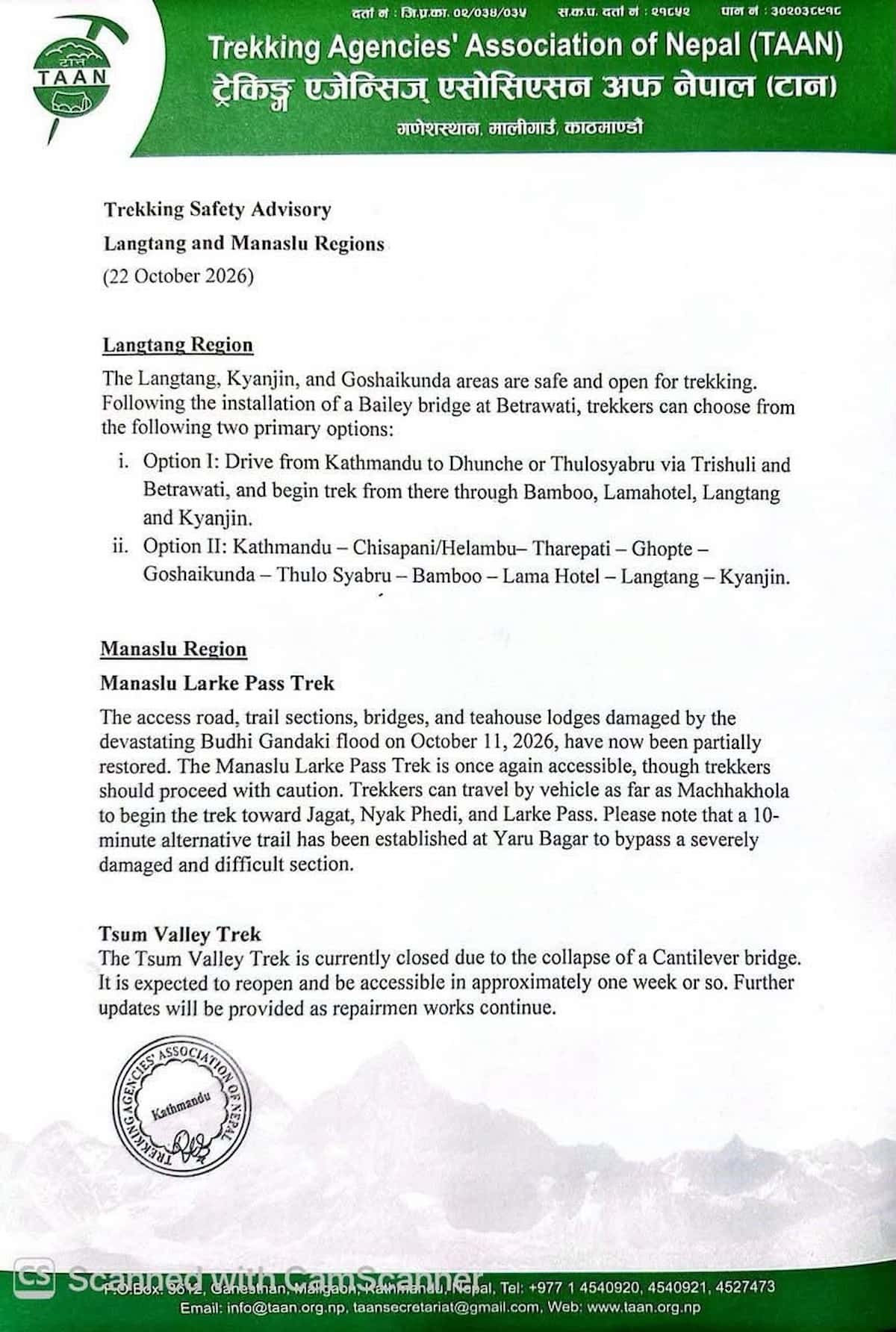
The Langtang trek is open this autumn, and you can walk it on a route that starts in Dhunche. On 22 October 2026, the Trekking Agencies' Association of Nepal (TAAN) issued a safety advisory for the Langtang and Manaslu regions. For Langtang, the message is short. The valley, Kyanjin Gompa, and the Gosaikunda area are safe and open for trekking.
That update changes how you plan a Langtang trek in 2026. A newly installed Bailey bridge at Betrawati restored the road approach from Kathmandu, and the advisory names Dhunche and Thulo Syabru as the drive-to points. Treklanders Adventures uses that guidance to run an 8-day Dhunche to Thulo Syabru route. It reaches Kyanjin Gompa through quiet forest trails and gives you a second look at the lower valley on the way down.
This guide explains the update in plain terms. You will see what changed, why the Dhunche start works, and what each of the eight days looks like, with altitudes, walking times, and sleeping places. You will also find permit notes, altitude advice, safety rules for freshly repaired trails, and a short list of alternative routes if your dates or fitness do not fit this one. Conditions in the Himalayas shift quickly, so read this as a snapshot of late October 2026 and confirm the details with your guide before you fly.
What Changed on the Langtang Trail in 2026
TAAN Notice
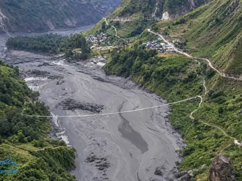
Trekkers spent most of October sending the same message to agencies, asking whether Langtang is safe. The flood that hit the Budhi Gandaki valley in the Manaslu region on 11 October 2026 made many people nervous about every trail north of Kathmandu. Langtang is a different valley inside a different protected area, and the advisory treats it separately. You can read how the flood affected the neighboring region in the Treklanders report on the Budhi Gandaki flood and its effect on Manaslu and Tsum Valley routes.
The TAAN advisory says three things about Langtang. The valley is open. Kyanjin Gompa is open. The Gosaikunda area is open. It credits the new Bailey bridge at Betrawati for the return of the standard road approach. A Bailey bridge is a prefabricated steel bridge that crews can assemble fast after a river removes a permanent crossing. It carries vehicles, and that matters because every Langtang trek starts with a long drive.
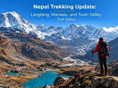
The advisory describes two ways to reach the trail. The first is a drive from Kathmandu to Dhunche or Thulo Syabru through Trishuli and Betrawati, followed by a walk through Bamboo, Lama Hotel, Langtang, and Kyanjin. The second is a longer walk-in from Chisapani or Helambu over Tharepati, Ghopte, and Gosaikunda to Thulo Syabru, then on to the valley. Our new 8-day route follows the first approach and ends the trek at the same two points. If you want the full regional picture, including trail status for Manaslu and Tsum Valley, the Treklanders Nepal trekking update for Langtang, Manaslu, and Tsum Valley covers each trail in detail.
Two words in any advisory deserve attention. One is "open," which means the trail works today. The other is "update," which means the situation can change tomorrow. A landslide in the monsoon tail or an early snowfall can close a stretch for a day or two. Your guide tracks those changes by radio and phone with lodge owners and other guides, which is one more reason to trek with a licensed team.
Before you fly, ask your agency for a status check three days ahead of your start date. Request the current trailhead, the condition of the bridges between Bamboo and Kyanjin, and the state of the lodges at Lama Hotel and Langtang Village. A good guide answers in plain words and offers a backup plan without being asked. Write down the answers, share them with your family, and keep the guide's phone number in your daypack. That short call prevents most surprises. Do this even if the forecast looks clear all week.
Why the Dhunche Route Works as a Safe Alternate Way
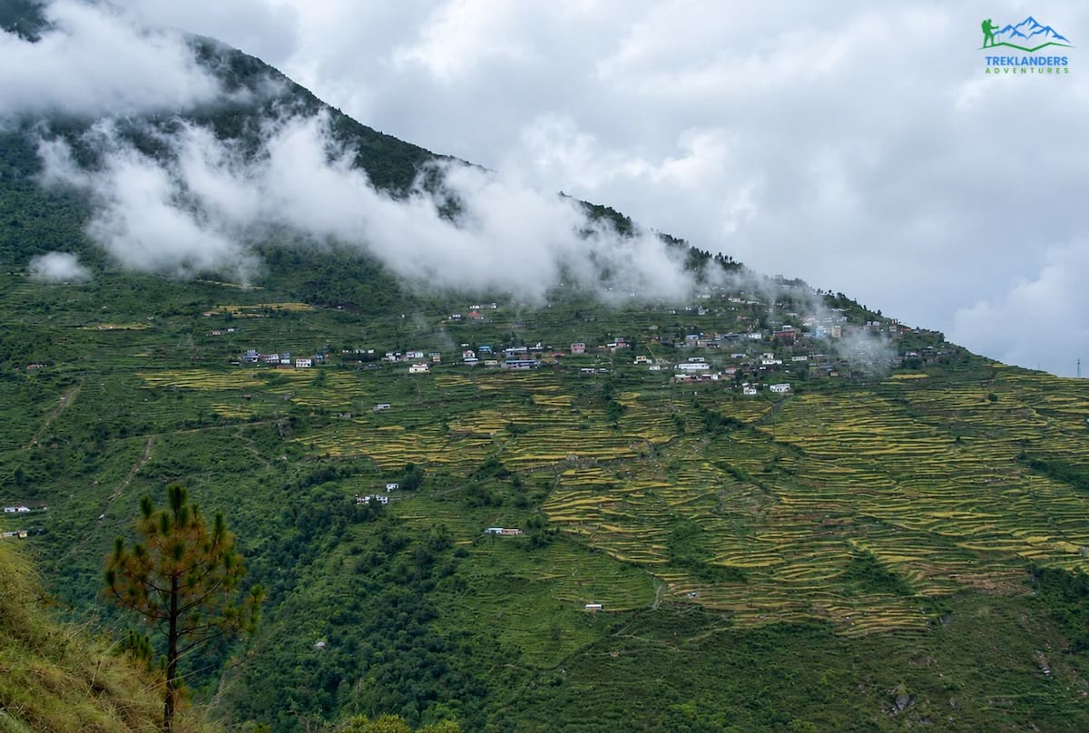
Dhunche
Dhunche is the district headquarters of Rasuwa and the entrance to Langtang National Park. It sits at 2,030 meters, high enough that you start acclimatizing the night you arrive, and low enough that most people sleep well. The park checkpoint is here, so your permits get checked before you walk, not after. Starting from Dhunche gives you three practical benefits.
First, the road reaches Dhunche from Kathmandu without the final stretch down to the Bhote Koshi river. That stretch is steep and narrow. Stopping at Dhunche shortens your time on the roughest section of the highway, and your driver has more room to wait out a delay.
Second, the walk from Dhunche to Thulo Syabru is a gentle first day on foot. You climb and descend through pine forest at a height where your body adjusts easily. By the time you reach Thulo Syabru at 2,210 meters, you have already walked a full day and slept a night in the hills.
Third, the route gives you a village stay that the standard out-and-back route skips. Thulo Syabru is a Tamang village on a ridge above the Bhote Koshi valley. Families there farm terraced fields, keep goats and buffalo, and rent rooms in houses that look out over Langtang Lirung and the Tibetan peaks. Staying there puts money in local hands, and it shows you how people live on this side of the Himalaya.
The route also builds a second pass through the lower valley into the plan. On Day 7 you walk back down through Langtang village, Ghora Tabela, Lama Hotel, and Bamboo to Thulo Syabru, so you see the same forest in reverse light. Trekkers often tell us that the descent shows them details they missed on the way up.
We chose this route for safety reasons as well as scenery. Every night from Day 1 to Day 8 falls at or below 3,870 meters, and the highest sleeping point, Kyanjin Gompa, comes on Day 5. Your first three nights sit at 2,030, 2,210, and 2,470 meters, which gives your body a gradual start before the climb into the high valley. That pacing lowers the chance of altitude trouble and makes the Day 6 climb to 4,985 meters more comfortable.
The New 8-Day Dhunche to Thulo Syabru Route at a Glance
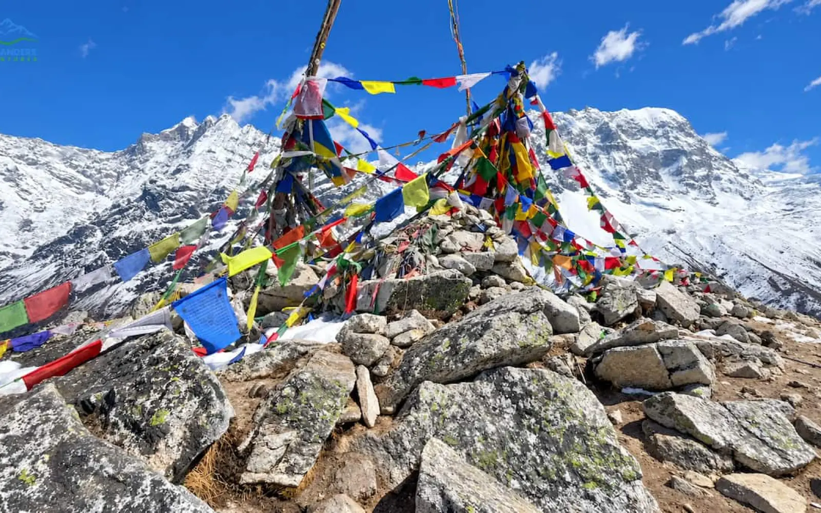
Kyanjin Gompa
The route follows this sequence. Each day below gets its own section with walking times and trail notes.
Day 1: Kathmandu to Dhunche (2,030m)
Day 2: Dhunche to Thulo Syabru (2,210m)
Day 3: Thulo Syabru to Lama Hotel (2,470m)
Day 4: Lama Hotel to Langtang Village (3,430m)
Day 5: Langtang Village to Kyanjin Gompa (3,870m)
Day 6: Acclimatization and Peak Exploration Day (up to 4,985m)
Day 7: Kyanjin Gompa back to Thulo Syabru (2,210m)
Day 8: Thulo Syabru to Dhunche, then drive to Kathmandu
The shape of the trip is simple. You climb for five days, rest and explore on the sixth, and descend for two. The ascent runs through forest, then yak pasture, then open valley. The descent compresses the same ground into two long days, so Day 7 and Day 8 ask more of your legs than the schedule suggests. We cover that in the day-by-day notes.
Your trek starts with a drive. The vehicle leaves Kathmandu in the morning and heads north-west on the road to Trishuli, with stops for tea and photos along the way. The ride to Dhunche takes roughly six to eight hours, depending on traffic, weather, and any road work. Confirm the vehicle type with your agency when you book, so you know whether you share the ride.
The road passes through Nuwakot, follows the Trishuli River for a long stretch, and crosses the Betrawati bridge, where the new Bailey bridge now carries traffic. Past Betrawati the valley narrows and the road climbs through terraced hillsides and small bazaars. On clear days, Ganesh Himal and the Langtang range appear above the ridgelines. Dhunche comes into view as a line of buildings on a slope above the river.
You arrive in the afternoon. Check into your lodge, drink something hot, and take a short walk through the bazaar to loosen your legs. Your guide gives a trek briefing at dinner and checks your gear, your permits, and your insurance paperwork. Ask every question you have tonight, because the briefing is the last time everyone sits at the same table with a full signal and a full plate.
Day 2 is a walking day of about five to six hours. You leave Dhunche after breakfast and follow a trail through pine forest, with short climbs and descents that warm up your legs. The path passes Bharku, where most groups stop for lunch, and continues to Thulo Syabru on a ridge. The gain in altitude is small. The point of the day is to find your pace.
Thulo Syabru shows up as stone houses and terraced fields across a hillside. The village is home to Tamang families, and you see their culture in prayer flags, carved mani stones, and small shrines at the edge of the trail. Langtang Lirung rises behind the village, and the Tibetan border peaks stand beyond it. Evenings here are quiet. Most lodges serve dal bhat with fresh vegetables from nearby farms, and the owners tend to share stories if you ask.
The village also marks the start of the trail to Sing Gompa and Gosaikunda Lake. If this trip makes you want to see the sacred lake, the Gosainkunda Lake Trek covers that route directly, and the 15 Day Langtang Gosaikunda Lake Helambu Trek links the lake to the Langtang valley and the Helambu hills in one long loop.
Use the evening to organize your pack. Keep the items you need during the day, such as water, a rain layer, sunscreen, and snacks, at the top. Leave the rest at the bottom, because porters carry the main bags and you will see them again only at the lodge.
Day 3: Thulo Syabru to Lama Hotel (2,470m)
Day 3 takes you into the heart of the Langtang valley. You leave Thulo Syabru, walk down through dense forest, and join the main Langtang trail near Bamboo. From there the path follows the Langtang Khola upstream, gaining height through oak, rhododendron, and bamboo groves until it reaches Lama Hotel. Plan for six to seven hours of walking with a lunch stop on the way.
This is a forest day, and the forest is the main event. Langurs sometimes show up in the branches, and red pandas live in these woods, though almost nobody sees one. Listen for the river on your left and watch your footing on roots and wet stones. In a year with heavy rain, parts of the trail can feel slick, so take short steps and use your poles.
Lama Hotel sits in a narrow gorge at 2,470 meters. The name comes from the first teahouse that stood here, which served pilgrims and traders long before trekkers arrived. The lodges are simple and warm, and the dining rooms fill with walkers comparing blisters. Eat well. Tomorrow you gain nearly a thousand meters, and a full dinner pays off on the climb.
You can also learn what other trekkers experience before you go. The Treklanders reviews page collects feedback from past guests on Langtang, Everest, Annapurna, and Manaslu routes, and you can read how real groups described the trail, the guides, and the food.
Day 4: Lama Hotel to Langtang Village (3,430m)
Day 4 climbs out of the forest and into the open valley. You leave Lama Hotel early, climb steadily through fir, hemlock, and rhododendron, and reach Ghora Tabela at the point where the trees thin out. A small Nepal Army post operates there as the park checkpoint. The walk from Lama Hotel to Langtang Village takes about six hours, and most of the gain happens in the first half.
Past Ghora Tabela the valley widens and Langtang Lirung appears in full for the first time. The trail runs through herder camps, where families bring yaks and cattle up to graze, and across rocky ground that shows how much the valley has changed. Langtang Village stood near here before the 2015 earthquake and the avalanche that followed. Many trekkers walk this stretch quietly. The survivors rebuilt a short distance away, and your stay in their lodges supports the community.
You arrive at Langtang Village at 3,430 meters. This is the first night where altitude starts to matter. Drink water through the afternoon, walk slowly to the dining room, and report any headache to your guide. Most people feel fine. A few feel light-headed, and a short rest solves it.
Evenings here are cold. Wear your down jacket as soon as the sun drops behind the ridge, and keep a warm drink in your hands. The lodge may have a stove in the dining room, and the whole group tends to gather around it.
Day 5: Langtang Village to Kyanjin Gompa (3,870m)
Day 5 is the shortest walking day and the most scenic. You walk about three to four hours up the valley through yak pastures, past stone walls and small streams, with snow peaks on both sides. The trail crosses old moraines and passes Mundu, a small settlement with a few houses and a view back down the valley. The pace is slow on purpose. You gain just over 400 meters, and the early finish gives you the afternoon to rest.
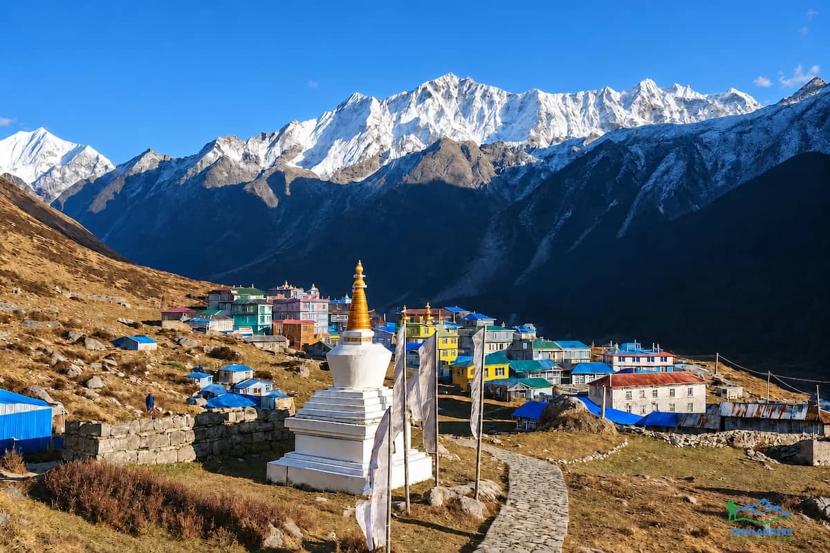
Kyanjin Gompa sits at 3,870 meters in a wide basin below Langtang Lirung. The village has a small monastery, a cheese factory that sells fresh yak cheese, and lodges with rooms that face the mountains. You may smell wood smoke and boiled milk as you walk in. After you drop your bag, take a short walk around the village and visit the monastery if it is open. A hot lunch tastes better here than anywhere else on the trail.
Keep the afternoon easy. Drink water, wash up, and go to bed early. Tomorrow is the climb, and the best preparation is a full night of sleep.
If you want to compare this stretch with a different route, the 14 Day Tamang Heritage with Langtang Valley Trek reaches Kyanjin through Tamang villages and adds culture days along the way. Guests who finish it often describe the cultural stops as the highlight of the trek.
Day 6: Acclimatization and Peak Exploration Day (Up to 4,985m)
Day 6 gives you the high point of the trek. The plan says "acclimatization" and "peak exploration," and both words matter. You stay at Kyanjin Gompa for a second night, so your body rests at the same height. During the day you climb to a viewpoint and return to sleep at 3,870 meters. That pattern, which mountain guides call climb high and sleep low, is the safest way to adapt to altitude.
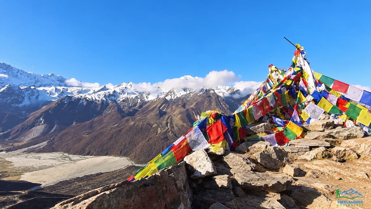
You have two choices. Kyanjin Ri is the shorter climb, reaching about 4,773 meters, and it takes roughly three to four hours round trip. Tserko Ri is the higher one, at about 4,985 meters, and it takes six to eight hours round trip. Your guide picks the climb based on how you slept, how you ate, and how your group moves. Both give wide views over Langtang Lirung, Ganesh Himal, Dorje Lakpa, Shalbachum, and the glacier below. On a clear morning, peaks across the Tibetan border show along the horizon.
Start before sunrise. The air is still and cold, the trail is firm, and the light on the snow peaks is the best you will see all week. Carry two liters of water, a warm hat, gloves, and a windproof layer, because the summit is exposed. Turn around if a headache grows or if you feel dizzy. The summit stays where it is, and your guide makes the final call on timing and safety.
After the climb, return to the lodge and rest. Eat a large lunch. Visit the cheese factory in the afternoon, and walk slowly around the village to loosen your legs. Pack your bag in the evening, because Day 7 begins early.
Day 7: Kyanjin Gompa Back to Thulo Syabru (2,210m)
Day 7 is the hardest day on the route, and we say so plainly. You retrace the valley from Kyanjin Gompa through Langtang Village, Ghora Tabela, Lama Hotel, and Bamboo, then climb the forest trail to Thulo Syabru. That covers ground that many itineraries split across two days. Expect a long walk of ten hours or more, with an early start under headlamps and, for slower groups, a few steps in the dark at the end.
The descent feels fast at first. The air thickens with every hour, and your legs move more easily than they did on the way up. The tricky part is the finish. After Bamboo you climb again, and tired legs find that final ascent harder than it looks on the map. Eat a solid breakfast, pack lunch and snacks, and keep a steady pace instead of rushing early.
Three habits help on this day. Stop every ninety minutes for water and a snack. Use your poles on the steep downhill sections to protect your knees. Let the guide set the pace, even if you feel strong. If your group moves slowly, ask whether you can add a night at Lama Hotel before the final climb, and plan for a longer trip if you do. That option splits the day into two more comfortable stages.
You arrive in Thulo Syabru at 2,210 meters tired and hungry. The lodge serves a hot dinner, and the warmth of the dining room feels very good after a day outside. Sleep deeply. The trail ahead is shorter.
Day 8: Thulo Syabru to Dhunche, Then Drive to Kathmandu
Day 8 closes the trek. You walk from Thulo Syabru to Dhunche in about four to five hours, climbing through pine forest and passing Bharku on the way. The trail mirrors Day 2, and you will notice how much stronger you feel. At Dhunche, your vehicle waits at the road. After lunch, you drive back to Kathmandu through Betrawati and Trishuli, a ride of roughly six to eight hours.
The drive is long, so settle in. Keep water and snacks in the car, and take a seat that faces the window. Hills that were hidden in cloud on the way up often show up clearly on the way down. You reach Kathmandu in the evening, check into your hotel, and take the first real shower in eight days. Ask your guide about a farewell dinner. Most groups celebrate with local food and a toast.
Build one spare day into your schedule after the trek. Roads in the hills slow down after rain or landslides, and a buffer day protects your international flight. Use it for a short outing. The Nagarkot Day Hike gives you a few easy hours outdoors close to the city, and the Chandragiri Cable Car Tour offers a ride with wide views over the valley. If you want to spend the afternoon in a kitchen, the Momo Making Class in Thamel teaches you how to fold the dumplings you ate on the trail.
Langtang Trek Permits and Paperwork for 2026
Langtang Trek Permits
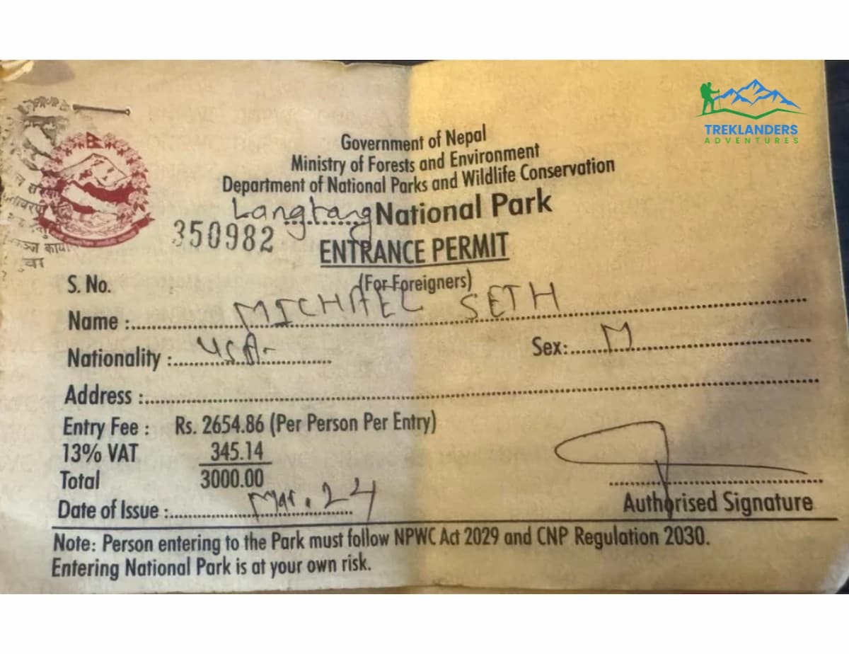
Permit rules did not change with the advisory, but you still need the right papers before you start. For the Langtang trek you need the Langtang National Park entry permit and a TIMS card. Your agency buys both in Kathmandu, and the park checkpoint at Dhunche checks them before you walk. Carry the originals and a few photocopies in a waterproof bag, because checkpoints along the trail may ask to see them again.
Trekking rules in Nepal now favor guided travel, and a licensed guide is the safest way to walk Langtang. In a year with recent flood damage, the guide matters more than usual. A licensed guide carries a radio, talks with other guides along the trail, and hears about a failed bridge or a blocked path before you reach it. Book through a registered agency, and ask for the guide's license details if you want to confirm them.
Travel insurance is also essential. Your policy should cover trekking to at least 5,000 meters, which includes the Tserko Ri climb, and it should include emergency helicopter evacuation. Read the policy for exclusions that apply to regions under advisory, and ask the insurer for written clarification if any wording is unclear. Keep a digital copy on your phone and a paper copy in your daypack.
Bring your passport, two passport photos, and your arrival details for the permit forms. The Treklanders team handles the rest. If you have a question about a specific document, send it through the contact page before your trip.
Altitude and Safety on the Langtang Trek After a Flood Year
Altitude and Safety on the Langtang Trek
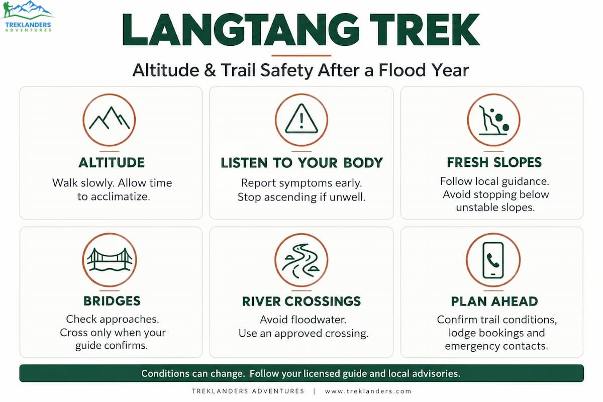
The route climbs from 2,030 to 3,870 meters over five days and visits 4,985 meters on the sixth. That is a gradual profile, and it helps, but altitude still affects every trekker differently. Fitness does not predict who gets sick. Drink three to four liters of water a day, eat even when you feel full, and report headache, nausea, or dizziness early. If symptoms get worse, descend. A guide who hears about a mild headache at lunch can fix it. A guide who hears about it at midnight faces a harder choice.
Trails that have been repaired recently fail in predictable ways, and you can avoid most problems with simple habits.
Fresh slopes shed rock. Landslide scars loosen in rain and again in the first cold nights. Cross open scars quickly, one person at a time, and never stop under one to take photos.
New bridges feel unfamiliar. A new Bailey bridge or suspension span is stronger than it looks, but the approaches may be soft or unfinished. Use the handrails and space out your group.
Rivers run differently. After a heavy season, channels shift. Wait for your guide to find a safe line before you step into any ford.
Lodges fill fast. Trekkers who planned for other regions may move to Langtang this season, so rooms in Kyanjin Gompa and Lama Hotel go quickly. Your agency reserves beds in advance, which is one more reason to book early.
Signal is patchy. Mobile coverage fades above the lower villages. Tell your family that you may go silent for several days, and give them your agency's phone number.
Fitness and Difficulty on the Dhunche to Thulo Syabru Route
The Langtang trek is rated moderate, and this route fits that rating with two exceptions. The first is Day 4, which climbs close to a thousand meters in one stretch. The second is Day 7, which packs a long descent and a final climb into a single day. Everything else sits in the comfortable range for a healthy adult who walks regularly.
You do not need mountaineering experience. You do need stamina. Aim for four to six weeks of preparation before you fly. Walk uphill with a loaded daypack three or four times a week, add a longer hike on weekends, and include stairs if your area has no hills. Strengthen your legs and core, because downhill walking taxes the knees more than most people expect. Break in your boots early and walk at least 15 kilometers in them before the trip.
Age matters less than preparation. Many people in their sixties finish Langtang comfortably, and fit twenty-year-olds sometimes struggle with altitude. The best predictor of a good trip is a steady pace and a willingness to listen to your body. Tell your guide how you feel, even when the answer seems minor.
Group size shapes the experience too. A small group moves at one pace and stops when one person needs a rest. A larger group needs more patience. Your guide can adjust the plan on the trail and split the day if two people want different speeds.
Culture and Responsible Trekking in Langtang
The Langtang valley is home to Tamang and Sherpa communities, and their traditions shape daily life along the trail. Prayer flags, mani walls, and chortens mark the paths. Walk to the left of every mani wall and chorten, as local custom asks, and ask before you take a photo of a person or a household shrine. A short greeting in Nepali or Tamang goes a long way. "Namaste" works everywhere, and a smile works even better.
Many families in Thulo Syabru, Langtang Village, and Kyanjin Gompa run the lodges you sleep in. Spend money in those lodges. Order your meals where you sleep, buy snacks from local shops, and pay a fair price for fresh yak cheese. These purchases support the communities that rebuilt the valley after the 2015 earthquake.
Carry your trash down the mountain. Burning and burying waste harm the soil and the water, and the high valley is slow to recover. Refill your bottle at lodge filters instead of buying plastic. Use biodegradable soap, stay on the marked trail, and leave stones and plants where you find them.
Treat porters with respect. They carry heavy loads on the same trail you walk, and they deserve warm clothing, a proper meal, and a safe place to sleep. Ask your agency about its porter policy before you book, including maximum loads, cold-weather gear, and wages.
Best Time for the Langtang Trek and What to Pack
October and November are among the best months for the Langtang trek in 2026. The post-monsoon air is clear, the trails are dry, and the mountain views are sharp. Crowds follow the clear weather, so book rooms early. Spring, from March to May, brings mild days and rhododendron blooms in the lower forest. Winter trekking works for experienced walkers, but nights at Kyanjin Gompa drop well below freezing. The monsoon months from June to August bring leeches, landslides, and low visibility, and they do not suit this route.
Pack for cold nights and changeable days. A warm sleeping bag rated for freezing temperatures, a down jacket, a waterproof shell, thermal layers, a warm hat, gloves, and sturdy broken-in boots cover the basics. Add trekking poles, sunglasses, a headlamp with spare batteries, sunscreen, lip balm, and a refillable water bottle. A few snacks from Kathmandu help on long days, especially Day 7. Keep the load light, because porters carry the main bag, but you carry your daypack every step.
Rent or buy gear in Thamel if you need it. Shops there stock jackets, bags, poles, and boots at several quality levels. Test everything on a short walk before you leave the city.
Alternatives If Langtang Does Not Fit Your Dates
Some trekkers have fewer days, a different fitness level, or a wish to see another region. Treklanders offers routes across Nepal, and you can browse every option on the trekking in Nepal page.
Ask your agency for current conditions on any route before you commit. Conditions change, and a good agency tells you the truth even when it costs a booking.
Plan Your Langtang Trek With Treklanders
Treklanders Adventures is a Kathmandu agency with licensed guides, local porters, and years of experience on the Langtang trail. We update our routes when conditions change, and we tell you what we know as soon as we know it. The new Dhunche to Thulo Syabru route reflects that approach, and it gives you a safe, scenic way into the valley this season.
Use the Plan My Trip form to share your dates, your fitness level, and the regions you want to see. You can also read more about the company and its guides on the About Us page, or follow the latest trail news on the Treklanders blog. Send your questions, and the team will help you choose the route that fits your plan.