
Tilicho Lake vs Thorong La Pass: Which Is Harder on the Annapurna Circuit Trek?
2 Jun 2026
Compare Tilicho Lake and Thorong La Pass on the Annapurna Circuit and discover which challenge is tougher.
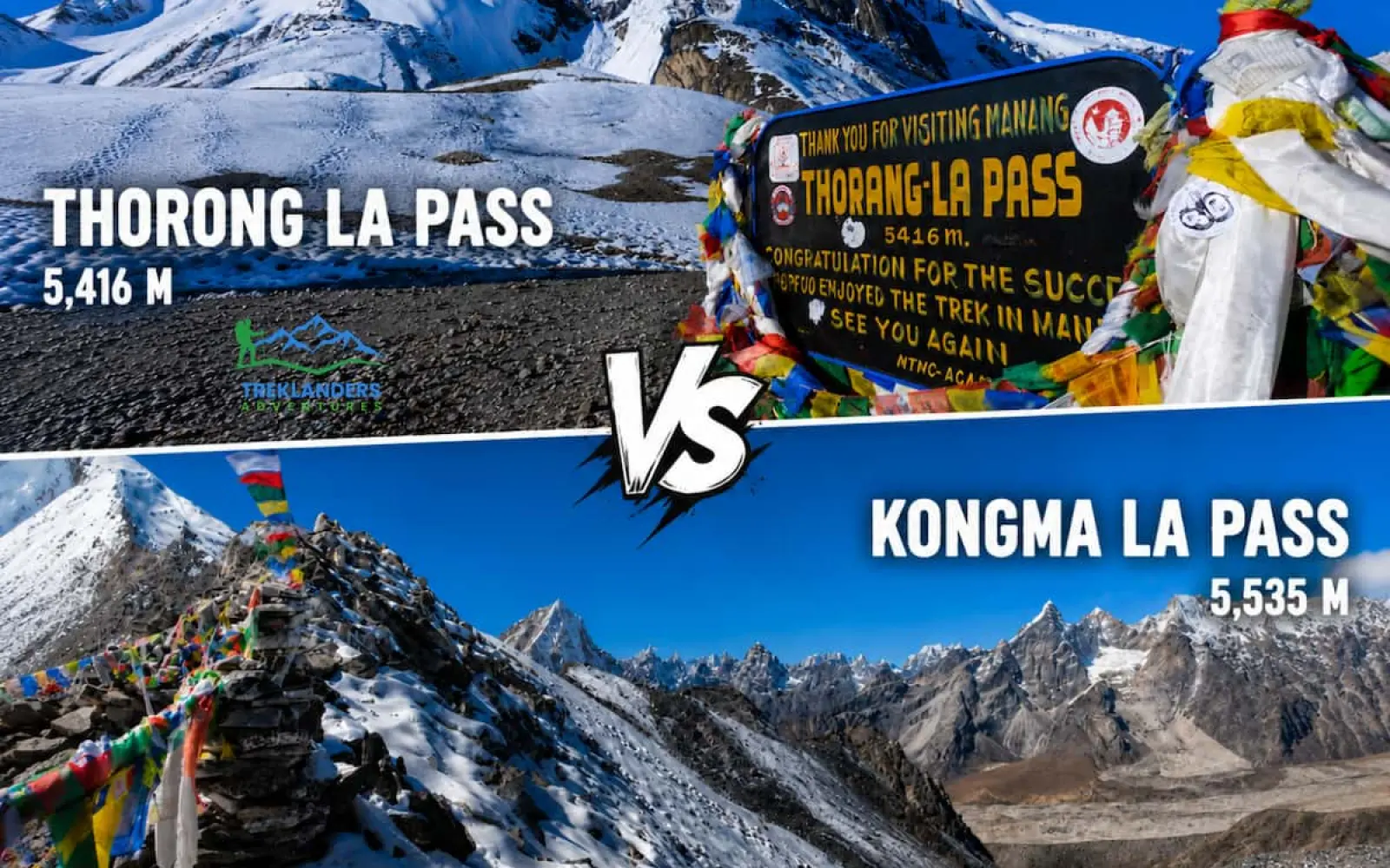
For any trekker, crossing a high-altitude Himalayan pass is almost like earning a trophy, a recognition of their determination and strength. In Nepal, the conversation generally centers on two giants that challenge one's endurance: Thorong La Pass and Kongma La Pass.
Indeed, both offer spectacular, breathtaking views and excellent opportunities for boasting; however, they are quite different. Thorong La is the spectacular highlight of the traditional Annapurna Circuit, well known for its grand scale and wide expanses. On the contrary, Kongma La is the relatively unknown and very challenging terrain among the three passes of Everest, characterized by its raw and harsh environment.
So, if you are in a quandary as to which high-pass expedition you should go for with Treklanders, this comparison will definitely make you aware of your best-suited option.
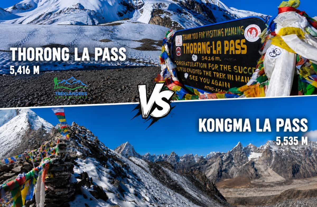
The physical footprint of a mountain pass dictates how your body reacts to the environment. The primary difference between Thorong La and Kongma La lies in their absolute elevation and the specific mountain massifs they traverse.
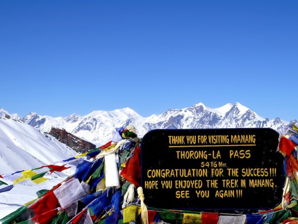
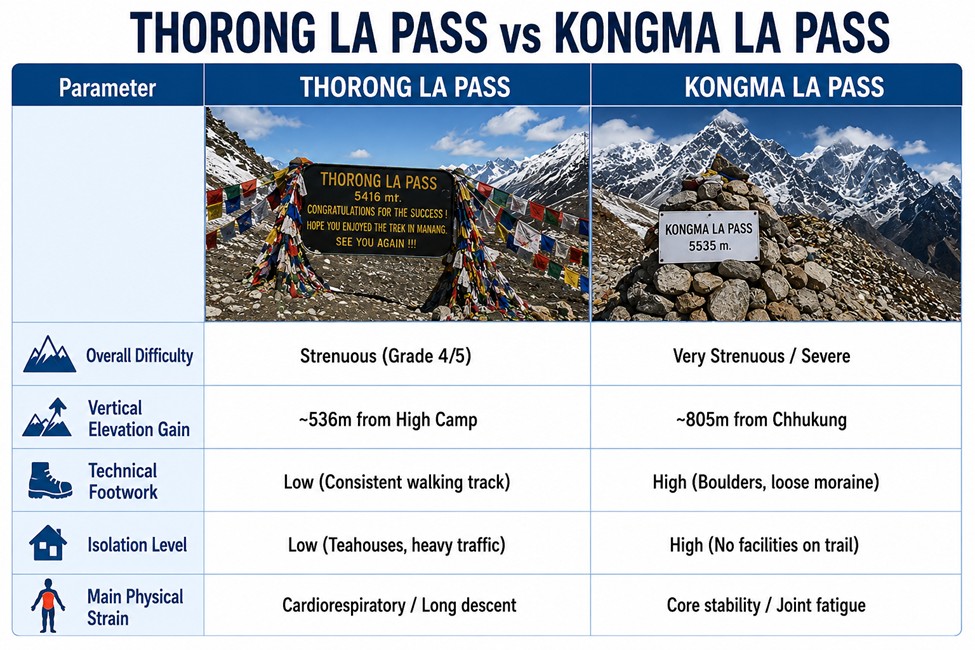
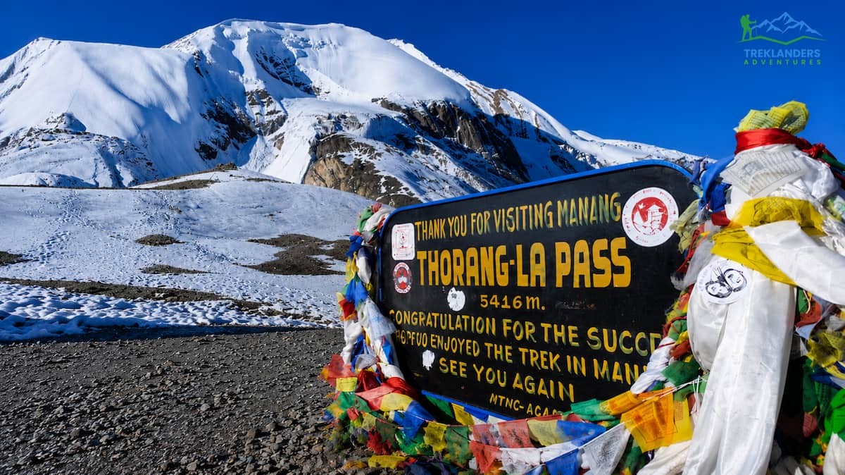
Thorong La Pass is located at an elevation of 5,416 meters above sea level. It is a huge natural barrier and demarcates the border between the fertile, alpine valleys of upper Manang and the dry, rain-shadow desert of the Mustang district. At the top of Thorong La, the air pressure is so low that you get only half the amount of oxygen that you would get at sea level. This elevation makes the pass a bit higher than Everest Base Camp (5,364 meters), and thus, it is among the highest altitude non-technical trekking destinations in the country.
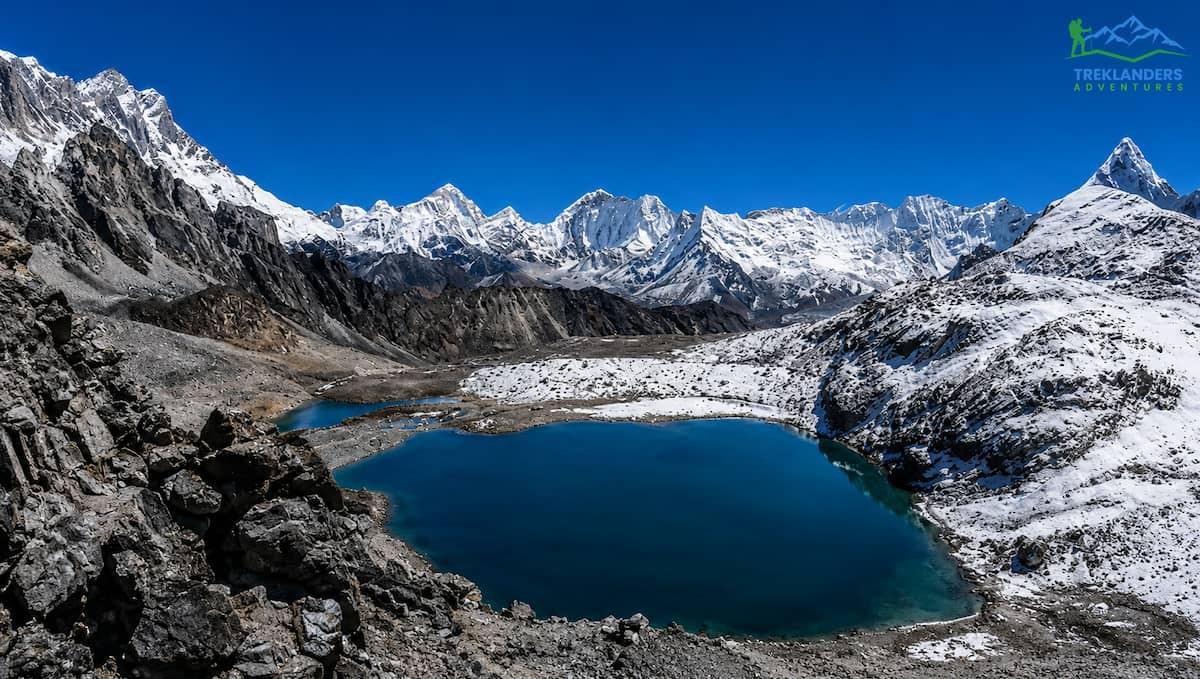
Kongma La Pass is much higher, reaching an awe-inspiring 5,535 meters (18,159 feet). Found deep inside the Khumbu area of Sagarmatha National Park, it is the highest one among the three passes of the Everest . The additional 119 meters of height over Thorong La might look like a small difference on the map, but at this severe altitude, every meter significantly adds to the effects of hypoxia (oxygen shortage). The air pressure at the highest point of Kongma La falls below the 50% mark, which means your lungs will have to work much harder to supply your muscles with oxygen during the final, vertical climb to the top. The pass physically connects the Imja Valley side near Chhukung with the debris-strewn area of the Khumbu Glacier near Lobuche.
Changing the trail beneath your feet changes the psychological needs and physical stability necessary to carry out the crossing. Under normal seasonal conditions, neither pass requires climbers' technical equipment such as ropes, harnesses, or ice axes, but the walking surfaces are totally different.
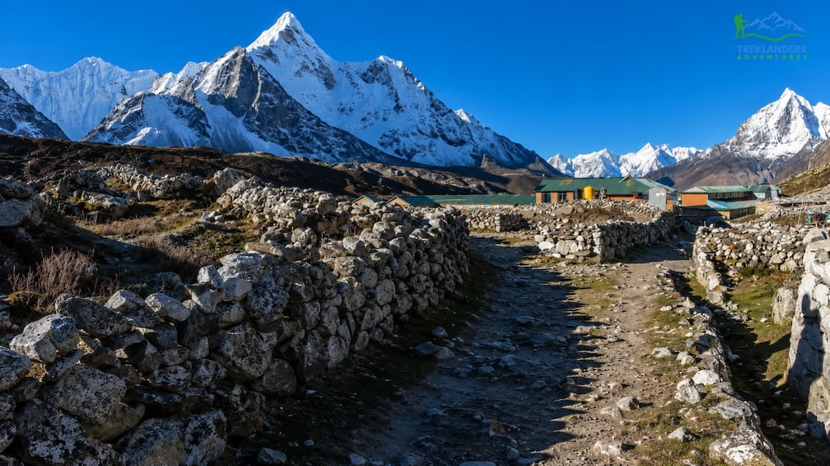
The path over Thorong La is very clear and quite wide, plus it is used by a lot of people. Since hundreds of trekkers, guides, porters, and pack animals cross this pass every week during the peak trekking season, the path ends up being a compact dirt and shale track.
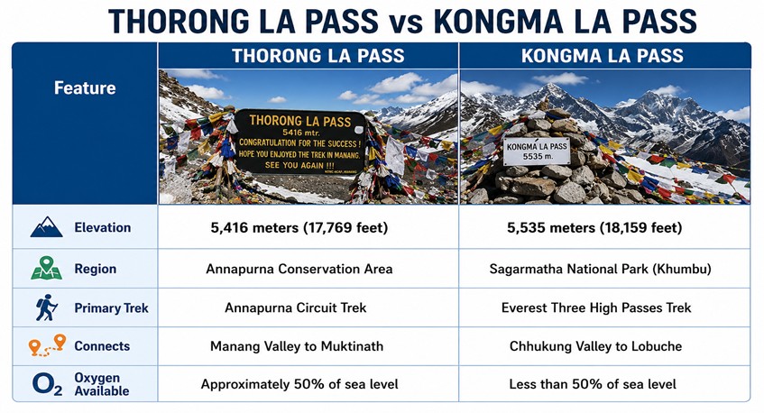
The route from Thorong Phedi or High Camp to the top is one of continuous switchbacks that are long and gradual, crossing the exposed, windswept slopes. The slope is steady, which means you can get into a regular, relaxed breathing and stepping rhythm. You are just going uphill on rough, gravelly mountain soil, unless a late-season blizzard or early spring freeze covers the trail with a layer of sheet ice. The main terrain difficulty on the Thorong La route is not stability but the great length of the trail and the monotonous, continuous climb.
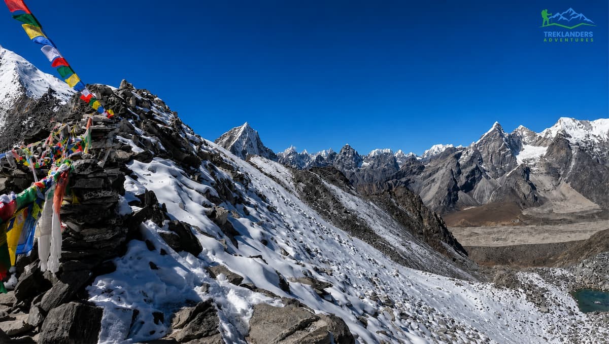
Kongma La is a radically different challenge. The path is quite rough, very isolated, and often not even clearly marked. Because it is used by only a very small number of people (in comparison to Thorong La), there is simply no solid, hard-packed trail. What the land offers instead are giant, unstable boulder fields, loose scree slopes, and bare, exposed rock surfaces.
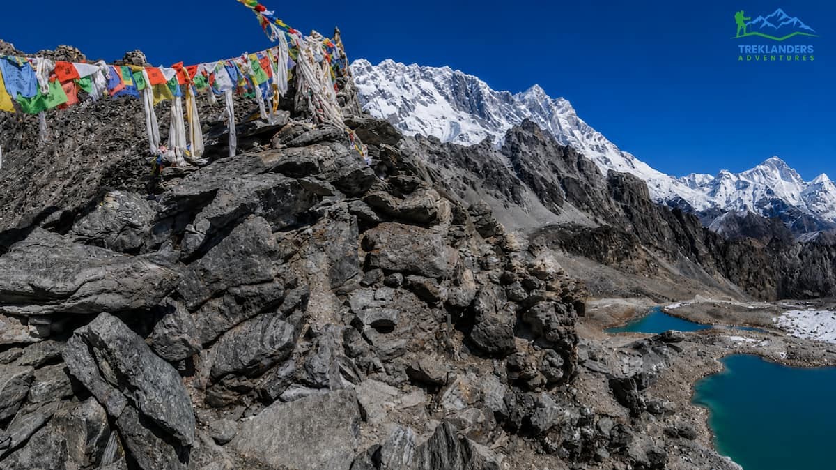
Heading up from the Chhukung valley will have you climbing over very large stones, which need very good lateral balance, ankle strength, and continuous focus. Finding a walking rhythm is not an easy thing to do here because every single footsteps are made based on a separate decision of foot placement. When heading west down to Lobuche, the path will have you walking along the top of some loose moraine walls and crossing the active, moving ice and stones of the Khumbu Glacier. The surface of the glacier is in a constant state of change, even within a single season, so one may encounter a complex of meltwater ponds, unstable gravel mounds, and slippery black ice that require a very careful way of walking.
The logistical schedule of the crossing days gives insight into the physical stamina needed to accomplish each goal. One must get up early on the days when they have to cross high-altitude passes in order to get ahead of the potentially dangerous weather that tends to build up during the afternoons.
The typical crossing of Thorong La moves from East to West, starting from either Thorong Phedi (4,450 meters) or High Camp (4,880 meters) and ending at the sacred temples of Muktinath (3,800 meters).
04:00 AM, Wake-Up and Departure: You wake up in freezing darkness at High Camp or Phedi. Leaving early is very important because strong, freezing winds regularly blow through the pass's saddle and can cause dangerous whiteout conditions if snow is around.
04:30 AM to 08:30 AM, The Grind Upward: From High Camp, you physically climb around 536 vertical meters over a total horizontal distance of around 5 kilometers. It is terribly cold; the temperature often drops to minus 10 to minus 20 degrees Celsius. Your headlamps will show the white breath of the slow-moving line of trekkers.
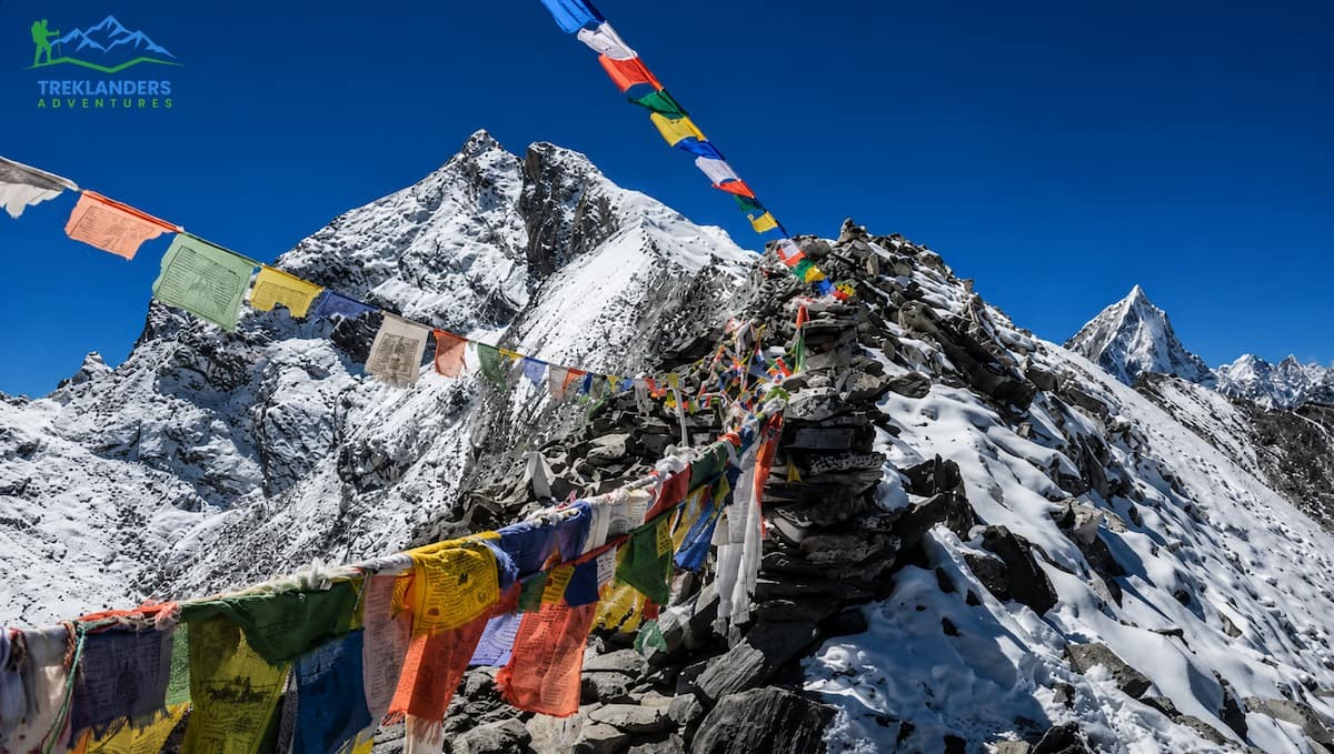
08:30 AM to 09:30 AM, Reaching the Summit: You get to the 5,416-meter summit, where thousands of brightly colored Buddhist prayer flags flutter, and there is a tiny, seasonal stone tea shop.
09:30 AM to 02:00 PM, The Knee-Crushing Descent: Getting to the top doesn't mean the trek is over. You have to start a long, continuous descent of 1,600 vertical meters on loose scree and rocky switchbacks over approximately 10 kilometers to reach Muktinath. This descent requires about four to five hours and puts great, jarring pressure on your quadriceps and knee joints.

The crossing of Kongma La traditionally moves from East to West, starting from the small lodge settlement of Chhukung (4,730 meters) and ending at Lobuche (4,930 meters).
05:00 AM, Heading Out for Isolation: You start your journey from Chhukung very early in the morning. Different from Thorong La, no midpoint "High Camp" or a safe emergency shelter on this trail. After leaving Chhukung, you will be in complete solitude in a raw alpine wilderness for up to 7 to 10 hours.
05:30 AM to 11:00 AM, The Uphill Climb: It is necessary to ascend over 800 vertical meters from the valley to the pass summit. The path goes steeply upwards beyond the high, frozen alpine lakes and through loose rock gullies. The last stretch to the pass is extremely steep and requires you to use your whole body to navigate through huge boulder piles.
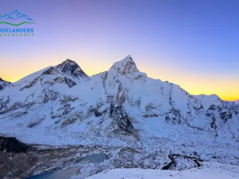
11:00 AM to 11:30 AM, At the Summit of Kongma La: At 5, 535 meters, this high point gives a very close visual of the stone giant walls of Nuptse and Lhotse as well as the needle-like sharp profile of Ama Dablam.
11:30 AM to 03:30 PM, The Ice Field: Going downhill, the path leads you to a very steep, eroded, stony trail that ends at the edge of the Khumbu Glacier. After that, you will have to make a very demanding final one to two hours of your time, where you will navigate through uneven and constantly moving glacier moraine, going up and down steep gravel ridges until, at last, you reach the lodges of Lobuche.
Quantifying the difficulty of these passes helps you evaluate your readiness. Both routes are categorized as strenuous, high-altitude endurance events, but they test your physical body in entirely different ways.
Thorong La Pass is a measure of how much your cardiovascular system can take you, and your mind can endure. Steep slopes are infrequent, but due to low oxygen levels, your heart rate will rise significantly even if your walking speed slows down to almost a crawl. The biggest reason why people get exhausted on Thorong La is the huge 1,600-meter descent. Four hours of downhill walking on loose, slippery gravel keep your stabilizing muscles working non-stop to protect your joints. No wonder many trekkers get almost immobilized by muscle soreness and physical tiredness when they reach Muktinath.
Kongma La Pass requires a much higher degree of physical strength, balance, and agility. Since you need to ascend more than 800 vertical meters just in one morning, the climb steepness far exceeds that of Thorong La. Moving from one large, sharp-edged rock to another demands a solid core and muscular legs. Also, as there are no teahouses or rest stops on the way, you need to carry all your water, snacks, warm clothing and heavy gear for a whole day, which only adds to the load on your spine and legs. Mountain guides consider Kongma La to be extremely challenging and physically exhausting, even more than Thorong La.
The primary hazard on any high-altitude trek in Nepal is Acute Mountain Sickness (AMS), along with its advanced, life-threatening forms: High Altitude Pulmonary Edema (HAPE) and High-Altitude Cerebral Edema (HACE). How each trekking route is structured plays a critical role in how well your body adapts to the thin air before you attempt the crossing.
The typical itinerary to reach Thorong La Pass is very well-planned for a gradual and safe acclimatization.
You begin at low altitudes in the sub-tropical river valleys of Besisahar or Dharapani, and gradually make your way through the Marsyangdi River valley over the course of five to six days as you hike higher.
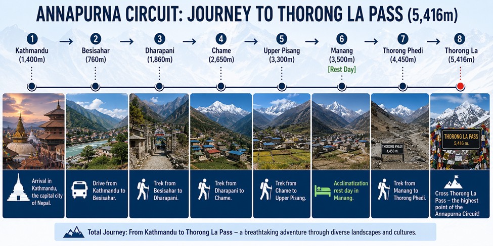
When you finally get to the big cultural center of Manang at 3,500 meters altitude, your body has been giving itself time to get used to a moderate elevation for a few days already. A mandatory acclimatization rest day in Manang, spiced up with short, steep day hikes to higher viewpoints like Ice Lake or the hundred-meter cliffs above the valley, helps your body to initiate a big red blood cell production increase. Such a gradual, step-by-step ascent with this profile is really the best way to reduce the risk of altitude sickness and will allow even quite fit beginners, following the schedule thoroughly, to consider Thorong La an attainable goal.
The approach to Kongma La Pass exposes your body to high elevation much faster, creating a significantly higher baseline risk of altitude issues. The trek begins with a high-altitude flight directly into the mountain airstrip of Lukla at 2,840 meters. Within just forty-eight hours of leaving Kathmandu, you are already sleeping at 3,440 meters in the trading hub of Namche Bazaar.
Itineraries usually cover vital rest and adjustment days at Namche Bazaar and Dingboche (4,230 meters); however, the actual altitude of your sleeping quarters increases quite fast. To begin with, you will have to sleep at an altitude of 4,730 meters in Chhukung, even before the day of crossing starts. Staying at this altitude would mean that your body is continually, at a basic level, experiencing hypoxia even before you take your first step towards the 5,535-meter summit. There is hardly any room for mistakes, and if you fail to hydrate yourself properly or pace your walk, the symptoms of serious mountain sickness will very soon show up.
The severe climate in the top Himalayas determines the times these passes are safe to cross. Two main trekking periods in a year, each with its own pros and cons, divide the year into parts.

This is undoubtedly the main season for both Thorong La and Kongma La. The heavy monsoon rains have left the air clean, leading to very stable weather, clear morning skies, and the most amazing mountain vistas.
The Reality: Although the weather during the day is suitable for walking, temperatures at the high camp sites plummet to well below zero at night. At times, early morning temperatures at the passes may reach as low as minus 10 to minus 15 degrees Celsius, so you will need to dress up with heavy windproof and insulated layers.
The next great period not only brings the sun warming up the air but also the color of nature emerging in the valleys. Gradually, the snow on the ground of the forest areas gets replaced by blooming wild rhododendrons in the temperate and subalpine zones of the lower altitudes.
The Reality: Spring weather is more varied and less comfortable than autumn. Usually, there is still a layer of snow from the winter season on the high mountain passes, so along the upper parts of the trail, you could be struggling through deep snow drifts or soft post-holing terrain. As the day goes on, the clouds build up faster, and there is a greater chance of snow showers in the middle of the day.
Trekking is not only strongly discouraged at these times, but it is also quite often not feasible. Winter can bring temperatures well below zero, very strong winds, and intense snowstorms that can cover the trail markers entirely, leading to closures of the passes for extended periods. On the other hand, the monsoon season in summer sees the areas drenched in heavy rains, causing the valleys to be prone to dangerous landslides, trails to become muddy and slippery, as well as mountain views being totally obscured.
The main motivating factor for most climbers to suffer the physical strains of a tough hike is the stunning view they get as a reward when they reach the top. Additionally, these passes, since they are located in completely different geographical areas of Nepal, each provide a totally different viewpoint of the Himalayan giants.
Upon standing on the wide saddle of Thorong La, one is met with a far-reaching, grand view that is as if you are staring into the vastness of the Tibetan plateau.
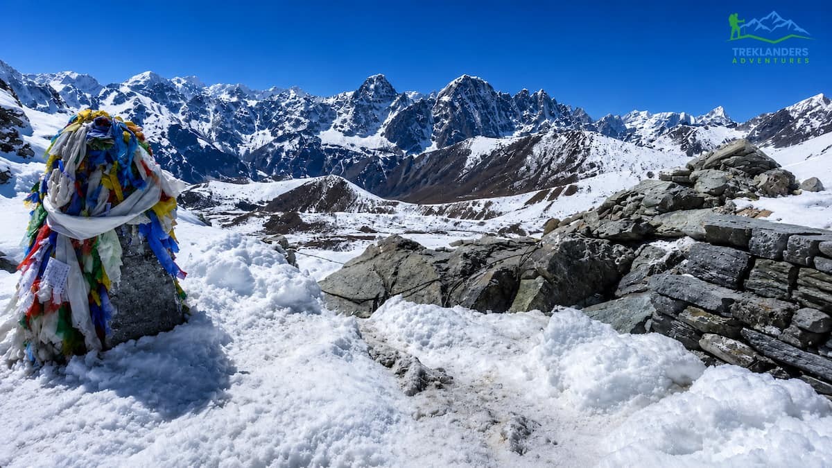
Kongma La does not give you the experience of wide and long horizons; rather, it places you in a very close, high-walled amphitheatre of vertical rock and hanging ice.
The presence of safety networks, communication lines, and comfortable tracking infrastructure can turn a potential emergency into a manageable situation. This is where the two passes diverge most dramatically.
As the Annapurna Circuit is one of the most popular and longest-running trekking routes in the world, the safety facilities around Thorong La have been well developed.
Accommodation Quality: The tea houses at Thorong Phedi and High Camp are large, multi-room buildings able to accommodate hundreds of trekkers per night. They serve hot food, have heated communal dining halls, and offer regular communication facilities.
Emergency Measures: If altitude sickness hits you badly at High Camp or Phedi, emergency evacuation horses are always kept at these places. Upon payment, a horseman will swiftly escort the ailing trekker down to the lower areas of Manang village in a few hours. The path is under constant surveillance by licensed guides and local officials, so you are never really alone or out of help.
Kongma La features virtually no safety net between the two valley settlements.
Zero Infrastructure: If you leave the Chhukung side, there are no emergency shelters, no seasonal tea shops, and you will be without cell phone reception for the entire 7 to 10 hours of the crossing. So, if there is a sudden storm or you hurt yourself on the boulder fields, you can neither call for a horse nor easily find a nearby lodge.
Self-Reliance: It will be your trekking guide and his team who will have to carry you down manually through the rugged boulder terrain if you get evacuated from the pass. Or, if the weather and visibility conditions are good, then a helicopter rescue can be arranged. This complete isolation makes the trek all the more mentally challenging and demands a very strong, independent mindset and a high degree of self-reliance.
To successfully cross a high-altitude pass, you'll need to physically prepare your body for several months before you even reach Nepal. At 5, 000 meters altitude, there is so little oxygen that just using your willpower won't be enough to keep your body going. To get into shape, you should start your training program about twelve to sixteen weeks before the day of your flight.
Before you can physically start preparing for the crossing of a pass, you need to develop a very strong aerobic system. This will enable your heart and lungs to provide oxygen to your muscles in the most efficient way possible, even when there is very little oxygen available in the air.
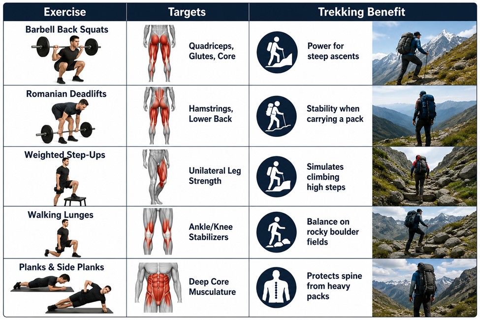
Low-Intensity Steady State (LISS) Cardio: Three to four times a week, dedicated to spending long periods of time doing cardio at a low pace. For 45 to 90 minutes, do running, cycling, rowing or using the stair-climber machine while keeping your heart rate at Zone 2 level (at the pace where you are able to have a conversation and breathe mainly through your nose). This kind of training increases the number of capillaries and the volume of mitochondria in your muscles.
Weighted Ruck Hiking: Getting a backpack and filling it up with 10 to 15 kilograms of gear and then going for a hike up steep hills or climbing stairs outdoors for several hours every weekend is the most effective training you can get. It will develop specific muscular endurance in your calves, glutes, and lower back.
A high-altitude pass day requires structural strength to withstand the relentless pounding of steep climbs and knee-jarring descents. Focus on functional compound movements twice a week
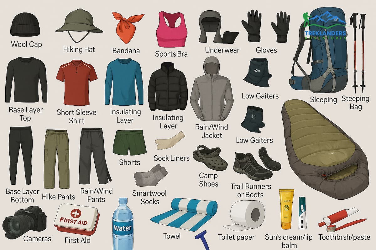
Extreme fluctuations in temperature and the harsh condition of remote mountain passes literally demand a packing strategy that is not only efficient but also extremely technical. Your equipment list must be such that it keeps you warm in sub-zero temperatures, shields you from high winds, and gives you stability on uneven surfaces while still not weighing down your pack with unnecessary items.
High-Ankle Trekking Boots: These mountain passes are not something you should be doing in low-cut trail running shoes. What you require are solid, waterproof leather or synthetic trekking boots with high ankle support so that you don't roll your ankle while coming down the boulder fields of Kongma La or the loose scree of Thorong La. Also, check that the outsole has deep lugs (such as Vibram) for gripping wet rock and packed snow.
Trekking Poles: You simply cannot go through this without a pair of trekking poles that can be locked, made of sturdy material. They help to take the pressure off your knees by as much as 20% when you are going down for a long time, and during critical balance points when crossing the shifting glacial moraines, they are your lifeline.
At high altitudes, the weather can change drastically within a few hours of the same day, e.g., from a freezing cold minus 15 degrees to a warm and sun-exposed 15 degrees Celsius by the time of noon. You must layer your clothing properly to keep sweating under control and to maintain the core body temperature:
Base Layer (Moisture Management): It should consist of high-quality merino wool or synthetics, both top and bottom. This layer is the only one that touches your skin, so it must be very close-fitting to your body to effectively wick the sweat away from it. Avoid wearing cotton at all costs as it absorbs and holds moisture and quickly leads to hypothermia when you stop in cold and windy conditions.
Mid-Layer (Insulation): It should be a lightweight, breathable grid fleece or a synthetic active jacket to keep body heat while moisture is allowed to get out during heavy efforts.
Outer Insulation (The Shield): A heavy, high-loft down jacket with at least 700 fill-power. You leave this one in your daypack when you are making the hard climb, and you immediately put it on when you get to the freezing summit, or when you are stopping for a rest.
Shell Layer (Weather Protection): Waterproof and windproof hardshell jacket and pants of high quality (such as Gore-Tex). This layer is really important in protecting you from the biting, freezing winds that blow over the open saddles of the passes.
Thorong La Pass is the best option for hikers who desire to immerse themselves in the majesty of the high Himalayas, but at the same time want to be on a well-used trekking route with good support facilities. In fact, it is a real treat for the physically healthy starters and also the intermediates who, apart from climbing moderate mountains, have experienced places like Annapurna Base Camp or Poon Hill and are eager to conquer their first 5, 000-meter pass. Along the way, with the route making a dramatic change from green valley's where Hindus live to Tibetan-Buddhist villages and then to the rugged beauty of the high-altitude alpine desert, there is also a story of changing landscapes and cultures. Lastly, those who like having easy-to-follow trails, nice teahouse places to stay, and well-organized service network will find Thorong La to be a good mix of tough and enjoyable.
Kongma La Pass is a perfect match for skilled and self-reliant mountaineers looking for a difficult and less-travelled Himalayan adventure. Those who have been through the classic high-altitude treks like the standard Everest Base Camp trek or the Manaslu Circuit and now want a challenge that is way beyond will be attracted to this pass. The pass takes you out of the heavily trafficked trekking routes and plunges you into a Khumbu region that is very wild and natural. The trek not only demands strong ankles and top-notch balance skills, but also the mind to be able to bear the long hours of climbing up and down through massive fields of rocks, glacial parts that keep changing, very steep parts, etc. So, if one's into the mountains, loves being out in the wild, enjoys the independence that comes from being alone, and appreciates that feeling of exploring the mountains, then getting to Kongma La will be one of the highlights of their mountain life in Nepal.
Nepal is not only famous for Thorong La and Kongma La but also has many other mountains passes that quite a few trekking enthusiasts would love to discover. These include mountain passes that vary in difficulty and can cater to different types of trekkers.
One of the passes that comes to mind is Cho La Pass (5, 420 m), which is often referred to as a compromise between Renjo La and Kongma La. It connects the well-known Everest Base Camp trail with the less frequented Gokyo Valley. This pass offers a mixed highlight of walking on glaciers, steep rocky areas, and spectacular views of the Himalayas. For those wanting a tough trek with good isolation but without venturing so far off the beaten path as Kongma La, this would be the right option.
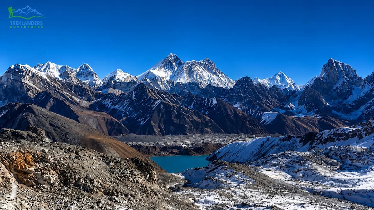
The Renjo La Pass (5, 360 m) can be considered the most attractive of the Everest Three Passes. This path provides a breathtaking view of the blue Gokyo Lakes, the huge Ngozumpa Glacier, and a wide-angle view of the peaks of Everest, Lhotse, Makalu, and Cho Oyu. Typically, it is less difficult and less crowded than the other two passes, Cho La and Kongma La. Hence, it is a perfect retreat for those who want to focus on nature and get away from the crowd.
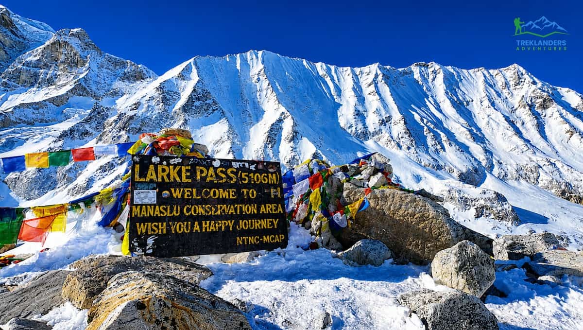
Another great alternative is the Larkya La Pass (5, 106 m) on the Manaslu Circuit. The valley surrounding this pass is one of the remotest in the Himalayas and also one that is dotted with authentic Tibetan culture. Not just that, the scenery here is nothing short of spectacular. The naturalness of Larkya La is such that it falls between the popularity of Thorong La and the rugged isolation of Kongma La.
Compare Tilicho Lake and Thorong La Pass on the Annapurna Circuit and discover which challenge is tougher.
Compare the 9-Day and 12-Day Everest Base Camp Helicopter Trek and find the best Everest adventure for your schedule and fitness.

Compare the Tamang Heritage Trail and Langtang Valley Trek for culture, villages, and stunning Himalayan views in Nepal.