
Top 5 Treks in the Annapurna Region: A Complete Guide
3 Sep 2026
Discover the top 5 treks in the Annapurna region and find the perfect route for your Himalayan adventure.

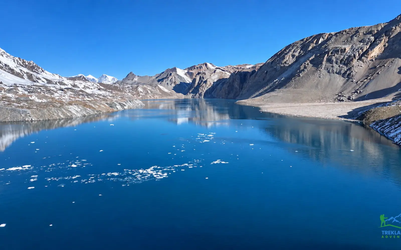
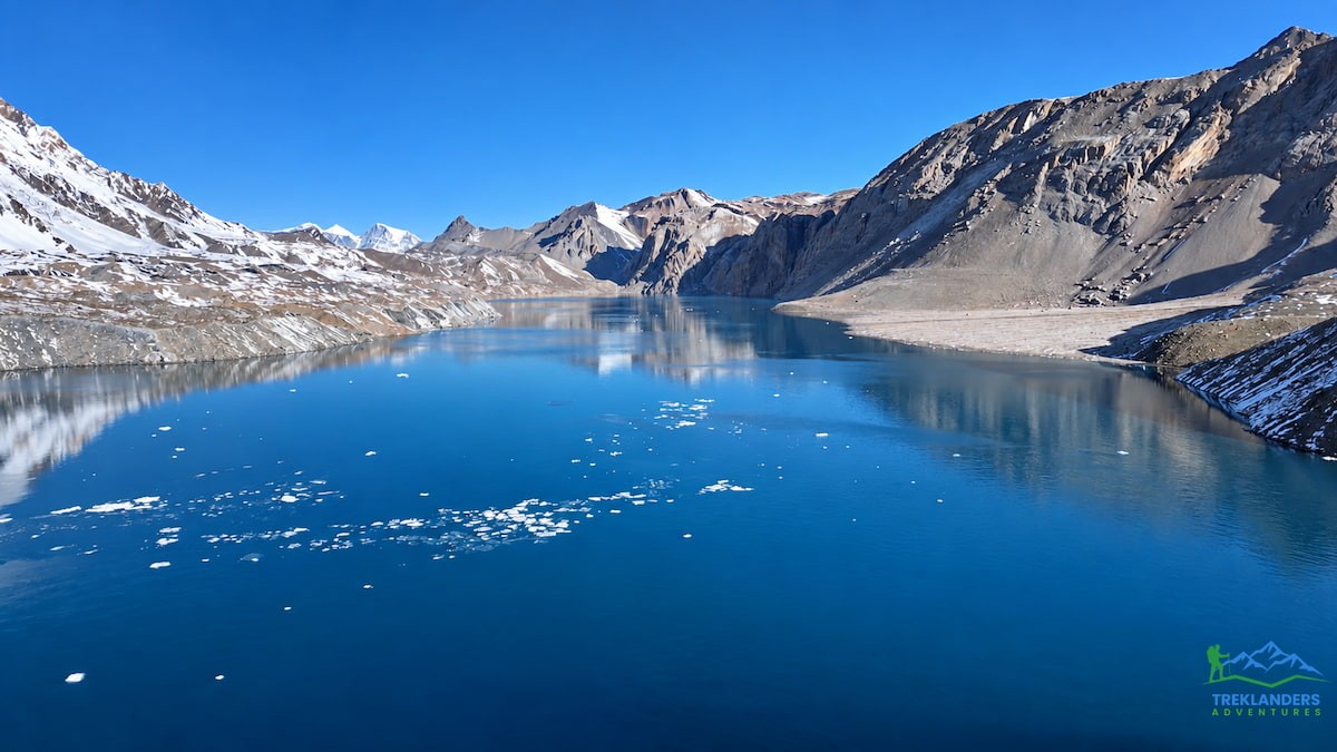
There's a point on the trail past Khangsar, somewhere around the third landslide-scarred bend, where the valley stops feeling like the Annapurna you've seen in photographs. The pines are long gone. The rivers have turned the color of wet cement. The wind carries dust instead of pollen. And somewhere above all that grey, at 4,919 meters, sits a lake so blue it looks like someone poured it there on purpose. That's Tilicho Lake, and the walk to reach it is one of the more demanding, more rewarding detours you can take off the Annapurna Circuit.
The Tilicho Lake Base Camp Trek isn't just a side trip to a pretty photo stop. It's a genuine expedition into one of the least-visited corners of the Manang district, a route that leaves the main circuit trail near Manang village and heads southwest into terrain that most trekkers never see. You'll cross narrow paths cut into loose scree, sleep at altitudes most people only reach on mountaineering trips, and eventually rejoin the classic circuit route to cross Thorong La Pass at 5,416 meters. It's a big trek. It's also, for the right kind of traveler, one of the best treks in Nepal.
This guide walks through the route as run by Treklanders Adventures, a 19-day itinerary that starts and ends in Kathmandu and covers the full loop: the long drive into the mountains, the climb through Manang, the push to Tilicho Base Camp and the lake itself, and the return over Thorong La to Muktinath, Jomsom, and Pokhara. No pricing, no packages, no fine print here, just what the trail actually looks like, day by day, and what you should know before you commit to it.
What makes this route worth singling out from the dozens of other Annapurna itineraries floating around is the detour itself. Most trekkers who set out to walk the Annapurna Circuit never see Khangsar, never cross the narrow shelf trail toward Tilicho Base Camp, and never stand on the shore of the lake that gives this trek its name. They walk the main loop, cross Thorong La, and head home having missed one of the more striking side trips in the entire region. This itinerary builds that detour in as the centerpiece rather than an optional add-on, which changes the character of the whole trek: quieter trails, a starker landscape, and a genuine sense of having gone somewhere most people don't.
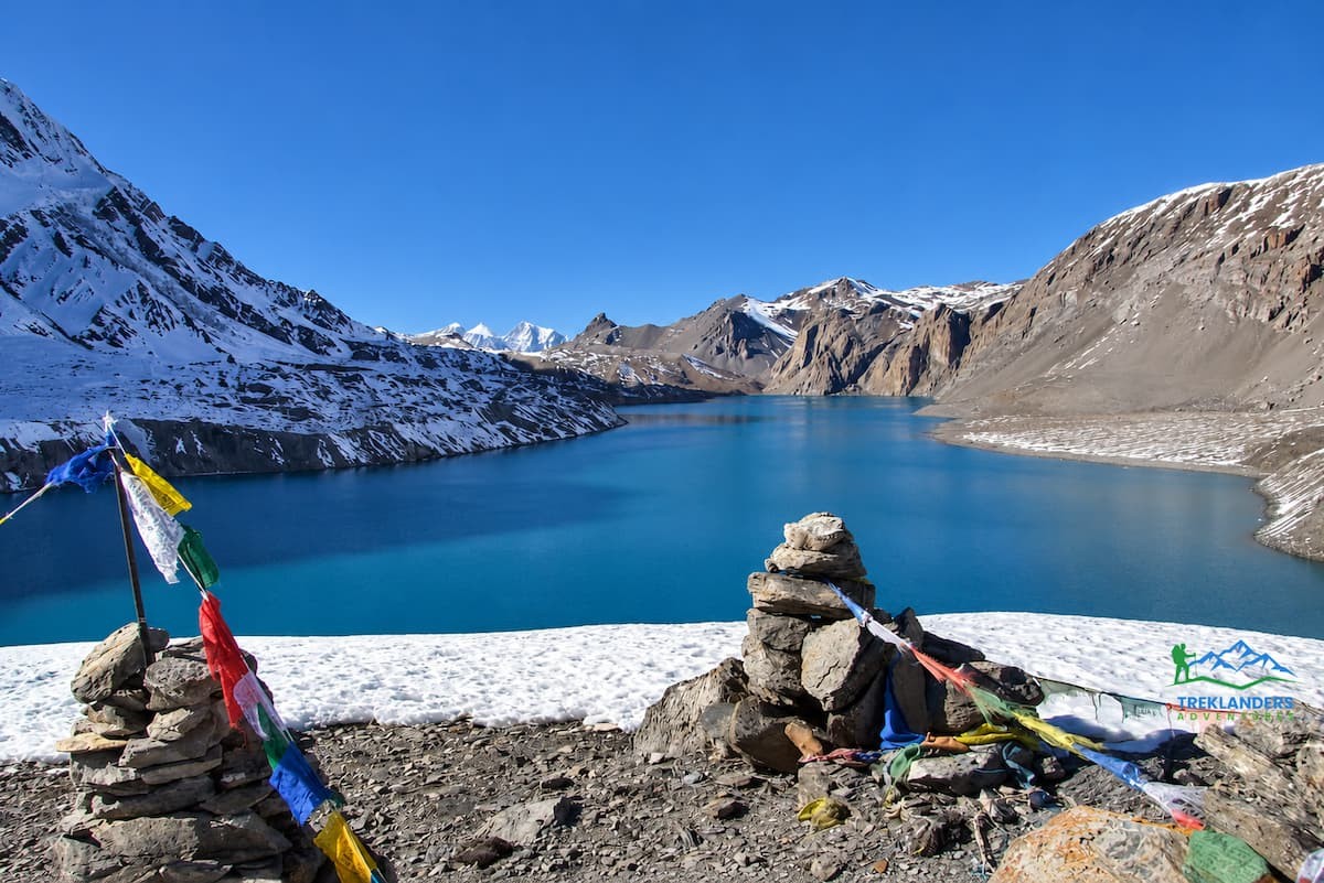
Tilicho Lake holds a strange kind of fame. For years it was marketed as the highest lake in the world, and while a newly identified lake near Lamjung Himal called Kajin Sara has technically claimed that title at over 5,200 meters, Tilicho hasn't lost much of its pull. It's still one of the highest lakes on the planet, still ringed by some of the biggest mountains in the Annapurna massif, and still a place that very few people outside serious trekking circles have ever heard of.
Part of the appeal is geography. Tilicho sits in a bowl carved out by glacial action, hemmed in by Tilicho Peak, Nilgiri, and the Gangapurna Himal. The water is fed by snowmelt off those peaks, and the cold keeps the lake essentially lifeless: no fish, no real vegetation in the water itself, just a flat sheet of turquoise sitting under some of the starkest scenery in the Himalayas. A Russian dive team once performed what's recorded as the highest-altitude scuba dive on the planet in these waters, which tells you something about how extreme the setting really is.
There's also a religious dimension that a lot of trekking blogs skip past. Tilicho Lake appears in the Ramayana, and Hindu pilgrims consider it a holy site, alongside Muktinath further down the trail. So this isn't purely a scenic detour for hikers chasing a good Instagram shot. It's a place with centuries of spiritual weight behind it, sitting at the edge of a valley that Buddhist Manangis have called home for just as long.
And then there's the trail itself. Once you leave Manang and head toward Khangsar, you're off the main Annapurna Circuit. The crowds thin out fast. You're walking through a landscape that looks more like the Tibetan plateau than anything most people picture when they think "Nepal trek": dry, brown, wind-scoured, and largely empty. If you've done a busier trek before and want something that feels more remote, this is where you find it.
There's also a practical argument for combining Tilicho with the classic circuit rather than treating it as a separate trip. The days spent walking to Base Camp and up to the lake double as acclimatization for the Thorong La crossing that follows. You're exposing your body to nearly 5,000 meters of altitude at Tilicho, then dropping back down through Khangsar before climbing again toward the pass, a textbook "climb high, sleep low" progression that reduces the risk of altitude sickness later in the trek. So the detour isn't just scenery for its own sake. It's smart route planning that happens to lead somewhere extraordinary.
Every Treklanders itinerary for this route begins in Kathmandu, and the first two days aren't really trekking days at all. They're for landing, adjusting, and getting oriented. On arrival, a guide meets you at Tribhuvan International Airport and takes you to a hotel in the city center. There's usually a briefing that evening: what to expect on the trail, what the accommodation looks like, food, safety, the whole rundown, often capped off with a welcome dinner and a bit of Nepali cultural performance thrown in.
Day two is a city tour, not a trek. Kathmandu's UNESCO World Heritage Sites, Durbar Square, Swayambhunath, Pashupatinath, Boudhanath, are usually on the list, giving you a full day to see the capital before you disappear into the mountains for the better part of two weeks. It's also a practical day: last-minute gear checks, currency, whatever you forgot to pack.
The real journey starts on day three, and it's a long one. You're driving from Kathmandu toward Besisahar, the headquarters of Lamjung district, along a busy highway that eventually gives way to a much rougher road following the Marsyangdi River. Past Besisahar the pavement disappears. The route climbs through Syange, then Jagat, a proper mountain village where the air noticeably cools, before winding on through Chamje and crossing into Manang district near Tal. The drive ends at Dharapani, a riverside village at 1,820 meters that also happens to sit on the Manaslu Circuit route. It's a full day in a vehicle, seven hours or more depending on road conditions, but it's the price of admission for reaching trailhead country without walking the lower Marsyangdi valley on foot.
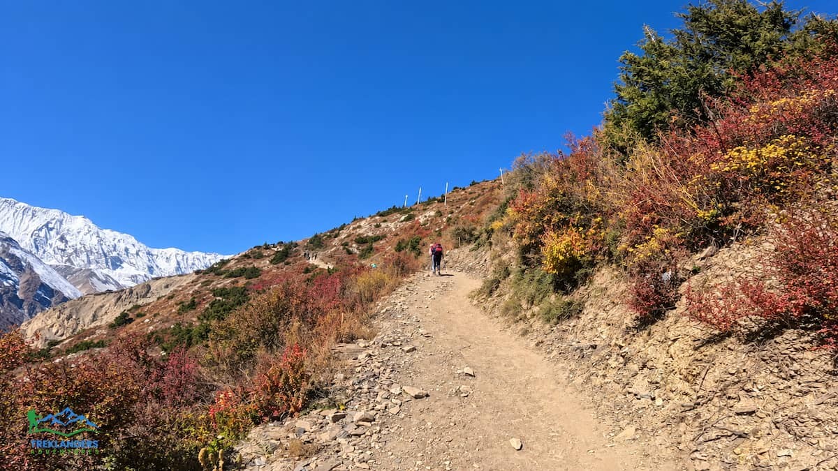
Day four is the first real trekking day, and after a day spent bouncing along mountain roads, most trekkers are glad to be walking again. The trail climbs gradually through cool pine and rhododendron forest, passing through Bagarchap and Danaque, villages where the Buddhist character of the region starts showing itself clearly, with stupas and mani walls lining the path.
From there the trail steepens toward Timang, a mixed village of Gurung, Magar, and Manange people, with grand views south to Lamjung Himal and northeast toward Manaslu. Most itineraries stop here for lunch, largely because the views make it worth lingering. After Timang, the walk eases toward Kodo village, where a side trail splits off toward the Nar-Phu valley, before a final short climb brings you into Chame at 2,710 meters, the administrative headquarters of Manang district and a proper mountain town, with Lamjung Himal rising over green hills to the south.
The stretch from Chame to Pisang, covered on day five, follows the Marsyangdi River west through dense forest (pine, fir, rhododendron) before reaching Bhratang and a bridge crossing that leads up to a ridge at Dukure Pokhari. This spot, with its handful of teahouses, offers some of the best early views of Pisang Peak and the Chulu range. From there it's a downhill push into Pisang village itself, sitting beneath the peak of the same name, with Annapurna II and IV visible across the valley. This is also where the altitude gain starts becoming noticeable: nothing dangerous yet, but you'll feel it.
Day six is shorter but significant: this is the day you properly enter Manang Valley. The walk climbs to a high ridge with sweeping views: Chulu peaks to the north, Annapurna and Gangapurna Himal along with Tilicho Peak to the southwest. From there it descends past Hongde and its small airstrip. From there the trail winds up to Braga, home to one of the oldest monasteries in the region, worth the short climb for its interior full of centuries-old Buddha statues and thangkas. A final short walk from Braga brings you to Manang village itself, at 3,540 meters, sitting on a plateau above the Marsyangdi River and surrounded on all sides by some of the biggest mountains in the Annapurna range.
Manang isn't just a scenic stopover. It's arguably the most important stop on the entire itinerary, because day seven is a dedicated rest and acclimatization day. This is standard practice on any high-altitude route, and for good reason: your body needs time at altitude to start producing more red blood cells and adjusting to reduced oxygen before you push higher. Skip this step and you're gambling with acute mountain sickness.
Most trekkers use the day to hike up toward the Gangapurna ice fall and glacier, a walk of a few hours each way from a ridge south of the village, overlooking Manang's small glacial lake with Chulu peaks to the north and Annapurna II, III, and IV close enough to feel almost touchable. It's active rest. You're gaining a little elevation during the day and dropping back down to sleep, which is exactly the "climb high, sleep low" principle that guides use to reduce altitude sickness risk. The rest of the day is usually left open to explore Manang's narrow lanes, its old stone houses, and the Tibetan-influenced culture that defines this whole upper valley.
Leaving the Circuit: The Road to Khangsar and Tilicho Base Camp
This is where the Tilicho Lake Base Camp Trek genuinely diverges from the standard Annapurna Circuit. On day eight, instead of continuing north toward Yak Kharka and the Thorong La approach, the trail turns southwest toward Khangsar. It's a moderate day (five hours or so on a mostly gradual path with a few short, steep sections), but the character of the trek changes almost immediately. You're leaving the more established teahouse infrastructure of the main circuit behind and heading into much quieter territory. Khangsar itself, at roughly 3,740 meters, is a small settlement with simple, homely guesthouses and a noticeably slower pace than anywhere you've stayed so far.
Day nine is where the trail earns its "adventurous" grading. The walk from Khangsar toward Tilicho Base Camp follows a narrow path that's genuinely exposed to rockfall in places, crossing smaller streams and a couple of bridges, with sections that show visible damage from past landslides. It demands attention (this isn't a trail to walk while staring at your phone), but it's also one of the more dramatic stretches of the entire route, with the terrain shifting into something drier and starker as you climb. Most groups stop for lunch either at Shree Kharka or push on to Base Camp itself, arriving by late afternoon at 4,150 meters for the overnight.
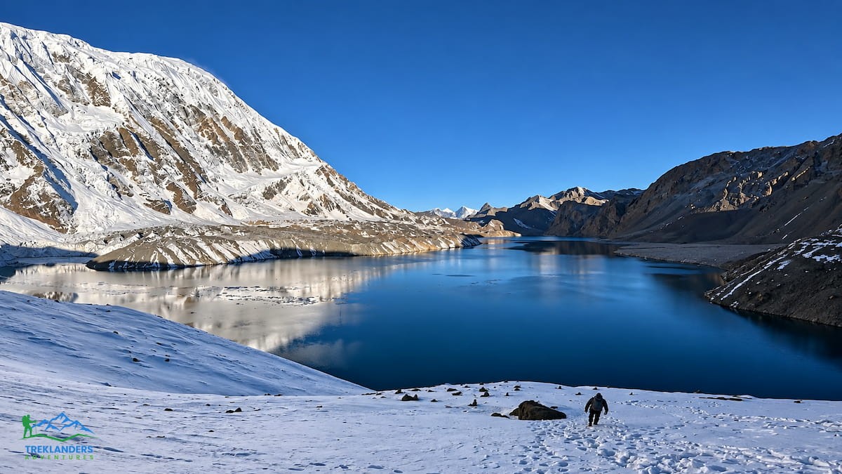
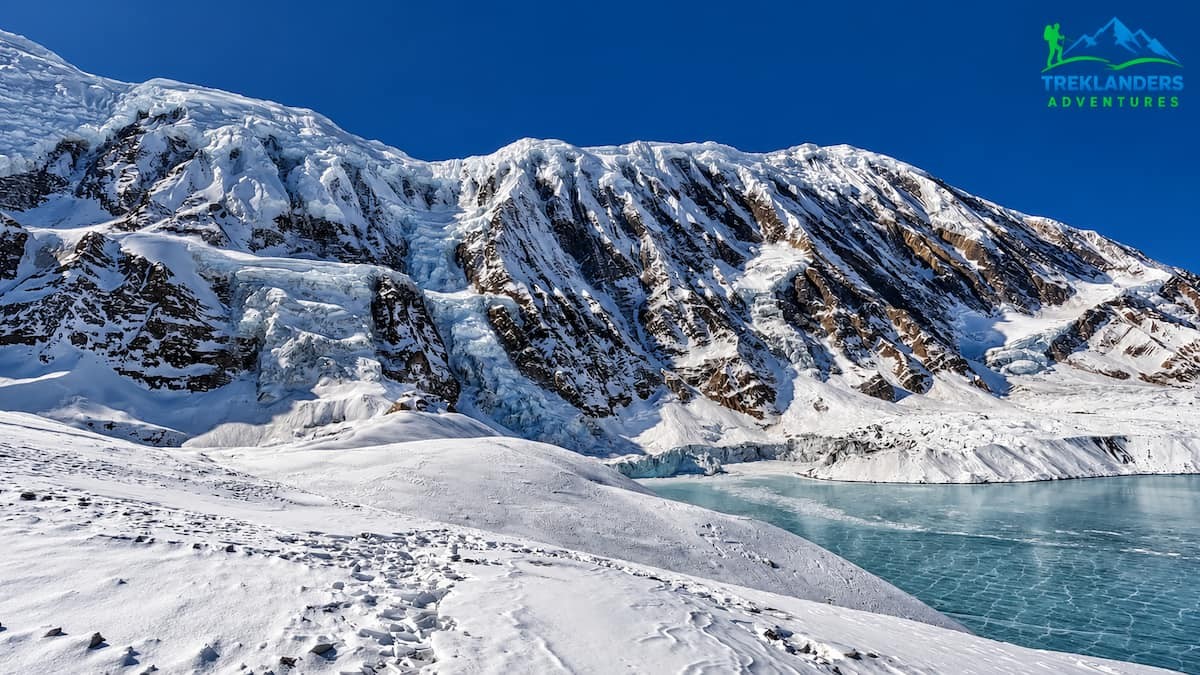
Day ten is the reason everyone signed up in the first place. The hike from Base Camp to Tilicho Lake isn't especially long in distance, but at nearly 5,000 meters every step costs more oxygen than it would lower down, so groups typically start early and move steadily rather than quickly. After a few hours of climbing, the trail crests a ridge and the lake opens up below: a flat expanse of glacial blue water hemmed in by Gangapurna Himal, the Nilgiris, and Tilicho Peak itself.
The scale of it is hard to describe until you're standing there. Tilicho Lake stretches about four kilometers in length with a maximum width near 1.2 kilometers, and an average depth of roughly 85 meters, covering a surface area of about 4.8 square kilometers. The cold is severe enough that nothing much lives in the water (no fish, minimal aquatic vegetation), yet the shoreline and surrounding slopes support surprisingly varied flora and fauna given the harsh conditions. As mentioned earlier, the lake's extreme setting once drew a team of Russian divers who completed what's recorded as the world's highest-altitude scuba dive here, a detail that says a lot about how uncompromising this place is.
For Hindu pilgrims, the visit carries deeper meaning: Tilicho is named in the Ramayana, and the lake is considered a holy site, which means you may well cross paths with pilgrims making the same climb for reasons that have nothing to do with trekking itineraries. After time at the shore, photos, quiet, whatever the moment calls for, the group descends back to Base Camp for a late lunch, then continues on for a few more hours to Shree Kharka, a small settlement with a handful of lodges, for the overnight stop.
Day eleven retraces the route back to Khangsar, a straightforward five-hour walk with the giant peaks of the previous days still visible behind you. It's a good day to let the trek settle in your memory a bit: less about new terrain and more about descending safely and re-acclimatizing before the next push upward.
Day twelve brings you back onto the main Annapurna Circuit trail, heading toward Yak Kharka at 4,110 meters. The walk passes smaller settlements with views of Chulu West and Gangapurna Himal, crossing a stream before reaching Yak Kharka for lunch and the overnight. This stretch of valley is known for wildlife sightings: herds of Goral (a type of mountain antelope), Himalayan thar, and if you're fortunate, the elusive snow leopard, along with pheasant-like snow-cocks that seem to appear out of nowhere on the scree slopes.
Day thirteen pushes higher still, to High Camp at 4,900 meters. The trail runs through Lehdar, a small stop on the route toward Chulu West's base camp, before a steep climb leads to Phedi, sitting at the literal bottom of Thorong La Pass. From Phedi it's a final steep haul up to High Camp, where the lodges are basic but the point is simple: get some rest, keep hydrated, and prepare mentally for the pass crossing that comes at dawn the next day.
Day fourteen is, by most accounts, the toughest single day of the entire trek. It starts early (often before sunrise) because the wind at the pass tends to pick up sharply as the day warms, and you want to be over and descending before that happens. The trail climbs on winding, undulating ground, passing a small hut near a frozen pond before the final push to the top of Thorong La at 5,416 meters, the highest point on the entire itinerary.
The reward for the effort is about as good as mountain views get. From the pass, on a clear day, you're looking at a sweep of peaks running from Dhaulagiri in the west through the Mustang Himal, Damodar Himal, and the Chulu range, all the way to Manaslu on the eastern horizon. The pass itself is marked with a signpost buried in thousands of faded prayer flags, and the feeling of standing there, after the accumulated fatigue of two weeks of walking, after Tilicho, after every acclimatization day, tends to hit people harder than they expect.
From the top, it's a long descent to a second Phedi with a few basic tea shops, then a final flat hour into Muktinath at 3,800 meters. Muktinath is considered one of the holiest pilgrimage sites in the Himalayan region, home to a temple dedicated to Lord Vishnu, and the contrast between the raw, windswept pass above and the settled, sacred village below is part of what makes this day memorable. Lodges here tend to be a step up in comfort, with wider food menus and clear views across to the Dhaulagiri range.
Day fifteen is a gentler downhill walk to Jomsom at 2,715 meters, passing through Jharkot with its ruined old fort, then following the Kali Gandaki River valley the rest of the way. Jomsom is the headquarters of Mustang district and home to the Thakali people, long known both for their trading ties across the border into Tibet and for running some of the better hotels and restaurants anywhere on the trekking circuit. It's a good place to unwind before the final transitions out of the mountains.
Day sixteen covers the long drive from Jomsom to Pokhara, a genuinely scenic if occasionally rough eight-to-ten-hour journey along the Kali Gandaki, through the apple-growing village of Marpha, the forests around Kalopani and Ghasa, and the hot spring village of Tatopani, before the road smooths out past Beni for the final stretch into Pokhara. Day seventeen is another travel day, driving from Pokhara back to Kathmandu (a short flight is usually available as an alternative, at extra cost), with the rest of the day free once you're back at the hotel.
The itinerary builds in a buffer day, day eighteen, for contingencies, weather delays, or simply extra time in Kathmandu for shopping or an additional sightseeing tour around Patan or Bhaktapur. Day nineteen is departure, with a transfer to the international airport closing out just under three weeks in Nepal.
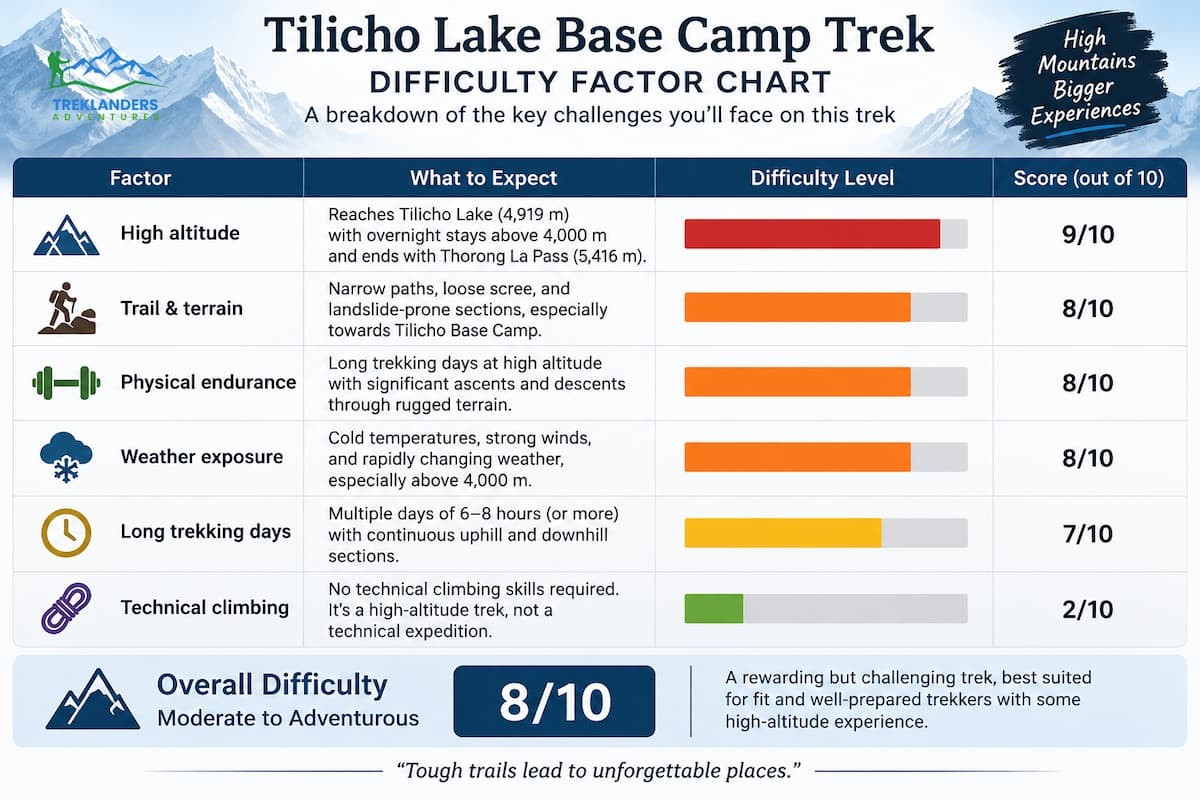
There's no getting around it: this is rated as a moderate-to-adventurous trek, and the "adventurous" part isn't marketing language. The trail between Khangsar and Tilicho Base Camp is genuinely exposed in sections, with loose rock and a history of landslide damage that means you need to stay alert rather than just put one foot in front of the other. Combine that with the altitude: you're sleeping above 4,000 meters for several consecutive nights and crossing a pass above 5,400 meters. This isn't a trek to underestimate.
That said, it's also not a technical climb. There's no rope work, no glacier travel requiring crampons under normal conditions, no scrambling with hands. What makes it hard is the cumulative effect of altitude, distance, and terrain over close to two weeks of trekking days. Good physical preparation matters here: regular cardio, some hill or stair training, and general fitness in the weeks before you fly out make a real difference in how much you enjoy the higher days rather than just endure them.
Previous trekking experience helps but isn't strictly required. What matters more is a willingness to walk slowly when the altitude demands it, drink enough water, eat properly even when your appetite drops at elevation, and listen to your guide when they tell you to slow down or, in rare cases, turn back. The itinerary's built-in acclimatization day in Manang exists precisely because rushing this kind of altitude gain is how people end up with serious problems.
Weather adds another layer of unpredictability on top of the terrain and altitude. Afternoon winds near Tilicho Base Camp can turn a calm morning walk into a genuinely uncomfortable slog by early afternoon, which is why most groups start the hike to the lake as early as possible. Snow isn't unusual at High Camp even outside the coldest months, and the crossing of Thorong La in poor visibility is a different, harder experience than the same walk under clear skies. A good guide reads these conditions daily and adjusts the plan accordingly, which is one more reason the mandatory guide requirement in this region works in your favor rather than against it.
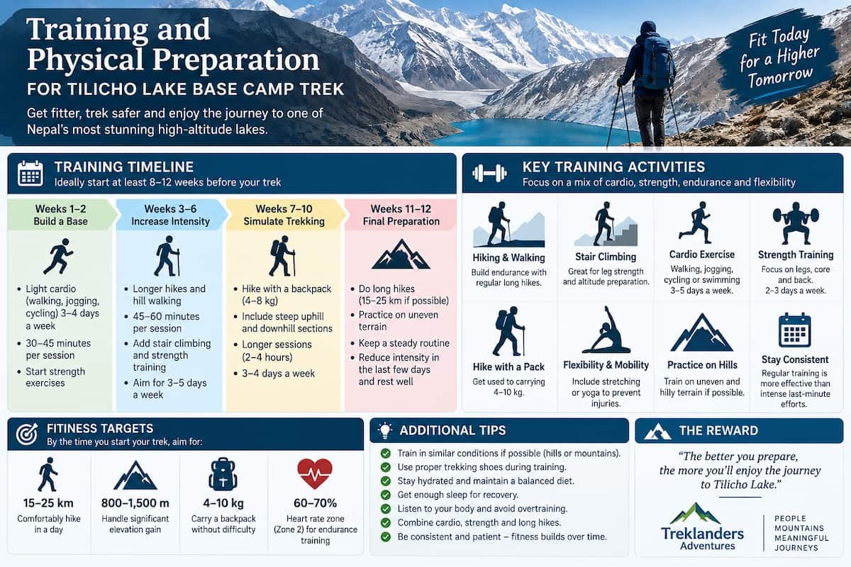
Nobody needs to arrive at Kathmandu airport in marathon shape, but showing up unprepared for the Tilicho Lake Base Camp Trek makes an already demanding route considerably harder than it needs to be. The single biggest factor in how much you enjoy the higher days isn't raw fitness. It's cardiovascular endurance combined with the ability to keep walking steadily for five to seven hours at a stretch, day after day, for close to two weeks.
A reasonable training window is somewhere between two and three months out, though even a few solid weeks of preparation beats none at all. Regular hill walking or stair climbing builds the specific leg and lung capacity this trek demands far better than flat-ground running does. If you have access to a loaded pack, practicing with fifteen to twenty percent of your body weight on your back for a couple of hours at a time gets your body used to the load, even though porters typically handle the heavier gear on this itinerary. Two to three cardio sessions a week (hiking, cycling, swimming, whatever keeps your heart rate up for 45 minutes or more) pay off noticeably once you're above 4,000 meters and every step costs more oxygen than it did the day before.
Strength training matters more than people expect, particularly for the knees and ankles. The descent from Thorong La and the downhill stretches around Tilicho Base Camp put real strain on joints, and a few weeks of squats, lunges, and general leg conditioning beforehand goes a long way toward preventing the kind of soreness that turns a good trek into a miserable one. Balance work helps too, given how much of the trail near Khangsar and Tilicho runs over loose, uneven rock.
None of this needs to be extreme. This isn't a technical mountaineering expedition, and the trek is designed with rest days built in specifically so your body has time to adjust. But going in with a reasonable base of fitness means you spend your energy actually appreciating the landscape rather than just surviving the walk to get there.
Two windows stand out clearly above the rest: spring, from March through May, and autumn, from September into November. Both offer the kind of stable, dry weather that makes high-altitude trekking safer and considerably more enjoyable.
Spring brings warmer days at lower elevations, rhododendron forests in full bloom lower down the valley, and generally clear skies, though afternoon cloud can build up and temperatures drop sharply once the sun goes down. It's a particularly good season if you want a bit of color in the lower valleys to contrast with the stark high country around Tilicho.
Autumn tends to offer the clearest mountain views of the year, since the monsoon rains wash the dust and haze out of the air before the season starts. Days are dry, temperatures are moderate rather than extreme, and visibility on a good day can be extraordinary, which matters enormously on a trek built around a handful of specific, dramatic viewpoints. It's also, unsurprisingly, the busier of the two seasons.
Winter trekking is possible for well-prepared, experienced trekkers, but expect serious cold, likely snow and ice on the approach to Tilicho Base Camp, and some upper teahouses closed for the season. Monsoon, from June through August, is best avoided altogether, persistent rain brings landslide risk to exactly the kind of exposed trail sections this trek already has plenty of, on top of near-constant cloud cover that can hide the mountains for days at a stretch.
Trekking in the Annapurna region, including the route to Tilicho Lake, requires two permits: the Annapurna Conservation Area Permit (ACAP) and a TIMS card (Trekkers' Information Management System). Both exist for genuinely practical reasons: ACAP fees go toward conservation work and community management within the protected area, while the TIMS system gives local authorities a record of who's on the trail, which matters enormously in the rare event of an emergency.
Current trekking regulations in the Annapurna Conservation Area also require a licensed guide, so solo, unguided trekking isn't an option here regardless of experience level. In practice this works in your favor: a guide handles route-finding on the more exposed sections near Tilicho Base Camp, monitors the group for early signs of altitude sickness, manages the day-to-day logistics of teahouse bookings and meal timing, and can coordinate emergency evacuation if it's ever needed. Most trekking companies, Treklanders included, handle the permit paperwork directly, needing only your passport details and photographs to get everything arranged before you land.
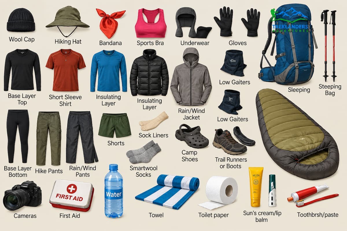
Packing for this trek means preparing for a genuinely wide temperature range. You'll walk through pine forest at under 2,000 meters and cross a pass above 5,400 meters within the same two-week window, sometimes with a 20-degree swing between a warm valley afternoon and a freezing High Camp night.
Layering is the whole strategy. Moisture-wicking base layers, a mid-weight fleece or light insulated jacket, and then a proper windproof, waterproof outer shell form the core system, with a heavier down jacket essential once you're above 4,000 meters. Good broken-in trekking boots with solid ankle support matter more than almost anything else on your packing list, paired with two or three pairs of proper trekking socks and a thicker pair for the coldest days. Trekking poles are worth carrying, especially on the loose, rocky descent sections around Tilicho.
A sleeping bag rated to at least minus ten degrees Celsius is standard for this route, since teahouse blankets alone won't cut it at High Camp or Tilicho Base Camp. Add sun protection too: proper UV-blocking sunglasses rated for high altitude, high-SPF sunscreen, and a wide-brimmed hat or cap, since UV exposure at altitude is far stronger than it feels. A basic first aid kit, water purification tablets or a filter, and a reliable headlamp round out the essentials. None of this needs to be expensive gear, but all of it needs to actually work when the temperature drops.
One of the most underrated parts of this trek is simply walking through Manang district and watching the culture shift as the altitude climbs. The Manang Gurung people who populate this upper valley are distinct from the Gurung communities further south around Lamjung: Tibetan in origin, Buddhist in religion, and historically pastoral, raising and herding livestock across these high pastures for generations.
You'll pass mani walls, prayer wheels, chortens, and monasteries throughout the trek, none more striking than the centuries-old monastery at Braga, tucked above its namesake village on a sandy hillock, filled with old statues and religious art that most trekkers on the busier Everest routes never get to see. Every house along the way carries prayer flags, and by the time you reach Thorong La, the pass itself is buried under thousands of them, snapping in the wind: a visual marker of respect for the mountain spirits that locals have honored here for centuries.
Cross over the pass into Mustang district and the culture shifts again, this time toward the Thakali people of the Kaligandaki valley, long-established traders with Tibet and, these days, some of the most reliably good hoteliers on the entire Annapurna circuit. Muktinath ties both worlds together as a shared pilgrimage site for Hindus and Buddhists alike, genuinely one of the more spiritually significant places you'll pass through on any trek in Nepal.
Food shifts along with the culture, which is part of the fun of a trek this long. Lower down, meals lean toward the familiar dal bhat, momos, and noodle soups found across most of Nepal's trekking regions. Higher up in Manang and around Tilicho, you'll notice more Tibetan influence in the kitchen: thukpa, tsampa, butter tea, if you're curious enough to try it. By the time you're back down in Jomsom and Marpha, the Thakali kitchens bring their own distinct flavor to the table, and the apple orchards around Marpha are famous enough that you'll want to budget time for a walk through them if the schedule allows it.
The Tilicho Lake Base Camp Trek isn't the easiest route in the Annapurna region, and it's not meant to be. It asks more of you than the standard circuit: a harder acclimatization schedule, a genuinely exposed stretch of trail near Base Camp, and a full pass crossing on top of all that. What you get back is a trek that most people never take: a side trip to one of the highest lakes on earth, a stretch of remote, dry, high-desert terrain that feels closer to Tibet than to the postcard version of Nepal, and a route through Manang and Mustang that layers Buddhist and Hindu culture into nearly every single day.
If you've already done a few treks and want something that pushes further off the standard trail without requiring technical climbing skills, this is a strong choice. If it's your first serious high-altitude trek, it's still doable. Just go in prepared, take the acclimatization day in Manang seriously, and trust your guide when the trail near Tilicho Base Camp asks for extra care. Either way, standing on the shore of that impossibly blue lake, with the Gangapurna and Nilgiri ranges rising straight out of the water, tends to make every long driving day and every cold night at altitude feel entirely worth it.
If your goal is simply to cross Thorong La and tick off the classic circuit, the standard route without the Tilicho detour is shorter and considerably less demanding. But if you're after something that combines that same pass crossing with a genuinely remote side trip to one of the most striking lakes in the Himalayas, the extra days and extra effort are hard to argue with. Few treks in Nepal pack in this much variety: forested lower valleys, high desert terrain, a glacial lake at nearly 5,000 meters, and a pass above 5,400 meters, all inside one well-paced itinerary
Discover the top 5 treks in the Annapurna region and find the perfect route for your Himalayan adventure.
Explore Tsum Valley’s ancient monasteries, remote villages, Tibetan culture, and breathtaking Himalayan landscapes.
Get the latest Manaslu Circuit Trek closure updates, trail conditions, reopening status, and alternative treks after the September 2026 flood.



