Everest Heli Tour vs Trekking to Base Camp: Which Should You Choose?
16 Aug 2026
Compare the Everest Heli Tour vs Base Camp Trek and choose the best Everest experience for your time, fitness, and travel style.

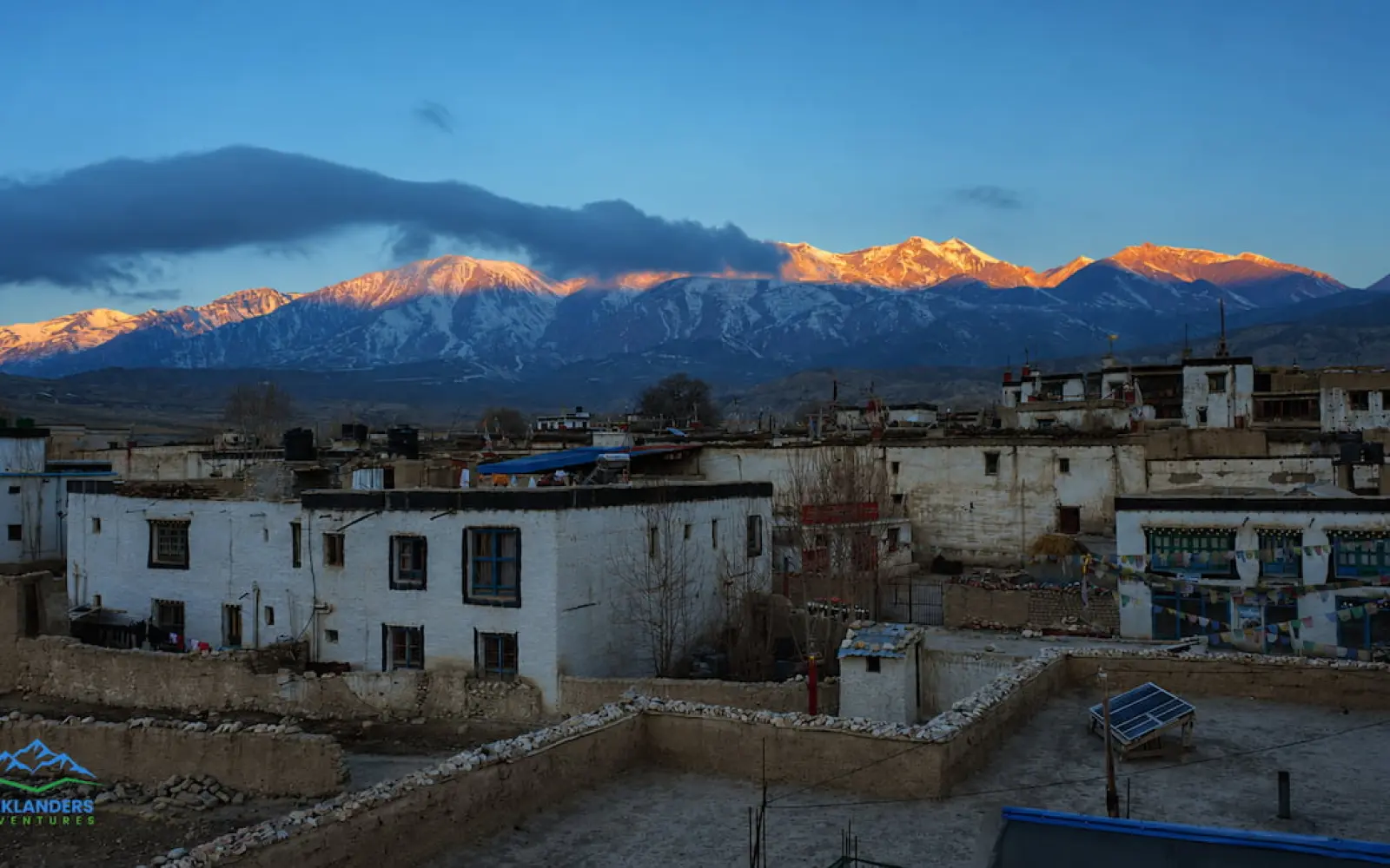
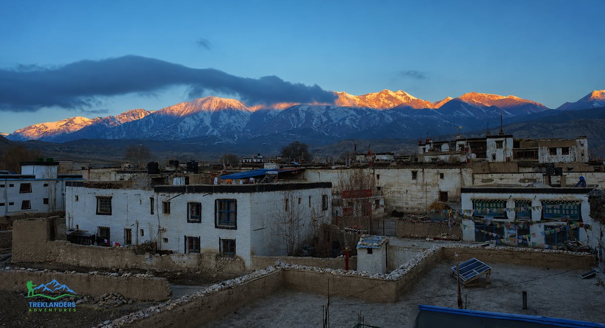
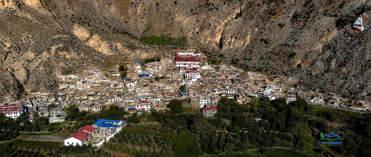
Lo Manthang sits behind a wall of packed clay in a desert most people never expect to find in Nepal. No forests here, no rice terraces, no green switchbacks. Just ochre cliffs, wind-carved canyons, and a walled city that ruled its own kingdom for over 600 years. You reach it by trekking through one of the driest, highest, and least visited corners of the Himalayas, and when you finally walk through the gate, you step into a place that still runs on its own calendar.
This guide takes you inside that city. You will learn how Lo Manthang came to exist, what its walls and palace and monasteries actually hold, how the Tiji Festival works, what the trek to get there looks like, and how to visit without disrespecting a living community. Upper Mustang is not a museum. People still live, farm, and pray inside these walls. That changes how you should approach the trip.
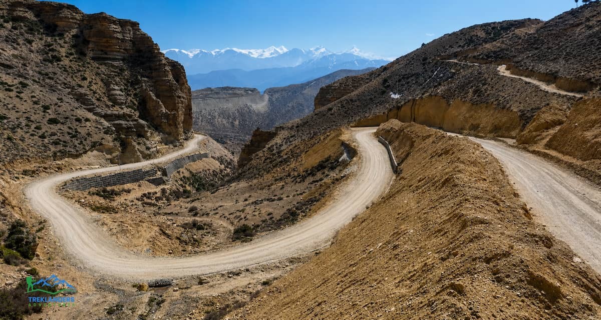
Lo Manthang sits at roughly 3,840 meters above sea level, in the Mustang district of Gandaki Province, in northern Nepal. It lies close to the border with the Tibet Autonomous Region of China, about 370 kilometers northwest of Kathmandu by road and trail. The city occupies a flat plateau above the Kali Gandaki valley, in the rain shadow of the Annapurna and Dhaulagiri ranges.
That rain shadow explains everything about the landscape. The Annapurna and Dhaulagiri massifs, both over 8,000 meters, block the monsoon clouds before they reach Mustang. What arrives on the other side is dry air and almost no rainfall. The result is a high-altitude desert: bare cliffs, eroded canyons, and soil the color of rust and ash. You will not find this terrain anywhere else in Nepal. It looks closer to the Tibetan plateau than to the rest of the country, and that resemblance is not an accident. Mustang shares its geology, culture, and history with Tibet far more than with the Kathmandu Valley.
The Kali Gandaki River carves the route south of Lo Manthang, running through what is often called the deepest gorge on earth, sitting between Dhaulagiri at 8,167 meters and Annapurna I at 8,091 meters. For centuries, traders used this gorge as a passage between Tibet and the Indian subcontinent, carrying salt north and grain south. That trade route built Mustang's wealth, and Lo Manthang sat at the center of it.
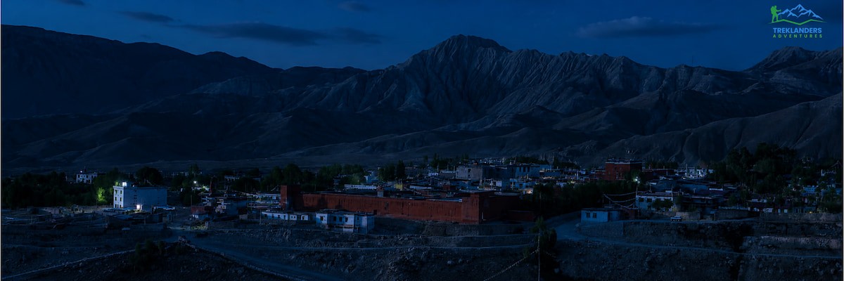
King Ame Pal founded Lo Manthang in 1380. He was a warrior chief who unified the scattered communities of the upper Kali Gandaki valley into one hereditary monarchy, the Kingdom of Lo. He chose the flat plain north of the river as his capital and built a wall around it to protect his people, his religion, and the trade routes that ran through his territory.
"Lo" is the old name for the kingdom itself, the land later folded into what maps call Upper Mustang. "Manthang" comes from Tibetan: "man," meaning medicine or medicinal plant, and "thang," meaning plain or open field. Put together, it roughly means the plain of medicine, though some translations render it closer to the plain of aspiration. Locals call themselves Loba, the people of Lo.
The kingdom grew rich by controlling the salt trade between Tibet and the lowlands. Caravans of yaks and mules moved through the Kali Gandaki gorge for centuries, and Lo Manthang taxed and hosted that traffic. Twenty-five kings ruled in unbroken succession from the palace at the center of the walled city, all descended from Ame Pal's line.
Nepal absorbed the kingdom in 1789, when the Shah dynasty unified the country under one crown. Lo Manthang kept its king as a local ruler, but lost full sovereignty. What kept the kingdom culturally intact for another two centuries was isolation, not independence. Nepal closed Upper Mustang to foreigners entirely, largely for political reasons tied to the region's proximity to Tibet and its role as a base for Khampa resistance fighters after China's occupation of Tibet in the 1950s. That closure lasted until 1992, when the Nepali government finally opened Upper Mustang to trekkers, under a restricted-area permit system that still applies today.
The monarchy itself lasted almost until the present day. Nepal formally abolished its national monarchy in 2008, and while the King of Mustang held no political power by then, the title continued as a cultural and ceremonial role. Jigme Dorje Palbar Bista, the last King of Lo, died in 2016. His passing marked the end of an unbroken line that had run for over 600 years, though his family remains prominent in Lo Manthang's cultural life.
That history is why people call Lo Manthang the last forbidden kingdom of the Himalayas. Other Tibetan Buddhist kingdoms and city-states either vanished, got absorbed into modern nation-states without a trace, or opened to the outside world decades earlier. Lo Manthang kept its walls, its palace, its language, and its religious practices largely because almost nobody could get in to disturb them.
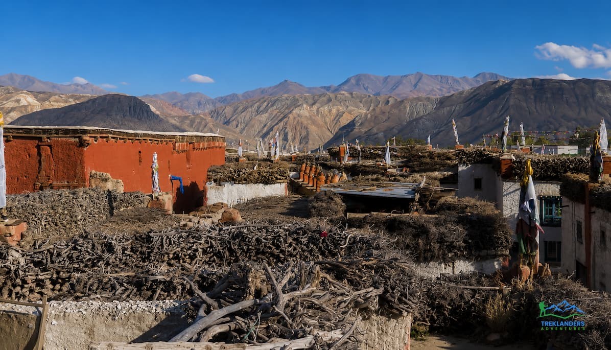
The wall around Lo Manthang is the reason people call it the walled city, and it still stands today, mostly intact. It runs about 856 meters around the settlement, stands roughly six meters high, and measures about a meter thick at the base. Builders made it entirely from compacted clay, using local earth mixed with water and packed in layers. Local elders say yaks were used to help compact the clay during construction, walking over each layer to press it firm before the next went on.
The wall was defensive. Rival groups controlled other valleys along the trans-Himalayan trade routes, and a fortified capital protected the royal palace, the monasteries, and the residents from raids. Four gates originally allowed entry, though only a couple remain in regular use today. Inside, the wall encloses a tight grid of narrow lanes, flat-roofed mud-brick houses, and the city's major religious and royal buildings, all packed into a surprisingly small footprint. Roughly 170 houses sit inside the walls, home to a population that has stayed small and stable for generations.
Walking along sections of the wall, you can see centuries of patchwork repair. Weather erodes packed clay steadily, especially with the fierce winds that rip through the valley every afternoon, so maintaining the wall has been an ongoing task for the community for as long as it has existed. Some of the oldest surviving sections date back close to the original construction, though most of what you see today reflects repeated rebuilding over hundreds of years.
Lo Manthang is considered the only continuously inhabited walled city left standing in the entire Himalayan region. Other fortified towns in Tibet and the wider Himalaya either lost their walls to time, conflict, or modern expansion, or were abandoned outright. Lo Manthang's isolation kept both its walls and its residents in place.
At the heart of the walled city stands the Tashi Gephel Palace, sometimes written Tashi Dhyekar or Tashi Dyaphel, meaning roughly "the fortunate palace." Ame Pal built the original four-story structure around 1400, shortly after founding the city, and it grew into a nine-cornered, five-story building that served as the royal residence for 25 generations of Lo's kings.
The palace sits near the main city gate, overlooking the central square known as the De, where public gatherings and festival events still take place. For over 600 years, this was a working royal residence, not a museum piece. Kings governed from here, received traders and pilgrims, and hosted the religious ceremonies that structured daily life in the kingdom.
Earthquakes have not been kind to the palace. A 2015 earthquake, the same one that devastated large parts of central Nepal, cracked sections of the structure and accelerated existing decay from age and weather. Restoration work has been ongoing since then, backed by heritage conservation groups working to stabilize the earthen walls and preserve the building's original construction techniques rather than replacing them with modern materials. Some sections remain closed to visitors during active restoration, so what you can see inside varies depending on when you visit.
Even from the outside, the scale of the palace stands out against the low, flat-roofed houses surrounding it. It rises well above everything else inside the wall, a physical reminder of what this building represented for six centuries: the seat of an independent kingdom, ruled by one family, inside walls they built themselves.
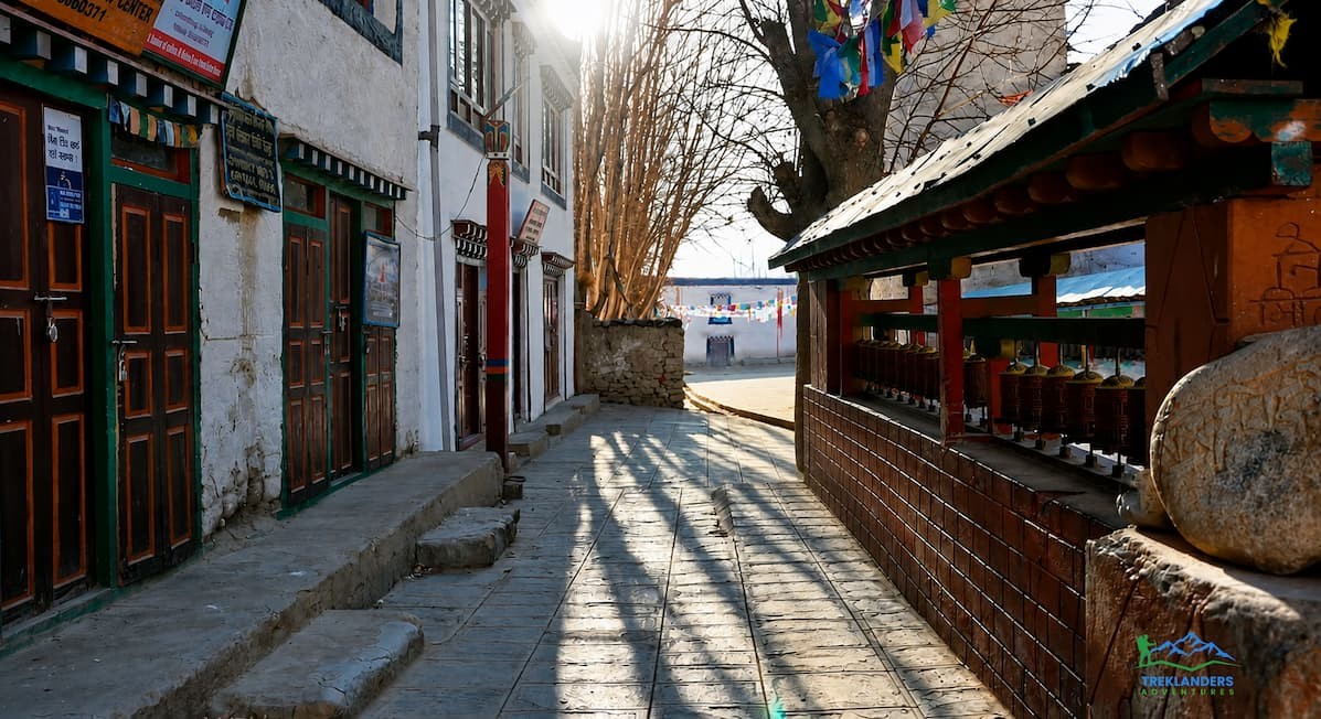
Three monasteries sit inside Lo Manthang's walls, along with a monastic museum, and together they hold some of the most significant Tibetan Buddhist art in Nepal.
Jampa Lhakhang, often called the God House, is the oldest of the three, dating to the fifteenth century. It houses a large statue of Jampa, the future Buddha, along with murals covering the interior walls and ceiling. The paintings depict mandalas and deities in the Newari-influenced style common to fifteenth-century Tibetan Buddhist art in this region, and many have survived remarkably well given the building's age and the harsh climate outside.
Thubchen Gompa stands nearby, a large assembly hall built in the same era. Its scale sets it apart. Thick columns support a high ceiling, and the walls carry murals on a scale rarely seen in monasteries this size. Restoration teams have worked for years to stabilize the artwork here, since damp, dust, and structural cracks threaten these paintings the same way they threaten the palace.
Choedhe Gompa, also called Chode Monastery, functions as the city's main working monastery. It belongs to the Sakya lineage of Tibetan Buddhism and remains an active religious center today, not just a historical site. This is where the monks who perform the Tiji Festival's ritual dances train and live, and it houses the courtyard where the festival's most dramatic scenes play out each year.
Visiting these monasteries means stepping into buildings that have functioned continuously for over 500 years. Photography rules vary by site and sometimes by season, so ask your guide before shooting inside. Many of the murals are fragile, and flash photography accelerates fading. Treat these spaces as active places of worship, because that is exactly what they are.
Lo Manthang works differently from a typical trekking village. Most Himalayan settlements you pass through on a long trek spread out along a trail or valley floor, with houses scattered where the land allows. Lo Manthang is compact by design. Everything sits inside the wall, packed into narrow lanes barely wide enough for two people to pass.
Houses here are flat-roofed and built from the same mud-brick construction as the wall around them, a style adapted to a dry, windy climate with almost no rainfall to worry about. Flat roofs double as storage space and work areas, used for drying crops, stacking firewood, and, in some households, even storing dung for fuel. Walking through the lanes, you pass close to daily life: women weaving, children playing in doorways, prayer wheels spinning outside homes, yaks and mules moving through narrow passages on their way to and from the fields.
Agriculture around Lo Manthang depends on irrigation from mountain streams, since rainfall here is negligible. Barley, buckwheat, and mustard grow in small terraced fields outside the walls, along with fodder crops for livestock. The short growing season and thin soil mean farming families supplement their income with trade, tourism, and seasonal migration for work, a pattern that has shaped Mustang's economy for generations.
Language and dress inside the walls reflect Tibetan roots more than Nepali ones. Many residents speak Loke, a Tibetan dialect specific to the region, alongside Nepali. Traditional dress, particularly during festivals, closely resembles Tibetan Buddhist clothing rather than anything you would see in Kathmandu or Pokhara. This is part of what gives Lo Manthang its distinct feel: you are inside Nepal's borders, but the culture you are walking through traces its roots north across the Himalaya rather than south.
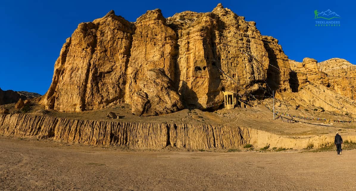
A short trip from Lo Manthang, usually built into the same trek itinerary, takes you to the Chhoser sky caves, sometimes spelled Jhong Cave. These are man-made caves carved into the soft cliff faces above the village of Chhoser, some reaching five stories in height within the rock itself.
Nobody knows the full history of who carved these caves or exactly when. Estimates place some of the oldest sections at over 2,000 years old, though the caves saw continuous use and modification well into the more recent past. Archaeologists and historians studying the region believe they served multiple purposes over time: shelter during conflict, storage for grain and valuables, meditation retreats for monks, and in some cases burial sites, based on human remains and artifacts found during surveys of similar cave complexes across Upper Mustang.
Climbing through the caves involves narrow passages, steep ladders, and low ceilings in places, so it is not a passive sightseeing stop. It rewards the effort. Standing inside a room carved by hand into a cliff face, looking out over the same desert canyons that surround Lo Manthang, gives you a sense of how long people have lived in this harsh, dry landscape and how resourceful they had to be to survive here.
The caves sit close enough to Lo Manthang that most itineraries treat them as a half-day or full-day side trip, often combined with a visit to Chhoser's own monastery and village.
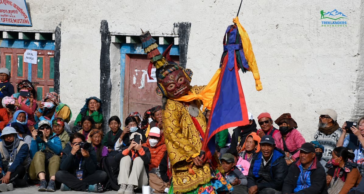
If you can time your visit around it, the Tiji Festival is the single biggest reason to plan a trip to Lo Manthang around a specific date rather than just a season.
Tiji, formally called Tenchi or Tenpa Chirim, means "prayer for world peace" in the local Lo-pa dialect. It is a three-day Tibetan Buddhist festival held annually in Lo Manthang, centered on Choedhe Monastery and the palace courtyard. Monks perform a sequence of masked ritual dances, known as Cham, that reenact the legend of Dorje Jono, an incarnation of the deity Vajrakumara, and his battle against a demon named Ma Tam Ru Ta, who brought drought, disease, and chaos to the kingdom. Dorje Jono's victory restored water and order to the land, and the festival reenacts that story each year as a form of protection for the community, not just as a historical performance.
The tradition traces back to the Vajrakila ritual practice that originated in eighth-century India and reached Tibet through Padmasambhava, the master credited with establishing Buddhism across the Himalayan region. Its formal codification in Mustang, in the version still performed today, is generally traced to the seventeenth century, when Sakya Trizin Ngawang Kunga Sinam was invited to Lo Manthang by the reigning king to perform the ceremony.
Tiji follows the Tibetan lunar calendar, so its Gregorian date shifts every year. It typically falls in May, sometimes stretching into early June, and Choedhe Monastery confirms the exact dates through astrological calculations, usually announced months in advance. If a specific year's festival matters to your trip planning, confirm dates directly rather than relying on the previous year's calendar, since they do not repeat on a fixed schedule.
Watching Tiji means watching something that happens nowhere else. This is not a festival staged for visitors. It is a living ritual performed by a monastic community inside the same walls, the same courtyard, and largely the same choreography that has structured this event for centuries. Trekkers who plan their trip around Tiji generally need to be in Lo Manthang for all three days to see the full sequence of dances, since each day covers a different part of the story.
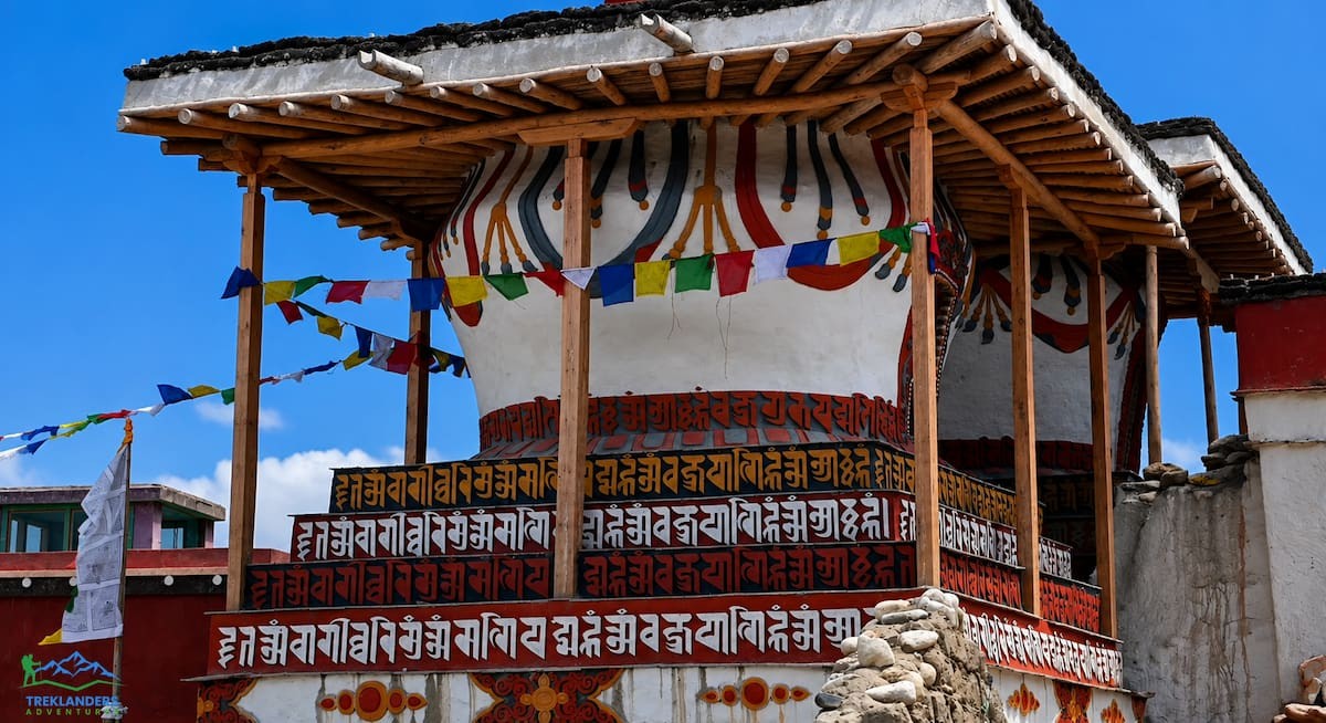
Beyond the main monasteries and the palace, Lo Manthang and the surrounding area hold smaller but no less significant religious markers. Chorten, the Tibetan Buddhist equivalent of stupas, appear at the edges of the city and along trekking routes throughout Upper Mustang, marking sacred ground or commemorating important events and figures. Mani walls, long stone structures carved with Buddhist prayers, line many of the paths in and around the region.
Walking etiquette matters here. Tradition calls for passing chorten and mani walls on the left side, keeping them on your right shoulder as you walk, in a clockwise direction that mirrors the movement used in circumambulating temples and monasteries. Your guide will likely remind you of this, but it helps to know it in advance so you are not learning the custom mid-stride.
Prayer flags, strung between poles, rooftops, and chorten throughout the region, carry mantras that the wind is believed to carry outward with each movement of the fabric. You will see them everywhere in and around Lo Manthang, faded by sun and wind, replaced periodically by families and monasteries as an act of ongoing merit and prayer.
Reaching Lo Manthang means trekking through Upper Mustang, a restricted area that requires more planning than most Nepal treks. You cannot simply show up and start walking.
Most trekkers start by flying from Kathmandu to Pokhara, then Pokhara to Jomsom, a short mountain flight that saves days of walking through the lower Kali Gandaki valley. From Jomsom, the trek north into Upper Mustang typically follows a route through Kagbeni, the last checkpoint before the restricted area begins, then continues through villages including Chele, Syangboche, Ghami, and Charang before reaching Lo Manthang itself. Depending on the itinerary and pace, this stretch takes anywhere from four to six days of walking, with return routes sometimes varying to take in different villages or side trips.
Altitude gain happens gradually along this route, which helps with acclimatization, but you are still trekking at consistently high elevation. Jomsom sits around 2,700 meters, and by the time you reach Lo Manthang you have climbed above 3,800 meters. Most itineraries build in rest days or shorter walking days to manage this gain sensibly, and side trips to places like the Chhoser caves or nearby villages often double as active acclimatization days rather than full rest.
Some travelers choose a jeep route instead of trekking the full distance on foot, particularly for the Tiji Festival, when time constraints make a multi-day trek impractical for shorter trips. A 4WD road now connects much of the route from Jomsom to Lo Manthang, and jeep tours cover the same ground trekkers walk, in a fraction of the time. This tradeoff is worth thinking through before booking. Trekking gives you a slower, more immersive pass through the villages and landscape between Jomsom and Lo Manthang. Jeep travel gets you there and back faster, useful if your schedule is tight or if walking at this altitude and terrain is not something you want to take on.
A typical trekking itinerary breaks the route into manageable daily stages. After the flight into Jomsom, day one usually covers the walk to Kagbeni, a short stretch that lets you settle into the rhythm of the trail and pass through the checkpoint marking the start of the restricted area. From Kagbeni, the days that follow push north through Chele, then Syangboche or Ghiling, climbing steadily through canyon country and small settlements with populations in the dozens rather than the hundreds. Ghami comes next, a village known for one of the longest mani walls in Nepal, followed by Charang, home to a red monastery and the ruins of an old fort perched above the village.
From Charang, most itineraries reach Lo Manthang within a single day's walk, arriving in time to settle into a guesthouse and start exploring the walled city itself. Many trekkers then build in a full rest day in Lo Manthang, using it to visit the palace, the monasteries, and the Chhoser caves without the pressure of also covering trail distance. The return route sometimes retraces the same path and sometimes diverts through different villages, such as Dhakmar or Ghar Gompa, to add variety to the second half of the trip before flying out of Jomsom again.
Upper Mustang requires a restricted-area permit on top of Nepal's standard trekking permits, and regulations require a minimum group size of two foreign trekkers, since solo trekking in the restricted area is not permitted. You also need a licensed, government-registered Nepali guide, and all permits must be processed through a registered trekking agency rather than arranged independently. Treklanders Adventures handles this permit process directly for every Upper Mustang itinerary, since navigating the paperwork independently is not an option under current regulations.
The trek to Lo Manthang is not just a corridor to the destination. The villages along the route hold their own history and are worth slowing down for, even on a tight schedule.
Kagbeni marks the entrance to Upper Mustang, a compact settlement of narrow alleys and a centuries-old monastery, sitting where the Kali Gandaki and Jhong rivers meet. Its position as the last checkpoint before the restricted area has made it a gatekeeper village for as long as trade and pilgrimage have moved through this valley.
Chele and Syangboche sit higher up the trail, small villages that mark the transition from the greener lower Mustang landscape into the fuller desert terrain that defines the region closer to Lo Manthang. Ghami follows, known locally for its mani wall, one of the longest in Nepal, stretching along the trail at the village edge and taking a genuine effort to walk its full length.
Charang holds some of the most significant sites outside Lo Manthang itself. A red-painted monastery dominates the village, alongside the ruins of an old fort that once controlled this stretch of the valley. Some itineraries also route through Ghar Gompa, one of the oldest monasteries in the entire Mustang region, predating even Lo Manthang's founding and tied to the early spread of Buddhism into this part of the Himalaya.
Each of these villages gives you a different piece of the same story: a chain of settlements that grew up around trade, religion, and survival in one of the driest, highest inhabited landscapes on earth. Treating them as stops rather than obstacles changes how the whole trek feels.
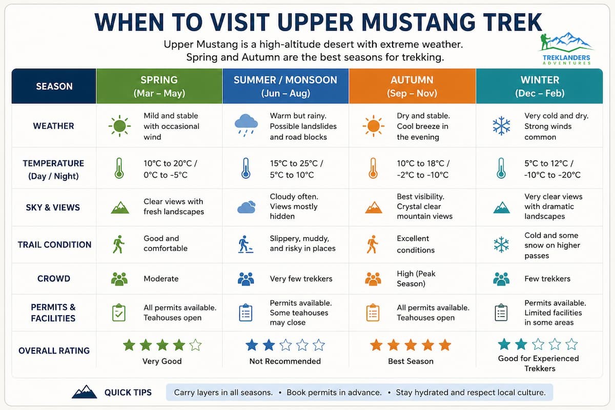
Upper Mustang's dry, rain-shadowed climate changes the usual trekking calendar you might expect elsewhere in Nepal. Because the region sees so little rainfall, the summer monsoon months that make lower-altitude treks miserable with mud and cloud cover barely affect Upper Mustang at all. That makes June through August a viable, even good, window for this specific trek, unlike almost anywhere else in the country.
Spring, running roughly March through May, brings warmer daytime temperatures and clearer mountain views before the winds pick up in earnest. This is also when the Tiji Festival typically falls, so spring trips often combine trekking with the festival if the dates align.
Autumn, September through November, is Nepal's most popular trekking season overall, and Upper Mustang benefits from the same stable weather patterns, with crisp air and strong visibility for the mountain views along the route.
Winter turns harsh here. Temperatures drop well below freezing, particularly at night, and the wind that already rips through the valley every afternoon becomes far more punishing. Some teahouses and services scale back or close entirely during the coldest months, and while Lo Manthang does not become fully inaccessible, winter travel demands serious cold-weather gear and a higher tolerance for discomfort than most trekkers want to sign up for.
Whatever season you choose, expect wind. Almost every account of trekking through Upper Mustang mentions the same pattern: calm mornings that turn into strong, dust-carrying wind by early afternoon. Planning your walking hours around this, starting early and aiming to reach your stop before the wind picks up, makes a noticeable difference in comfort.
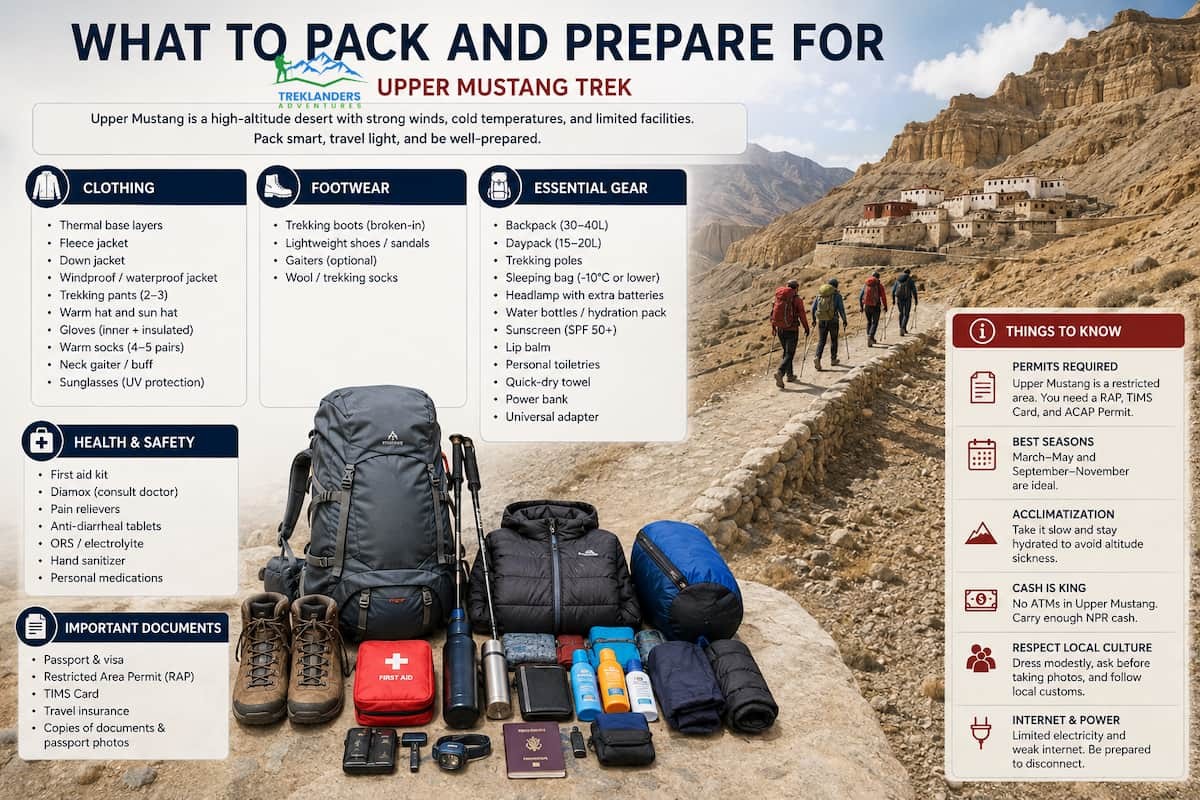
Upper Mustang's high-altitude desert climate demands different preparation than Nepal's greener, wetter trekking regions. Days can be warm in direct sun, especially in spring and summer, while mornings and evenings drop sharply once the sun goes down. Layering matters more here than almost any other gear decision.
A windproof outer layer earns its place in your pack more than almost anywhere else in Nepal, given how consistently strong the afternoon winds get. Dust is a real factor too, kicked up by that same wind across the dry terrain, so a buff or scarf that covers your nose and mouth helps on exposed stretches of trail.
Sun exposure at this altitude is intense, with thin air offering less protection from UV radiation than you might expect. Sunscreen, sunglasses, and a hat are not optional extras. Good broken-in trekking boots matter on the uneven, sometimes rocky trail sections, and given the length of most itineraries, blister prevention is worth taking seriously before you start walking rather than after problems show up.
Altitude sickness is a real consideration above 3,000 meters, and Lo Manthang sits close to 3,840 meters, with some side trips and viewpoints along the route climbing higher still. Build acclimatization days into your itinerary, drink more water than feels necessary, and pay attention to early symptoms like headache, nausea, or unusual fatigue. A guide experienced in this specific region, which any registered Upper Mustang trekking agency should provide, makes a meaningful difference in managing altitude risk safely.
Pack a warm sleeping bag rated for below-freezing temperatures even outside winter, since teahouse rooms this high up rarely have reliable heating overnight. A headlamp, a basic first-aid kit, water purification tablets or a filter, and a portable power bank round out the practical essentials, given how limited electricity and charging access becomes the farther you get from Jomsom.
Lo Manthang is not a preserved historical site frozen for tourism. People live inside these walls, farm the fields outside them, and practice a religion that shapes daily life in ways visible in every lane you walk through. That distinction should guide how you behave as a visitor.
Ask before photographing people, particularly inside monasteries or during religious ceremonies like Tiji. Some sites restrict photography entirely, and your guide can tell you where those lines sit. Dress modestly, especially when entering monasteries, covering shoulders and knees regardless of the season's heat.
Support local businesses directly where you can. Teahouses, guesthouses, and shops inside and around Lo Manthang are largely family-run, and the income from trekkers matters directly to households in a region with limited agricultural output and a short growing season. Buying local crafts, eating at local teahouses rather than only relying on packaged food, and tipping guides and porters fairly all put money directly into the community you are walking through.
Waste management is a genuine concern in a region this remote, where there is no infrastructure to process the trash tourism generates. Carry out what you carry in wherever possible, and choose trekking operators who take this seriously rather than treating it as an afterthought.
Language is another small but meaningful gesture. Learning a handful of Nepali or Loke greetings before you arrive goes a long way in a region where English is a second or third language for most residents. A simple hello or thank you in the local tongue tends to open doors, sometimes literally, that stay closed for visitors who never try.
Lo Manthang faces real pressure from both natural decay and modern development. The 2015 earthquake damaged sections of the palace and several monastery structures, accelerating restoration work that heritage organizations, including groups working with Nepal's National Reconstruction Authority, have carried out in the years since. That work aims to preserve original earthen construction techniques rather than replacing centuries-old materials with modern substitutes, a slower and more difficult process but one that keeps the buildings historically authentic.
Roads represent a different kind of pressure. The same 4WD route that now lets jeep tours reach Lo Manthang in a fraction of the trekking time also changes the character of a region that spent centuries defined by its isolation. Easier access brings more visitors and more income to a historically poor region, but it also brings faster cultural change, more waste to manage, and pressure on infrastructure that was never built for high visitor volumes.
None of this means Lo Manthang is disappearing. The walls still stand, the monasteries remain active, the Tiji Festival still draws the whole community into the palace courtyard each year, and families still live inside the wall much as their ancestors did. But the pace of change here is faster than it has been in centuries, and visiting with that awareness, choosing operators who prioritize sustainable and respectful tourism, and treating the place as a living community rather than a photo backdrop, matters more here than in almost any other Nepal trekking destination.
Most trekking destinations in Nepal sell you mountains. Lo Manthang sells you something different: a working piece of history that never stopped functioning as itself. You are not walking through ruins. You are walking through a capital city that ruled its own kingdom for six centuries, behind walls its own people built, practicing a religion that has structured daily life here since before most European cathedrals were standing.
The trek to get there is demanding, dry, windy, and remote in a way that filters out casual travelers. That filtering is part of what has kept Lo Manthang intact. Few places in the Himalaya, or anywhere, let you stand inside a still-inhabited medieval walled city, watch monks perform a centuries-old ritual dance in a palace courtyard, and sleep in a guesthouse run by a family whose roots in that same valley go back further than most nations' recorded history.
Treklanders Adventures runs guided treks into Upper Mustang built around exactly this kind of access, handling the permits, the guide requirements, and the route planning that a restricted area like this demands. Whatever season or itinerary fits your trip, Lo Manthang rewards the effort it takes to reach it, and it does so on its own terms, not yours.
Compare the Everest Heli Tour vs Base Camp Trek and choose the best Everest experience for your time, fitness, and travel style.
Explore Nepal’s UNESCO World Heritage Sites, from ancient temples and sacred Lumbini to Chitwan’s wildlife and the spectacular Everest region.
Discover how solo female trekkers can explore Nepal safely with practical advice on guides, permits, altitude, preparation, and trail safety.



