
Private Trek vs Group Trek in Nepal: Flexibility and Which One Fits You
13 Aug 2026
Choosing between a private and group trek in Nepal depends on flexibility, pace, budget, and travel style. Compare both to find your best fit.

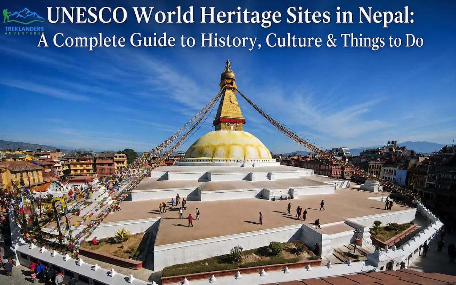
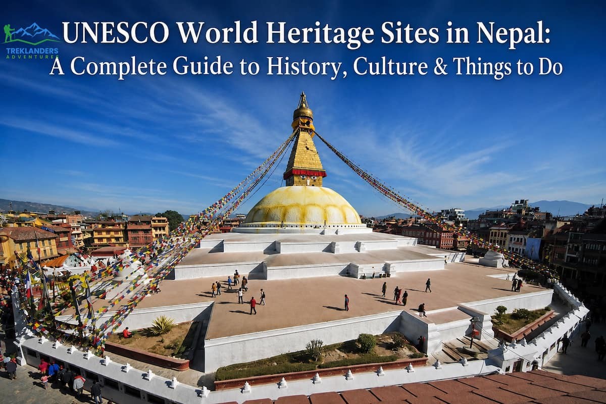
Nepal packs four UNESCO World Heritage Sites into a country smaller than Illinois. Two are cultural. The two are natural. Together they cover a 5th-century stupa, a jungle full of one-horned rhinos, the birthplace of the Buddha, and the highest mountain on earth. You can visit all four without crossing a single international border.
This guide breaks the sites down by cluster, the way you would actually plan a trip. The Kathmandu Valley holds seven separate monument zones under one UNESCO listing. Lumbini stands alone in western Terai. Chitwan National Park sits in the subtropical lowlands. Sagarmatha National Park climbs from pine forest to the roof of the world. Each section covers what the site actually is, how it earned UNESCO status, and what you do once you get there.
Most first-time visitors assume Nepal's heritage sites all sit in Kathmandu. That assumption costs people a full third of what the country actually protects. Chitwan and Sagarmatha alone cover ecosystems most travelers never associate with Nepal at all, from rhino-filled river grassland to alpine terrain above the tree line. Treat all four sites as one connected trip and you get a far more complete picture of the country than a valley-only itinerary ever could.
UNESCO inscribes a site when it holds "outstanding universal value," meaning its importance goes beyond national borders. Nepal joined the World Heritage Convention in 1978, and by 1979 it had two sites on the list already: Kathmandu Valley and Sagarmatha National Park. Chitwan followed the same year. Lumbini joined in 1997 after archaeological excavation confirmed it as the Buddha's birthplace.
Each site falls into one of two categories. Cultural sites protect human-made heritage: temples, palaces, monuments, and the traditions tied to them. Natural sites protect ecosystems, wildlife habitats, and geological features. Nepal's four sites split evenly between the two, with the Kathmandu Valley and Lumbini listed as cultural sites, and Chitwan and Sagarmatha listed as natural sites.
Inscription is not permanent protection on its own. UNESCO requires each member state to maintain a management plan and report on site conservation, and a site can be moved to the List of World Heritage in Danger if that protection slips, as happened briefly with the Kathmandu Valley in the 2000s. That accountability is part of why UNESCO status carries weight beyond tourism marketing. It comes with an ongoing obligation, not a one-time award.
The Kathmandu Valley World Heritage Site is not one location. It is seven separate monument zones scattered across Kathmandu, Lalitpur, and Bhaktapur districts, all inscribed together in 1979. UNESCO grouped them because they represent the peak of Newar architecture and urban planning, developed over more than a thousand years under the Licchavi, Malla, and early Shah dynasties.
The valley sat on a major trade route between India and Tibet for centuries. That position brought wealth, and the Malla kings who ruled the valley from the 12th to the 18th century spent it on temples, palaces, and public squares. Three rival Malla kingdoms, Kathmandu, Patan, and Bhaktapur, competed to build the most impressive Durbar square in their own capital. That rivalry is why you get three separate palace complexes instead of one.
The 2015 Gorkha earthquake damaged large sections of all three durbar squares. Reconstruction has restored most major structures using traditional building techniques, though you will still see scaffolding and rebuilding work in progress at some temples.
The pagoda style itself, tiered roofs stacked in decreasing size with wide eaves and carved wooden struts, originated in the Kathmandu Valley before spreading to Tibet, China, and eventually Japan. A Newar architect named Araniko is credited with carrying the design north into Tibet and the Yuan court in the 13th century, which makes the valley the origin point for a roof style now associated more commonly with East Asia than with Nepal. Standing in front of any of the three durbar squares, you are looking at the source material, not a regional variation.
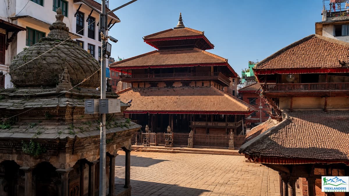
Kathmandu Durbar Square sits in the old city center, a short walk from Thamel. It was the royal palace complex of the Kathmandu Malla kings and later the early Shah kings after the 1768 unification of Nepal. Kings were crowned here, and the tradition continued until 2008, when Nepal abolished its monarchy.
The square holds around 50 structures packed into a compact area, including the nine-story Basantapur Tower, the Kumari Ghar where Nepal's living goddess resides, and the Kasthamandap pavilion, which locals say gave Kathmandu its name. The Kasthamandap collapsed in the 2015 earthquake and has since been rebuilt using its original 12th-century timber-joint techniques, without a single nail.
Walk the square slowly and you will notice the mix of Hindu and Buddhist iconography on the same buildings. The Malla kings patronized both religions, and Newar architecture blends them without much separation. Stop at the Hanuman Dhoka palace museum to see royal artifacts, and look up at the Kal Bhairav statue, an 11-foot stone carving of Shiva's fierce form that locals once used to swear oaths, since lying in front of it was believed to bring instant punishment.
Visit early morning, around 7 to 8 AM, to watch vendors set up marigold and incense stalls before the tour groups arrive. The square functions as a public space, not a museum. Locals cross through it on their way to work, kids play cricket in open corners, and pigeons scatter off the pagoda roofs on cue.
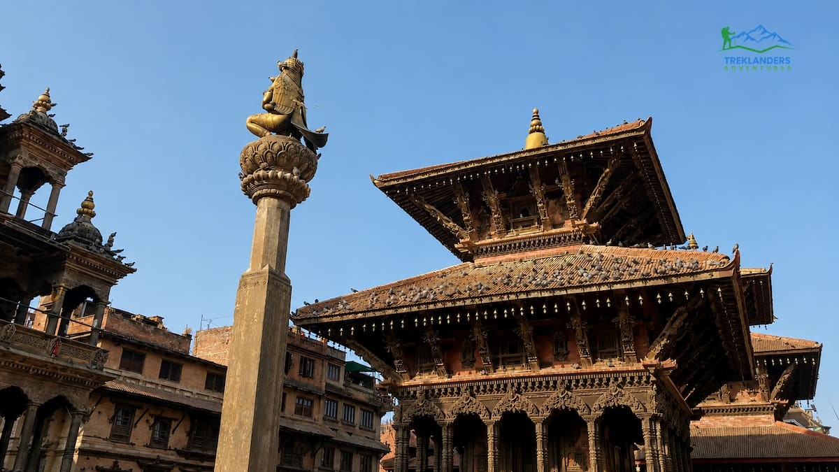
Patan sits across the Bagmati River from Kathmandu, in what is now Lalitpur. Locals call it the city of fine arts, and the durbar square backs that up. Patan's Malla kings built a palace complex denser with intricate wood and metal work than either of the other two squares, and the tradition of Newar craftsmanship is still visible in the workshops surrounding the square today.
The Krishna Mandir stands out immediately. Built entirely from stone in the 17th century, a rare material choice in a valley that mostly built in brick and timber, its 21 golden pinnacles catch the light differently depending on the hour. The temple's outer walls carry carved scenes from the Mahabharata and Ramayana, detailed enough that you could spend an hour just reading the story panels.
The Patan Museum, housed inside the old palace, ranks among the best-curated museums in South Asia. It walks you through Newar bronze casting, repoussé metalwork, and religious iconography with English descriptions that actually explain the symbolism instead of just labeling objects. Budget at least 90 minutes if you want to read through it properly.
After the square, walk into the surrounding alleys. Patan is still home to working metal and stone artisans, many from families who have practiced the same craft for generations. You can watch bronze statues being cast using the lost-wax method in small courtyard workshops a few minutes from the main square.
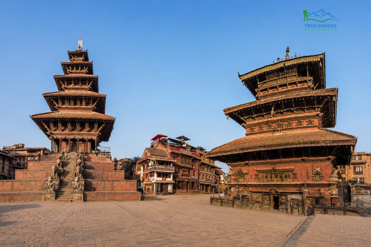
Bhaktapur feels different from the moment you walk in. The city charges an entry fee at its edges specifically to fund preservation, and that funding shows. Bhaktapur has restored its brick streets, wood-carved windows, and pottery squares more completely than Kathmandu or Patan, and traffic restrictions keep most vehicles out of the old city core.
The 55-Window Palace anchors the square, named for the ornately carved wooden windows along its facade. Next to it stands the Golden Gate, considered one of the finest pieces of metal artistry in the valley, its gilded copper panels showing Hindu deities in relief work fine enough to see individual strands of hair on the carved figures.
Nyatapola Temple is Bhaktapur's signature structure. At five stories and roughly 30 meters, it is the tallest pagoda-style temple in Nepal, and it survived the 2015 earthquake with minimal damage, a fact locals point to as proof of Newar earthquake engineering. Climb to the temple's base for a wide view over the square's terracotta rooftops.
Walk fifteen minutes toward Potters' Square and you will find rows of clay pots drying in the sun, exactly as the neighborhood has operated for centuries. Bhaktapur also makes juju dhau, a thick, caramelized yogurt served in clay cups, sold from small stalls throughout the old city. Try it fresh rather than from a tourist-facing restaurant menu, the stall versions taste noticeably better.
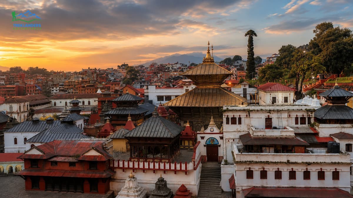
Pashupatinath sits on the banks of the Bagmati River on Kathmandu's eastern edge, and it holds a different status from the other monument zones. It is one of the most sacred Hindu temples in the world dedicated to Shiva, and it functions as an active cremation site, not a historical monument you observe from a distance.
Non-Hindus cannot enter the main temple's inner sanctum, a restriction the temple enforces strictly. You can, however, view the pagoda-roofed main temple from across the river, and you can walk freely through the surrounding temple complex, which includes over 500 smaller shrines, statues, and structures spread across both riverbanks.
The cremation ghats along the river operate daily, and watching them requires a shift in how you approach the site. This is not a tourist attraction in the conventional sense. Families conduct funeral rites in public view, following a tradition where cremation by the sacred river is believed to aid the soul's release. Stand on the opposite bank if you want to observe respectfully, keep conversation quiet, and avoid photographing grieving families directly.
Sadhus, Hindu holy men who have renounced worldly life, gather around the temple complex, some in elaborate face paint and orange robes. Many pose for photos in exchange for a small donation, which is a fair transaction if you want the photo, but do not photograph them without asking first.
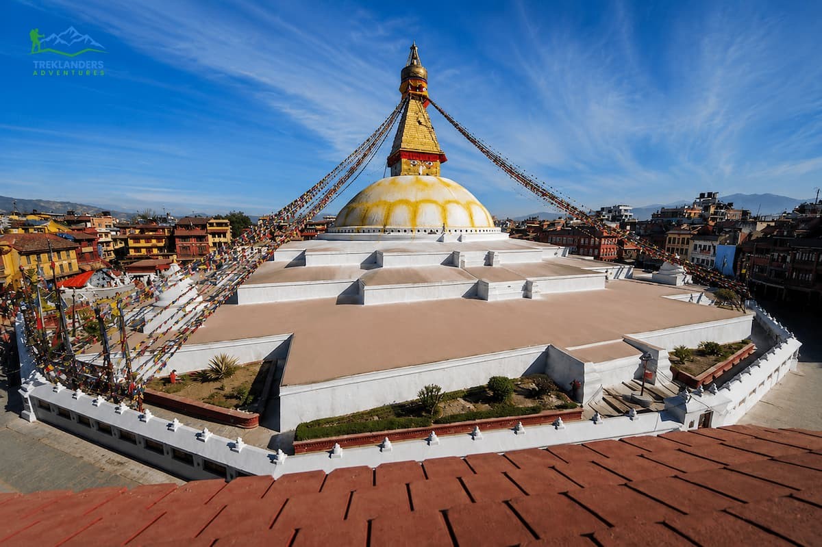
Boudhanath is the largest stupa in Nepal and one of the largest in the world, with a base spanning 100 meters in diameter. Built sometime in the 14th century on an earlier structure believed to date to the 5th century, it sits along the old trade route between Kathmandu and Tibet, which explains why it became a major center for Tibetan Buddhism.
The stupa's white dome and gold spire, painted with the watchful eyes of the Buddha on all four sides, dominate the surrounding neighborhood both physically and culturally. After 1959, Tibetan refugees settled around Boudhanath in large numbers, and the area now holds one of the largest concentrations of Tibetan monasteries outside Tibet itself.
Walking the kora, the circular path around the stupa's base, is the standard way to experience the site. Buddhist tradition holds that you walk clockwise, spinning the prayer wheels set into the stupa's base as you pass. Locals do this daily as a devotional practice, not a tourist activity, so match their pace and direction rather than cutting across.
Visit at dusk if you can. Butter lamps get lit around the stupa's base, monks in maroon robes filter out of the surrounding monasteries for evening prayers, and the whole plaza takes on a different atmosphere than the daytime crowds. Several rooftop cafes ring the stupa and give you an elevated view for watching the kora from above.
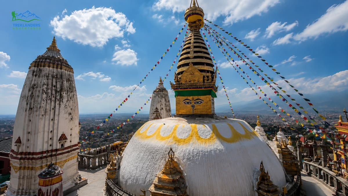
Swayambhunath sits on a hilltop west of central Kathmandu, and English-speaking visitors often call it the Monkey Temple, for the rhesus macaques that live around the grounds in large numbers. The stupa's origins go back roughly 1,500 years, and Buddhist tradition holds it as one of the oldest religious sites in the valley, predating much of what surrounds it today.
You reach the main stupa by climbing 365 stone steps from the eastern entrance, one for each day of the year according to local explanation, though a road also leads to the western side if you want to skip the climb. The steps themselves are lined with stone carvings, prayer wheels, and small shrines, so the ascent is part of the experience rather than just a means to reach the top.
The stupa's design mirrors Boudhanath, with the painted Buddha eyes on its central spire, but Swayambhunath's hilltop position gives it something the valley-floor sites cannot match: a full panoramic view over Kathmandu. On a clear day, you can see the Himalayan range in the distance beyond the haze that usually sits over the city.
The site mixes Buddhist and Hindu shrines throughout the complex, a pattern consistent with the valley's broader religious blending. Watch your belongings around the monkeys, they are used to visitors and will grab food, sunglasses, or anything left within reach.
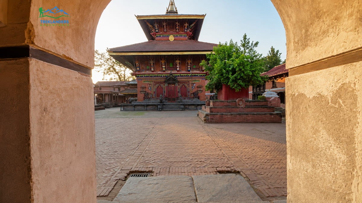
Changu Narayan is the least visited of the seven monument zones, and that is part of its appeal. Sitting on a forested hilltop northeast of Bhaktapur, it holds Nepal's oldest surviving temple structure, with an inscription dated to 464 CE, making it more than a millennium older than most other valley monuments.
The temple is dedicated to Vishnu and its current structure, rebuilt after a fire in the 1700s, still preserves stone and metal artwork from far earlier periods. The complex houses some of the finest stone sculpture in the valley, including a 5th-century stone inscription considered the oldest in Nepal, and detailed Licchavi-era carvings that predate the Malla dynasty's more famous work in the other durbar squares.
Because tour groups rarely make the trip out, you get a quieter, slower visit here compared to the other monument zones. The temple courtyard is small enough to see thoroughly in under an hour, and the surrounding hilltop offers a short, easy walk with views over the eastern valley.
Combine Changu Narayan with a visit to nearby Bhaktapur, the two sit close enough together to see in the same day, and the contrast between Changu Narayan's quiet hilltop and Bhaktapur's active old city makes for a good pairing.
UNESCO's own description of the Kathmandu Valley calls out something most cultural heritage listings do not deal with: the sites are still in active daily use. Pashupatinath still holds cremations every day. Boudhanath's kora still fills with monks and locals during evening prayer. Kathmandu Durbar Square still functions as a public thoroughfare where people commute, shop, and gather, not a roped-off exhibit.
That living status cuts both ways. It is what makes the valley feel different from a preserved-in-amber historical site, since you are moving through spaces that carry the same religious and civic weight they held centuries ago. It also means the valley faces constant pressure from modern development, traffic, and population growth pressing against monument zones that were never designed for 21st-century density. UNESCO placed the valley on its List of World Heritage in Danger between 2003 and 2007 over concerns about unregulated construction encroaching on protected zones, a status lifted only after Nepal tightened building regulations around the monument areas.
Understanding that tension helps explain what you see on the ground: a carved 17th-century window next to a modern concrete building, a sacred cremation ghat within view of city traffic. The valley was never meant to be frozen. It was built to keep functioning, and it still does.
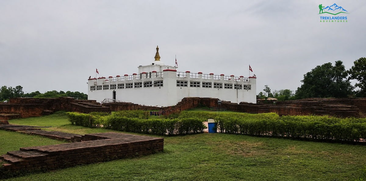
Lumbini sits in Nepal's western Terai region, close to the Indian border, a full day's drive or a short flight from Kathmandu. It holds a different kind of significance from the valley's monument zones. This is the confirmed birthplace of Siddhartha Gautama, who became the Buddha, and the site draws Buddhist pilgrims from across Asia alongside general visitors.
Archaeological excavation at the Maya Devi Temple confirmed the birth site through a marker stone dated to the 3rd century BCE, placed by Emperor Ashoka when he visited Lumbini around 249 BCE. Ashoka also erected a sandstone pillar nearby, still standing today, with an inscription in Brahmi script recording his visit and confirming Lumbini as the Buddha's birthplace. That pillar is one of the most important archaeological artifacts in South Asian history, predating almost every other structure in Nepal by centuries.
The Maya Devi Temple itself protects the exact excavated brick structures believed to mark the birth spot, viewable through a raised walkway inside the temple. Next to it sits the sacred pond, where tradition holds that Maya Devi bathed before giving birth, and the Bodhi tree, where monks and pilgrims sit in quiet meditation throughout the day.
Beyond the core archaeological site, Lumbini spreads into a larger development zone designed by Japanese architect Kenzo Tange in the 1970s. The plan organized the area into an eastern monastic zone for Theravada Buddhist countries and a western zone for Mahayana and Vajrayana traditions. Walking through both zones, you pass monasteries built by Myanmar, Thailand, Sri Lanka, China, Japan, Korea, Vietnam, Cambodia, Germany, and France, each constructed in that country's own architectural style. The German monastery looks nothing like the Thai one two hundred meters away, and that contrast is worth the walk on its own.
The World Peace Pagoda sits at the northern end of the site, a white stupa built by Japanese Buddhist organizations, and the walk out to it takes you past a canal lined with monasteries reflected in the water. Rent a bicycle if you want to cover the full site without exhausting yourself, the monastic zone spans several kilometers and the heat in the Terai gets intense by midday.
Lumbini works best as an overnight stop rather than a rushed day trip. The core sites take a few hours, but the surrounding monasteries reward slower exploration, and several offer meditation sessions open to visitors who ask in advance.
The archaeology behind Lumbini's UNESCO status deserves more attention than most guides give it. British archaeologist Alois Anton Führer identified the Ashoka pillar in 1896, but the exact birth spot inside the Maya Devi Temple was not confirmed until a 1996 to 2003 excavation led by archaeologist Robin Coningham uncovered a series of brick structures beneath the temple, one layer dating to the 6th century BCE. That timeline lines up with the historical estimates for the Buddha's birth and gave UNESCO the physical evidence to support Lumbini's inscription in 1997. Very few religious birthplaces anywhere in the world carry this level of archaeological confirmation, which is part of why Lumbini draws serious historians and researchers alongside pilgrims.
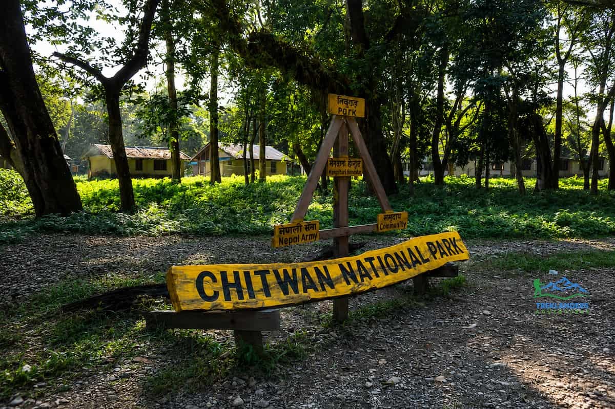
Chitwan National Park covers roughly 950 square kilometers of subtropical forest, grassland, and river system in Nepal's central Terai, and it was Nepal's first national park, established in 1973. UNESCO inscribed it in 1984 for its role protecting some of the last habitat for several endangered species in South Asia.
The park's location matters. Chitwan sits in the Terai lowlands, a completely different ecosystem from the mountains most visitors associate with Nepal. Elevation here runs close to sea level, temperatures stay warm year-round, and the landscape is dense sal forest cut through by the Rapti, Reu, and Narayani rivers.
Chitwan protects one of the largest populations of greater one-horned rhinoceros outside Kaziranga in India, along with an estimated 128 Bengal tigers as of the most recent national count, one of the higher tiger densities in South Asia. Both species were pushed close to extinction by poaching in past decades, and Chitwan's conservation program, including armed anti-poaching patrols and community-based tourism revenue sharing, has helped both populations recover.
Beyond rhinos and tigers, the park holds over 68 species of mammals and more than 540 recorded bird species, making it one of the most significant birding destinations in South Asia. Gharial and mugger crocodiles inhabit the rivers, along with wild elephants, sloth bears, and four species of deer.
A jeep safari is the standard way to see the park's interior, typically run in morning and afternoon sessions when animals are most active. Canoe trips along the Rapti River give a lower, quieter vantage point, good for spotting crocodiles basking on the banks and birds along the treeline. Guided jungle walks, always with an armed park guide, let you track animal signs on foot and get closer to the forest floor than a jeep allows, though walks come with real risk around rhinos and should never be attempted without a trained guide.
The buffer zone around Chitwan is home to the Tharu community, an indigenous ethnic group with a distinct culture shaped by centuries of living alongside the jungle. Many lodges around the park are run by Tharu families, and cultural programs showing traditional stick dance performances are common in the evenings. Staying in a community-run lodge rather than a large resort puts more tourism revenue directly into local conservation and livelihood programs.
Visit between October and March for the most comfortable weather and best wildlife visibility, when tall grasses get cut back after the monsoon and animals are easier to spot. April and May bring intense heat but also drive animals toward rivers and waterholes, concentrating wildlife sightings if you can handle the temperature.
Chitwan's recovery is one of the better conservation stories in South Asia, and it is worth knowing before you go. Rhino numbers in the park dropped below 100 individuals during the poaching crisis of the late 1990s and 2000s, driven by demand for rhino horn in traditional medicine markets across East Asia. Nepal responded by deploying army battalions specifically for anti-poaching patrol inside the park, a measure still in place today, and by building revenue-sharing agreements that route a share of park income back into buffer zone communities. The result: Nepal has had multiple full calendar years with zero rhino poaching recorded in Chitwan, and the national rhino population has climbed past 700 across all protected areas. Tigers followed a similar pattern, with Nepal setting a national goal to double its tiger population and largely meeting it well ahead of the original 2022 target shared across tiger-range countries.
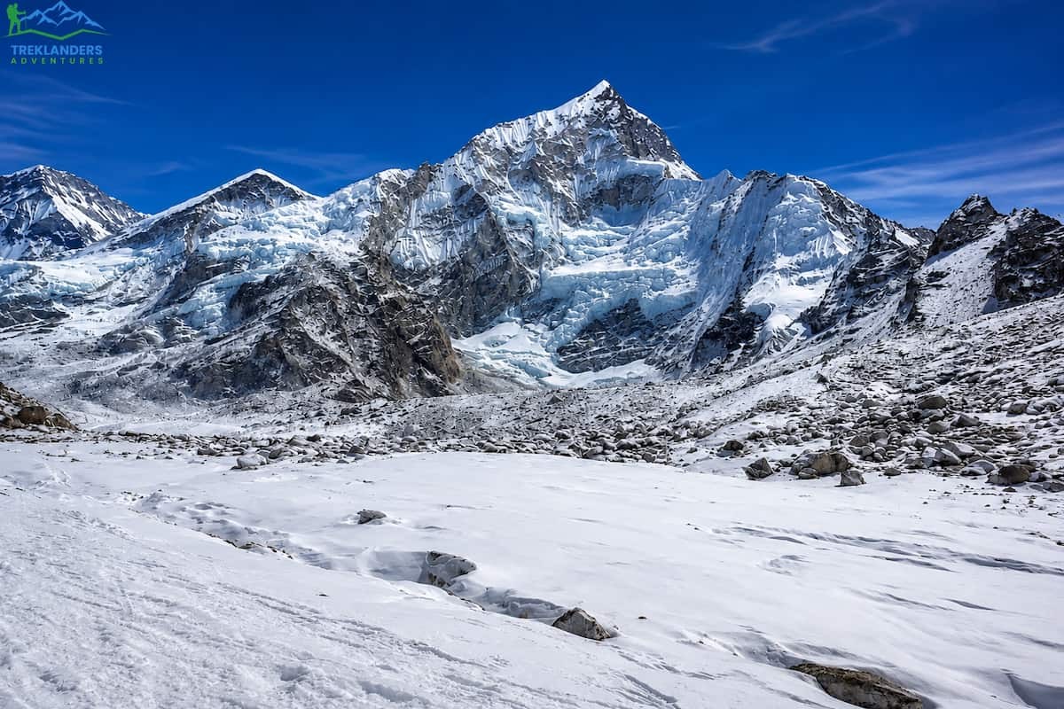
Sagarmatha National Park covers 1,148 square kilometers in the Khumbu region of northeastern Nepal, named for the Nepali word for Mount Everest. Established in 1976 and inscribed by UNESCO in 1979, it protects the ecosystem surrounding the world's highest peak, along with several other 8,000-meter and 7,000-meter mountains within its boundaries.
The park's elevation ranges from around 2,800 meters at its entrance near Monjo up to 8,848 meters at the Everest summit, giving it one of the widest elevation ranges of any protected area on earth. That range creates distinct ecological zones as you climb: pine and hemlock forest at lower elevations, giving way to birch and rhododendron, then alpine scrub, and finally bare rock and permanent snow above 5,000 meters.
Wildlife in the park has adapted to extreme altitude and cold. Snow leopards inhabit the higher zones, though sightings are rare given their elusive nature and low population density. Himalayan tahr, musk deer, and red panda live in the forested lower elevations, while lammergeiers and Himalayan griffons soar the thermals above the valleys. The snow leopard's status as a near-threatened species makes the park's protection significant beyond Nepal's borders, since the cat's range spans several Himalayan and Central Asian countries.
The park is also home to the Sherpa people, whose culture and Buddhist practice are woven into daily life throughout the Khumbu. Sherpa villages like Namche Bazaar, Khumjung, and Tengboche sit inside the park boundaries, and several important Buddhist monasteries, including Tengboche Monastery, function as both religious centers and cultural landmarks for trekkers passing through.
Most visitors experience Sagarmatha through trekking rather than any single point of entry. The Everest Base Camp trek is the most common route, typically taking 12 to 14 days round trip from Lukla, passing through Namche Bazaar, Tengboche, Dingboche, and Gorak Shep before reaching base camp at 5,364 meters. Shorter routes exist too, including treks to Everest View Hotel or Namche Bazaar itself for visitors who want a taste of the Khumbu without committing to the full base camp trek.
Namche Bazaar functions as the region's main hub, a market town built into a natural amphitheater in the hillside, with a Saturday market that has served as a trading point between Tibet and Nepal for centuries. It is also the last major point to acclimatize before pushing higher, and most itineraries build in an extra day here specifically for altitude adjustment.
Altitude is the defining factor for any visit to Sagarmatha. Above 3,000 meters, altitude sickness becomes a real risk, and proper acclimatization schedules matter more than trekking pace or fitness level. A well-planned itinerary gains elevation gradually, includes rest days at key points, and never pushes daily altitude gain much beyond 500 meters once above 3,000 meters.
The park's connection to mountaineering history runs alongside its conservation status. Tenzing Norgay, the Sherpa climber who summited Everest with Edmund Hillary in 1953, was born in the Khumbu region the park now protects, and Sherpa guides and climbers from these same villages have supported the vast majority of Everest expeditions since. The Sherpa Culture Museum in Namche Bazaar and the Tenzing-Hillary Everest Marathon, which finishes in Namche each May, both trace back to that history. Sagarmatha's UNESCO listing protects the physical landscape, but it sits inside a living mountaineering tradition that predates the park's official designation by decades.
Beyond the four inscribed sites, Nepal has submitted several additional locations to UNESCO's Tentative List, the step a country takes before formally nominating a site for full inscription. None of these currently carry World Heritage status, but they signal where Nepal's heritage protection is headed and they make worthwhile stops if you have already covered the four confirmed sites.
Ramagrama Stupa, also in the Lumbini region, is believed to hold one of the original relics of the Buddha and remains one of the few Buddhist relic stupas never opened or disturbed since ancient times. Panauti, a Newar town southeast of Kathmandu, preserves a medieval townscape and temple architecture comparable to Bhaktapur but almost entirely free of tourist infrastructure. The Tilaurakot archaeological site, also near Lumbini, is identified by many historians as the ruins of ancient Kapilavastu, the palace city where the Buddha spent his early life before renouncing it.
Nepal has also proposed a serial nomination covering several of its high-altitude protected areas beyond Sagarmatha, including sections of the Annapurna and Manaslu Conservation Areas, recognizing the broader Himalayan ecosystem's ecological and cultural value. None of these tentative sites have a confirmed inscription timeline, and the review process for full World Heritage status typically takes years once a formal nomination is submitted. Still, visiting Panauti or Tilaurakot now gets you an unfiltered version of what Kathmandu Durbar Square or Lumbini might have felt like before either site saw regular tourist traffic.
Seeing all four UNESCO sites in one trip is possible, but it requires planning around Nepal's geography, since the sites sit in three different regions with different terrain and climate.
The Kathmandu Valley sites work well together since they sit within a 20-kilometer radius of each other. You can realistically see all seven monument zones in three to four days, moving between Kathmandu, Patan, and Bhaktapur, with Changu Narayan added as a half-day trip from Bhaktapur.
Lumbini requires a separate leg, either a 25-minute flight from Kathmandu to Bhairahawa followed by a short drive, or a full day's road journey. Most visitors treat Lumbini as a one-to-two-night stop rather than a day trip given the travel time involved.
Chitwan sits along the main highway route between Kathmandu and Lumbini, which makes it easy to combine both in a single loop. A common routing runs Kathmandu to Chitwan by road, Chitwan to Lumbini by road, then a flight back to Kathmandu from Bhairahawa, cutting total travel time significantly compared to backtracking overland.
Sagarmatha requires the most separate planning, since reaching the Khumbu means flying into Lukla and trekking in, a commitment of at least a week for even a shortened itinerary. Weather at Lukla frequently delays flights, so build buffer days into any schedule that includes Sagarmatha, particularly if you have an international flight booked immediately after.
A realistic order for covering all four sites in one extended trip starts with three to four days in the Kathmandu Valley to acclimatize to the country and adjust to the time difference, followed by a flight into Lukla for the Sagarmatha trek while your schedule still has flexibility to absorb weather delays. Save Chitwan and Lumbini for the back half of the trip, after the trek, when a few days of lower-altitude, slower-paced travel through jungle and archaeological sites works as a natural wind-down before flying home. Running the trek first also means any Lukla delay affects the earlier part of your itinerary, where the valley sites give you flexible, weather-independent options to fill extra days.
Best timing for the country as a whole runs October through November and March through April, when skies are clearest for mountain visibility and temperatures are manageable across all four regions. Monsoon season, June through September, brings heavy rain to the valley and Terai and obscures mountain views entirely in the Khumbu, though it is also when the valley's temples feel least crowded if avoiding tourist groups matters more to you than clear weather.
Whichever combination of sites you choose, moving slowly through each one gets you more than rushing between all four in a short window. A packed checklist trip leaves you with photos and little else. A slower trip leaves you with an actual sense of how these places fit into daily life in Nepal, which is the whole point of visiting a living heritage site instead of a museum. The Kathmandu Valley alone holds enough carved stone, temple courtyards, and living tradition to fill a week if you let it, and the same goes for a proper trek through Sagarmatha or a few unhurried days tracking wildlife in Chitwan. Nepal's UNESCO sites were not built to be checked off a list. They were built to be lived in, worshipped in, and walked through, and the ones still standing today have survived exactly because people kept doing all three.
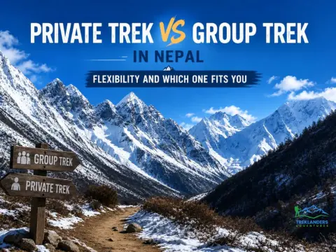
Choosing between a private and group trek in Nepal depends on flexibility, pace, budget, and travel style. Compare both to find your best fit.
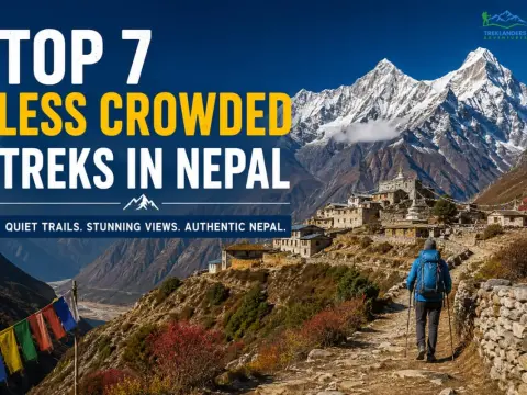
Discover 7 less crowded treks in Nepal with quiet trails, stunning Himalayan views, remote villages, and authentic experiences away from the crowds.
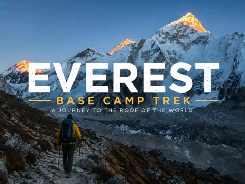
Compare the Everest Heli Tour vs Base Camp Trek and choose the best Everest experience for your time, fitness, and travel style.



