
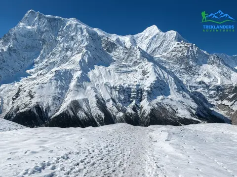
Gokyo Ri vs Kala Patthar: Which Has the Best Everest View in Nepal?
8 Jun 2026
Compare Gokyo Ri and Kala Patthar for the best Everest views and Himalayan trekking experience.
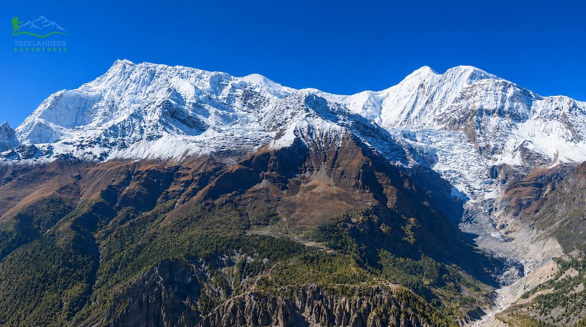
The Annapurna Circuit Trek is well known for its dramatic changes. Along the way, hikers pass through subtropical forests, climb into alpine woodlands, and finally reach a high-altitude desert. Manang is a big town that marks this change. It is a high-altitude settlement at 3,540 meters (11,614 feet) above sea level. The town is located in the wide valley of the Marshyangdi River, right north of the Annapurna mountain range. For Treklanders.com readers, Manang is not just a geographical landmark but also the cultural center.
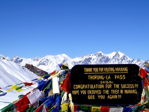
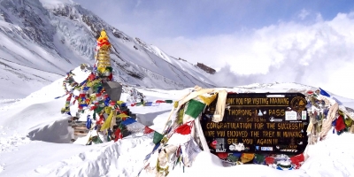
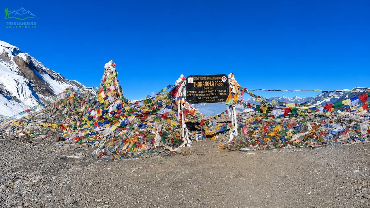
Historically, this small town was a refuge for trans-Himalayan traders, pilgrims, and mountaineers. Nowadays, it's the most essential acclimatization station on the whole of Annapurna Circuit. The body must adapt to the thin air before attempting the crossing of Thorong La Pass at 5,416 meters.
Manang is far more than just a stopover. Here, beautifully preserved Tibetan Buddhist ways of life are adjacent to the harshness of nature. The town is characterized by stone houses, ancient monasteries, and prayer flags waving in the wind against the backdrop of snow-covered peaks. This piece aims to be your go-to source for everything you need to know about Manang, the crowning glory of the Annapurna area.
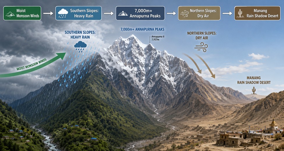
The surrounding nature of Manang is a reflection of its geographical position, being located in the northern-central part of Nepal under Gandaki Province and in the rain shadow area of the Annapurna mountain range. In fact, this place controls the morphology, weather, and way of life of the whole valley.
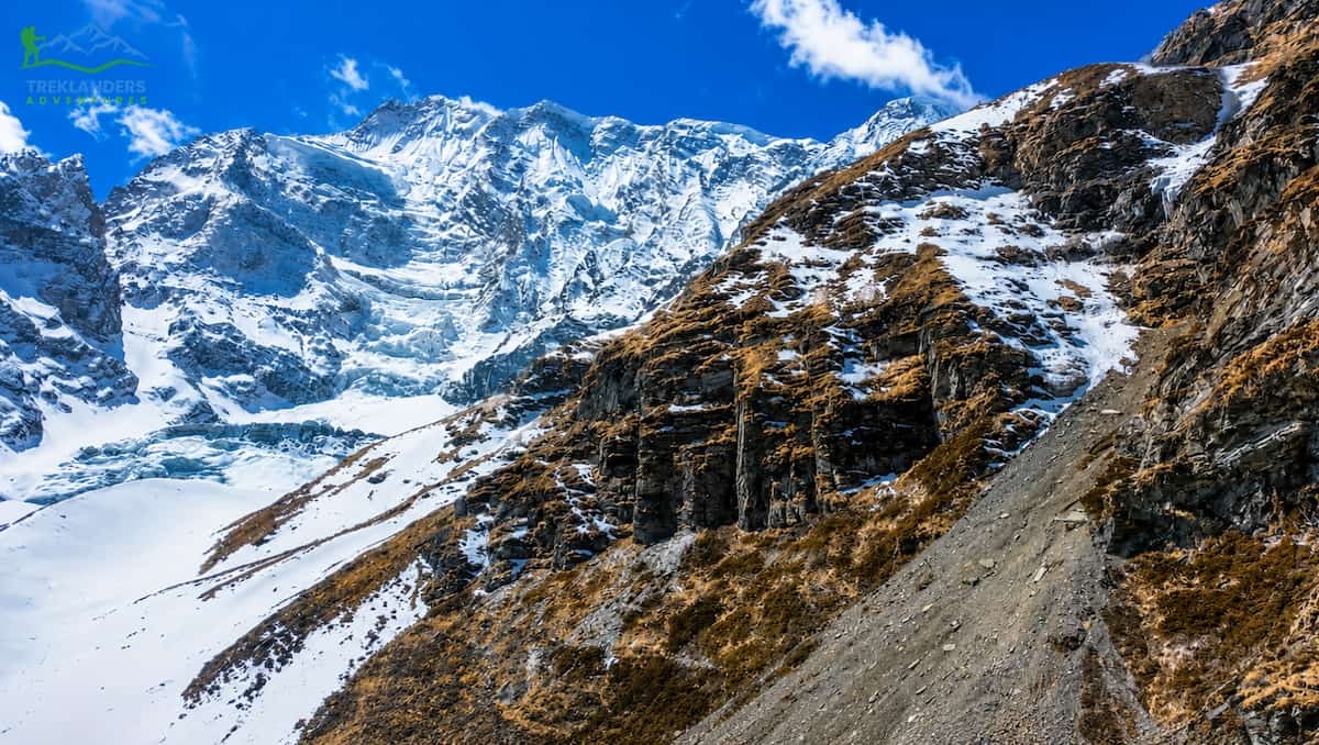
Several peaks of the Annapurna massif rise above 7 and 8 thousand meters. These colossal mountains create a barrier that prevents the wet monsoon winds coming north from the Bay of Bengal from passing. Winds of warm and moisture-laden clouds, when forced up against the mountain slopes in the south, cool down quickly and give heavy rain to the valleys like those of Pokhara and Ghandruk.
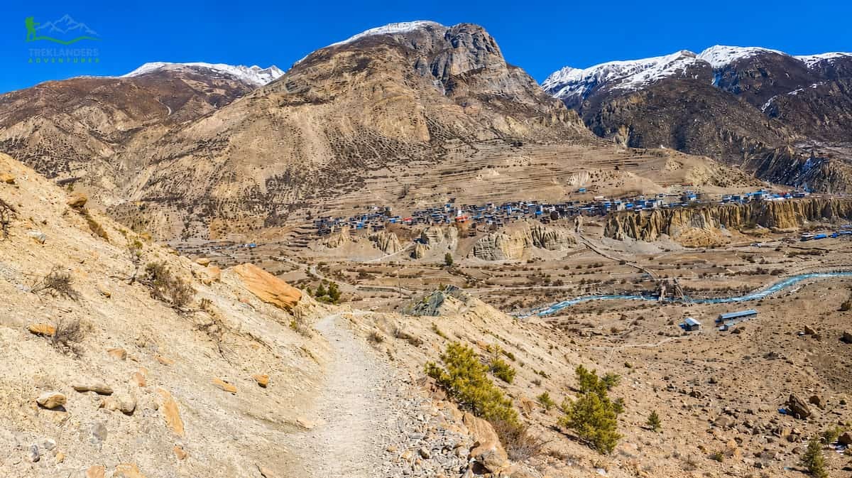
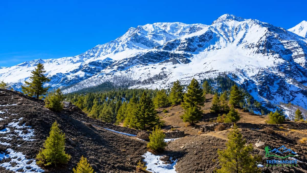
As the air masses cross over the mountain ridges and drop into the Manang Valley, the moisture they carried is almost completely gone. Due to this rain shadow, Upper Manang is a dry high-altitude desert. This stark difference is very evident while doing the Annapurna Circuit trek. Sooner than expected, one leaves behind the waterfalls and dense forests of Dharapani and Chame and steps into a world of sheer cliffs, dusty scree slopes, and weathered rock that one can hardly recognize.
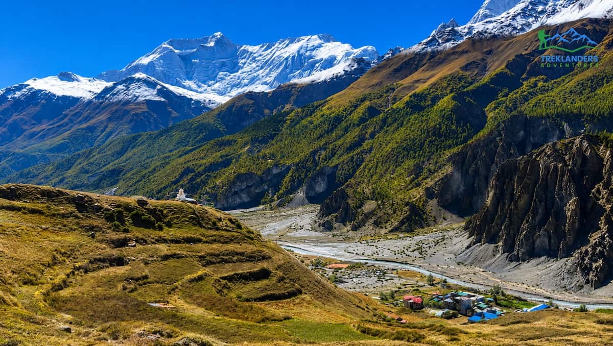
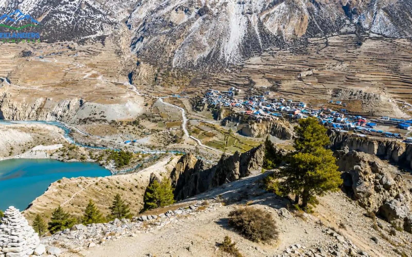
Perched on a broad glaciated shelf, Manang village offers a spectacular view of the Marshyangdi River. This river is mainly fed by the melted ice from the glaciers of Tilicho Peak, Thorong Peak, and the Chulu range. The river flows toward the east, forming a deep gorge; this gorge is the natural path or "highway" for the lower section of the trek.
The rarefied atmosphere at an altitude of 3,540 meters affects the local plant life. Around Upper Pisang village, the majestic pine, fir, and maple forests vanish one after the other. Near Manang, the plant life consists primarily of low juniper bushes, robust alpine grasses, and dwarf scrubs. This rather bare landscape offers great, unobstructed vistas of the surrounding high mountains.
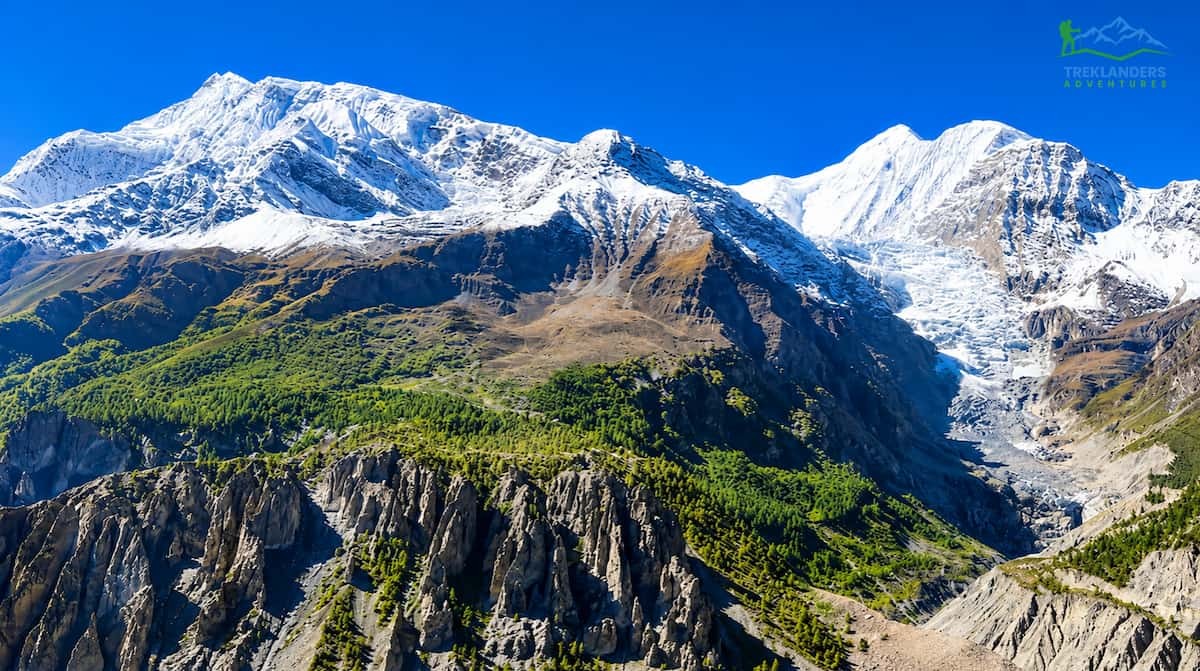
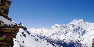
The view from Manang village is dominated by a semi-circle of snow-covered peaks. These mountains are not distant outlines on the horizon. They form an immediate, vertical wall that rises directly above the valley floor.
| Mountain Peak | Elevation (Meters) | Elevation (Feet) | Prominent Visual Features |
| Annapurna II | 7,937 m | 26,040 ft | Ridged eastern anchor of the massif; visible down-valley. |
| Annapurna III | 7,555 m | 24,787 ft | A massive, block-like rock wall with thick hanging glaciers. |
| Gangapurna | 7,455 m | 24,459 ft | Sharp pyramid shape; feeds the central glacier and lake. |
| Tilicho Peak | 7,134 m | 23,406 ft | Distinctive western wedge shaping the high-altitude lake plateau. |
| Pisang Peak | 6,091 m | 19,984 ft | Pyramidal trekking peak guarding the eastern entrance. |
| Chulu East | 6,584 m | 21,601 ft | Rounded glaciated dome dominating the northern skyline. |
Looking south from a teahouse window in Manang, the vertical rise from the valley floor to the summit of Annapurna III amounts to nearly 4,000 vertical meters. Because of the closeness, you can hear the avalanche rumbling dropped off hanging ice cliffs across the river. The northern horizon is dominated by the Chulu range, which includes Chulu East and Chulu West. The peaks here are common goals for alpine mountaineering expeditions. To the west, the valley constricts the direction to the pass, where the white ridges of Thorong Peak and Tilicho Peak are the frame of the way before you.
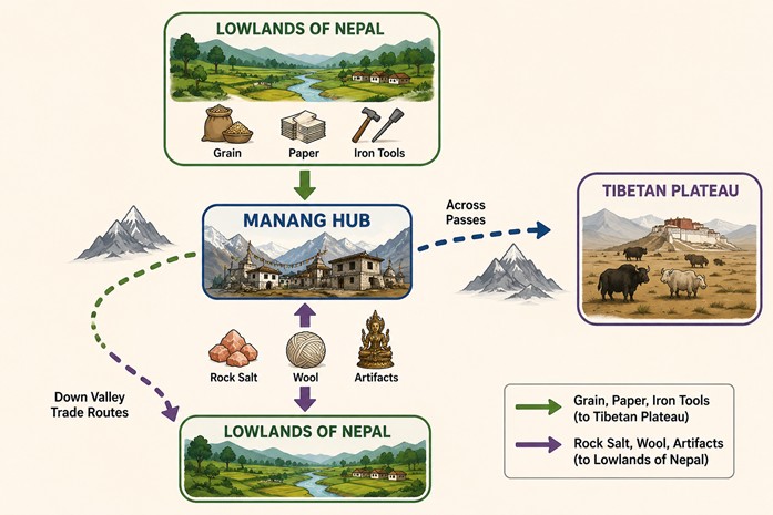
The modern infrastructure of Manang, including Wi-Fi, bakeries, and espresso machines, is a recent development. For centuries, Manang was a remote hub on an ancient trade network connecting Tibet with the lowlands of Nepal and India.
Manang's economy, back when the Tibetan border was still open in the 1950s, heavily depended on caravan trade. The valley was a through route along the way. Yak, mule, and sheep caravans transported grain, paper and manufactured goods from the lower hills of Nepal by way of the Marsyangdi gorge. They then went over high mountain passes like Thorong La and Larkya La pass to Tibet.
Therefore, the traders brought back to the valley such things as rock salt, sheep wool, gold dust and religious artefacts from the Tibetan plateau. This salt-grain exchange formed the basis of life for both regions. The lowlands needed salt for preserving food, while the high-altitude communities depended on the lowland grain supply to get them through the short growing seasons.
For the most part, the Manang people, or Manangis, were famous not only as local farmers but also as international businesspeople. In fact, the rulers from the Shah and Rana dynasties in Nepal, in realizing how challenging life in an arid alpine valley could be, understood the need for supporting the Manangis in trade by granting special trade privileges.
Back in the 18th and 19th centuries, royal orders not only freed Manangis from paying the ordinary customs duties but also gave them the right to have passports, which most of the citizens did not have. So, they could also roam Southeast Asia. Moreover, by the 1960s and 1970s, the Manangi commercial networks had extended to Calcutta, Bangkok, Hong Kong, and Singapore, trading in gems, textiles, and manufactured goods. It is through this historical perspective that one can understand why many families living in this isolated valley are entrepreneurs, speak several languages, and have travelled widely.

Manang's cultural identity has its foundations in Tibetan Buddhism. Tibetan Buddhist influence in the locals' language, architecture, clothing and spiritual life is so strong that it even exceeds that of the Hindu hill cultures of southern Nepal, which is thought to be the closest region culturally to Tibet.
Several cultural landmarks requiring proper trail etiquette are located along your walk through Manang. Trekkers should at all times keep these edifices on their right-hand side when passing, walking in a clockwise direction, as a manifestation of respect.
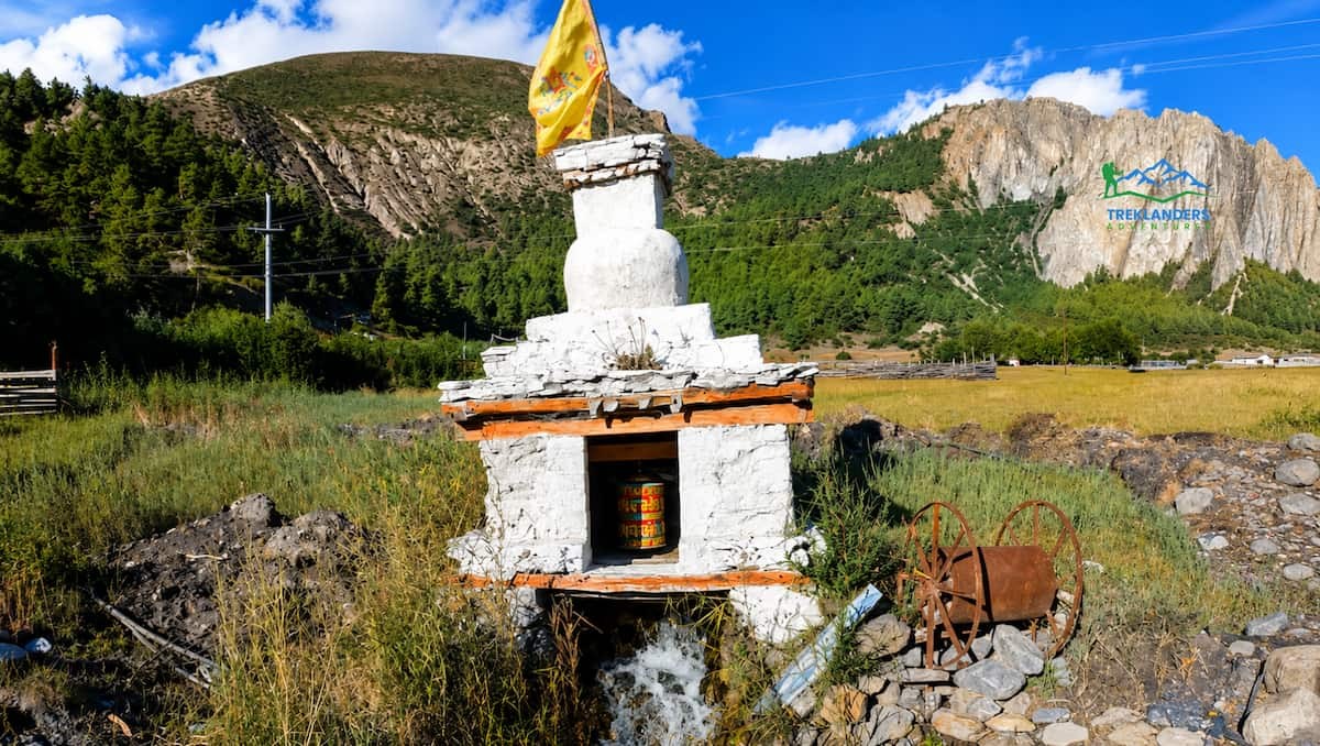
The older section of Manang features traditional flat-roofed stone houses. These homes are built close together, with the roof of one house often serving as the terrace or workspace for the neighbor above. This layout helps conserve heat during winter winds and creates a defensive wall against the elements.
Wood is scarce in this high valley. It is reserved for window frames, doors, and interior structural pillars. The wood frames are often painted with bright symbols representing long life, good luck, and protection from spirits.
The single most serious mistake that a trekker can make on the Annapurna Circuit is not having a rest day in Manang. Being at 3,540 meters, the air pressure reduces, and each breath conveys around 35% less oxygen than at sea level.
Acclimatization means the human body gets used to the low oxygen level.
This process takes time and cannot be in a hurry. Ideally, the ascent rate should be gradual. When you stay 48hours at the same height in Manang, your body will undergo multiple steps of nature:
Bypassing the rest interval reduces the body's chance of accommodating itself to the altitude and increases the risk of Acute Mountain Sickness (AMS). If untreated, AMS may evolve into High Altitude Pulmonary Edema (HAPE) or High-Altitude Cerebral Edema (HACE), which are two fatal conditions.
In order to be successful, the guides advise that you carry out active acclimatization on your rest day. It means rather than just lying in bed, you go for a hike at a higher altitude in the morning and afterwards come back to Manang for the night. This way, the body is exposed to a short period of lower oxygen levels, which stimulates the body's adaptation without tiring you before the next mountain passes.
For those hikers wanting a moderate walk for acclimatization that shows off beautiful views, the trail to Gangapurna Lake and its viewpoint would be the perfect option.
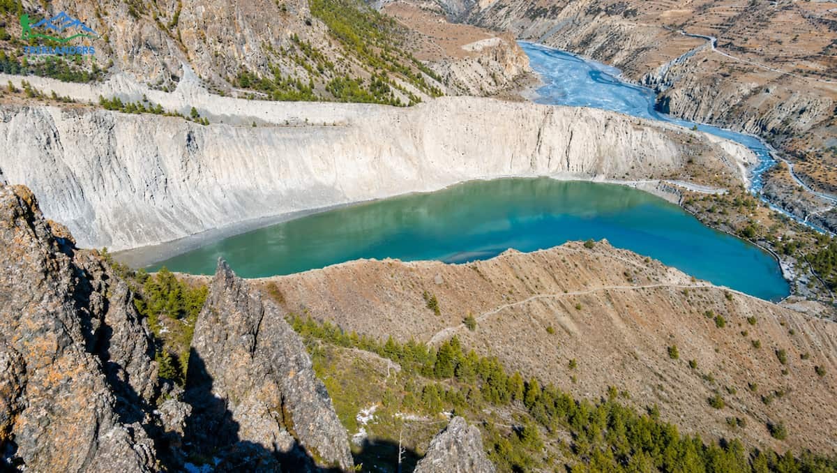
Gangapurna Lake is just about 15 minutes off the main street of Manang village. It is at the foot of the pile of debris left by the ancient Gangapurna Glacier. The lake is mainly getting water from the melting glacier, so it has this beautiful shimmering aqua color. It is due to the "rock flour"; these extremely fine silt particles that remain suspended in the water and reflect the light in the blue-green spectrum.
Throughout the year, the lake level fluctuates. During late spring and fall, it is a small pond that perfectly mirrors Annapurna III and Gangapurna peaks. There is a wooden bridge over the river, so walkers can follow the water's edge.
If you are on the opposite side of the lake, you will find a very steep trail gradually ascending along the lateral moraine up to the Chongkor Viewpoint. This path gains approximately 300 vertical meters, and it takes around 45 to 60 minutes for the upward journey.
Initially, the trail runs through low juniper bushes and unveils a valley view by going alongside the loose shale. From the top of the viewpoint, one can even visualize the hollow form of the glacial lake, follow the Marsyangdi River's route back up to Humde and see the tiled Manang village scattered on the valley floor. Most importantly, it shows in a very definite way how glaciers have sculpted these mountains over millennia.
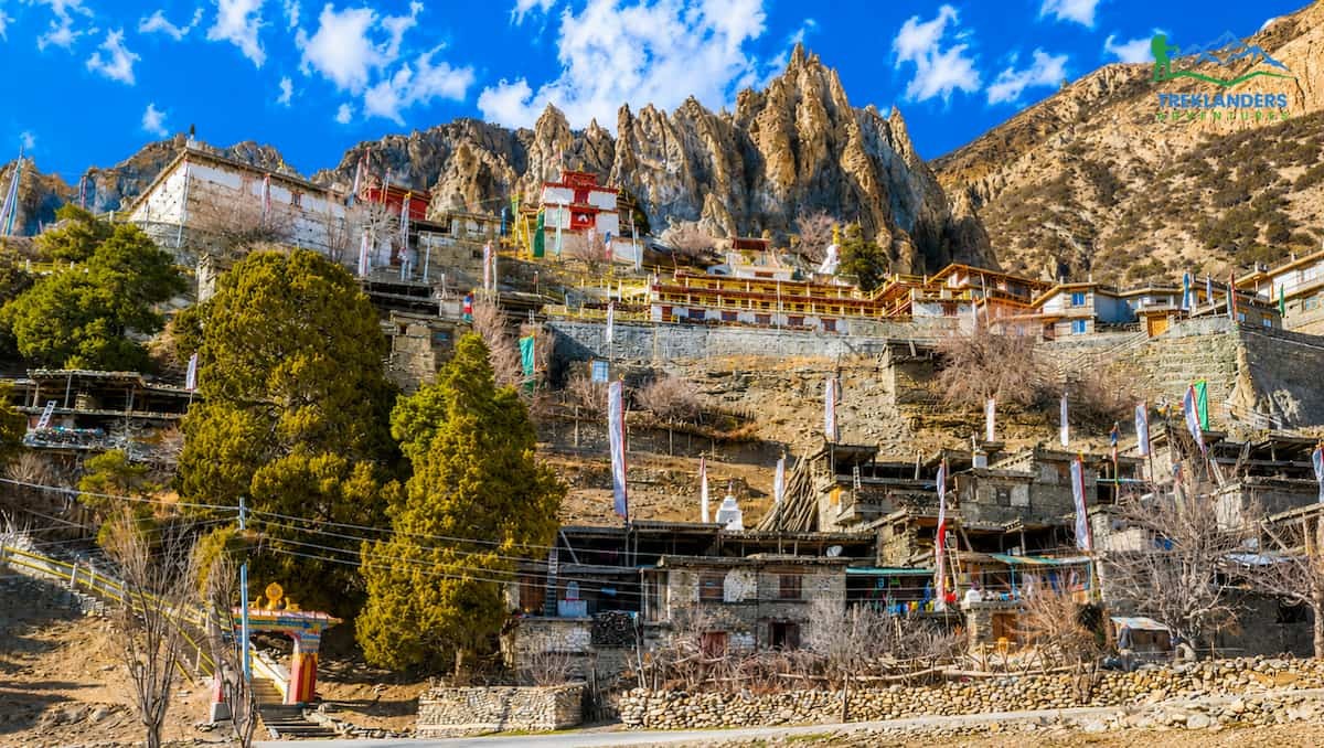
Located two kilometers down-valley from Manang is the village of Bhraka (also spelled Braga). This settlement is built on a cliffside and features one of the most important cultural and religious sites in the region: the Bhraka Gompa.
Six Centuries of Devotion
Bhraka Monastery is the oldest monastery in the Manang District, with a history spanning over 500 years. The building belongs to the Kagyupa sect of Tibetan Buddhism. The main structure is built directly into the dark rock face above the village, appearing as an extension of the cliff itself.
To visit, you climb through the narrow, tiered alleyways of old Bhraka village. The homes here are stacked vertically, with wooden ladders connecting the levels. The trail leads to the heavy wooden doors of the monastery assembly hall.
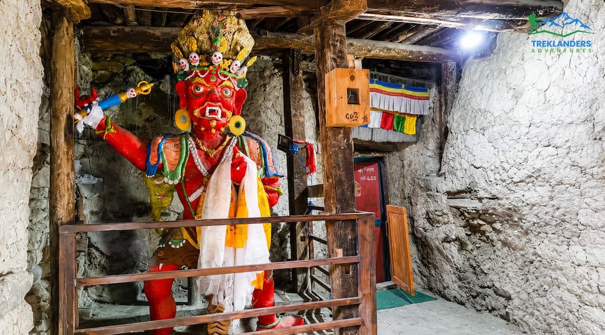
The inside of the monastery is quite dim, only illuminated by the glimmer of butter lamps and a few rays of sunlight sneaking through the tiny windows. The main hall, or Du-Khang, is the location of a huge religious heritage collection:
Making some time to explore this place can bring an understanding of the spiritual way of life that has enabled the valley inhabitants to survive through long Himalayan winters.
If you are looking for a rigorous, full-day acclimatization hike that tests your lungs and stamina before Thorong La, the trail to Ice Lake (known locally as Kicho Tal) is the premier option.
Trail Mechanics and Elevation Profile
Going to Ice Lake is not a light decision, expecting to walk more than 1, 100 vertical meters from the flat valley to the top of 4,600 meters (15,091 feet).
Initially, the path breaks into a very steep elevation on the north valley wall. The trail runs up and around following the contours of the mountain. Across the open, wind-swept meadows which are used as summer pastures for yaks. However, as you go up, oxygen is scarce, and that means your pace will drop to a very slow and even one that has a suitable rhythm to it.
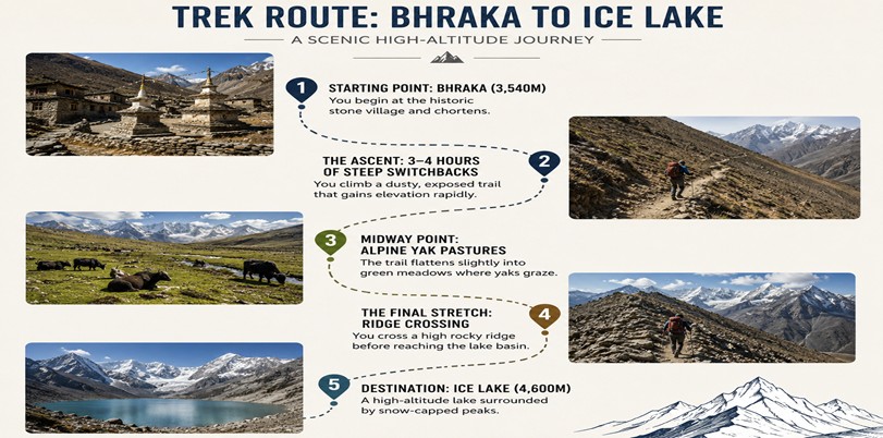
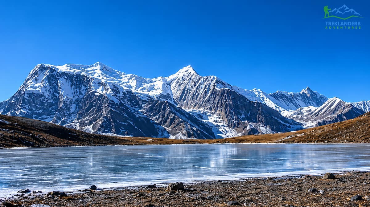
Ice Lake sits in a high alpine bowl. It consists of two bodies of water: a smaller lower lake and a larger upper lake. During the spring trek season (March to May), the lake is often covered in sheet ice, which melts away by autumn (September to November) to reveal clear water.
The primary reason to hike here is the panoramic view. At 4,600 meters, you are eye-to-eye with the peaks of the Annapurna massif. The entire range from Tilicho Peak in the west to Annapurna II in the east stands visible across the valley. The scale of the mountains is much clearer from this elevated vantage point than from the valley floor.
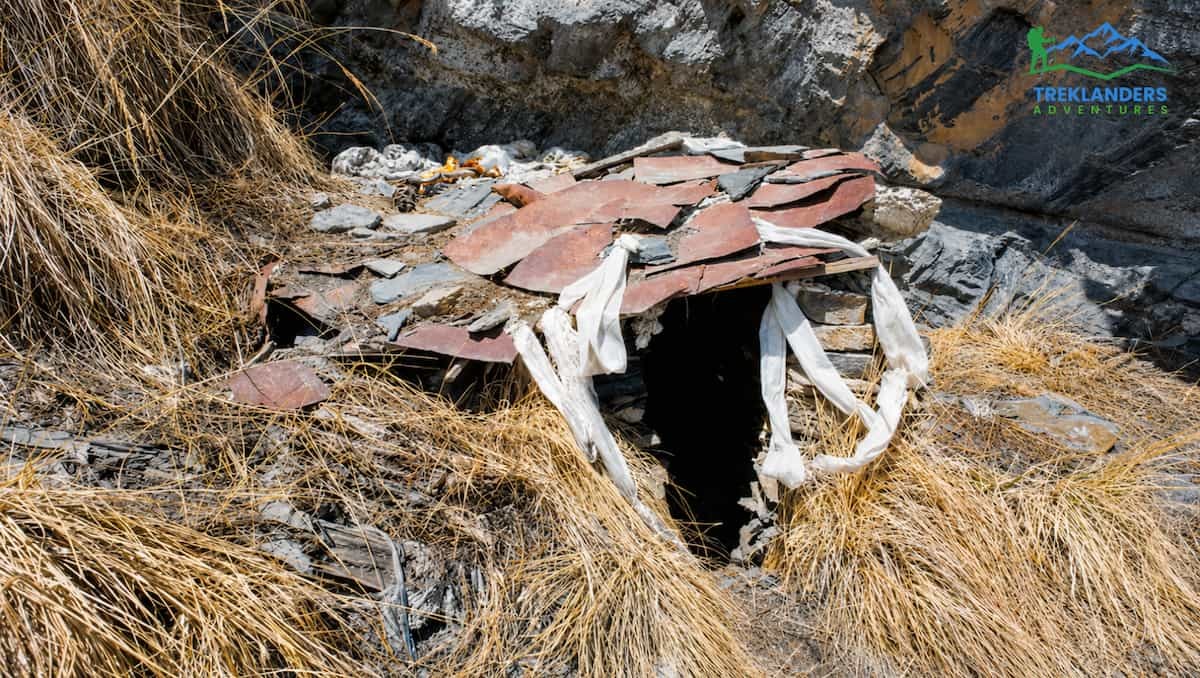
According to spiritual enthusiasts looking for an alternative acclimatization hike with a strong historical layer, Milarepa's Cave trek is a journey through the very root of Tibetan Buddhism in this area.
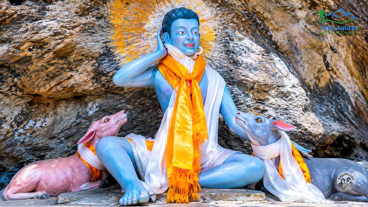
Jetsun Milarepa, a painter of some of the most beautiful lyrical songs in the whole of Tibetan literature, was also a Buddhist master and a yogi of the 11th century. He was known for his tough-severe way of living, long-hour meditations alone in mountain caves that are hard to find and his "a hundred thousand songs" that present the Buddhist doctrine in an easily understandable way.
The ancient records mention that Milarepa meditated for a good number of years inside the caves on the northern slopes of the Annapurna range. The one near Manang is the scene of a legend very well known to the local community involving a hunter by the name of Chira Gonpo. Chira was in the process of catching a wild deer with his dog when, suddenly, unexpectedly, he found Milarepa deep in meditation. The narrative also says that Milarepa's serene aura was such that it not only calmed down the fleeing deer but also the hunting dog. When the man arrived, Milarepa sang a song about the love of all sentient beings, convincing Chira to give up hunting and become a follower.
The trail to the cave starts not far from the village of Bhraka. It involves crossing the Marshyangdi River and then heading south up a valley beneath the glacier of Annapurna IV.
Though the original cave has suffered from rockfalls for a long time, the place is still frequented by local worshippers and tourists from all over the world.
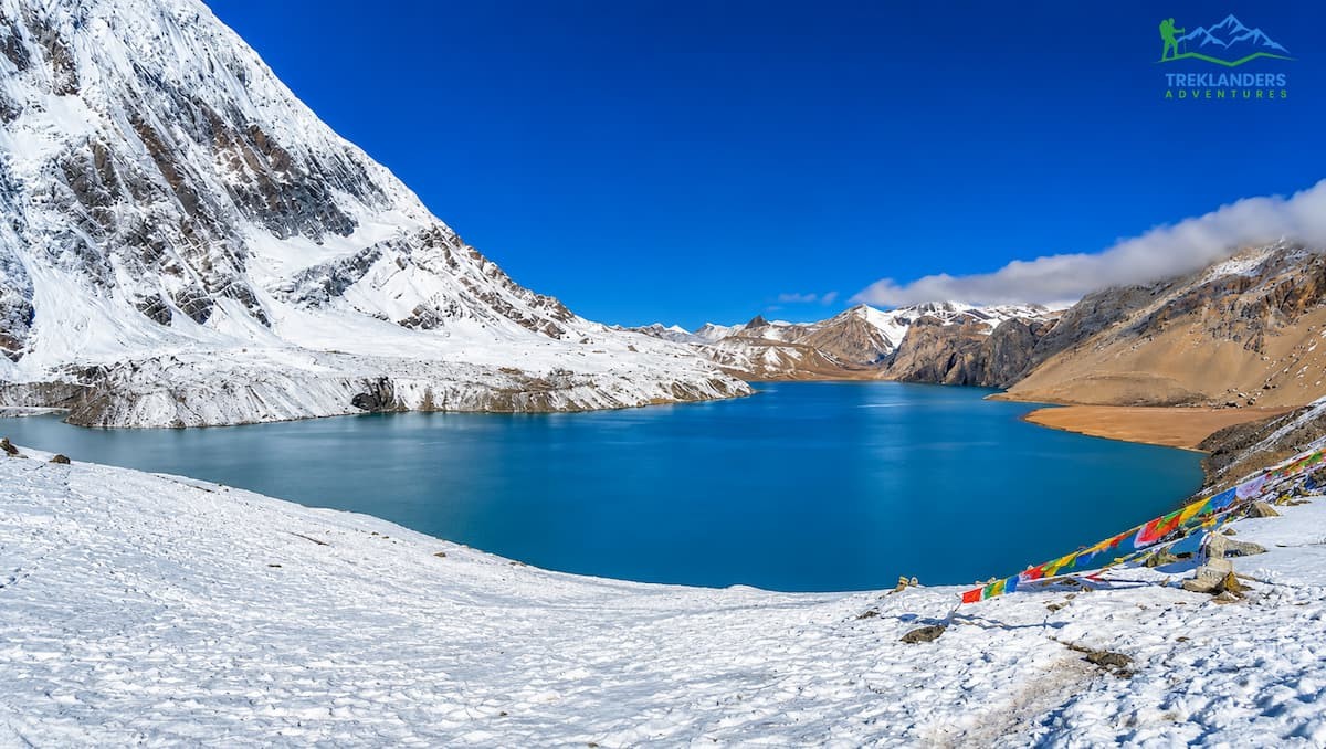
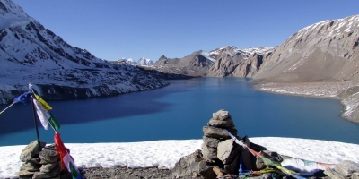
Besides that, Manang is also the place where trekkers on the Annapurna Circuit get their last supplies before going on their side trip to Tilicho Lake. This is a natural lake situated at 4, 919 meters (16, 138 feet) and is considered to be one of the highest lakes of such size in the world.
Leaving the Circuit Trail
If you want to go to Tilicho Lake, you must leave the main Annapurna Circuit trail at the village of Khangsar. It is a two-hour walk west of Manang. After Khangsar, the path goes through a very rough area that has very steep scars from landslides and places where the ground has very recently slid down the hillside.
With this path, you have to spend a night at Tilicho Base Camp (4,150 meters), which includes a few lodges in a narrow valley just below the ice walls. The following day, the walkers go up a very steep path leading to the lake in the valley.
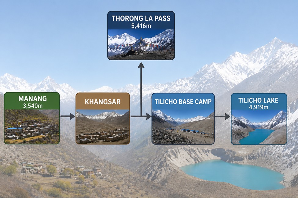
The area around Tilicho Lake is quite harsh. The lake itself measures four kilometers in length and one kilometer across, and it is flanked by the icy walls of Tilicho Peak and Annapurna's "Great Wall".
Most of the time, the lake's surface is frozen hard, looking like a flat white sheet surrounded by dark mountain peaks. Once the ice melts in late autumn, the lake exhibits its beautiful blue shade filled by the glacier water from the surrounding mountains. This visit will increase your overall Annapurna hiking schedule by three days; however, it will offer you an amazing encounter with mountain wilderness at a very high altitude.
Successful acclimatization in Manang depends greatly on one's health, safety, and logistical considerations of the hiking routes. If Manang is your final stop, this village will be your last chance to make any necessary gear changes and physical readiness assessment before you go to the high altitude, uninhabited areas. Also, this is the place where you can get the most up-to-date and trustworthy weather reports.
In Manang, the Himalayan Rescue Association (HRA) has a permanent rescue post. This post is usually staffed with international and Nepali volunteer physicians who specialize in high-altitude medicine during the main trekking seasons.
The HRA organizes an altitude sickness briefing every afternoon, and it is highly recommended that all trekkers attend it. The doctors discuss the means of detecting early symptoms of AMS, which, among others, include:
They also talk about how to correctly use drugs for prevention, like Diamox (Acetazolamide) and set the standards for when one has to go down immediately due to the mountain sickness. The post also has a pressure chamber (Gamow bag) and oxygen, which are the main things used to stabilize a patient.
After leaving Manang and crossing the Yak Kharka, the next place to buy supplies will be very limited, so use your rest day to check your gear:
Winter Clothing: Make sure your down jacket, thermal underwear, and gloves are not only dry but clean as well. The temperatures at Thorong Phedi and High Camp fall below freezing quite frequently.
Shoes: Inspect your hiking boots for loose sole or old shoelaces. You will need very good boots to avoid the risk of slipping on loose stones when you are making your way to the pass.
Water: It can be tricky to keep water purified because purification pumps get frozen and soak cracks, and batteries lose their charge quickly in subzero temperatures. Carry your backup water purification tablets and always keep your camera and mobile phone batteries inside your inner garments, where they are close to your body heat.
Food and Snacks: Buy plenty of energy-rich snacks such as nuts, dried fruits, and chocolate bars so that you can get a quick energy boost when you climb the pass.
Manang is the very symbol of the significant change that one experiences in the famous Annapurna Circuit Trek. As if in a dream, after several days of hiking through verdant river valleys, pine forests, waterfalls, and mountain villages, you come to Manang, where you get ready for the high-altitude, tough part of the trek. This small spot set down in a huge alpine valley with the Himalayas looming upon it is a picture-perfect location. Also, this village is one of the essential stops for getting used to the situation before doing the tough Thorong La Pass crossing.
Manang has quite a different vibe from other places on the trail. Timeworn stone dwellings, prayer walls, the constant turning of prayer wheels, and the presence of very old monasteries are evidence of how Tibetan Buddhist culture indeed dominates life in this secluded Himalayan community. Trekking enthusiasts usually have a few days' break here that they take not only to get their bodies used to the rarefied air but also to check out the nearby scenery. To give a further boost to acclimatization, one can do some short hikes to Gangapurna Lake, Ice Lake, and along the ridges. Besides being a great way to get mountain views, it is also a particularly perfect moment to enjoy the utmost magnificent setting resulting from the snow-capped mountains, glaciers, and rough valleys.
Beyond its practical importance, Manang offers a rare chance to experience authentic mountain life. Local people continue traditions that have been preserved for generations, and visitors can observe the unique balance between culture, spirituality, and survival in one of Nepal’s most isolated regions. Tea houses filled with trekkers from around the world create a lively atmosphere, while the quiet monasteries and peaceful trails surrounding the village offer moments of reflection and calm.
By spending time in Manang, walking through ancient paths, visiting monasteries, exploring glacial lakes, and resting before the ascent, you gain far more than physical preparation. You develop a deeper connection to the Himalayas and to the people who call these mountains home. When the trail finally leads west toward Yak Kharka, Thorong Phedi, and eventually the high pass beyond, the memories of Manang’s landscapes, culture, and quiet beauty remain one of the most unforgettable highlights of the entire trek.
Compare Gokyo Ri and Kala Patthar for the best Everest views and Himalayan trekking experience.
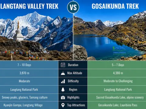
Compare the Langtang Valley Trek and Gosaikunda Trek to choose the best Himalayan trek in Nepal.
Essential guide to crossing Thorong La Pass from Manang with acclimatization tips, altitude safety, and Annapurna Circuit trekking advice.