Mohare Danda Trek: Route, Permit, and Distance Details
13 Sep 2026
Explore Mohare Danda; peaceful trails, stunning Himalayan views, and authentic Magar culture in the Annapurna region.

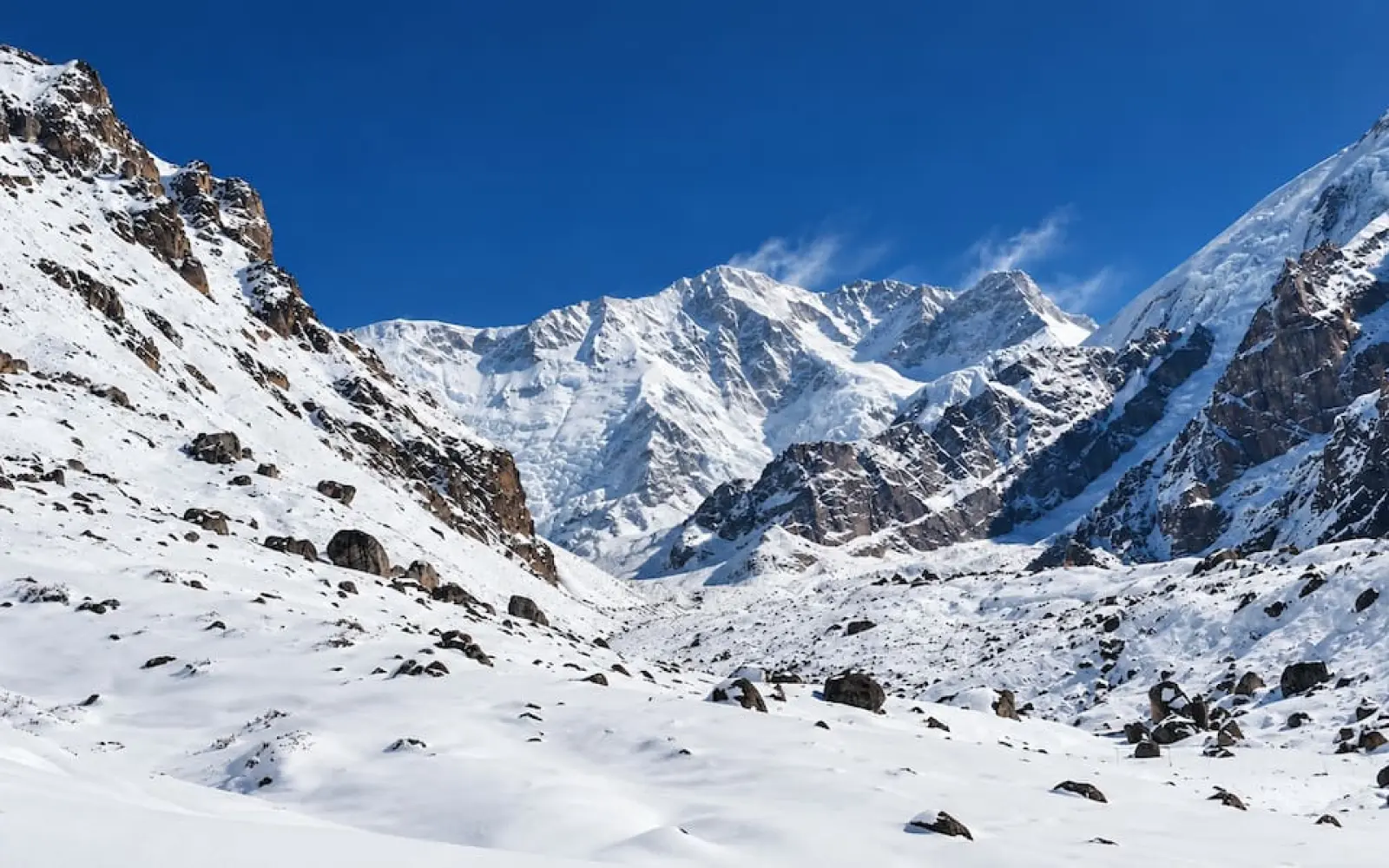
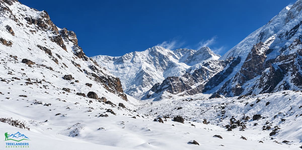
I have a soft spot for treks that make you work for the view. The Kanchenjunga Base Camp Trek makes you work for it twice, because the route visits both the south side at Oktang and the north side at Pang Pema, and the two sides are separated by a wall of passes you cross in a single long day. There is no shortcut and no helicopter shuttle waiting at the top of the valley. You walk in, you walk out, and somewhere in the middle you stand under the third highest mountain on the planet with almost nobody else around.
That last part is the reason most people come. Everest and Annapurna are wonderful, and they are also busy. Kanchenjunga is still quiet in a way that the famous routes stopped being quiet about twenty years ago. You can walk for two hours without meeting anyone.
This guide covers the Kanchenjunga Base Camp Trek in detail: where it goes, how hard it is, what the seasons do to it, what the permits require, and what each day of the 23 day Treklanders itinerary actually involves. No cost breakdown, no FAQ list, just the route and the things worth knowing before you commit three weeks to it.
Mount Kanchenjunga sits at 8,586 metres in the far eastern corner of Nepal, on the border with Sikkim in India. Taplejung district holds the Nepali side of it. Look at a map of Nepal and put your finger on the bottom right corner, then slide north until you hit snow. That is the neighbourhood.
The name comes from Tibetan and is usually translated as the five treasures of the great snow, a reference to the five main summits in the massif. Locally it is pronounced closer to Kanchendzonga. A British team led by George Band made the first ascent on 25 May 1955, and by tradition climbers stop a few metres short of the true summit out of respect for the mountain's standing among the people below it.
The geography explains how the trek feels. Because the massif is so far east, no road gets close to the high valleys. Reaching the trailhead means a flight to Bhadrapur on the Terai plain and then a long drive up through the hills. That distance filters out casual traffic.
Kanchenjunga has a base camp on each side, and they are completely different experiences.
The south base camp area is reached from Tseram, past Ramche, out onto the moraine of the Yalung Glacier. This is the historic route, the one expeditions use for summit attempts. The walk up is a wide glacial valley with Talung, Kabru and Rathong lining the far side. At the top you get the south and west faces of Kanchenjunga at close range, plus Yalung Kang at 8,505 metres across the head of the valley. There is a chorten hung with prayer flags at the best viewpoint.
Pang Pema, the north base camp at 5,150 metres, is the opposite. It is bleak. You walk along a moraine shelf above the Kanchenjunga Glacier, the path shifts every year as rocks fall and ice moves, and then the valley opens and the north face is simply there, a vertical mile of ice and rock with nothing in front of it. A few stone huts used by yak herders sit on a grassy patch. There is a memorial plaque for the American climber Chris Chandler. Wedge Peak, Nepal Peak, Tent Peak and the Sharphu group crowd the skyline behind you.
Doing one and skipping the other is possible and plenty of people do it for time reasons. I would not. The crossing between them, over Sinion La and Mirgin La and Sele La, is one of the best days of walking in Nepal, and you only get it if you do the full route.
Hard. Not technical, but hard.
There is no climbing on the standard route. You will not need a rope, crampons are optional and mostly for spring snow on the passes, and nothing requires mountaineering skill. What it requires is stamina across three weeks. Walking days run five to eight hours and some are longer. The pass day out of Tseram is eight hours with a steep start and three cols.
The terrain is rougher than the famous routes. Sections above Khambachen cross old landslide scars where the trail is a scratch across loose ground. Nothing is beyond a careful walker, but there is no margin for sloppiness and no ambulance.
Fitness wise, you want to be able to walk six to eight hours on consecutive days with a daypack and wake up ready to do it again. Six to eight weeks of preparation is realistic for someone already reasonably active: long weekend hikes with a loaded pack, stairs, running or cycling, and some leg and core work. Do the hikes on hills if you can find them.
Previous high altitude experience helps enormously, not because Kanchenjunga is higher than other treks but because knowing how your own body behaves above 4,000 metres removes a whole category of anxiety. If you have done Everest Base Camp or the Annapurna Circuit and enjoyed it, you have the right background.
Kanchenjunga is a restricted area. Two permits are mandatory: the Kanchenjunga Restricted Area Permit and the Kanchenjunga Conservation Area Permit. You cannot buy the restricted area permit yourself. It has to be issued through a registered trekking agency in Kathmandu, which is one of several reasons the trek is organised rather than improvised.
Permits get checked properly here. Expect checkpoints around Taplejung, Sekathum and Ghunsa. Officers write down passport numbers and permit details, and trekkers without papers are turned back.
For the paperwork you need a valid passport, passport photos, proof of travel insurance and a confirmed itinerary through a licensed agency. Processing usually takes a few hours once everything is submitted. A good operator handles it before you land.
The restricted status exists because of the border with India and Tibet, the fragility of the conservation area, and the small communities living inside it. A licensed guide is required, and on this trail you would want one anyway. Village to village distances are long, signage is nearly nonexistent, weather changes quickly, and if something goes wrong at Lhonak your guide's radio or satellite phone is the entire emergency system.
Spring and autumn. Everything else is a compromise.
Autumn, from late September through November, gives the clearest air of the year. The monsoon has washed the dust out of the sky and the peaks look carved. Days are shorter, mornings and evenings are properly cold above 3,000 metres, and occasional light snow is possible high up. If your priority is seeing the north face of Kanchenjunga sharp against blue sky, come in October.
Spring, March to May, is the other strong season. Days are longer and warmer, and the forests between Khewang and Tseram fill with rhododendron bloom, from small ground bushes to trees twelve metres tall. There is more haze than in autumn and afternoon cloud builds more often, but the trade is worth it for many people. Snow on the passes lingers into April in some years, which is worth asking about before you fix dates.
Winter is possible for experienced, well equipped parties and unpleasant for everyone else. Heavy snow closes sections of trail, the passes between the two sides become a real problem, and lodges at altitude run without supplies.
Monsoon, June to August, brings rain, leeches, cloud where the mountains should be, and landslide risk on roads that are marginal in good weather. The lower villages are green and lovely in July. The high route is not the place to be.
The flight from Kathmandu to Bhadrapur takes about 45 minutes and is one of the more reliable domestic routes in Nepal. It is a proper lowland airport rather than a mountain airstrip, so it does not suffer the cancellation chaos of Lukla or Jomsom. On a clear morning the flight east runs past Everest, Lhotse, Makalu and finally the Kanchenjunga massif, which is a good warm up for what you are about to walk into.
From Bhadrapur the trip continues by road. The drive climbs from the subtropical Terai into the hills through Ilam, which is Nepal's tea country and worth the window seat by itself. Terraced tea gardens run across whole hillsides. Depending on the itinerary you overnight at Phidim or continue towards the roadhead.
There is a seasonal airstrip at Suketar near Taplejung, but flights are irregular and prone to cancellation when passenger numbers are low. Most operators, including Treklanders, use Bhadrapur and drive, because a missed flight at the end of a three week trek is a bigger problem than a long drive. Overland from Kathmandu to Taplejung by bus or jeep takes 18 to 20 hours, which is cheaper and eats two days.
This is the full circuit version: south base camp first, then over the passes to the north side and Pang Pema, then out via Ghunsa, Sekathum and Suketar. Nineteen days of trekking and travel, 22 nights total.
A guide meets you at the airport and transfers you to a hotel in the city. There is a briefing with your trek leader covering route, permits, gear and logistics, and a group dinner at a Nepali restaurant. Altitude 1,365 metres. Use the evening to sort anything missing from your kit, because Kathmandu is the last place you can buy a down jacket.
A half day tour of the valley's heritage sites, then free time for preparation. Durbar Square, Swayambhunath and Boudhanath are each worth a couple of hours. This is also the day permits get processed and duffels get packed.
Morning flight east, 45 minutes, with Everest and Makalu out of the left window if the weather cooperates. Bhadrapur is hot and flat and feels nothing like the mountains. You meet the trekking crew and drive, climbing out of the Terai into cooler hills through the tea terraces around Ilam, to Phidim at 1,340 metres. Phidim sits among tea gardens and pines, and on a clear evening Kanchenjunga is visible far to the north.
The drive leaves the highway for a rough side road towards Hapu Khola, bumping through small farming villages until the road runs out at Banketar, 2,570 metres. From there the walking starts. A gentle two hour introduction through farm terraces brings you to Khewang, also spelled Khebang, at 1,915 metres. This is Kirat country, home to Rai and Limbu communities who have farmed these hills for centuries.
Six hours. The morning climbs steadily to a ridge at 2,070 metres to reach Ekchana Bhanjyang, then continues towards Ghatichinne Bhanjyang, joining the Mamankhe trail along the way. A rough dirt road is under construction here but not yet open to vehicles. The walk passes cultivated land where cardamom is the main cash crop, grown on damp ground under tree cover. Sherpa Gaon at 2,890 metres is the stop.
Six hours and a long climb. The trail hauls uphill towards Deurali Danda, a ridge at 3,292 metres, through dense rhododendron forest, and the gradient is unrelenting in places. Higher up the forest opens at Chitre, a broad ridge with a water pool, and a short way on is Lashe Bhanjyang at 3,415 metres, a scatter of huts serving as teahouses. You will feel the altitude in the evening.
Five hours, mostly down. From Lashe Bhanjyang the view northwest opens onto Jannu and Kanchenjunga, the first proper look at what you came for. The descent towards Simbua Khola starts on a section damaged by a landslide with a long drop below it, so go slowly and follow your guide's line. The trail re-enters forest and drops to the river in about an hour. A walk along the bank and a small bridge bring you to Torongten at 3,010 metres, an open clearing with a few basic lodges.
Six hours into the high country. The lower Lalung valley is thick with pine and rhododendron. The trail follows a river northeast, which drains the Yalung Glacier, and the snow peaks start appearing ahead. As the valley widens the walking gets easier along the riverbed, and eventually the terminal moraine of the Yalung Glacier comes into view with Talung at 7,349 metres, Kabru at 7,338 metres and Rathong at 6,678 metres above it. Tseram sits at 3,910 metres on a grassy terrace above the north bank. It is the junction point for both base camps, and you will be here three nights.
Eight hours and the hardest day so far. Start early, carry packed lunch. The trail climbs steeply for the first hour, then eases onto a gentler slope and continues to the Oktang area and the Yalung Glacier. Lunch usually happens at Ramche, up or down depending on pace. Beyond Ramche the route turns north at a corner and the entire south and west faces of Kanchenjunga open up. A small path leads onto the lateral moraine to a chorten, the best viewpoint on this side: the main summit, Yalung Kang at 8,505 metres, and Khambachen Peak at 7,903 metres across the valley head. Then you walk back to Tseram.
A genuine rest day at 3,910 metres, and by this point it is welcome. Wash some clothes, sit in the sun, eat, and let your body catch up with the altitude. The scenery from the lodge is good enough that doing nothing is no hardship. Tomorrow is the biggest day of the trek, so treat this as preparation rather than a bonus.
Eight hours, three passes, the day people remember. It starts with a hard climb straight out of Tseram, a steady haul for a couple of hours to a small frozen pond at Chhuchung Pokhari, and from there a few minutes to the top of Sinion La, also called Lepcha Pass, at 4,663 metres. That is the hard part done. The reward is a full 360 degree panorama with Makalu and Baruntse to the northwest and unbroken foothills to the south. The traverse continues on easier ground over Mirgin La at 4,026 metres and Sele La at 4,200 metres, then drops towards Phedi with the mass of Kumbhakarna, which is Jannu, above. Phedi is a handful of huts serving as basic lodges.
Four hours, all downhill, and a relief after the pass day. The trail drops through cool dense woods to the rim of the Yama Tori valley, then down through pine and rhododendron to Ghunsa at 3,140 metres. Ghunsa is the best village on the route: around thirty stone houses with corrugated roofs, a monastery, a police post and lodges that feel luxurious after Phedi. It is a Bhotia and Sherpa community of Tibetan origin, and a good place to sit in a dining room and talk to people.
Six hours and back into the high mountains. The trail follows the valley floor beside the green water of the Ghunsa Khola, through scrub rhododendron and juniper, with the terminal moraine of the Jannu glacier ahead. After a bridge and the grassy flats of Rambuk Kharka comes the section everyone talks about: a steep traverse across a large landslide scar where rockfall is a real risk. Past it the gorge opens and Phole, Sobithongie and Jannu appear above the moraines. Khambachen at 3,930 metres is a small summer settlement with basic lodges, and the Sharphu peaks fill the valley head.
Six hours on rough but not difficult ground. The path follows the west bank of the river, crosses a boulder field and climbs a short snow slope onto the flats at Ramtang Kharka, a good spot for a break and a look at the Ramtang Glacier and the western outlines of the massif. From there the trail runs fairly level to the snout of the Kanchenjunga Glacier, with Pyramid Peak, Tent Peak and Nepal Peak rising from the moraine. Lhonak at 4,575 metres is a sandy flat with a few stone huts. It gets windy in the afternoon and cold at night, and the sunset on Wedge Peak is worth standing outside for.
Seven hours round trip and the summit of the whole trip in every sense except the literal one. Carry packed lunch. The route to Pang Pema follows a shelf of lateral moraine above the Kanchenjunga Glacier and shifts year to year as rocks fall and ice moves, which is why you follow the guide rather than a GPS track. The views improve the whole way: Wedge, Nepal, Tent and Pyramid peaks, then the Sharphu group dominating the valley. Pang Pema at 5,150 metres is a grassy meadow with a few herders' huts, a boulder draped in prayer flags, and the plaque for Chris Chandler. The north face stands directly in front of you across a field of ice. Then you turn around and walk back to Lhonak.
Eight hours of descent past Khambachen, along the west ridge of the Khambachen valley and down to the Ghunsa Khola, where a newly built suspension bridge crosses the river. The trail drops into golden pine and rhododendron, and the air gets thicker with every hour. Ghunsa at 3,140 metres feels like a town after Lhonak, and the lodge feels like a hotel.
Five hours on an alternative route, crossing the Ghunsa Khola for the last time. The forest here mixes pine, rhododendron, birch and Himalayan bamboo, with mani walls along the way. You pass through Phole, a settlement with a semi nomadic history, then cross a large landslide section that is stable enough to be safe. The rest is forest walking down to Gyabla Phedi at 2,725 metres, a tidy village with a few teahouses, one surprisingly large lodge, and waterfalls visible across the valley.
Seven hours, and the landscape changes completely. Morning starts on a narrow trail with a slow climb then a short descent to Amjilosa, the usual lunch stop. The afternoon is a long downhill to a suspension bridge over a big river, then Lamatar with its waterfalls, another bridge, and a final one an hour later along the upper Tamur. Sekathum at 1,650 metres is warm, green and subtropical, and after three weeks of pine and ice it feels like another country.
A short walk across the Ranipul suspension bridge over the Tamur to the roadhead, then a four to five hour drive up to Suketar at 2,440 metres, the village beside the Taplejung airstrip. The walking is over. The driving is only beginning.
Six hours by road to Ilam at 1,210 metres via Kanyam, with lunch at Phidim. If there is daylight left, walk into the tea gardens. On a clear evening you can see Kanchenjunga and Jannu from among the tea bushes, which is a strange and excellent way to say goodbye to a mountain you stood underneath five days earlier.
A few hours of driving past the big tea estates and down into the Terai heat to Bhadrapur airport, then the flight back to Kathmandu. Transfer to your hotel, afternoon free.
Built in deliberately, because mountain roads in eastern Nepal do not always cooperate and a delayed drive should not cost you a flight home. If everything ran to schedule, this is a free day: shopping in Thamel, a trip to Patan or Bhaktapur, or nothing at all.
Transfer to the international airport for your onward flight.
The profile is more forgiving than it looks. Days 4 through 7 sit between 1,900 and 3,400 metres, a long slow introduction, so by the time you reach Tseram at 3,910 metres you have been walking for five days. The day hike to 4,780 metres followed by a rest day at 3,910 is close to textbook: climb high, sleep low, recover.
The north side repeats the pattern. Ghunsa at 3,140, Khambachen at 3,930, Lhonak at 4,575, then Pang Pema at 5,150 as a day trip with a return to sleep lower. Nobody sleeps above 4,600 metres on this route.
Altitude is still the main medical risk on the trek and it does not care how fit you are. Headache, nausea, dizziness, poor appetite and disturbed sleep are the common early symptoms. Tell your guide the moment you notice any of them, and tell them honestly. Mild symptoms often settle with rest, fluids and a slower pace. Serious symptoms have one treatment, which is going down, and going down from Lhonak is a long way.
Three to four litres of water a day, boiled or purified. Skip alcohol above Ghunsa. Walk slower than feels natural, particularly on the first hour of each climbing day. If you are considering Diamox, talk to a doctor at home rather than a stranger in a dining room.
Evacuation from the upper valleys means a helicopter, and helicopters need weather and money. Insurance covering trekking to at least 5,500 metres including helicopter rescue is not optional here. Read the policy wording for the altitude limit: plenty of standard policies stop at 4,000 metres, which leaves you uncovered from day 9 onwards.
From Phidim onwards, accommodation is basic. Rooms are small, usually twin share with a bed, a mattress and a blanket. Bathrooms are shared and often outside. Some villages have a wood or kerosene stove in the dining room, which is where everyone gathers in the evening, and no heating in bedrooms at all. A sleeping bag rated to minus 10 or minus 15 Celsius is essential rather than nice to have.
In the bigger villages, Ghunsa above all, the lodges are noticeably better. At Phedi, Lhonak and Lashe Bhanjyang you are staying in stone huts that exist because trekkers pass through. Some operators carry tents for the highest sections, and Treklanders lists tented camping alongside teahouse nights for that reason.
Food is simple, hot and calorie dense. Dal bhat is the backbone, and there is a good reason every trekker in Nepal eats it twice a day: rice, lentils, vegetables, usually refillable, and it keeps working for eight hours. Beyond that expect noodles, fried rice, potatoes, soup, omelettes, pancakes, chapati and Tibetan style dishes. The menu contracts as you climb because everything has to be carried in. Vegetarians are fine everywhere. Strict vegans can manage on rice, potatoes, lentils and vegetable dishes but should bring snacks and stay flexible.
Drinking water comes from teahouses as boiled water, usually for a small fee, or you treat it yourself with tablets, drops or a filter. Bottled water gets expensive and environmentally silly higher up, so carry two litres of capacity. Hot showers exist in some lower teahouses with solar or gas heating. Above Ghunsa, assume wet wipes.
This is worth saying plainly: for a large part of the Kanchenjunga Base Camp Trek you will have no phone signal and no internet.
NTC and Ncell have coverage around Taplejung, Suketar and lower villages such as Chiruwa. It weakens as you go north and disappears in the deep valleys and above Ghunsa. Wi-Fi exists in a few lower lodges and is unreliable. Compared with Everest or Annapurna, where you can post from most villages, this is another world.
Plan for it rather than fight it. Tell family before you leave that you will be out of contact for one to two weeks and agree what silence means, so nobody panics on day 12. Guides carry radios or satellite phones, which is the actual communication system here.
Charging is patchy too. Larger villages with micro hydro or solar will charge a phone for a fee. Bring a 10,000 to 20,000 mAh power bank and keep batteries inside your sleeping bag at night, because cold kills charge faster than use does.
These are the items that make a real difference on this specific trek.
A sleeping bag rated minus 10 to minus 20, because teahouse blankets are not enough at Lhonak. Sturdy waterproof boots, broken in, with ankle support, since the landslide traverses and moraine walking are where thin soles cause injuries. Trekking poles for the descent from Sinion La. A proper down jacket for the Pang Pema morning, category 3 or 4 sunglasses for glacier glare, and both liner gloves and heavy mittens.
Layers: two or three merino or synthetic base tops, thermal bottoms, a fleece, a lightweight insulated jacket, and a hard shell. Waterproof trousers, a warm hat, a buff and a sun hat.
A 30 to 35 litre daypack for what you carry, a 60 to 70 litre duffel for the porter. Headlamp and spare batteries. Water purification. A personal first aid kit with blister treatment, painkillers, anti diarrhoea tablets, rehydration salts and prescription medication, because there are no pharmacies past Phidim.
Cash in small denominations. There are no ATMs or card machines.
The whole route sits inside the Kanchenjunga Conservation Area, roughly 2,035 square kilometres of protected land running from subtropical forest to permanent ice. It is one of the more ecologically intact corners of Nepal, partly because so few people go there.
Red pandas live in the bamboo and rhododendron forest between about 2,500 and 3,800 metres, which makes the stretch from Sherpa Gaon to Torongten genuine red panda habitat. Seeing one is rare and mostly a matter of luck at dawn. Snow leopards exist higher up and are essentially never seen. Himalayan black bear, musk deer and pheasant species including danphe, Nepal's national bird, are all present.
The forest itself is the daily reward. Below 3,000 metres you walk through oak, chestnut and magnolia. Between 3,000 and 4,000 it becomes rhododendron, hemlock, pine, fir and birch. In April the rhododendron turns whole hillsides red and pink and white, with the trail running through the middle of it.
The cardamom terraces around Sherpa Gaon are worth noticing too. Large cardamom is the main cash crop of these hills, grown in damp shade, and much of local household income depends on it.
The trek crosses two cultural zones and the transition is one of its quieter pleasures.
The lower and mid hills through Khewang, Sherpa Gaon and the farming villages are home to the Rai and Limbu, the Kirat peoples of eastern Nepal, alongside Magar, Chhetri and Brahmin communities. Hindu practice and Kirat tradition mix here, and life runs on terraced farming.
From Ghunsa upwards you are among Bhotia and Sherpa communities of Tibetan origin, practising Tibetan Buddhism. Mani walls line the trail, prayer flags mark the passes, and Ghunsa has its own monastery. Herders bring yaks up to Khambachen and Lhonak in summer and move down before winter.
The usual courtesies apply. Ask before photographing people. Walk clockwise around mani walls and chortens. Give way on the inside of narrow trails when yaks or porter trains come through, because yaks do not negotiate. A few words of Nepali go a long way in villages that see a few hundred foreign visitors a year.
The Kanchenjunga Base Camp Trek suits people who have done multi day trekking at altitude and want the next thing. It suits photographers who want mountains without other trekkers in the frame, and anyone who has looked at the queue on the Everest trail and thought there must be another way to do this.
It does not suit first time trekkers, however fit they are, or anyone on a tight schedule. Three weeks is the realistic minimum and the itinerary above uses every day of it. It does not suit people who need connectivity, comfortable rooms or a varied menu. If none of that put you off, you are probably the right person for it.
The Kanchenjunga Circuit is not a trek to rush. Following the south side first, as this itinerary does, allows you to reach Pang Pema after nearly three weeks on the trail, well acclimatized and fully immersed in the journey. Take the rest day at Tseram seriously, leave some flexibility in your travel plans for eastern Nepal’s unpredictable roads, and communicate openly with your guide about altitude, appetite, sleep, blisters, knee pain, or anything else that does not feel right. Small problems are much easier to manage when addressed early.
And carry a good book. Evenings in the remote teahouses can be long and quiet, with little more than a warm dining-room stove and the mountains outside. That stillness and simplicity are often as memorable as the high passes and Himalayan views themselves.
Treklanders Adventures operates this 23-day Kanchenjunga Circuit Trek with licensed guides, experienced porters, required permits, transportation, and logistics arranged from Kathmandu. Contact us to discuss available dates and create an itinerary that fits your schedule, trekking experience, and travel plans.
Explore Mohare Danda; peaceful trails, stunning Himalayan views, and authentic Magar culture in the Annapurna region.
A quick guide to the Annapurna Base Camp Trek 2027, covering the route, best seasons, difficulty, and essential tips.
Explore three incredible short treks from Pokhara, with stunning Himalayan views, scenic trails, and unforgettable mountain experiences.



