
Everest Base Camp Trek in Winter: What Changes Above Namche from December to February
27 Jul 2026
Learn what changes above Namche Bazaar during the Everest Base Camp Trek in winter, from icy trails to stunning Himalayan views.

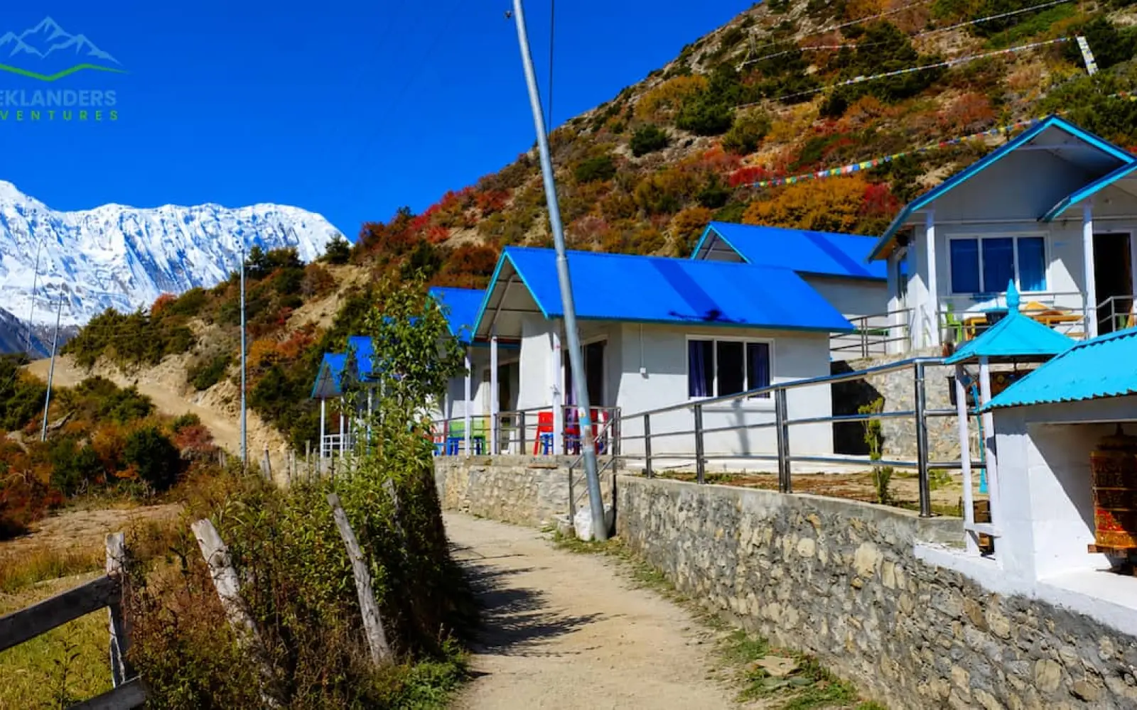
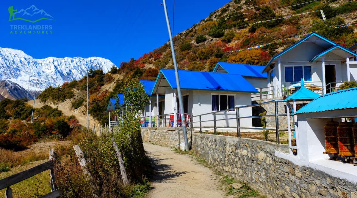
When you ask a bunch of trekkers about the Annapurna Circuit, their first words will be about the Thorong La Pass, Muktinath temples or the amazing and shocking color of Lake Tilicho. Very few of them mention Shree Kharka. And indeed, that seems strange, because it's in an obscure Manang district where much of the real magic happens. It is the gateway to Tilicho, a wonderful spot to rest where you have some of the most breathtaking mountain views on the whole trail, and also a confirmation that, after decades of road development, the Annapurna Circuit still has quiet places left.
As Treklanders, we route almost all our Annapurna Circuit itineraries through Shree Karka for our own reasons. This post will help you discover why this village is so worth your while: it will introduce you to the atmosphere of the place and give you a good idea of the walk from that part of the route, and how to prepare for the detour to Tilicho Lake, such that you don't get caught off guard on it.

There is another quite practical reason why one should get familiar with that portion before the trip starts. In fact, the days you spend on Shree Kharka include some of the most challenging sections of the entire Annapurna Circuit, such as an open landslide walk and a considerable altitude increase, all in a short span. The trekkers who are both psychologically and practically prepared before reaching this village tend to enjoy this part of the trail far more than those others who treat it only as 'a walking day with villages'.
That's not true; it's possibly the single most deciding point of the entire route, determining how your crossing of the Thorong La and the whole trek itself under foot will be felt.
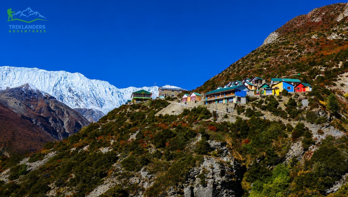
Shree Kharka is a hamlet in the Manang region of Nepal. It is located within the Annapurna Conservation Area at around 4,045 meters above sea level. In Nepali, "kharka" means a high-altitude pasture, and this place is very much a high-altitude pasture, with the surrounding area consisting of teahouses and grazed land, all of which are perched above the tree line, with the Annapurna range directly across the valley.
It is not a village in the usual sense of the word. There is no permanent community here, no farm, no school, and no local market. You will be greeted with just a group of stone lodges made for serving trekkers going to Tilicho Lake, and these lodges are operated by local families who come seasonally up from Khangsar or Manang to be there during the trekking seasons. This temporary and practical nature, combined with the view of Shree Kharka being at the highest part of the mountain range, makes it so that Shree Kharka feels like it's a mountain community of real people, not just a made-up place meant for tourists.
The site is geographically very significant because it lies at a key crossroads. The paths at this point bifurcate, with one heading up to Tilicho Base Camp, then to Tilicho Lake, while the second takes you towards Yak Kharka, then merges again to the route through the Annapurna Circuit before you start the climb towards Thorong La.
Hence, there arises practically every trekker who does the little Tilicho trip goes at least one time through Shree Kharka and often twice, first while heading there and then when coming back from there just before resuming the journey on to the pass. To travel this section, your valid ACAP (Annapurna Conservation Area Permit) will be necessary. Rangers do their job, verifying permits at various trail junctions, so it is advised that you should not think of going through this route if you do not have proper permits and travel documents.
There's also a naming quirk worth knowing about: on some maps and guidebooks, Shree Kharka appears under slightly different spellings, including "Shri Kharka" or "Shree Kharkha." This isn't unusual in the Manang and Mustang regions, where transliteration from Nepali has never been fully standardized, and settlements often carry two or three accepted spellings depending on the source. If you're cross-referencing trail information, it helps to know these all refer to the same place.
What makes the location genuinely useful, beyond its role as a junction, is its elevation relative to what comes before and after it. Sitting at just over 4,000 meters, it functions as a natural staging point between the comparatively gentle walking around Manang and the more serious elevation gain required for both the Tilicho Lake detour and the eventual crossing of Thorong La.
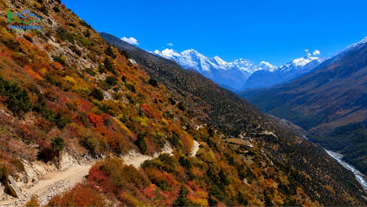
Reaching Shree Kharka is not a difficult task, but it is going to be a daylong steady tramp that involves some serious climbs. A few plans even start the day from Manang village, to be exact, at Braga, the nearby hamlet that is famous for its ancient monastery that overlooks the village.
After Manang, one of the most commonly taken routes leads a bit above the lower riverside path up the hill and then through a coniferous forest, after which the path descends briefly to cross a river. The path continues uphill very steadily to Khangsar, a Tibetan-styled hamlet, which is the last village where people have settled before the trail leads you to really remote places. The beauty of Khangsar is not that obvious: crumbling stone houses, prayer flags fluttering with the wind, and landscapes that unfold before you as you get away from the trees.
From Khangsar, trekkers cross the Khangsar Khola and continue through cultivated fields before the trail rises again along a track above the river. This final stretch into Shree Kharka takes roughly two hours and gains noticeable altitude, so pacing matters here more than on earlier days of the circuit. By the time the teahouses of Shree Kharka come into view, most trekkers have covered somewhere between five and seven hours of walking, depending on their pace and how many photo stops they take along the way, and there will be photo stops, because the views toward Gangapurna and Khangsar Kang are hard to ignore.
This is also the point in the trek where many people first notice the altitude. Manang already sits above 3,500 meters, and Shree Kharka pushes past 4,000, so a slow, deliberate pace on this stretch pays off later.
Some itineraries break the walk into two shorter days instead of one long push, spending a night in Khangsar before continuing on to Shree Kharka the following morning. This approach spreads the elevation gain out more evenly and gives trekkers an extra chance to acclimatize before reaching the higher ground around Tilicho. It adds a day to the overall itinerary, but for trekkers who are feeling the altitude even slightly by the time they leave Manang, it's usually worth the trade-off. Rushing this stretch to save a single day rarely pays off, especially once the trail steepens past Khangsar.
The condition of the trail itself between Khangsar and Shree Kharka also varies noticeably by season. In early autumn, right after the monsoon has cleared, the path can still be soft and a little unstable in places where runoff has cut into the hillside. By late autumn, the ground firms up considerably, making for a more straightforward walk. Spring conditions tend to sit somewhere in between, with occasional patches of lingering snow on shaded sections of the trail, particularly in the weeks right after winter.
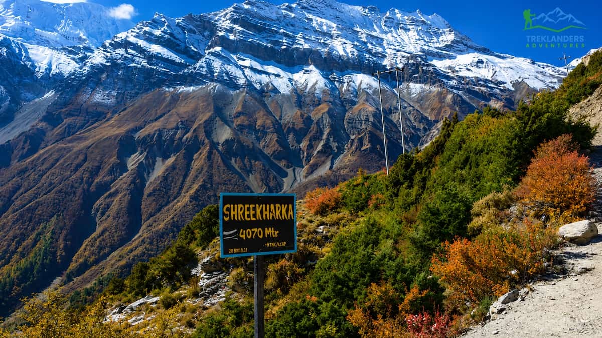
One of the things that makes Shree Kharka memorable is its location. The thing is, the classic route of the Annapurna Circuit, especially the sections near Beisahar and Lower Manang, has been reshaped through road construction over the past decade. Buses and jeeps now go through terrain that'd normally take days on foot, and many climbers feel something is lost in the process.
The route via Shree Kharka avoids all that. There're no roads here, no vehicular traffic. No dust kicked up by passing jeeps, just trails crisscrossing open terrain and Plateaus with the Annapurna mountains filling the horizon. What's cool about this is that the scene changes from the greener, sheltered feel of Manang to something starker and more open. If you think about it, so yeah, that's the idea. The grass gives way to rocks and boulders in places; rosehip bushes with their deep red autumn leaves stretch along the trail. And the wind tends to pick up as the valley narrows.
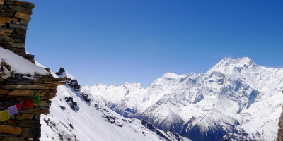
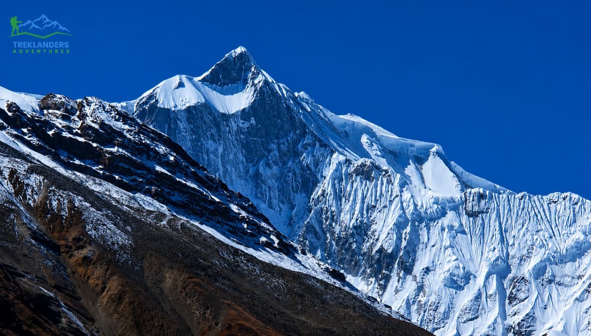
Looking south from Shree Kharka, you get a truly stunning view of the Annapurna mountains, along with Gangapurna and Khangsar Kang towering close enough to dominate the frame. What stands out is that, to the east, Chulu, its peak reaching 6,584 meters, is visible on a clear day. What's cool about this is mornings here tend to be calm and cool, with frost covering the ground, while afternoons can even be warm enough that a t-shirt feels comfortable in direct sunlight a contrast that catches many first-time climbers off guard.
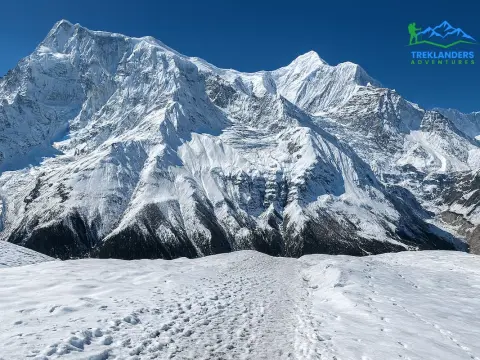
Because Shree Kharka isn't a major overnight hub the way Manang or Muktinath are, it retains a kind of stillness that's increasingly rare on the more heavily trafficked parts of the circuit.
Photographers in particular tend to linger here longer than the itinerary dictates. Essentially, the morning light hitting Gangapurna and the surrounding ridges produces a kind of soft, golden clarity that's hard to find in the lower reaches of the valley, as mist and vegetation tend to soften the view. Evenings offer a completely different feel, with the peaks turning pink and orange as the sun sets behind the western mountains, often accompanied by such a noticeable drop in temperature that most climbers head indoors within minutes of the color draining from the sky.
The silence is also worth mentioning, as it's easy to underestimate how much noise, however subtle, exists on the lower, more developed parts of the Annapurna Circuit: distant motorbikes, generator hums, the chatter of larger trekking groups passing through busier villages. Around Shree Kharka, none of them really exist. Looking at it closely, all you hear is the wind moving across the clearing, the occasional bird calls, and little else. Real talk, for many climbers, the serenity is as memorable as any mountain view.
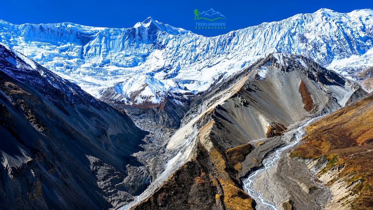
For most trekkers, Shree Kharka isn't the final destination; it's the launch point for one of the more demanding and rewarding detours on the entire Annapurna Circuit: the trek to Tilicho Lake. This section deserves its own mention because it's genuinely different in character from anything trekkers have encountered up to this point.
The trail out of Shree Kharka begins with a gradual ascent, passing a smaller pasture area known as Tho Kharka before the terrain shifts into something more serious. Roughly a kilometer of the route crosses an active landslide zone, a narrow, exposed section that takes about 45 minutes to cross carefully. This isn't a stretch to rush. The path is cut into a steep slope; loose rock shifts underfoot, and there's a real drop below in places. Guides typically time crossings for the morning, when the ground is still frozen and more stable, avoiding the afternoon when melting snow and sun can loosen debris higher up the slope.
Beyond the landslide area, the trail levels out somewhat before another exposed traverse leads to Tilicho Base Camp, set among glacial moraine and rugged, barren terrain beneath the surrounding peaks. It's a dramatic, slightly stark landscape, one that makes it obvious why this side trip has such a reputation among serious trekkers.
Most itineraries have trekkers overnight at Tilicho Base Camp before the early morning push to the lake itself, then return the same way back through Shree Kharka. It's a long, demanding round trip, and Shree Kharka's role as a staging point on both ends makes it a natural place to rest and recover.
Guides who work this route regularly will often tell you that the landslide crossing is less about physical difficulty and more about mindset. The path itself isn't technically complicated; there's no scrambling or climbing involved, but the combination of loose footing, a visible drop below, and the psychological weight of being fully exposed on a narrow trail can rattle trekkers who haven't encountered this kind of terrain before. Moving at a steady, unhurried pace, keeping eyes on the trail rather than the drop, and following directly behind a guide who knows the safest line through the debris all make a noticeable difference.
Weather can also change quickly along this stretch, and wind rather than rain is the main concern, particularly in the open sections leading up to base camp. Afternoon winds funneling through the valley can pick up substantially, which is part of why guides push for early starts on both the crossing itself and the summit push to the lake.
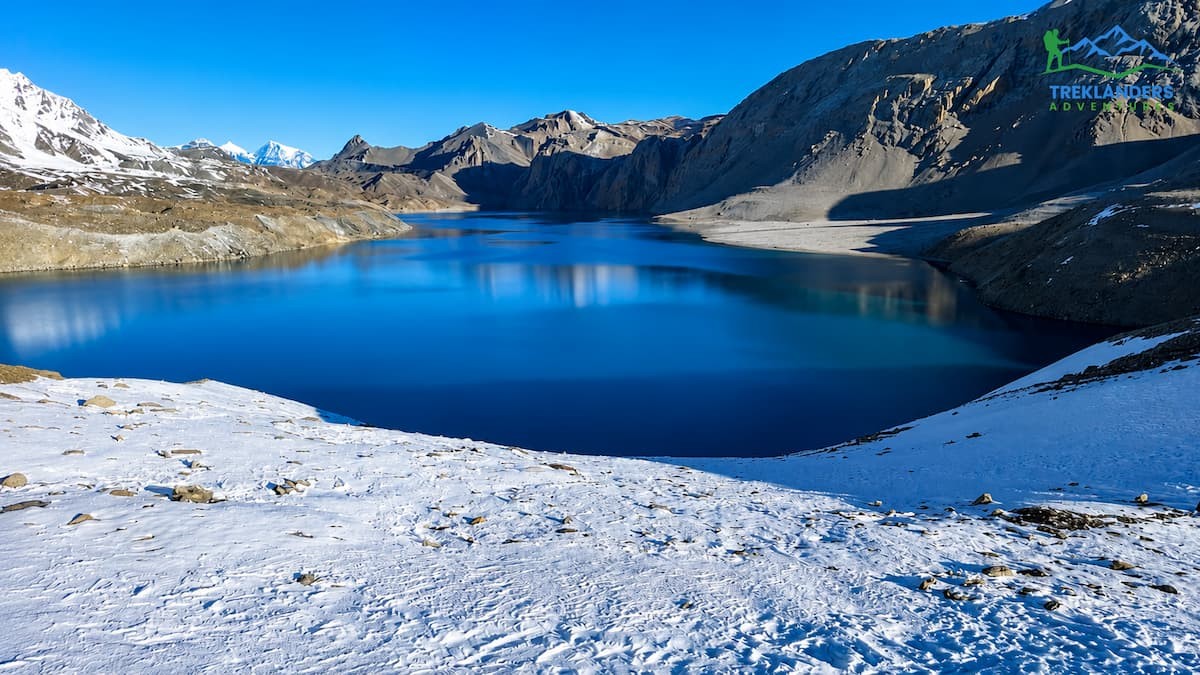
With its average elevation of between 4,919 and 4,949 meters (16,138 and 16,237 feet), depending on your map, Tilicho Lake is one of the highest lakes in the world for its size. To reach it from the base camp requires a very early start because the morning winds, which are strong by mid-morning, can make the final exposed trek unpleasant or dangerous.
From Tilicho base camp, the path gains altitude along a steady, upward path, crisscrossing along switchbacks, becoming steeper before it opens onto a wide, irregular plateau that even outside of the winter season can be covered in snow. Then you are finally treated to the sight of this unbelievably turquoise-colored lake surrounded by the 7,000m plus peaks. Most of us agree that it’s well worth the climb.
The common practice is to descend from Tilicho Lake back down to base camp, where we stop for a late breakfast/ lunch, then continue down to Shree Kharka for a second overnight there. Here you will be offered two options for your trek. One will take you off onto the regular trekking route at Yak Kharka where the trail is relatively flat for four or six hours and offers opportunities to spot some wildlife. The second will take you directly through to Thorong Phedi with a long trek day.
Either way, Shree Kharka is the nexus point to the entire side trip, as you will pass through it both on the way to the lake as well as when heading towards Thorong Phedi.
This is another one of the places where the reality on the ground leaves an even stronger impression on most of us than we expected. Whether we have photos, the true sense of scale is lost when we try to represent this magnificent turquoise body of water and the majestic 7,000-meter-plus mountains that rise around it with our cameras. On a calm, clear morning, it can look as if a huge sheet of glass has been placed over the surface of the lake as we view our reflection in it. But the setting also lends itself to dramatic effects as the lake becomes more animated with wind when it can appear a bit choppy, and the peaks seem to come and go from view through clouds that pass above it.
Given the relatively extensive ground coverage and elevation gained in a single push to reach Tilicho, guides usually allow no more than 30 to 45 minutes to enjoy the lake’s spectacular setting before beginning the descent. This can feel like a rush after putting in so much effort, but you will not want to spend much longer than this in the potentially harsh and changeable environment of the high mountain environment. To prolong the experience, some treks offer an extra night at Tilicho base camp, allowing a more leisured visit to the lake, if the weather permits.
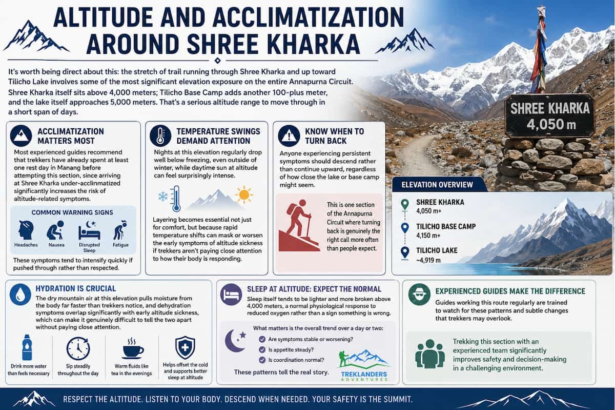
It's worth being direct about this: the stretch of trail running through Shree Kharka and up toward Tilicho Lake involves some of the most significant elevation exposure on the entire Annapurna Circuit. Shree Kharka itself sits above 4,000 meters; Tilicho Base Camp adds another 100-plus meter, and the lake itself approaches 5,000 meters. That's a serious altitude range to move through in a short span of days.
Acclimatization matters more here than almost anywhere else on the circuit. Most experienced guides recommend that trekkers have already spent at least one rest day in Manang before attempting this section, since arriving at Shree Kharka under-acclimatized significantly increases the risk of altitude-related symptoms. Headaches, nausea, disrupted sleep, and general fatigue are common warning signs, and they tend to intensify quickly if pushed through rather than respected.
The temperature swings here also demand attention. Nights at this elevation regularly drop well below freezing, even outside of winter, while daytime sun at altitude can feel surprisingly intense. Layering becomes essential not just for comfort, but because rapid temperature shifts can mask or worsen the early symptoms of altitude sickness if trekkers aren't paying close attention to how their body is responding.
Anyone experiencing persistent symptoms should descend rather than continue upward, regardless of how close the lake or base camp might seem. This is one section of the Annapurna Circuit where turning back is genuinely the right call more often than people expect.
Hydration plays a bigger role in how trekkers feel through this stretch than most people anticipate before the trip. The dry mountain air at this elevation pulls moisture from the body far faster than trekkers notice, and dehydration symptoms overlap significantly with early altitude sickness, which can make it genuinely difficult to tell the two apart without paying close attention. Guides typically encourage drinking more water than feels necessary, spread steadily throughout the day rather than in large amounts at once, along with warm fluids like tea in the evenings to help offset the cold and support better sleep at altitude.
Sleep itself tends to be lighter and more broken above 4,000 meters, a normal physiological response to reduced oxygen rather than a sign something is wrong. What matters is the overall trend over a day or two, whether symptoms are stable or worsening, and whether appetite and coordination remain steady. Guides working this route regularly are trained to watch for these patterns, which is one reason trekking this section with an experienced team makes a meaningful difference.
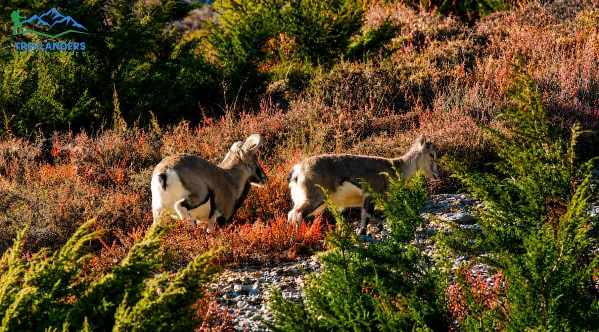
Apart from being beautiful, the area around Shree Kharka and the path connecting it with Yak Kharka is a good viewing spot for bharal. They're the wild relatives of sheep, also known as blue sheep, and have evolved to be excellent climbers with their hooves, giving them an advantage in grazing on the rocky slope above the trail while most of the grazing is done by the local animals. Seeing a group of them running across the ridging from a quite distant point has become so much of a routine for our guides that they often don't draw special attention to it.
On the same stretch, and to a much lesser extent, snow leopards might be occasionally seen at a distance with a good camera. There are a couple of documented sightings of them in the area, mainly around sunrise or sunset, as that is also the time when the big cats tend to be most active. You can probably just ignore the thought of meeting them during your walk, as your guide or even the locals will rarely spot one even though the area is quite big and has enough hiding spots. Still, the thought of a potential presence of a big cat, especially after your guide or a local draws attention to the fact, is enough to make you raise a pair of binoculars just in case while taking the next picture or just having a break.
Other birds besides the ones which are found only in high and dry mountainous regions do live here, and sometimes Himalayan marmot can be seen running among the boulders quite near the trail, mainly during the warm season when the animals are most likely to be seen.
For hikers who are really into wildlife, it's a good idea to make the day around this route a little flexible instead of simply following it as a point-to-point trail. To increase the chances of sighting birds other than the typical domestic grazing herds, one needs to move slowly, make frequent stops to get a good look around, and at times remain quite quiet.
Local guides who have worked along this exact portion of the trail for many years often develop a trained eye, capable of detecting movements on distant slopes, which are difficult to overlook for a visitor. Talking directly with them about the things they've seen recently will typically give you the best indication of what you can reasonably hope to see on your trip.
This part of the land has been declared a conservation area due to its outstanding natural value, and wildlife will find the very features that keep them away from humans' isolation and minimal disruption to the landscape attractive. These, combined with open meadows and rocky terrain, are what the conservationists are trying to protect. To be respectful and in accordance with nature conservation principles, trekking only along trails that have been clearly defined and refraining from making noise are a few of the basic conditions that must be met to have successful wildlife sightings.
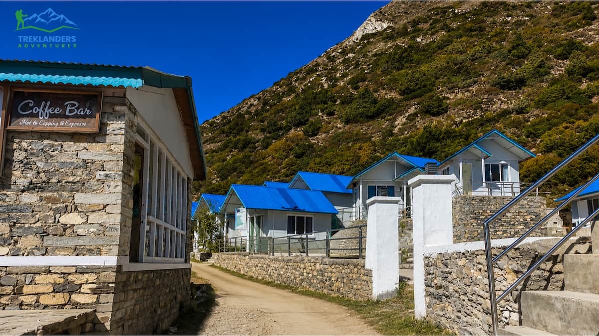
Accommodation in Shree Kharka is intended to be simple. You need to know what to expect from these accommodations even before setting foot there. The houses here are basic stone or wood buildings meant for the harsh elements rather than to stand out in appearance. Usually, the rooms are quite small, with two beds, thin walls, and the bath is usually shared by several people. It's almost a norm rather than an exception.
Nevertheless, the teahouses serve their purpose satisfactorily. Most come with a shared dining room that is heated from a central stove. It's really a place for trekkers of different groups to have social interaction and exchange experiences, especially when it comes to getting the details about the landslide crossing and how they can push on to Tilicho. The food usually consists of dal bhat, noodle soups, tea, and generally carbohydrate-rich meals to keep the energy going during the day's climb.
Considering Shree Kharka is not so big, it naturally has a very limited number of accommodations. Consequently, one can find rooms occupied as early as noon during the prime trekking season, spring and autumn. In general, having a good tie-up with a particular lodge will be a major advantage to securing some rooms, which is also one of several reasons why it may be preferable to do this particular trek part with a group company rather than attempting to do it all independently.
Given the altitude and the physical demands of the following day, most trekkers find they sleep less soundly here than at lower elevations; a normal, if slightly frustrating, part of high-altitude trekking that's worth mentally preparing for.
Electricity in Shree Kharka's teahouses tends to be limited, often generated by small solar setups rather than a stable grid connection, and charging devices can take considerably longer than trekkers are used to at lower elevations. It's worth bringing a portable power bank charged in advance, along with a headlamp with fresh batteries, rather than relying entirely on lodge power being consistently available, particularly during longer overcast stretches when solar charging is less effective.
Hot water for washing is usually available but limited, sometimes offered in a bucket rather than a proper shower. Wi-Fi, where it exists at all, tends to be slow and unreliable, which most trekkers eventually come to appreciate rather than resent, given how much it reinforces the sense of being genuinely away from daily life. The overall experience has more in common with a mountaineering base camp than a conventional guesthouse, and setting expectations accordingly makes the stay far more enjoyable.
This particular part of the Annapurna Circuit is greatly influenced by timing, even more than lower parts of the trail. Spring, roughly from March to May, as well as autumn, from September to November, are the two main trekking seasons, each of them offering a different experience around Shree Kharka.
Compared to spring, autumn is generally regarded as a more consistent season. The sky is usually clear, and the visibility between the Annapurna range and Tilicho Peak is at its peak. In addition, the trail conditions as well as those of the landslide crossing are normally better after the monsoon season has ended. However, it's worth noting that this period is the most crowded season; hence, teahouses become full more rapidly, and the main path will have higher pedestrian movement.
It may snow around the Tilicho Base camping site, and the lake itself could look nice and snowy; these conditions sometimes affect one to finish the walk.
Winter trekking through this section is possible but considerably more demanding, with heavy snow, closed teahouses in some cases, and a real risk of the Tilicho detour becoming impassable. Monsoon season, from June through August, is generally avoided altogether, both because of poor visibility and because the landslide-prone section near Shree Kharka becomes significantly more hazardous when saturated.
Within the autumn window specifically, late September and October tend to draw the largest number of trekkers, since this period offers the most consistently stable weather of the entire year. November remains a strong option too, with the added benefit of noticeably thinner crowds, though overnight temperatures drop more sharply as the month progresses, which matters given how cold nights around Shree Kharka already get even in milder conditions.
Spring trekkers aiming for Tilicho specifically should pay attention to snow reports before committing, since the final approach to the lake can remain snow-covered well into April in years with a heavier winter, occasionally requiring traction gear that wouldn't otherwise be necessary. Checking recent trail conditions with a local operator is generally more reliable than relying on general seasonal guidelines alone.
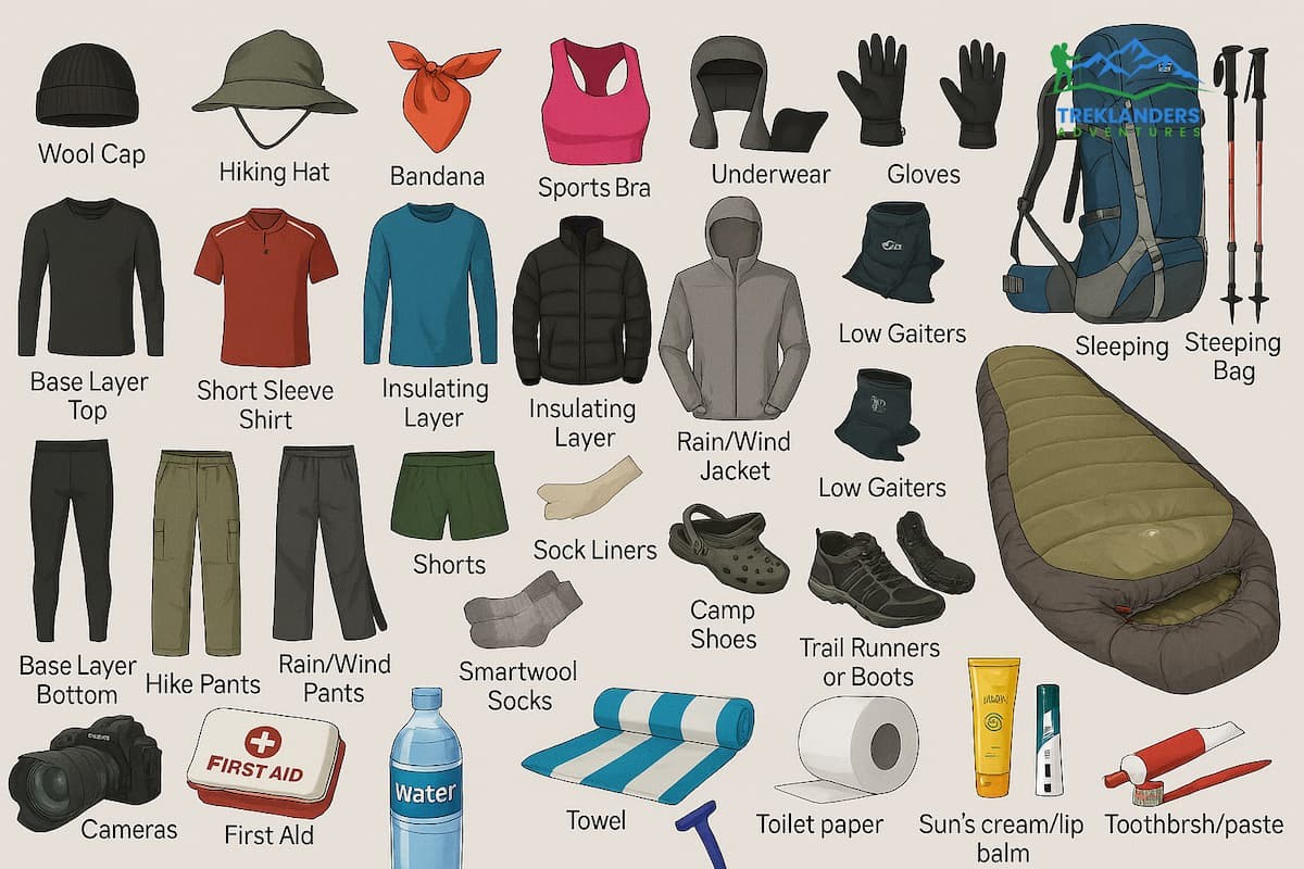
Preparing specifically for the Shree Kharka and Tilicho stretch is a little different from packing for the lower, more forested sections of the Annapurna Circuit. Because you're dealing with high altitude, exposed terrain, and significant temperature swings between day and night, gear choices here carry more weight than usual.
A proper down jacket rated for sub-zero temperatures is essential, along with a sleeping bag suited to high-altitude conditions, since teahouse rooms at this elevation offer minimal insulation. Layering is critical: a moisture-wicking base layer, an insulating mid-layer, and a windproof, waterproof outer shell will handle the shifts between still, sunny mornings and the wind that tends to pick up by midday, particularly on the exposed approach to Tilicho.
Trekking poles are genuinely useful here, not just for the steady climbs but for stability across the landslide section, where loose scree makes footing less predictable than on a standard dirt trail. Good sunglasses with strong UV protection matter more at this altitude than lower down, since sun exposure intensifies with elevation, and a headlamp is necessary for the early starts most itineraries require for the final push to Tilicho Lake.
A basic altitude sickness medication kit approved and understood beforehand rather than experimented with on the trail, along with a reliable water purification method, rounds out the essentials. Given the limited resupply options in Shree Kharka itself, it's worth carrying enough snacks and energy food to cover the full detour to Tilicho and back, rather than relying entirely on what's available at the teahouses.
Footwear deserves particular attention for this section specifically. The landslide crossing and the loose, rocky ground around Tilicho Base Camp put more demand on ankle support and grip than the gentler trails lower down the valley, and worn-out or poorly broken-in boots tend to become a real liability here rather than just a minor discomfort. Trekkers should ideally have already put meaningful mileage on their boots before arriving in Nepal, rather than testing new footwear for the first time on the most technical section of the entire circuit.
A lightweight personal first aid kit is also worth carrying independently of whatever a guide might have, including blister treatment, basic pain relief, and any regular personal medication. Because Shree Kharka sits well beyond easy access to proper medical facilities, this kind of small self-sufficiency matters more here than closer to the trailhead. A dry bag or waterproof liner for a backpack is a small addition that pays off, protecting gear from sudden weather shifts that are common at this elevation.
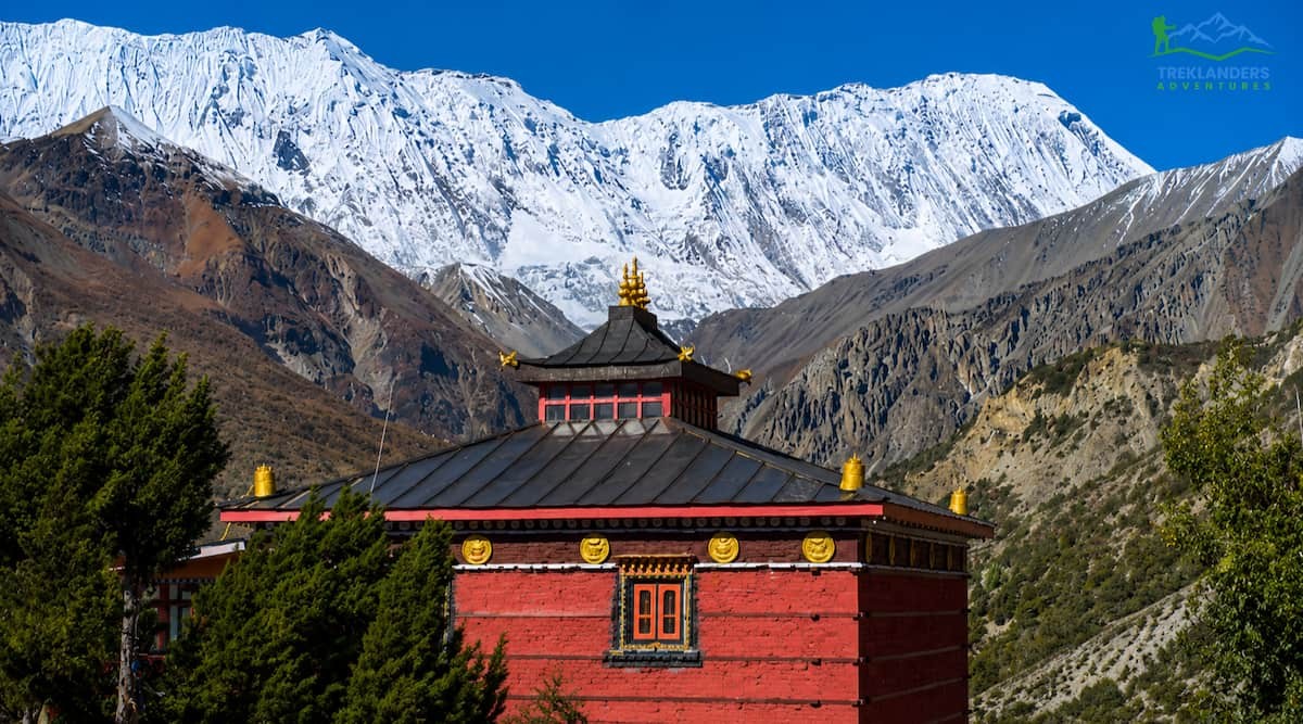
For most, Shree Kharka would probably not even come to mind until they begin their Annapurna Circuit planning, and that is precisely why you should check out Shree Kharka. This is the point where the path becomes more secluded, the sightseeing becomes more spectacular, and your whole journey begins to feel like that mountain trip in the middle of nowhere, which people in general imagine about Nepal.
Whether you base yourself in Shree Kharka to push through for Tilicho Lake or just happen to pass through on your way to Thorong La, in either case you'd be rewarded by trekkers like Shree who really know their altitude limits (not only from the view of their equipment), how to pack and are giving themselves plenty of time to really see, not just passing by.
At Treklanders, we plan our Annapurna Circuit and Tilicho Lake programs around a steady walk with expert guides who are familiar enough with the area around Shree Kharka so that they can tell you when it is a good time to cross the landslide, what to expect from the weather before you head to the lake, and how to get properly ready for the challenging part of the trail ahead. It would be better to do this part of the Manang area trekking only when the conditions allow you to do so properly.
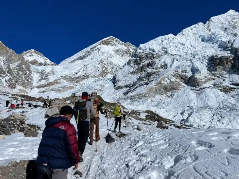
Learn what changes above Namche Bazaar during the Everest Base Camp Trek in winter, from icy trails to stunning Himalayan views.
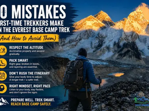
Avoid the 10 most common Everest Base Camp Trek mistakes and prepare with expert tips for a safer, more enjoyable Himalayan adventure.
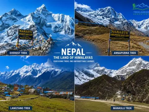
Compare the Everest, Annapurna, Langtang, and Manaslu treks to choose the perfect trekking adventure in Nepal.



