
10 Best Treks in Nepal: Ultimate Himalayan Trekking Guide
12 Jun 2026
Explore the best treks in Nepal, from Everest Base Camp to Annapurna and Langtang, and find the perfect Himalayan adventure for you.
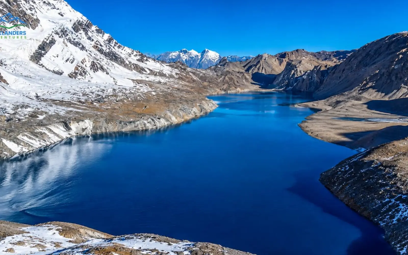
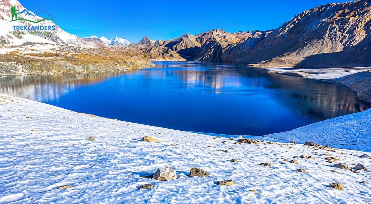
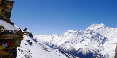
Situated at an elevation higher than almost any other lake on Earth, Tilicho Lake is a stunning glacial turquoise body of water nestled in a desolate and wind-swept corner of the Nepalese Annapurna region. For those who have envisioned the traditional Annapurna Circuit, Tilicho Lake is a completely different experience, a detour so isolated and breathtaking that it has turned into its own bucket-list adventure. This detailed guide takes you step-by-step through the whole Tilicho Lake Trek route from Kathmandu all the way to the lake's edge and back. It discusses each segment of the trail, the local villages, the essential acclimatization stops that ensure trekkers' safety, and the key practical aspects that can elevate your trekking experience from good to great. If you intend to take Tilicho Lake as a mere side trip from Manang or if you want to integrate it with the full Thorong La Pass crossing on the Annapurna Circuit Trek, having a thorough understanding of the route before your departure will enable you to traverse the path not only with greater confidence but also with much less dependence on guesswork.
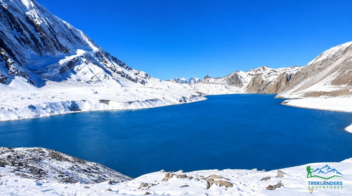
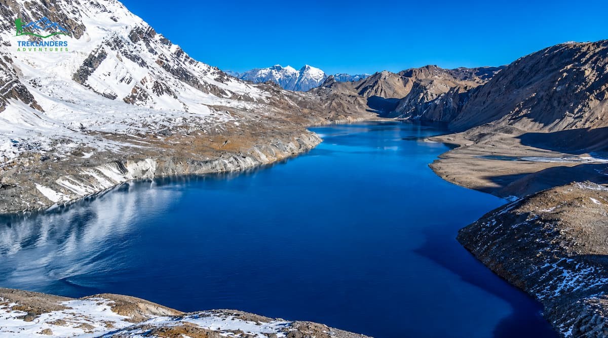
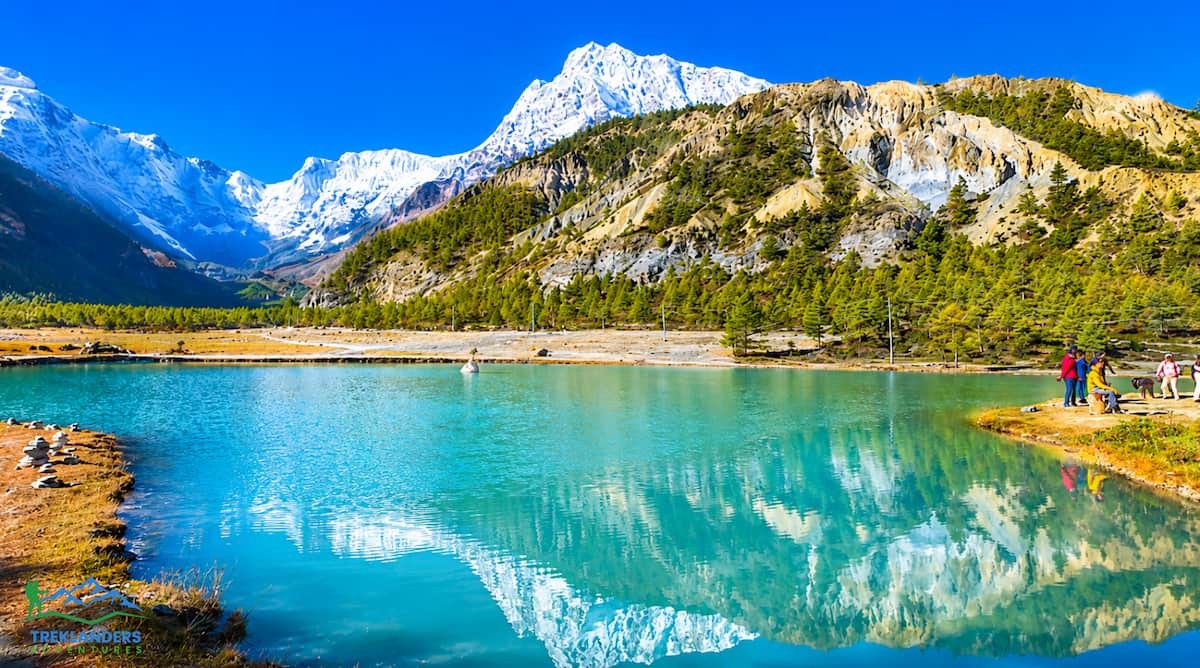
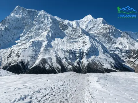
Located at an elevation of 4,919 meters (16,138 feet), Tilicho Lake is situated in the Manang district of Nepal, within the Annapurna Conservation Area. Because of its size, it is generally recognized as the highest lake in the world, extending for about 4 kilometers in length with a width of approximately 1.2 kilometers and a mean depth of nearly 85 meters. The lake's water surface area is nearly 4.8 square kilometers, consisting of the glacial meltwater from the slopes of Tilicho Peak, Gangapurna Himal, and the Nilgiri massif, which all tower right above its shore.
The thing that reveals Tilicho Lake most stunningly visually is the contrast it produces. The environs area is desolate, rocky, and almost lunar in appearance, yet the water itself shines a deep turquoise blue, which is totally out of place in such a bare setting. The cold is so extreme here that no types of fish, moss, or aquatic plants exist in the lake, and despite this, a team of Russian scuba divers once carried out what is considered the world's highest-altitude dive in these waters, proving that this remote corner of the Himalayas takes human endurance to extreme limits.
Tilicho Lake holds profound religious value as well. It is considered a sacred body of water by the Hindus, who mention the lake in the Ramayana, an ancient epic. It not only attracts pilgrims but also trekkers year after year. Not long ago, adventurers came upon another high-altitude lake near Lamjung Himal called Kajin Sara, which is situated at an altitude of approximately 5,200 meters and currently holds the highest elevation record. Nevertheless, Tilicho is still the better-known and much more frequently visited place, partly because it naturally lies on the main trekking route through Manang, whereas Kajin Sara is still a far more hidden side trip.
Though the lake is surrounded by a desolate landscape, the larger Manang area around it is teeming with life. Down in the valley, the woods near Chame and Pisang provide a refuge for pheasants, Himalayan thar, and sometimes even a few Goral, while birds of prey can often be seen circling the thermals that come off the dry ridgelines near Tilicho. The stark contrast between the lush, wooded lower valley and the almost high desert of the lake area is one of those things that make this trek feel like several different journeys wrapped into one.
The majority of adventurers get to Tilicho Lake as part of their Annapurna Circuit. They make a detour from the main route near Manang village and then either retrace their steps for the return or move on to cross Thorong La Pass and complete the full circuit through Mustang.

The Tilicho Lake Trek route begins with road travel from Kathmandu toward the Manang district, since no trail currently reaches all the way back to the capital on foot in a practical timeframe. From Kathmandu, the journey follows the highway to Besisahar, the headquarters of Lamjung district, before continuing along rougher hill roads beside the Marsyangdi River to Syange, Jagat, Chamje, and on toward Dharapani, where most itineraries begin trekking on foot.
From Dharapani, the trail climbs steadily through Bagarchap, Danaque, Timang, and Koto before reaching Chame, the administrative center of Manang district. Beyond Chame, the route passes through Bhratang and a high ridge at Dukure Pokhari before dropping into Pisang village. From Pisang, trekkers continue into the wide, dramatic expanse of Manang Valley, passing Hongde and the Braga Monastery before arriving at Manang village itself, where a built-in rest day allows the body to acclimatize.
From Manang, the standard route to Tilicho Lake diverts away from the main Annapurna Circuit trail, heading southwest to Khangsar and then climbing to Tilicho Base Camp. A short, steep push the following morning brings trekkers to the shores of the lake itself, after which the trail retraces a portion of the same path back toward Shree Kharka.
For trekkers combining the lake with the full Annapurna Circuit, the trail then rejoins the main route near Yak Kharka, climbs to High Camp, crosses Thorong La Pass at 5,416 meters, and descends to the sacred site of Muktinath. From there, the path continues down through Jharkot to Jomsom, followed by overland travel or a short flight to Pokhara, and finally a return drive to Kathmandu. Depending on pace, rest days, and whether the pass is included, the full Tilicho Lake Trek typically takes anywhere from twelve to nineteen days door to door, including arrival and departure days in Kathmandu.
Not all walkers decide to cross Thorong La. The shorter version of the route just turns Tilicho Lake into an out-and-back side trip from Manang: the walkers go up to the lake and then back down to Khangsar or Manang, from where they take the lower valley trail back toward Besisahar and Kathmandu by road. This option is best for walkers with a limited time schedule or those who would like to avoid the long, cold, pass-crossing day while still seeing the lake itself, which is the most photographed feature of the whole region. A very small number of very experienced groups exit toward Jomsom via Mesokanto La Pass, about 5,121 meters, southwest of the lake, thereby skipping Thorong La completely. This alternative is much less developed, with no dependable teahouses on the way, and is only recommended if you have an experienced guide and proper camping support.
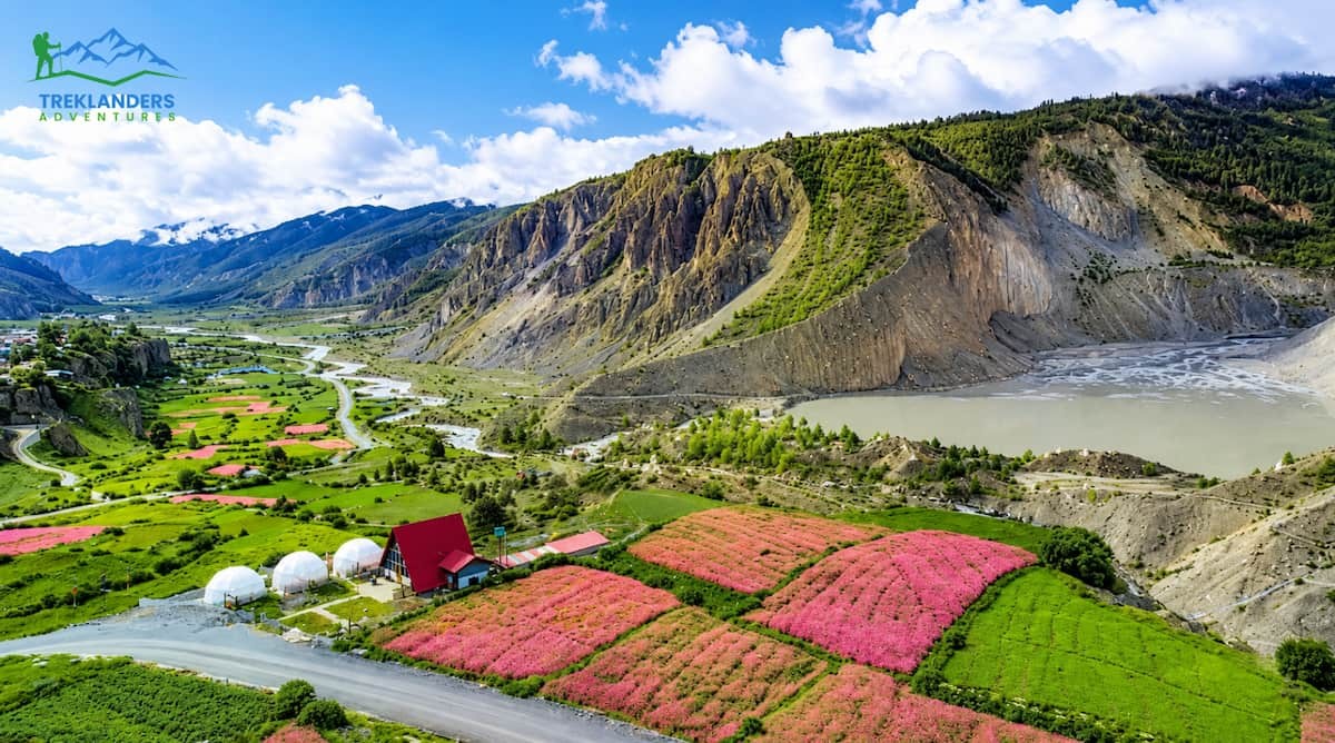
The overland journey from Kathmandu to Dharapani is long but scenic, following the Marsyangdi River through a changing landscape of terraced farmland, narrow gorges, and the mountain air growing cooler as the road goes up to the Manang district.
Once the trekking starts at Dharapani, the trail goes through cool pine and rhododendron forests with a gradual and winding path.
Passing through Bagarchap and Danaque, trekkers come across apple orchards and get the first glimpse of Annapurna III and IV mountains towering to the south. Besides, this section also introduces deep facets of Tibetan Buddhist culture on the way, manifested in the presence of mani walls and small stupas along the trail.
Afterwards, the trail goes up more steeply to Timang, a village inhabited by Gurung, Magar, and Manange people, where on clear days, one can see Lamjung Himal to the south and Manaslu Himal to the northeast.
From Timang, the walk gradually descends to Koto, where trekkers on the Nar-Phu Valley route branch off. A final short stretch, afterwards, brings walkers to Chame, the district headquarters and a fitting stop with Lamjung Himal views over gently rolling green hills.
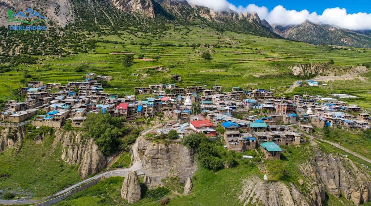
After Chame, the track tackles the Marsyangdi River going westward through thick forest until Bhratang, then it ascends to a ridge at Dukure Pokhari with stunning views of Pisang Peak and the Chulu range, before going down to Pisang village below the peak. From Pisang, a very short yet scenic walk over a high ridge offers magnificent views of Manang Valley before passing Hongde, with its small airstrip, and finally reaching Braga, which possesses one of the oldest monasteries in the region. A slight ascent out of Braga marks the end of the day's hiking into Manang village, perched on a plateau above the Marsyangdi River and surrounded by some of the Annapurna range's most spectacular peaks.
Accommodation options in this area are largely limited to teahouse lodges, which are essentially simple guest houses managed by local families. These establishments provide a bed, a cozy dining hall, and a set menu featuring Nepali, Tibetan, and basic Western dishes. As you ascend the trail, the room facilities tend to become more basic, with shared bathrooms becoming the standard after Chame; however, most villages still have hot showers available for a small fee and fairly reliable solar or hydro power for charging electronic devices.
Located at 3,540 meters, Manang village is the largest single rest stop along the Tilicho Lake Trek route. Practically every schedule allocates an entire acclimatization day here, as the higher elevation area is a lot more challenging, and to forgo this step would be to greatly increase the chances of developing an altitude-related illness on the trek.
Resting at Manang usually means taking a hike to the Gangapurna ice fall and glacial lake viewpoint, which is a few hours each way, and offers close-up views of Annapurna II, III, and IV, along with the Chulu peaks to the north. This sort of active rest, where the body is exposed to a higher altitude during the day but comes back to sleep at the same elevation, is the main principle of high-altitude trekking and helps the body start adjusting to the less dense air.
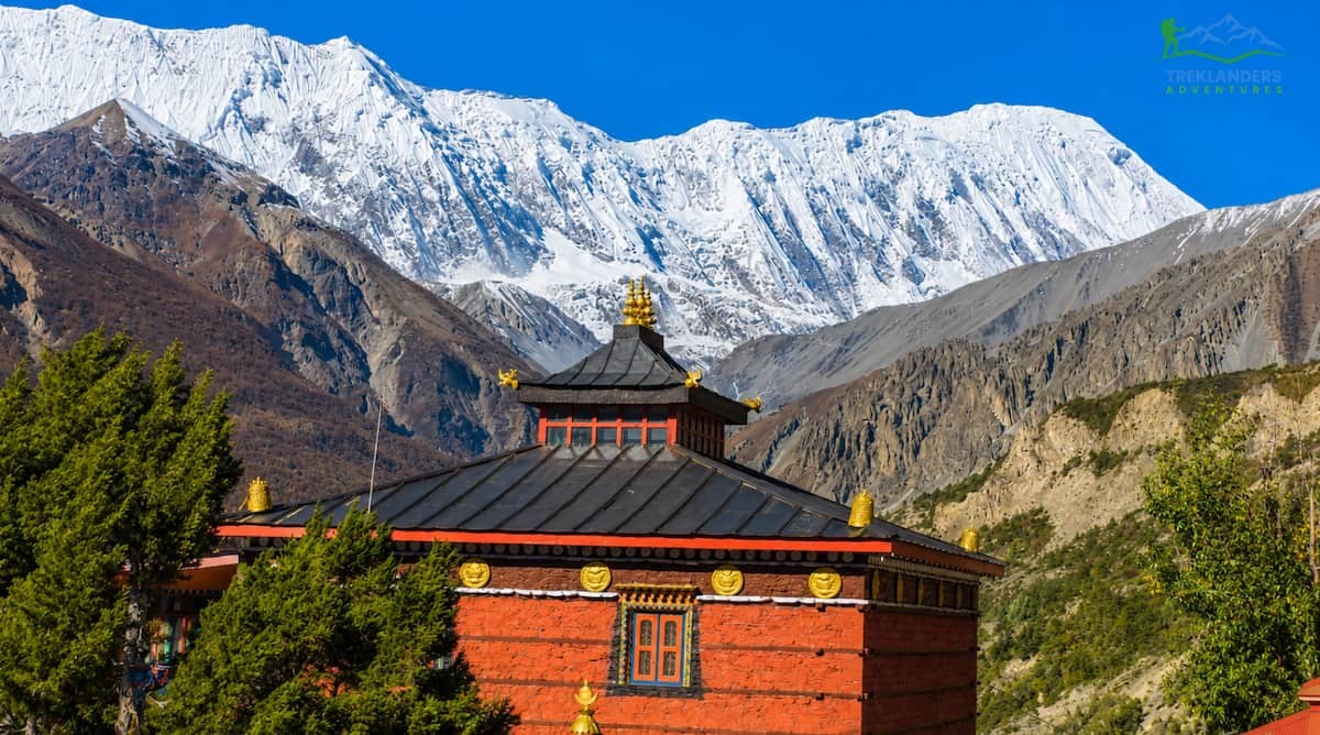
Manang in itself encourages a leisurely pace. The village hosts communities of Tibetan descent, and the tightly clustered stone houses, prayer wheels, and fluttering prayer flags there testify to a rich Buddhist heritage. The nearby Braga Monastery, which you pass through on your way into the village, contains ancient murals and statues that are probably worth a longer visit if you have the time. In the main trekking seasons, the Himalayan Rescue Association also operates a seasonal post in Manang, where they provide advice on altitude sickness, a service well worth using before going further up.
Besides, Manang is the biggest village on the whole route, and it has a good range of lodges, bakeries, and even small shops selling extra equipment for the colder days ahead. Many trekkers take the rest day to fix or get extra gear for the cold weather here, because this is the last place with such a variety before the trail goes into the more isolated areas of Khangsar and Tilicho.
From Manang, the route to Tilicho Lake breaks away from the busier Annapurna Circuit trail and heads southwest toward Khangsar, sitting at roughly 3,734 meters. This is the last permanent village before the trail enters genuinely remote terrain, and the walk there follows a gradual path with a few short, steep sections.
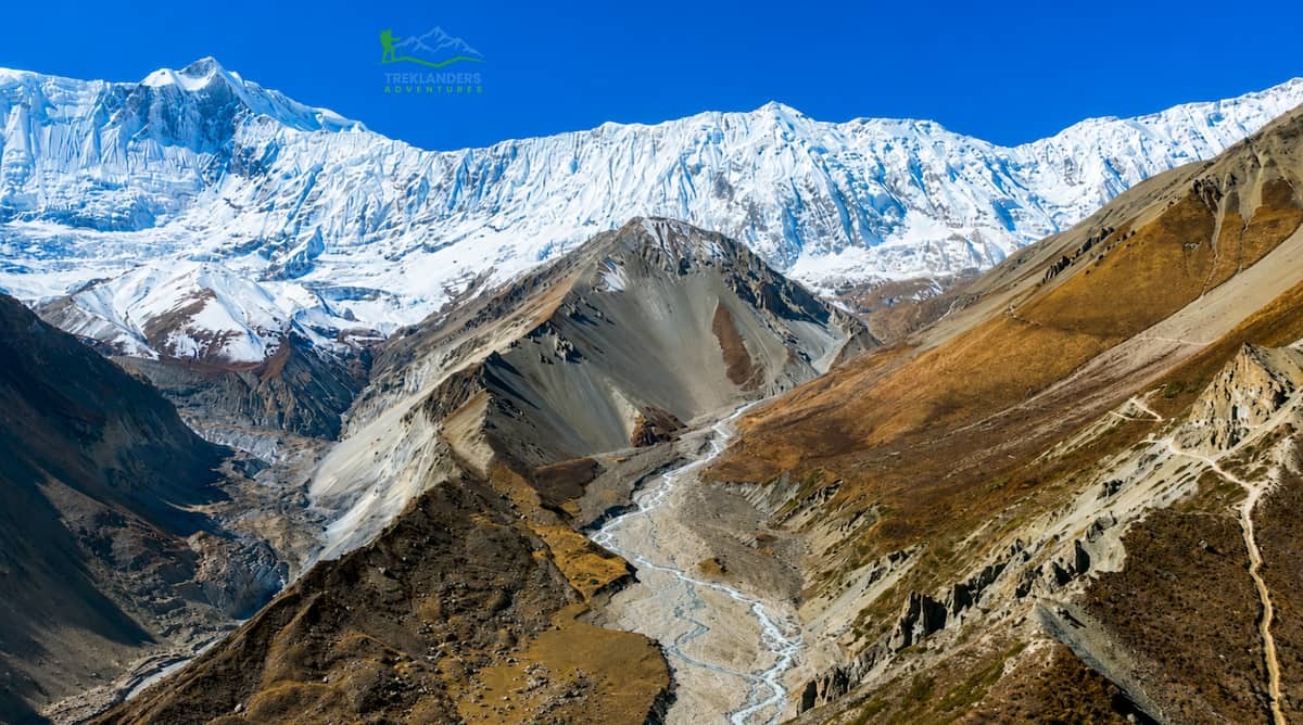
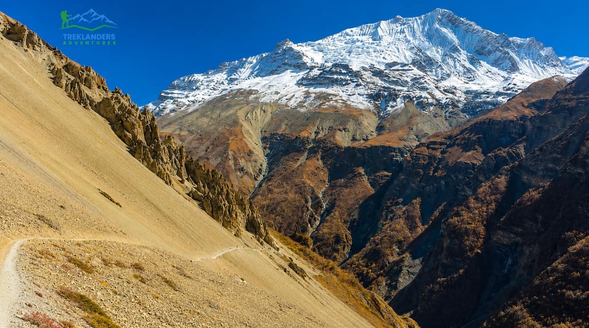
Beyond Khangsar, the trail to Tilicho Base Camp, at around 4,150 meters, demands more attention. The path runs along a narrow, exposed route where rockfall is a real and recurring hazard, particularly after periods of rain or snowmelt. Trekkers cross small streams and footbridges, some of which show damage from past landslides, and steady footing becomes essential. Many guides prefer to cross the most exposed sections in the morning, before the sun has had a chance to loosen rock and ice higher up the slopes, and a measured, unhurried pace matters more here than speed. Despite the caution required, most hikers find this stretch deeply rewarding, since the surrounding scenery grows wilder and more dramatic with every kilometer as trees disappear, and the landscape opens into a high desert.
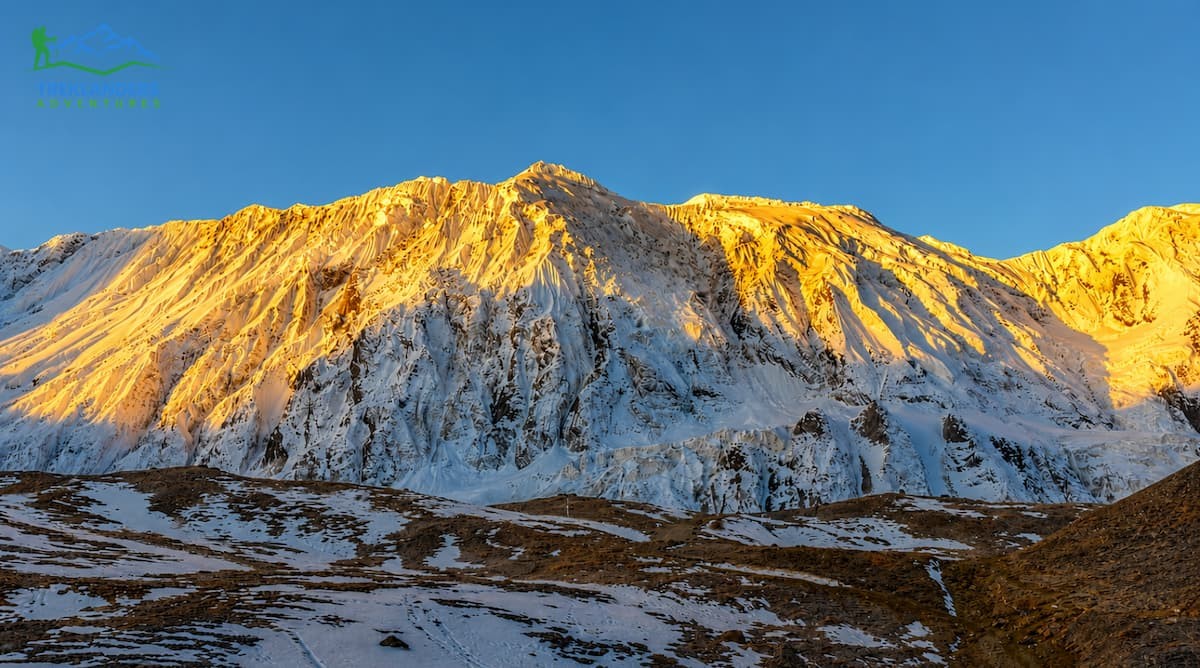
Tilicho Base Camp itself consists of a tiny handful of rather basic lodges. However, it's located in a breathtaking place surrounded by the towering Gangapurna Himal, Tilicho Peak, and the Nilgiri range. The deteriorating facilities here are, to some extent, what makes this place attractive: after this stage of the trek, most hikers will be deep in the wild, quite far away from the comforts of the bigger guest houses in Manang.
Most people reckon the walk from Tilicho Base Camp up to the lake is the toughest single bit of the whole trail, and they say it is also the most beautiful one. Even though the direct distance is only a few clicks, this path gains almost 770 meters as it climbs from 4,150 meters to 4,919 meters along a narrow ridge covered with loose scree.
From a climbing point of view, this part of the route does not present any technical challenges; however, it does require a slow and steady pace, good balance, and a level head, as some parts of the path are situated close to steep drop-offs where the margin for a mistake is almost non-existent. At this altitude, even slight slopes feel much more difficult than at sea level; one gets out of breath easily, the muscles in the legs fatigue more quickly, and strong winds along the exposed ridge can make things quite tough.
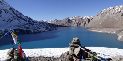
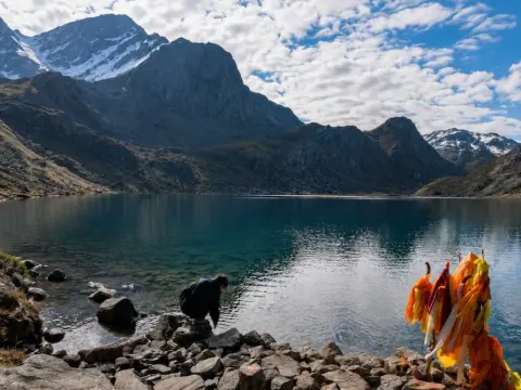
Reaching the shore of Tilicho Lake after this effort is, for most trekkers, the emotional high point of the journey. The water's vivid turquoise colour stands in sharp contrast to the barren, rock-strewn terrain surrounding it, and the close presence of Tilicho Peak, Gangapurna Himal, and the Nilgiri massif gives the setting a sense of scale that photographs rarely capture fully. On calm mornings, the surface turns almost glass-like, mirroring the surrounding peaks, while afternoon winds can whip across the open water and send a chill through anyone lingering too long without proper layers. Many trekkers still stay here far longer than planned, simply taking in the silence and the views before beginning the return walk back to Tilicho Base Camp and onward to an overnight stop at Shree Kharka, completing what is typically a six-hour round trip with stops included.
Trekkers who intend to do Tilicho Lake and the full Annapurna Circuit go back from Shree Kharka through Khangsar and finally rejoin the main trail near Yak Kharka at an altitude of about 4,110 meters. This part of the valley is famous for wildlife sightings, like groups of Goral and Himalayan thar, and on very few occasions, even a view of a snow leopard or the rare snow partridge. Actually, the detour to Tilicho Lake shows up as more than just a scenic highlight; as most trekkers, having already reached 4,919 meters and then descended, arrive at Yak Kharka much better acclimatized for the push towards Thorong La than they would have been if they had only done the standard circuit.
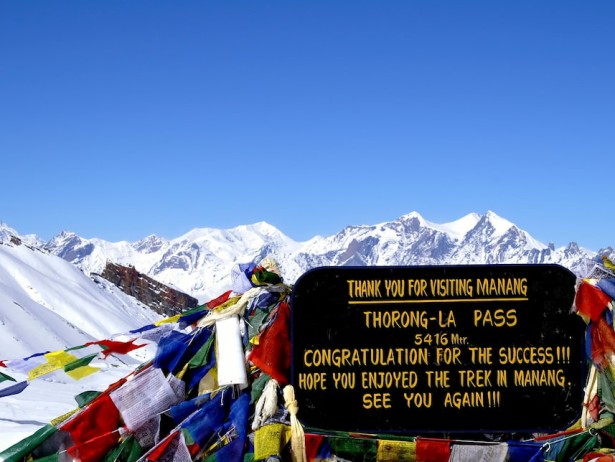
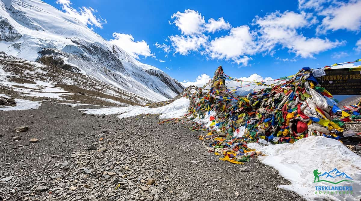
Onwards from Yak Kharka, the path upslopes a little too High Camp at approximately 4,900 meters - the last station before Thorong La Pass crossing. Nearly all parties start the pass crossing far before sunrise because both wind and cold increase very sharply as the day continues. The ascent from High Camp meanders upward through the mainly bare, very windy area to the pass at 5,416 meters, the highest altitude on the trail as well as the division line between Manang and Mustang districts. When the weather is clear, the peak offers trekkers a panoramic view of Dhaulagiri, the Damodar Himal, the Chulu peaks, and a long section of the Annapurna range.
The descent from the pass drops roughly 1,600 meters to Muktinath, a demanding stretch on tired legs that often proves harder than the climb itself. Muktinath is one of the most revered pilgrimage sites in the Himalayas, sacred to both Hindus and Buddhists, and its temple complex, with its row of sacred waterspouts, marks a striking shift in atmosphere after days in raw, high-altitude terrain.
From Muktinath, the trail passes through Jharkot, with its old hilltop fort, before descending into the Kali Gandaki River valley and on to Jomsom, the Thakali heartland and headquarters of Mustang district. From Jomsom, the route continues overland through Marpha's apple orchards, the forested stretch near Kalopani, and the hot springs at Tatopani, eventually reaching smoother roads near Beni before arriving in Pokhara. A short scenic flight between Jomsom and Pokhara is also commonly used to shorten this leg. From Pokhara, the final stretch back to Kathmandu completes the loop.
Spring (March to May) and autumn (September to November) are the two best periods for the Tilicho Lake Trek. With spring, you get more daylight hours and the flowering of rhododendron forests in the lower valleys; generally, the mornings are quite stable, but by May, the clouds tend to gather in the afternoons. It stays pretty cold in the mornings, even at high altitude, during the whole season; Yet, for the well-prepared trekkers, it is usually fine.
Autumn is when the mountains are more visible than at any other time of the year, mostly after the monsoon breaks in late September, and the sky is almost completely free of dust and haze. Although the days are still shorter than in spring and the nights and early mornings are very cold at the higher altitudes, even at the beginning of November, the trade-off is usually the best mountain view that can be seen anywhere along the circuit.
Winter, December through February, can be possible for well-equipped and experienced trekkers, but heavy snowfall may cause the complete closure of Thorong La Pass, and a lot of lodges at High Camp and Tilicho Base Camp close for the season. The monsoon months from June to August bring heavy rainfall, the trails can be very slippery and dangerous, visibility is greatly reduced, and most trekking operators don't recommend going through the route during this period. Besides, compared to the more crowded Everest Base Camp or Annapurna Base Camp, the Tilicho Lake trail is less busy and sometimes very quiet even during the peak season. This makes it a perfect choice for trekkers looking for a more secluded experience. As far as photography is concerned early autumn mornings tend to bring the best and sharpest light on those peaks, whereas in spring the afternoons in Manang often have softer and hazier conditions.
The Tilicho Lake Trek falls into the moderate to adventurous category. Usually, the trekking hours per day are five to seven, although certain parts, especially at the lakeshore and the crossing of Thorong La, may take longer. It is the combination of continual walking effort day after day, the high-altitude environment, and the trail sections that are exposed and at times narrow, which makes the path challenging rather than a single technical problem.
Physically gearing up in the six to eight weeks before the trip will undoubtedly make a difference. Going for a walk regularly, doing hills or stairs to develop leg muscles, and cardio exercises like running, cycling, or swimming will all help in raising the level of fitness for doing a long, hardcore physical effort at altitude. Aside from that, training the torso muscles also helps in keeping one balanced on the irregular and rocky path near Tilicho Base Camp and the Thorong La approach.
One simple way to prepare for this is to start by briskly walking for thirty minutes, five days a week, for the first two weeks. Then, to build the strength that the long descents of the leg muscles require, add hill or stair sessions in weeks three and four. During weeks five and six, taking weekend walks of two or three hours, preferably on uneven terrain and with a daypack loaded, results in the type of endurance that the trek demands. Speed is not the objective; the ability to keep walking comfortably for five to seven hours a day, day after day, for nearly two weeks is the target.
Altitude sickness is definitely a risk on this route since most of the time you will be at heights above 3,500 meters. Anyone can be affected by Acute Mountain Sickness, no matter how fit they are, and it usually shows up as headache, nausea, tiredness, loss of appetite or difficulty sleeping. The serious conditions, High-Altitude Pulmonary Edema and High-Altitude Cerebral Edema, call for immediate descent and medical help. The biggest rule in dealing with this risk is quite simple: if symptoms get worse, go down straight away without trying to continue.
Gradual ascent, built-in rest days like the one in Manang, and steady hydration of three to four liters of water daily all reduce risk substantially. Alcohol should be avoided during the high-altitude stages of the trek, since it interferes with both acclimatization and sleep quality. Some trekkers choose to carry Acetazolamide, commonly known as Diamox, as a preventive measure, though this should only be done after consulting a doctor, since it carries its own side effects and is not a substitute for proper pacing. Experienced guides play a meaningful role here too, monitoring the group daily and arranging a safe descent, including emergency evacuation where necessary, if a trekker's symptoms become serious.
You'll need two permits to do this trek: the Annapurna Conservation Area Permit, which allows you to enter the protected area, and a TIMS card, which is Nepal's system for registering trekkers and ensuring their safety. You can easily get both in Kathmandu or Pokhara before starting your trip. Also, trekking agencies usually take care of the paperwork for their clients so that no time is wasted after the trek begins. Having a few passport-sized photos and a photocopy of your passport handy will make this process a lot faster.
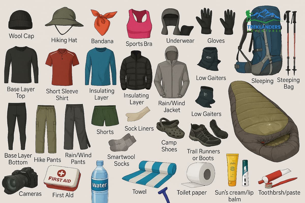
Your clothing will need to be a system of layers, as the temperatures will go from hot in the valleys to below freezing at the Thorong La and Tilicho Lake.
First, a moisture-wicking base layer, then a fleece or a light insulated mid-layer, finally a windproof and waterproof outer shell; these are the main components of a good system, plus a heavier down jacket for the extremely cold parts during High Camp and also around the lake. Trekking gloves, a warm hat, a buff or neck gaiter, and UV-blocking sunglasses rated for high altitude.
Special care should be given to footwear. Durable, waterproof hiking boots that provide good ankle support and that have been well-worn before the trip are necessary for the rough and steep parts in and around Tilicho Base Camp and the pass. Besides these, you will need lightweight camp shoes for hanging around in the lodge in the evenings, and a few pairs of quality wool or synthetic trekking socks will complete the footwear kit.
Trekking poles form perhaps the most helpful tool on the trail, Mainly on the steep downward scrambling from Thorong La to Muktinath as well as the gravelly slopes around Tilicho Lake, where they help people not only rest their knees but gain better balance too Besides that, you should think about a daypack with a capacity of 30-35 liters, a sleeping bag capable of withstanding temperatures down to -10 to -20 degrees Celsius, a headlamp that won't fail with spare batteries, and your very own first aid kit including blister treatment and minor medications are the basic must-have items to accompany the ones that are quite functional. Water disinfection tablets or a filtering device combined with a strong bottle or a hydration bladder are the best means of supporting regular intake of fluids, which is a main factor of adjusting to the higher altitudes.
Some minor things are easy to miss but really matter when you are at high altitudes, for example. Water-resistant sunscreen and lip balm with an SPF factor defend skin from the very strong ultraviolet rays that are a part of being over 3,000 meters, even when clouds cover the sun. Having a power bank of 10,000 to 20,000 mAh capacity ensures that phones, cameras, and flashlights remain charged in the hiking area where electricity is either limited or non-existent, and biodegradable soap, wet wipes, and a fast-drying towel provide basic sanitation for those who are in areas where showers are either unreliable or unavailable. Besides, doing this before bedtime makes a huge difference in battery life. One of the most effective measures to prevent your batteries and electronic devices from getting completely drained by the cold is to keep them in an inner jacket pocket rather than an outer pack pocket.
On the documentation side, travellers should carry a valid passport, arrange the Annapurna Conservation Area Permit and TIMS card in advance, and secure travel insurance that explicitly covers high-altitude trekking and helicopter evacuation, given how remote sections of this route can be.
All in all, the Tilicho Lake Trek pathway combinedly grants the perfect Himalayan expedition packed full of delights: the natural beauty of forested valleys, encounters with mountain people who are deeply Buddhist, a side visit to the world's most famous high-altitude lake, and those who continue the loop, will be able to witness one of the highest trekking passes in Nepal before descending to the sacred place of Muktinath. There are not many other routes in the Annapurna region that offer such a great variety in a single itinerary. The journey moves from subtropical forest to high desert and back to a river valley all within two to three weeks. Doing the walk with a clear understanding of the route, proper altitude acclimatization, and carrying the right gear will make this challenging trail one of your most memorable trekking experiences in Nepal.
Explore the best treks in Nepal, from Everest Base Camp to Annapurna and Langtang, and find the perfect Himalayan adventure for you.
Complete guide to the Gosaikunda Lake Trek with permits, best season, altitude tips, itinerary, and essential trekking advice in Nepal.
A first-hand journey to Gosaikunda Lake through misty forests, monsoon trails, and sacred Himalayan landscapes.